Bewley Wood

Wood, Forest in Westmorland Eden

England

Bewley Wood

Old Boundary Marker in Fousonsrigg Plantations Parish Boundary Marker in Fousonsrigg Plantations, on the south side of the road, west of Colby. On the boundary of King's Meaburn, formerly a township and a parish since 1866, and Colby, a parish created in 1894. Inscribed KINGS / MEABURN and COLBY on opposite faces. See also <span class="nowrap"><a title="http://www.geog.port.ac.uk/webmap/thelakes/photos/bng11.jpg" rel="nofollow ugc noopener" href="http://www.geog.port.ac.uk/webmap/thelakes/photos/bng11.jpg">Link</a><img style="margin-left:2px;" alt="External link" title="External link - shift click to open in new window" src="https://s1.geograph.org.uk/img/external.png" width="10" height="10"/></span> , <a title="https://www.geograph.org.uk/photo/4534169" href="https://www.geograph.org.uk/photo/4534169">Link</a> . <a title="https://www.geograph.org.uk/photo/4534161" href="https://www.geograph.org.uk/photo/4534161">Link</a> , <a title="https://www.geograph.org.uk/photo/5299740" href="https://www.geograph.org.uk/photo/5299740">Link</a> , <a title="https://www.geograph.org.uk/photo/5299736" href="https://www.geograph.org.uk/photo/5299736">Link</a> and <a title="https://www.geograph.org.uk/photo/4534175" href="https://www.geograph.org.uk/photo/4534175">Link</a>.

Milestone Society National ID: WE_KMECOL01pb
Old Boundary Marker in Fousonsrigg Plantations Credit: J Glew

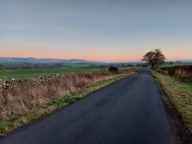
Bewley Wood, located in Westmorland, is a picturesque forest that covers a vast area of land. This enchanting woodland is known for its breathtaking beauty and rich biodiversity, making it a popular destination for nature enthusiasts and hikers alike.

The wood is characterized by its dense canopy of towering trees, which includes a variety of species such as oak, beech, and birch. The lush undergrowth is adorned with an array of wildflowers, creating a vibrant and colorful landscape throughout the year.

The forest is home to a diverse range of wildlife, providing a habitat for numerous species to thrive. Birdwatchers will be delighted by the presence of various birds, including woodpeckers, owls, and songbirds. Additionally, Bewley Wood is known to host a population of red squirrels, which are a rare sight in many parts of the country.

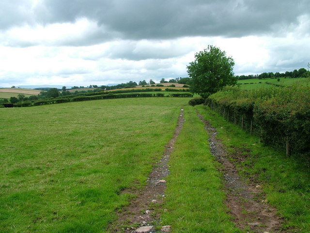
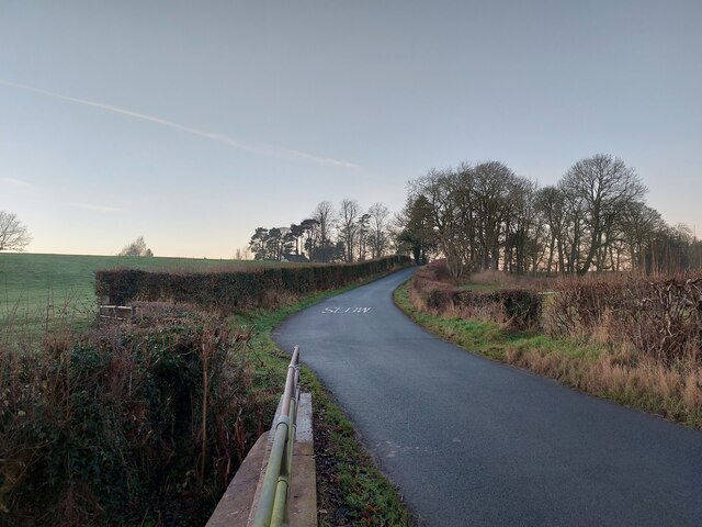
The wood is intersected by several well-marked walking trails, allowing visitors to explore its natural wonders at their own pace. These trails wind through the forest, offering stunning views of the surrounding countryside and providing an opportunity to observe the flora and fauna up close.

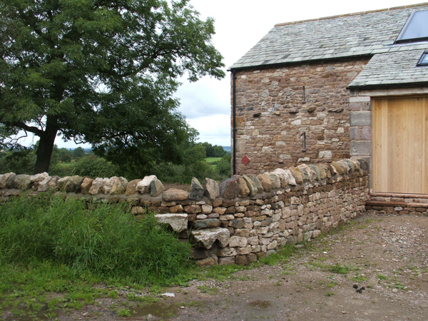
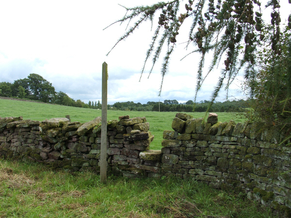
Bewley Wood is not only a haven for nature lovers but also a place steeped in history. The ancient trees and remnants of old stone walls serve as a reminder of the area's past, adding an element of intrigue to the overall experience.

In summary, Bewley Wood in Westmorland is a captivating forest that offers a peaceful retreat into nature. Its beauty, biodiversity, and historical significance make it a truly remarkable destination for anyone seeking to immerse themselves in the natural wonders of the region.

If you have any feedback on the listing, please let us know in the comments section below.
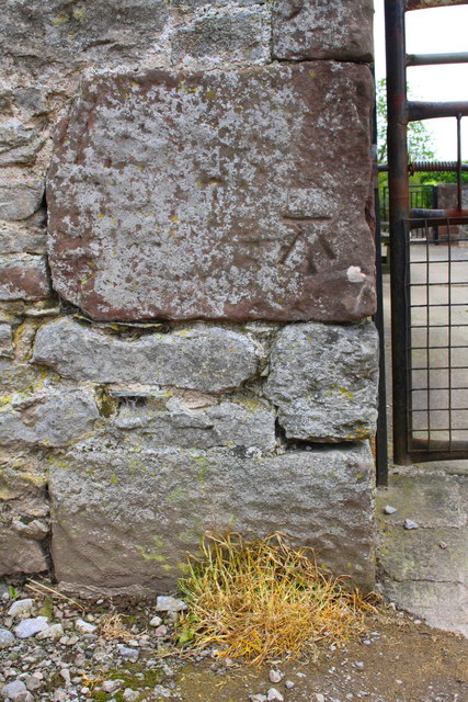
Bewley Wood Images

Images are sourced within 2km of 54.583348/-2.543342 or Grid Reference NY6421. Thanks to Geograph Open Source API. All images are credited.

Old Boundary Marker in Fousonsrigg Plantations Parish Boundary Marker in Fousonsrigg Plantations, on the south side of the road, west of Colby. On the boundary of King's Meaburn, formerly a township and a parish since 1866, and Colby, a parish created in 1894. Inscribed KINGS / MEABURN and COLBY on opposite faces. See also <span class="nowrap"><a title="http://www.geog.port.ac.uk/webmap/thelakes/photos/bng11.jpg" rel="nofollow ugc noopener" href="http://www.geog.port.ac.uk/webmap/thelakes/photos/bng11.jpg">Link</a><img style="margin-left:2px;" alt="External link" title="External link - shift click to open in new window" src="https://s1.geograph.org.uk/img/external.png" width="10" height="10"/></span> , <a title="https://www.geograph.org.uk/photo/4534169" href="https://www.geograph.org.uk/photo/4534169">Link</a> . <a title="https://www.geograph.org.uk/photo/4534161" href="https://www.geograph.org.uk/photo/4534161">Link</a> , <a title="https://www.geograph.org.uk/photo/5299740" href="https://www.geograph.org.uk/photo/5299740">Link</a> , <a title="https://www.geograph.org.uk/photo/5299736" href="https://www.geograph.org.uk/photo/5299736">Link</a> and <a title="https://www.geograph.org.uk/photo/4534175" href="https://www.geograph.org.uk/photo/4534175">Link</a>.

Milestone Society National ID: WE_KMECOL01pb
Old Boundary Marker in Fousonsrigg Plantations
Parish Boundary Marker in Fousonsrigg Plantations, on the south side of the road, west of Colby. On the boundary of King's Meaburn, formerly a township and a parish since 1866, and Colby, a parish created in 1894. Inscribed KINGS / MEABURN and COLBY on opposite faces. See also LinkExternal link , Link . Link , Link , Link and Link. Milestone Society National ID: WE_KMECOL01pb
Stile and converted barn. Stile near Wormpotts farm.
Stile and converted barn.
Stile near Wormpotts farm.
Gap Stile and Footpath sign. Stile across fields from the road over Chitty Hill.
Gap Stile and Footpath sign.
Stile across fields from the road over Chitty Hill.
The Road to Jerusalem
Field near Colby
Field near Colby
Derelict barn
Derelict barn
Footpath across the fields
Stone marking Colby / Kings Meaburn boundary
Stone marking Kings Meaburn / Colby boundary
Minor road at Kings Meaburn / Colby boundary The boundary is marked by a stone on the right hand grass verge
Minor road at Kings Meaburn / Colby boundary
The boundary is marked by a stone on the right hand grass verge
Benchmark on gatepost by track SW of Jerusalem Farm Ordnance Survey cut mark benchmark described on the Bench Mark Database at <span class="nowrap"><a title="http://www.bench-marks.org.uk/bm67215" rel="nofollow ugc noopener" href="http://www.bench-marks.org.uk/bm67215">Link</a><img style="margin-left:2px;" alt="External link" title="External link - shift click to open in new window" src="https://s1.geograph.org.uk/img/external.png" width="10" height="10"/></span>
Benchmark on gatepost by track SW of Jerusalem Farm
Ordnance Survey cut mark benchmark described on the Bench Mark Database at LinkExternal link
Farm trailer at entrance to field near Jerusalem Farm There is an OS benchmark <a href="https://www.geograph.org.uk/photo/4535738">NY6519 : Benchmark on gatepost by track SW of Jerusalem Farm</a> on the gatepost on the right hand side of the gateway
Farm trailer at entrance to field near Jerusalem Farm
There is an OS benchmark NY6519 : Benchmark on gatepost by track SW of Jerusalem Farm on the gatepost on the right hand side of the gateway
Benchmark on building at Jerusalem Farm Ordnance Survey cut mark benchmark described on the Bench Mark Database at <span class="nowrap"><a title="http://www.bench-marks.org.uk/bm66664" rel="nofollow ugc noopener" href="http://www.bench-marks.org.uk/bm66664">Link</a><img style="margin-left:2px;" alt="External link" title="External link - shift click to open in new window" src="https://s1.geograph.org.uk/img/external.png" width="10" height="10"/></span>
Benchmark on building at Jerusalem Farm
Ordnance Survey cut mark benchmark described on the Bench Mark Database at LinkExternal link
Buildings at Jerusalem Farm There is an OS benchmark <a href="https://www.geograph.org.uk/photo/4589276">NY6519 : Benchmark on building at Jerusalem Farm</a> on the large quoin on the near corner of the left hand building, left of the metal gate
Buildings at Jerusalem Farm
There is an OS benchmark NY6519 : Benchmark on building at Jerusalem Farm on the large quoin on the near corner of the left hand building, left of the metal gate
Benchmark on south parapet of Teas Bridge Ordnance Survey pivot benchmark described on the Bench Mark Database at <span class="nowrap"><a title="http://www.bench-marks.org.uk/bm66625" rel="nofollow ugc noopener" href="http://www.bench-marks.org.uk/bm66625">Link</a><img style="margin-left:2px;" alt="External link" title="External link - shift click to open in new window" src="https://s1.geograph.org.uk/img/external.png" width="10" height="10"/></span>
Benchmark on south parapet of Teas Bridge
Ordnance Survey pivot benchmark described on the Bench Mark Database at LinkExternal link
Teas Bridge taking road over Teas Sike There is an OS benchmark <a href="https://www.geograph.org.uk/photo/4589970">NY6519 : Benchmark on south parapet of Teas Bridge</a> on the bridge parapet over the centre of the stream
Teas Bridge taking road over Teas Sike
There is an OS benchmark NY6519 : Benchmark on south parapet of Teas Bridge on the bridge parapet over the centre of the stream
South End
South End
South End
South End
Show me another place!

Bewley Wood is located at Grid Ref: NY6421 (Lat: 54.583348, Lng: -2.543342)

Administrative County: Cumbria

District: Eden

Police Authority: Cumbria

What 3 Words

///accusing.blinking.modifies. Near Appleby-in-Westmorland, Cumbria

Nearby Locations

New Bewley Bewley Wood

Related Wikis

Colby, Cumbria

Colby is a village and civil parish in the Eden district of the English county of Cumbria. It is near the village of Bolton to the north and the town of...

Crackenthorpe

Crackenthorpe is a village and civil parish in the Eden District of Cumbria, England. It is about 12 miles (19 km) south east of Penrith. The village was...

North Westmorland Rural District

North Westmorland was a rural district in Westmorland, England from 1935 to 1974. It now forms part of the Eden district of Cumbria. It was formed in...

King's Meaburn

King's Meaburn (English: ) is a small village and civil parish in Cumbria, England. It is located 5 miles (8.0 km) from Appleby-in-Westmorland and 10 miles...

Nearby Amenities

Located within 500m of 54.583348,-2.543342
Old Bewley
Place: locality
Lat/Long: 54.5851115/-2.5478691
Bewley Castle
Historic: castle
Ruins: yes
Lat/Long: 54.5844356/-2.5463132
Power: pole
Lat/Long: 54.5833267/-2.5362036
Power: pole
Lat/Long: 54.5838206/-2.537477
Power: pole
Lat/Long: 54.5843351/-2.5388334
Power: pole
Lat/Long: 54.5848748/-2.5402413
Power: pole
Lat/Long: 54.5853836/-2.5415404
Power: pole
Lat/Long: 54.585882/-2.5428415
Power: pole
Lat/Long: 54.5863312/-2.5443067
Power: pole
Lat/Long: 54.5867921/-2.5458055
Power: pole
Lat/Long: 54.5875721/-2.5450087
Power: pole
Lat/Long: 54.5817339/-2.537479
Power: pole
Lat/Long: 54.582457/-2.5368956
The data included in this document is from www.openstreetmap.org. The data is made available under ODbL.

Have you been to Bewley Wood?

Leave your review of Bewley Wood below (or comments, questions and feedback).