Howbeech Slade

Wood, Forest in Gloucestershire Forest of Dean

England

Howbeech Slade

Cycle trail on former railway trackbed
Cycle trail on former railway trackbed Credit: David Martin

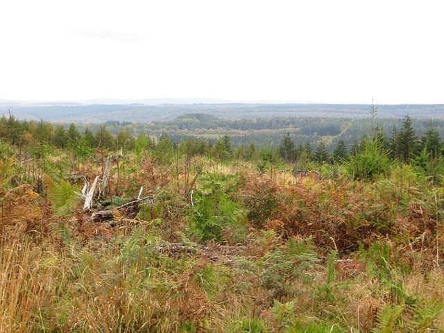
Howbeech Slade is a picturesque woodland area located in Gloucestershire, England. Situated near the village of Woodchester, it is a popular destination for nature enthusiasts and hikers alike. Covering an area of approximately 100 hectares, this ancient woodland is a designated Site of Special Scientific Interest (SSSI) due to its rich biodiversity.

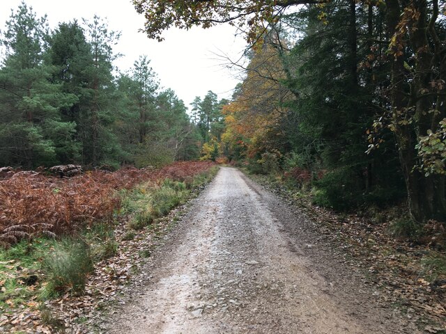
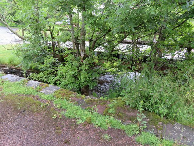
The woodland is predominantly composed of beech trees, hence its name, but also features a variety of other tree species such as oak, ash, and hazel. The dense canopy of the trees creates a serene and tranquil atmosphere, making it an ideal spot for a peaceful walk or picnic. The forest floor is covered with a thick carpet of ferns and wildflowers, providing a vibrant and colorful display throughout the seasons.

Howbeech Slade is home to a diverse range of wildlife, including several rare and protected species. Birdwatchers can spot a variety of birds, including woodpeckers, owls, and various songbirds. The woodland is also inhabited by mammals such as foxes, badgers, and deer, making it a haven for wildlife enthusiasts.

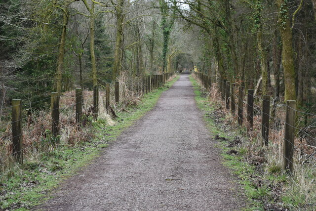
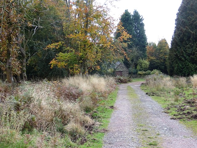
The woodland is crisscrossed with a network of well-maintained footpaths, offering visitors the opportunity to explore the area and take in the breathtaking views. There are also designated picnic areas and benches for visitors to relax and enjoy the peaceful surroundings. The wood is open to the public year-round, and entry is free.

In conclusion, Howbeech Slade in Gloucestershire is a stunning woodland area that offers visitors a chance to immerse themselves in nature. With its ancient trees, diverse wildlife, and tranquil atmosphere, it is a must-visit destination for anyone seeking a peaceful retreat in the heart of the countryside.

If you have any feedback on the listing, please let us know in the comments section below.

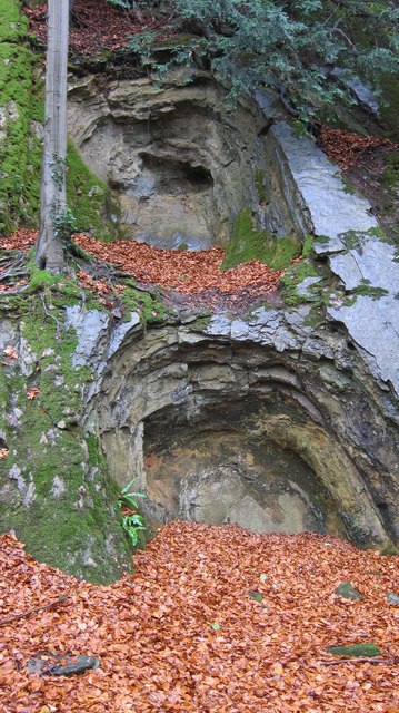
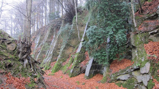
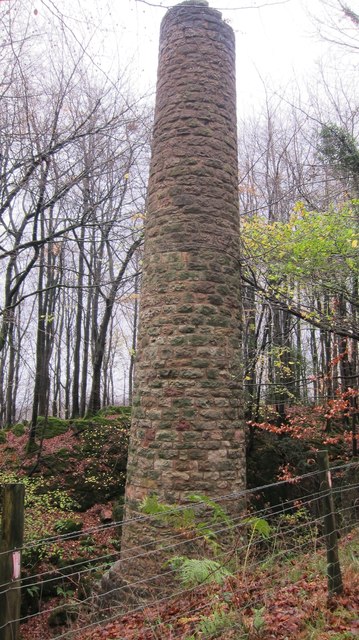
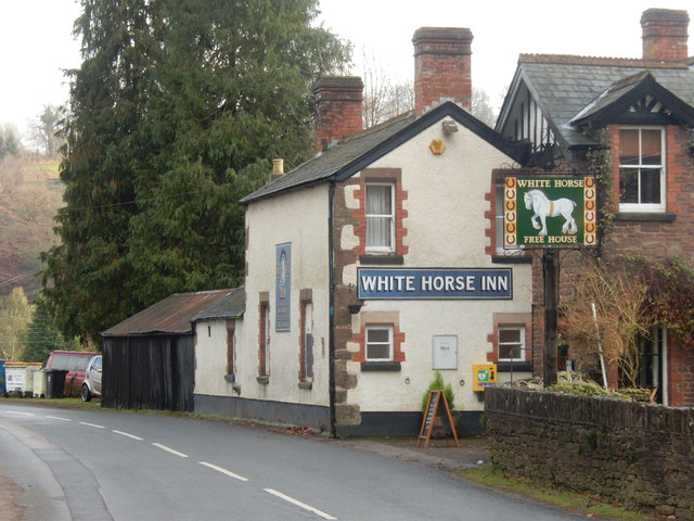
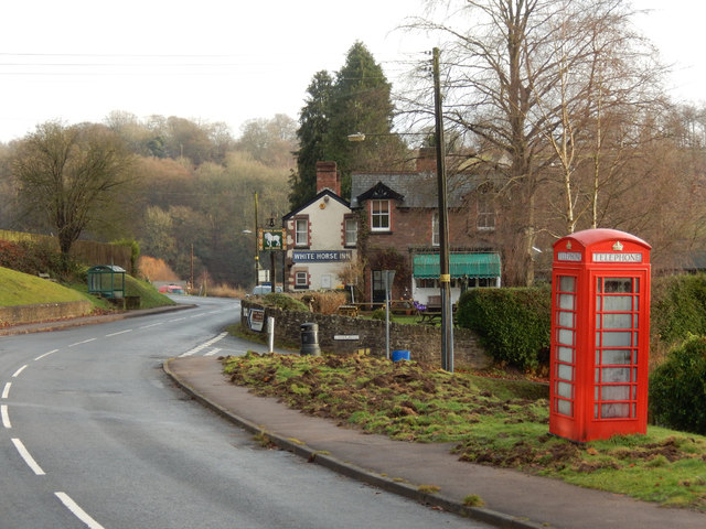
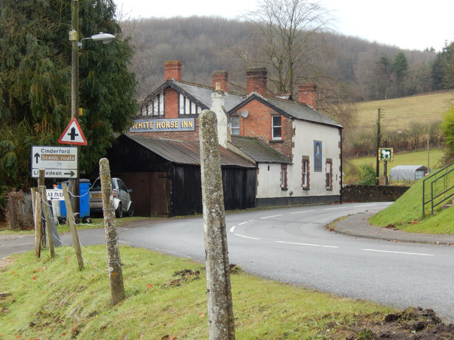
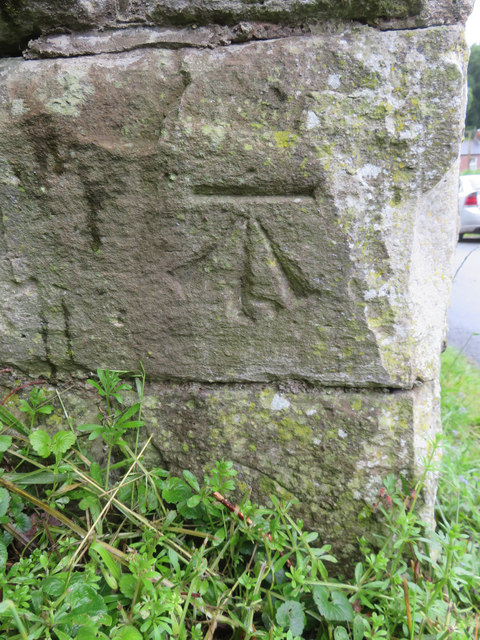
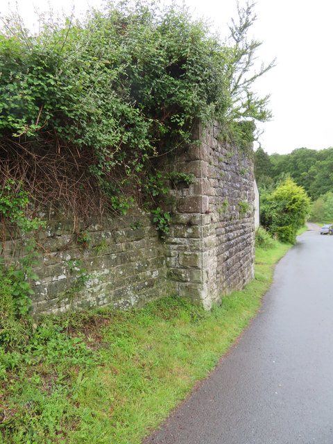
Howbeech Slade Images

Images are sourced within 2km of 51.77997/-2.5162858 or Grid Reference SO6409. Thanks to Geograph Open Source API. All images are credited.

Cycle trail on former railway trackbed
Family Cycle Trail, Forest of Dean The Cycle Trail follows the main line of Severn and Wye Railway to the site of Drybrook Road Junction and then this, the northern part of the Mineral Loop Line. The final part of the cycle loop leaves old railway routes.
Family Cycle Trail, Forest of Dean
The Cycle Trail follows the main line of Severn and Wye Railway to the site of Drybrook Road Junction and then this, the northern part of the Mineral Loop Line. The final part of the cycle loop leaves old railway routes.
Forestry road, Forest of Dean
Young trees, Staple Edge Wood Near the summit of Staple Edge with a big view.
Young trees, Staple Edge Wood
Near the summit of Staple Edge with a big view.
Staple Edge An inhabited summit in the Forest of Dean.
Staple Edge
An inhabited summit in the Forest of Dean.
Remains of limestone extraction workings The softer limestone has been extracted from harder dolomite by a process of heating by fire and quenching by cold water.
Remains of limestone extraction workings
The softer limestone has been extracted from harder dolomite by a process of heating by fire and quenching by cold water.
Exposed ribs of dolomite The harder layers of dolomite remain where softer limestone has been extracted by a laborious fire/quenching process.
Exposed ribs of dolomite
The harder layers of dolomite remain where softer limestone has been extracted by a laborious fire/quenching process.
Findall chimney-well hidden in extensive beech woods This well preserved monument to industry in the Forest of Dean coal field utilised the rising hot air from a fire at the base of the chimney to pull out stale air from the adjacent coal mines.
Findall chimney-well hidden in extensive beech woods
This well preserved monument to industry in the Forest of Dean coal field utilised the rising hot air from a fire at the base of the chimney to pull out stale air from the adjacent coal mines.
The White Horse Inn, Upper Soudley Village pub on Church Road apparently noted for snail racing.
The White Horse Inn, Upper Soudley
Village pub on Church Road apparently noted for snail racing.
Top Road, Upper Soudley Looking towards the White Horse Inn with a still functioning telephone box. There are plans to close the box, a controversial move because mobile reception is poor in this area.
Top Road, Upper Soudley
Looking towards the White Horse Inn with a still functioning telephone box. There are plans to close the box, a controversial move because mobile reception is poor in this area.
Church Road, Upper Soudley Ahead is the White Horse Inn. The road through the heart of the Forest of Dean is designated a scenic route. The entrance on the immediate left gives access to the pub car park but at one time there was a station here on the long-closed Cinderford branch.
Church Road, Upper Soudley
Ahead is the White Horse Inn. The road through the heart of the Forest of Dean is designated a scenic route. The entrance on the immediate left gives access to the pub car park but at one time there was a station here on the long-closed Cinderford branch.
Bench mark in Upper Soudley, Forest of Dean This Ordnance Survey bench mark is on the remaining bridge support that once carried the G.W.R. Forest of Dean Branch through Upper Soudley.  See also: <a href="https://www.geograph.org.uk/photo/6182266">SO6510 : Former railway bridge support in Upper Soudley</a>
Bench mark in Upper Soudley, Forest of Dean
This Ordnance Survey bench mark is on the remaining bridge support that once carried the G.W.R. Forest of Dean Branch through Upper Soudley. See also: SO6510 : Former railway bridge support in Upper Soudley
Former railway bridge support in Upper Soudley The remaining bridge support that once carried the G.W.R. Forest of Dean Branch through Upper Soudley.  There is an Ordnance Survey bench mark on the short face facing the camera: <a href="https://www.geograph.org.uk/photo/6182260">SO6510 : Bench mark in Upper Soudley, Forest of Dean</a>
Former railway bridge support in Upper Soudley
The remaining bridge support that once carried the G.W.R. Forest of Dean Branch through Upper Soudley. There is an Ordnance Survey bench mark on the short face facing the camera: SO6510 : Bench mark in Upper Soudley, Forest of Dean
A rivet-less rivet bench mark on Soudley Bridge, Forest of Dean This indistinct rivet bench mark is on the low east parapet on the older of the two bridges over Soudley Brook, Upper Soudley. The older bridge has now been by-passed providing safer access to the village hall. See also <a href="https://www.geograph.org.uk/photo/6182288">SO6510 : Soudley bridges over Soudley Brook</a>
A rivet-less rivet bench mark on Soudley Bridge, Forest of Dean
This indistinct rivet bench mark is on the low east parapet on the older of the two bridges over Soudley Brook, Upper Soudley. The older bridge has now been by-passed providing safer access to the village hall. See also SO6510 : Soudley bridges over Soudley Brook
Soudley bridges over Soudley Brook Part of the older of the two Soudley Bridges, with the more modern, and safer one behind the trees.  There is a rivet bench mark cut into the low parapet in front of the camera: <a href="https://www.geograph.org.uk/photo/6182279">SO6510 : A rivet-less rivet bench mark on Soudley Bridge, Forest of Dean</a>
Soudley bridges over Soudley Brook
Part of the older of the two Soudley Bridges, with the more modern, and safer one behind the trees. There is a rivet bench mark cut into the low parapet in front of the camera: SO6510 : A rivet-less rivet bench mark on Soudley Bridge, Forest of Dean
'Herbert & Young Coleford Glos' Sluice Valve cover This old cast iron cover is near the road bridge over Cinderford Brook. probably cast between 1893 and 1942 when the company were at Howler's Slade, Coleford, Forest of Dean.
'Herbert & Young Coleford Glos' Sluice Valve cover
This old cast iron cover is near the road bridge over Cinderford Brook. probably cast between 1893 and 1942 when the company were at Howler's Slade, Coleford, Forest of Dean.
Top Road, Upper Soudley A bit higher up the hillside than Lower Road.
Top Road, Upper Soudley
A bit higher up the hillside than Lower Road.
Phone Box, Top Road, Upper Soudley In a prominent location on a neat bit of verge. Still quite red and with all its windows, and a phone inside. A rare specimen these days.
Phone Box, Top Road, Upper Soudley
In a prominent location on a neat bit of verge. Still quite red and with all its windows, and a phone inside. A rare specimen these days.
Show me another place!

Howbeech Slade is located at Grid Ref: SO6409 (Lat: 51.77997, Lng: -2.5162858)

Administrative County: Gloucestershire

District: Forest of Dean

Police Authority: Gloucestershire

What 3 Words

///binds.pyramid.interest. Near Cinderford, Gloucestershire

Related Wikis

Meezy Hurst

Meezy Hurst (SO638089 to SO647091) is a 4.3-hectare (11-acre) geological Site of Special Scientific Interest in Gloucestershire, notified in 1986.The site...

Soudley

Soudley, including Upper Soudley, is a village to the west of Cinderford, in the civil parish of Ruspidge and Soudley, in the Forest of Dean district,...

Upper Soudley Halt railway station

Upper Soudley Halt railway station is a disused railway station that was opened by the Great Western Railway (GWR) on the former Bullo Pill Railway, later...

Mitcheldean Road & Forest of Dean Junction Railway

The Mitcheldean Road and Forest of Dean Junction Railway was an independent railway company incorporated in 1871, to provide a northerly outlet for iron...

Nearby Amenities

Located within 500m of 51.77997,-2.5162858
Power: pole
Lat/Long: 51.7770571/-2.5209492
The data included in this document is from www.openstreetmap.org. The data is made available under ODbL.

Have you been to Howbeech Slade?

Leave your review of Howbeech Slade below (or comments, questions and feedback).