Brandrick's Green

Wood, Forest in Gloucestershire Forest of Dean

England

Brandrick's Green

Cycle trail on former railway trackbed
Cycle trail on former railway trackbed Credit: David Martin

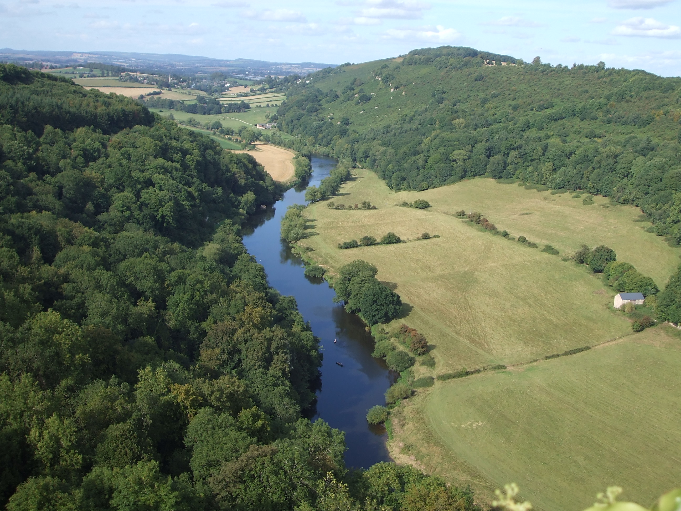
Brandrick's Green is a small hamlet located in the county of Gloucestershire, England. Nestled within the picturesque surroundings of the Forest of Dean, this charming woodland area offers a serene and tranquil retreat for nature enthusiasts and outdoor lovers. The hamlet is situated within close proximity to the bustling market town of Coleford, providing convenient access to amenities and services.

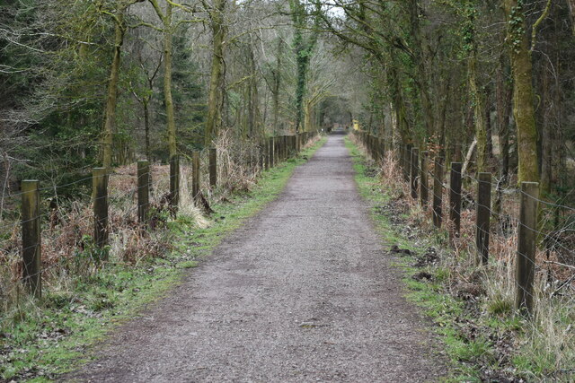
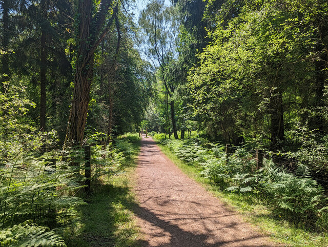
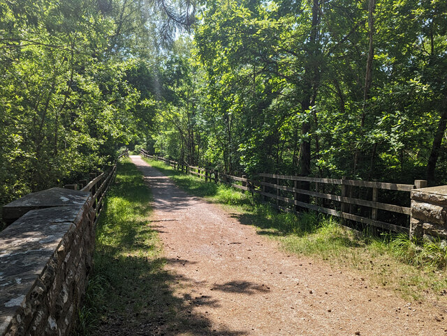
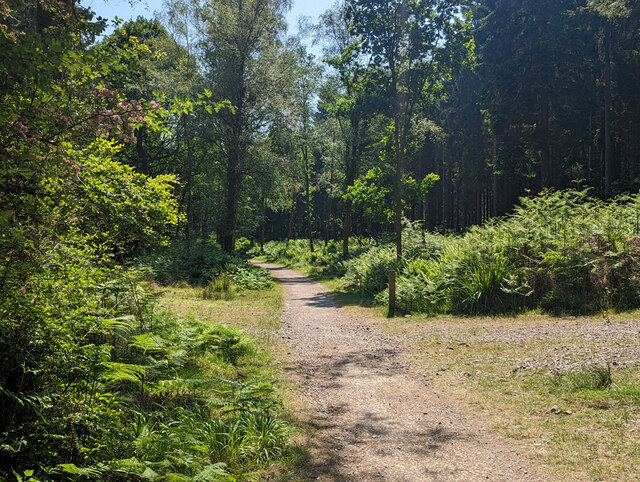
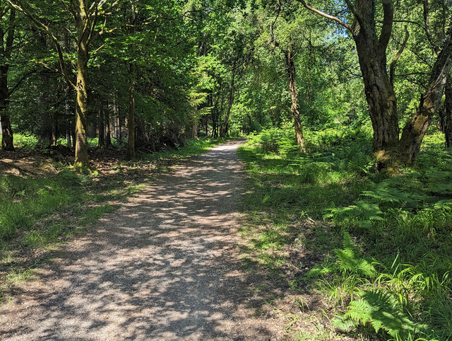
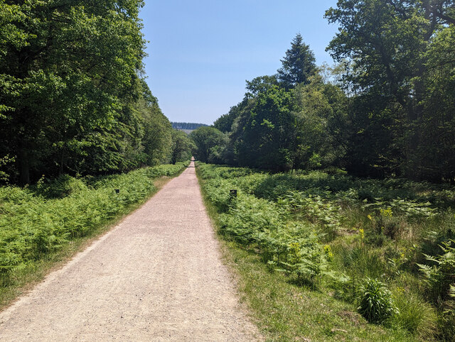
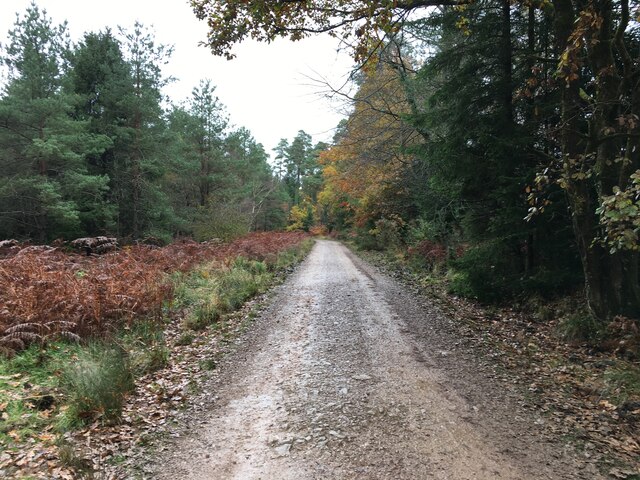
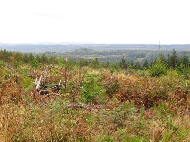
The main feature of Brandrick's Green is its lush greenery, encompassing a variety of trees such as oak, beech, and birch. The woodlands offer an ideal habitat for a diverse range of wildlife, including deer, foxes, and various species of birds. This attracts birdwatchers and wildlife enthusiasts from far and wide.

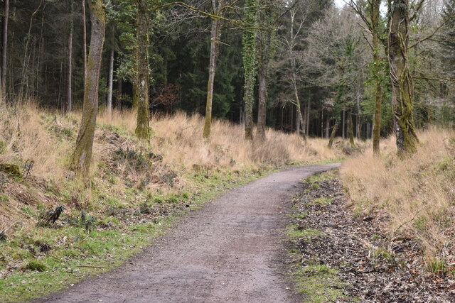
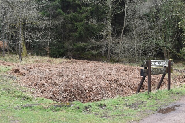
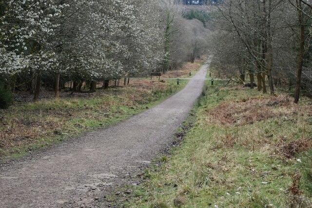
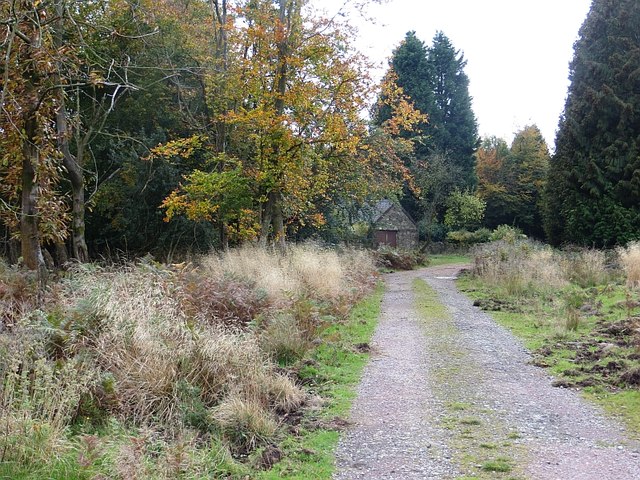
The area is crisscrossed by an intricate network of walking trails, allowing visitors to explore the natural beauty of the Forest of Dean. These trails provide an opportunity to immerse oneself in the peaceful atmosphere, taking in the sights and sounds of the woodlands. Additionally, the hamlet is bordered by several enchanting streams and brooks, adding to the charm of the surroundings.

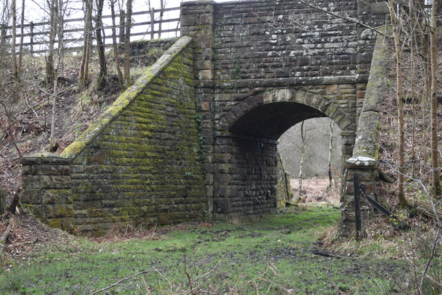
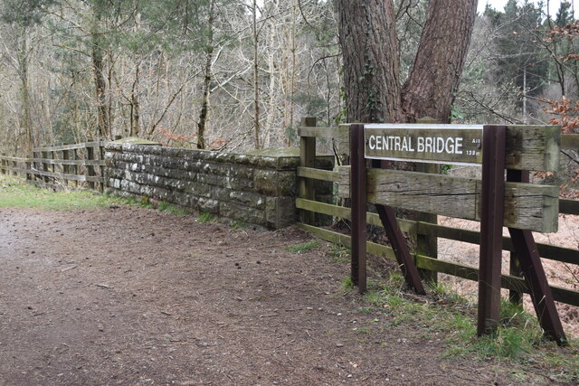
Brandrick's Green also holds historical significance, with remnants of the area's mining past still visible. The Forest of Dean was once a hub for coal and iron ore mining, and the hamlet serves as a reminder of this industrial heritage.

Overall, Brandrick's Green offers a serene and idyllic escape for those seeking to connect with nature. Its lush woodlands, diverse wildlife, and historical significance make it a must-visit destination for outdoor enthusiasts and history buffs alike.

If you have any feedback on the listing, please let us know in the comments section below.

Brandrick's Green Images

Images are sourced within 2km of 51.783537/-2.5308375 or Grid Reference SO6309. Thanks to Geograph Open Source API. All images are credited.

Cycle trail on former railway trackbed
Former railway bridge Carrying the railway trackbed above a Forest track.
Former railway bridge
Carrying the railway trackbed above a Forest track.
Former railway bridge sign
Cycle trail on former railway trackbed
“Spruce Ride” sign Where Spruce Ride crosses the former railway trackbed.
“Spruce Ride” sign
Where Spruce Ride crosses the former railway trackbed.
Former railway cycle trail waymarker post This design, showing railway track changing to cycle tyre track, marks cycle trails on former railway trackbed in this area of the Forest Of Dean.
Former railway cycle trail waymarker post
This design, showing railway track changing to cycle tyre track, marks cycle trails on former railway trackbed in this area of the Forest Of Dean.
Spruce Drive
Spruce Drive
Family Cycle Trail, Forest of Dean The Cycle Trail follows the main line of Severn and Wye Railway to the site of Drybrook Road Junction and then the northern part of the Mineral Loop Line which  is seen here.  The final part of the cycle loop leaves old railway routes and is rather steeply down.
Family Cycle Trail, Forest of Dean
The Cycle Trail follows the main line of Severn and Wye Railway to the site of Drybrook Road Junction and then the northern part of the Mineral Loop Line which is seen here. The final part of the cycle loop leaves old railway routes and is rather steeply down.
Family Cycle Trail, Forest of Dean The Cycle Trail follows the main line of Severn and Wye Railway to the site of Drybrook Road Junction and then the northern part of the Mineral Loop Line which  is seen here from its bridge over a track.  The final part of the cycle loop leaves old railway routes and is rather steeply down.
Family Cycle Trail, Forest of Dean
The Cycle Trail follows the main line of Severn and Wye Railway to the site of Drybrook Road Junction and then the northern part of the Mineral Loop Line which is seen here from its bridge over a track. The final part of the cycle loop leaves old railway routes and is rather steeply down.
Family Cycle Trail, Forest of Dean The Cycle Trail follows the main line of Severn and Wye Railway to the site of Drybrook Road Junction and then this, the northern part of the Mineral Loop Line. The final part of the cycle loop leaves old railway routes.
Family Cycle Trail, Forest of Dean
The Cycle Trail follows the main line of Severn and Wye Railway to the site of Drybrook Road Junction and then this, the northern part of the Mineral Loop Line. The final part of the cycle loop leaves old railway routes.
Spruce Ride, Forest of Dean Looking from its intersection with the Family Cycle Trail.
Spruce Ride, Forest of Dean
Looking from its intersection with the Family Cycle Trail.
Family Cycle Trail, Forest of Dean The Cycle Trail follows the main line of Severn and Wye Railway to the site of Drybrook Road Junction and then this, the northern part of the Mineral Loop Line. The final part of the cycle loop leaves old railway routes.
Family Cycle Trail, Forest of Dean
The Cycle Trail follows the main line of Severn and Wye Railway to the site of Drybrook Road Junction and then this, the northern part of the Mineral Loop Line. The final part of the cycle loop leaves old railway routes.
Large log
Large log
Forestry road, Forest of Dean
Young trees, Staple Edge Wood Near the summit of Staple Edge with a big view.
Young trees, Staple Edge Wood
Near the summit of Staple Edge with a big view.
Staple Edge An inhabited summit in the Forest of Dean.
Staple Edge
An inhabited summit in the Forest of Dean.
Show me another place!

Brandrick's Green is located at Grid Ref: SO6309 (Lat: 51.783537, Lng: -2.5308375)

Administrative County: Gloucestershire

District: Forest of Dean

Police Authority: Gloucestershire

What 3 Words

///energy.knowledge.hopes. Near Cinderford, Gloucestershire

Related Wikis

Meezy Hurst

Meezy Hurst (SO638089 to SO647091) is a 4.3-hectare (11-acre) geological Site of Special Scientific Interest in Gloucestershire, notified in 1986.The site...

Mitcheldean Road & Forest of Dean Junction Railway

The Mitcheldean Road and Forest of Dean Junction Railway was an independent railway company incorporated in 1871, to provide a northerly outlet for iron...

Forest of Dean

The Forest of Dean is a geographical, historical and cultural region in the western part of the county of Gloucestershire, England. It forms a roughly...

Cantref Coch

Cantref Coch (Welsh pronunciation: [ˈkantrɛ(v) koːχ] transl. The Red Cantref) was a cantref associated with the kingdoms of Ergyng, Gwent and the later...

Nearby Amenities

Located within 500m of 51.783537,-2.5308375
Parking
Access: yes
Fee: yes
Parking: surface
Lat/Long: 51.7802753/-2.526882
Bus Stop
The Barracks
Naptan AtcoCode: 1600GLF562
Naptan Bearing: SE
Naptan CommonName: The Barracks
Naptan NaptanCode: gloagtpt
Naptan Street: Blakeney Road
Naptan Verified: no
Source: naptan_import
Lat/Long: 51.7806618/-2.5346203
Parking
Malards Pike
Access: yes
Fee: yes
Operator: Forestry Commission
Parking: surface
Lat/Long: 51.7809755/-2.528928
Toilets
Check Date: 2022-12-24
Fee: no
Wheelchair: yes
Lat/Long: 51.7810692/-2.5281441
Fast Food
Burger Van
Cuisine: burger
Lat/Long: 51.7812802/-2.5282394
Malards Pike Canoe Launch
Leisure: slipway
Lat/Long: 51.7827912/-2.5274051
Bbq
Lat/Long: 51.7802377/-2.5271665
Tourism: picnic_site
Lat/Long: 51.7812879/-2.5276052
Bus Stop
The Barracks
Naptan AtcoCode: 1600GLF561
Naptan Bearing: W
Naptan CommonName: The Barracks
Naptan Indicator: Opp
Naptan NaptanCode: gloagtpj
Naptan Street: Blakeney Road
Naptan Verified: no
Source: naptan_import
Lat/Long: 51.7805653/-2.5348861
Power: pole
Lat/Long: 51.7857233/-2.5251335
Power: pole
Lat/Long: 51.7853101/-2.525332
Power: pole
Lat/Long: 51.7841121/-2.5258443
Location Transition: yes
Power: pole
Lat/Long: 51.7834318/-2.5261554
Give Way
Direction: forward
Lat/Long: 51.7801854/-2.5330147
Location Transition: yes
Power: pole
Lat/Long: 51.7795696/-2.5275676
Telephone
Booth: K6
Covered: booth
Listed Status: Grade II
Phone: +44 1594 562338
Lat/Long: 51.7807041/-2.5346813
Post Box
Collection Times: Mo-Fr 09:00; Sa 07:00
Operator: Royal Mail
Operator Wikidata: Q638098
Post Box Type: lamp
Ref: GL15 17D
Royal Cypher: EIIR
Royal Cypher Wikidata: Q33102113
Source: survey
Lat/Long: 51.7806962/-2.5346458
Barrier: height_restrictor
Flickr: https://www.flickr.com/photos/196297230@N06/52784357428
Maxheight: 5
Lat/Long: 51.7833436/-2.5262706
New Fancy Colliery Junction
Historic Railway: junction
Railway: site
Lat/Long: 51.7831541/-2.5328468
Power: pole
Lat/Long: 51.7792103/-2.5293687
The data included in this document is from www.openstreetmap.org. The data is made available under ODbL.

Have you been to Brandrick's Green?

Leave your review of Brandrick's Green below (or comments, questions and feedback).