Cocklemire Wood

Wood, Forest in Lancashire Lancaster

England

Cocklemire Wood

Disused railway bridge crosses Leck Beck Once part of the Ingleton Branch Railway until closure on 1 October 1964
Disused railway bridge crosses Leck Beck Credit: Tim Glover

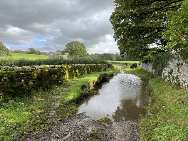
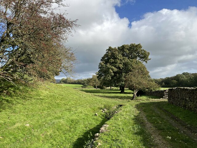
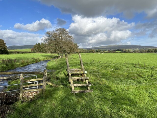
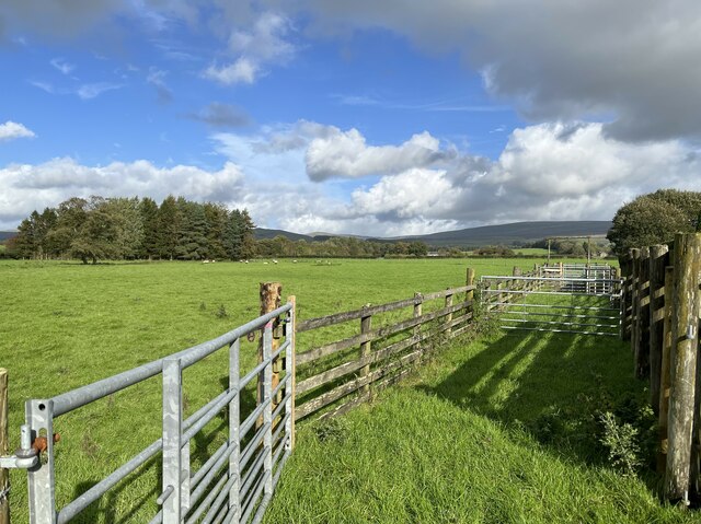
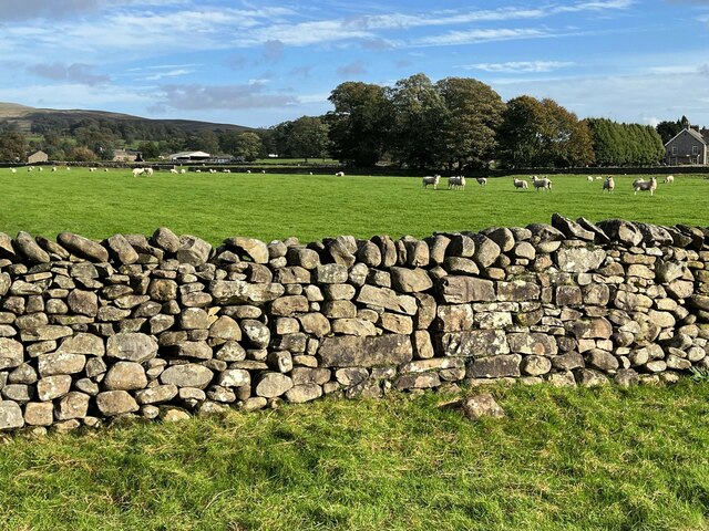
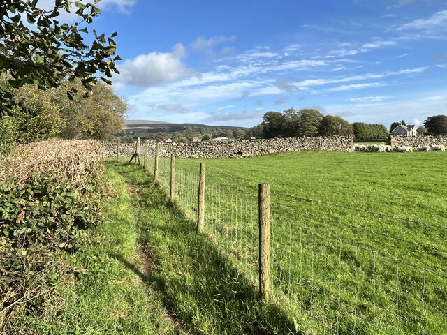
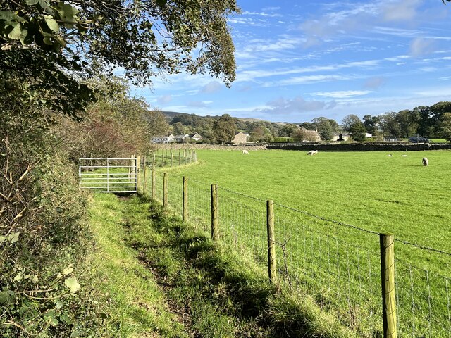
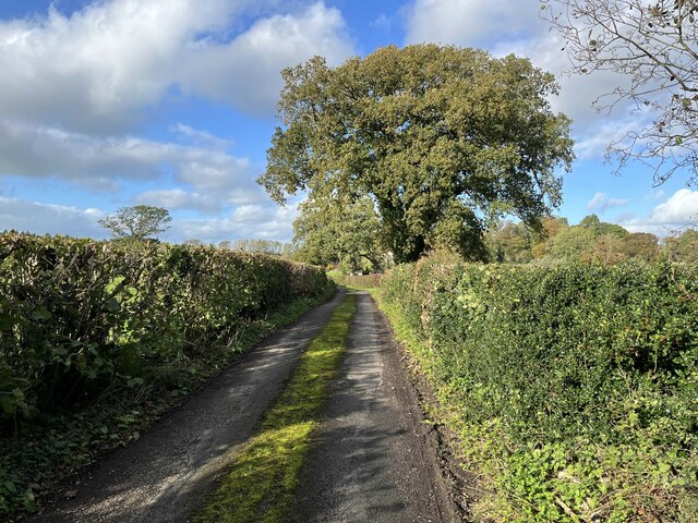
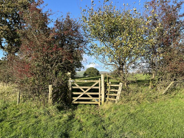
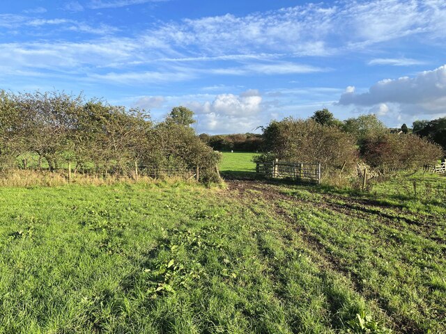
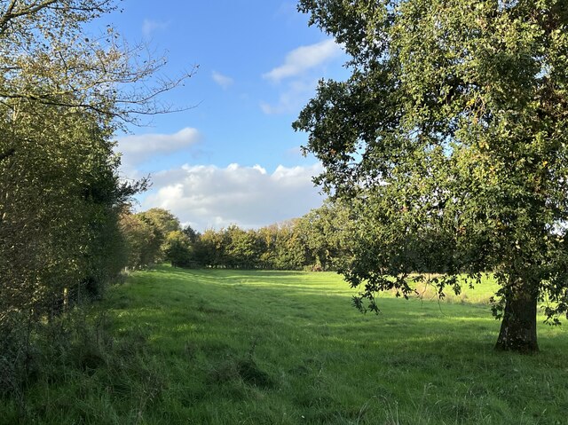
Cocklemire Wood is a picturesque woodland located in Lancashire, England. It covers an area of approximately 100 acres and is known for its diverse range of wildlife and stunning natural beauty. The wood is situated in a rural setting, surrounded by fields and rolling hills, providing a peaceful and tranquil environment for visitors.

The wood is predominantly made up of various species of broadleaf trees, including oak, beech, and birch, which create a dense and vibrant canopy. This lush vegetation provides a rich habitat for a wide array of wildlife, including birds, mammals, and insects. Visitors to Cocklemire Wood have the opportunity to spot species such as woodpeckers, deer, foxes, and butterflies, making it a popular destination for nature enthusiasts and birdwatchers.

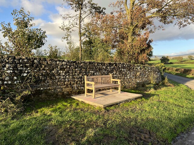
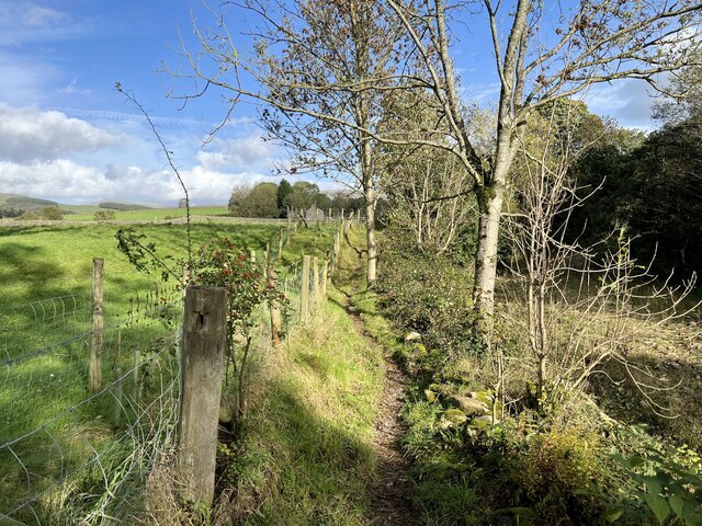
There are several well-maintained walking trails that wind through the wood, allowing visitors to explore its natural wonders at their own pace. These pathways are clearly marked and offer stunning views of the surrounding landscape. In addition to the walking trails, there are also picnic areas and benches scattered throughout the wood, providing opportunities for visitors to relax and enjoy the peaceful surroundings.

Cocklemire Wood is managed by the local council, which ensures the protection and preservation of this valuable natural resource. The wood is open to the public year-round, and there is no admission fee. Whether you are seeking a peaceful retreat, an opportunity to connect with nature, or simply a pleasant stroll through the woods, Cocklemire Wood offers something for everyone.

If you have any feedback on the listing, please let us know in the comments section below.

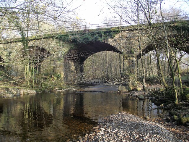
Cocklemire Wood Images

Images are sourced within 2km of 54.17309/-2.566825 or Grid Reference SD6375. Thanks to Geograph Open Source API. All images are credited.

Disused railway bridge crosses Leck Beck Once part of the Ingleton Branch Railway until closure on 1 October 1964
Disused railway bridge crosses Leck Beck
Once part of the Ingleton Branch Railway until closure on 1 October 1964
Benchmark, Cowdber Farm Detail of the Ordnance Survey cut benchmark on the north side of the barn door opening at Cowdber Farm.  The benchmark is not on the Ordnance Survey Database (location photograph <a href="https://www.geograph.org.uk/photo/7623506">SD6275 : The front of Cowdber Barn</a>).
Cowdber Farm is no longer a working farm and the barn has been converted into holiday accommodation.
Benchmark, Cowdber Farm
Detail of the Ordnance Survey cut benchmark on the north side of the barn door opening at Cowdber Farm. The benchmark is not on the Ordnance Survey Database (location photograph SD6275 : The front of Cowdber Barn). Cowdber Farm is no longer a working farm and the barn has been converted into holiday accommodation.
The front of Cowdber Barn Cowdber Farm is no longer a working farm and the barn has been converted into holiday accommodation.
There is an Ordnance Survey cut benchmark on the angle of the wall beyond the door (detail photograph <a href="https://www.geograph.org.uk/photo/7623470">SD6275 : Benchmark, Cowdber Farm</a>).
The front of Cowdber Barn
Cowdber Farm is no longer a working farm and the barn has been converted into holiday accommodation. There is an Ordnance Survey cut benchmark on the angle of the wall beyond the door (detail photograph SD6275 : Benchmark, Cowdber Farm).
Cowdber Barn Cowdber Farm is no longer a working farm and the barn has been converted into holiday accommodation.
There is an Ordnance Survey cut benchmark wall beyond the barn door (detail photograph <a href="https://www.geograph.org.uk/photo/7623470">SD6275 : Benchmark, Cowdber Farm</a>).
Cowdber Barn
Cowdber Farm is no longer a working farm and the barn has been converted into holiday accommodation. There is an Ordnance Survey cut benchmark wall beyond the barn door (detail photograph SD6275 : Benchmark, Cowdber Farm).
Ford near Burrow Hall This ford is on a farm access track between Over Burrow and Leck Beck Barn adjacent to the grounds of Burrow Hall, behind the high stone wall to the right.
A footbridge beside the wall on the northeast side of the ford is provided for the public footpath from Over Burrow to Cowan Bridge.
Ford near Burrow Hall
This ford is on a farm access track between Over Burrow and Leck Beck Barn adjacent to the grounds of Burrow Hall, behind the high stone wall to the right. A footbridge beside the wall on the northeast side of the ford is provided for the public footpath from Over Burrow to Cowan Bridge.
Seat on Woodman Lane The installation of this seat in commemoration of the Coronation of King Charles III was funded by the local community.  Slightly elevated on a stone and concrete plinth, it offers a distant view of the summit of Ingleborough.
The inscription on the seat is:
KING CHARLES III CORONATION 6 MAY 2023
The stone wall behind the seat bounds Burrow Deer Park.
Seat on Woodman Lane
The installation of this seat in commemoration of the Coronation of King Charles III was funded by the local community. Slightly elevated on a stone and concrete plinth, it offers a distant view of the summit of Ingleborough. The inscription on the seat is: KING CHARLES III CORONATION 6 MAY 2023 The stone wall behind the seat bounds Burrow Deer Park.
Footpath by Leck Beck The public footpath from Over Burrow to Cowan Bridge beside Leck Beck near High Gale.
Footpath by Leck Beck
The public footpath from Over Burrow to Cowan Bridge beside Leck Beck near High Gale.
Track and ditch near Leck Beck Barn A public footpath from Over Burrow to Cowan Bridge follows the track.
Track and ditch near Leck Beck Barn
A public footpath from Over Burrow to Cowan Bridge follows the track.
Stile beside Eller Beck This stile, leaning and on the point of collapse, beside Eller Beck near Low Gale is provided for the public footpath from Over Burrow to Cowan Bridge.
The fell in the left background is Brownthwaite, that in the right background is Cragareth.
Stile beside Eller Beck
This stile, leaning and on the point of collapse, beside Eller Beck near Low Gale is provided for the public footpath from Over Burrow to Cowan Bridge. The fell in the left background is Brownthwaite, that in the right background is Cragareth.
Sheep pens, Low Gale
Stile at Cowan Bridge When the old bridge carrying the A65 road over Leck Beck at Cowan Bridge was bypassed with a new bridge built alongside it to the north, the stile provided at the south end of the northeast parapet of the old bridge for the public footpath to Leck was severed from the footpath it had previously served, rendering it virtually redundant.  A new stile was provided for the continuation of the footpath on the opposite side of the present A65.
Stile at Cowan Bridge
When the old bridge carrying the A65 road over Leck Beck at Cowan Bridge was bypassed with a new bridge built alongside it to the north, the stile provided at the south end of the northeast parapet of the old bridge for the public footpath to Leck was severed from the footpath it had previously served, rendering it virtually redundant. A new stile was provided for the continuation of the footpath on the opposite side of the present A65.
Blocked stile near Hagg Brow This stile, blocked with stones, was made redundant when the public footpath from Cowan Bridge to Leck was diverted a few metres to the northwest along the top of the bank above Leck Beck, and fenced off from the field.
Blocked stile near Hagg Brow
This stile, blocked with stones, was made redundant when the public footpath from Cowan Bridge to Leck was diverted a few metres to the northwest along the top of the bank above Leck Beck, and fenced off from the field.
Path near Hagg Brow This is the public footpath from Cowan Bridge to Leck.
Path near Hagg Brow
This is the public footpath from Cowan Bridge to Leck.
Footpath near Leck This is the public footpath from Cowan Bridge on the approach to Leck, visible in the background.
Footpath near Leck
This is the public footpath from Cowan Bridge on the approach to Leck, visible in the background.
Coulter Beck Lane
Coulter Beck Lane
Footpath gate This gate is on the public footpath from Collingholme to Cowan Bridge.
Footpath gate
This gate is on the public footpath from Collingholme to Cowan Bridge.
Field gateway near Collingholme
Roman road near Cowdber Farm This important Roman road went from Manchester via Ribchester, Tebay and Kirkby Thore where it crossed the roman road from Catterick to Carlisle, and on to the Roman fort at Carvoran on Hadrian’s Wall.
The road agger can be seen as a distinct ridge beside the hedge with the drainage ditch discernible beside it.
Roman road near Cowdber Farm
This important Roman road went from Manchester via Ribchester, Tebay and Kirkby Thore where it crossed the roman road from Catterick to Carlisle, and on to the Roman fort at Carvoran on Hadrian’s Wall. The road agger can be seen as a distinct ridge beside the hedge with the drainage ditch discernible beside it.
Show me another place!

Cocklemire Wood is located at Grid Ref: SD6375 (Lat: 54.17309, Lng: -2.566825)

Administrative County: Lancashire

District: Lancaster

Police Authority: Lancashire

What 3 Words

///munch.chose.infants. Near Kirkby Lonsdale, Cumbria

Nearby Locations

Cocklemire Wood

Related Wikis

Cowan Bridge

Cowan Bridge is a village in the English county of Lancashire. It is south-east of the town of Kirkby Lonsdale where the main A65 road crosses the Leck...

Cowan Bridge School

The Cowan Bridge School was a Clergy Daughters' School, founded in the 1820s, at Cowan Bridge in the English county of Lancashire. It was mainly for the...
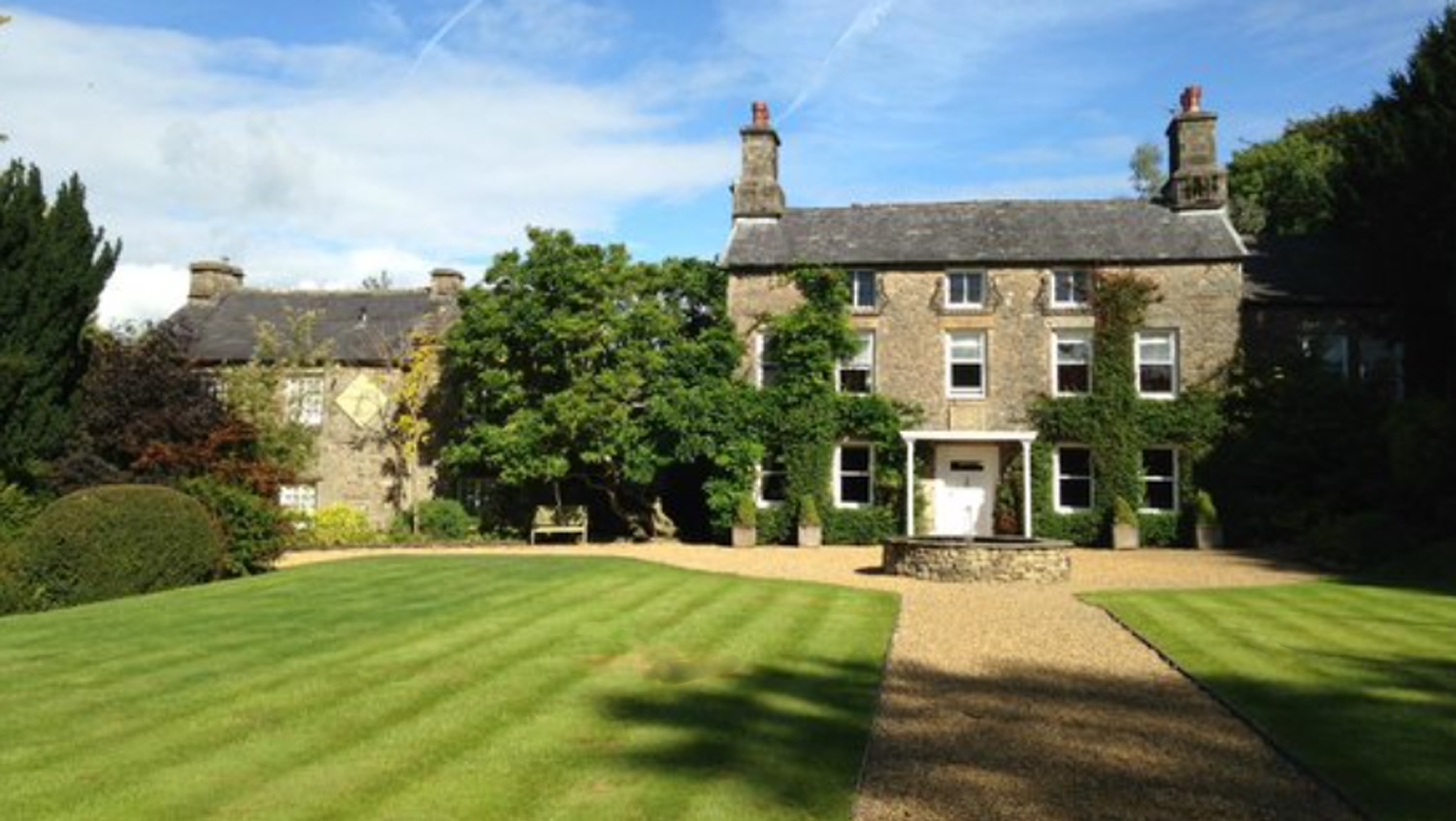
Hipping Hall

Hipping Hall is a country house hotel on the border of Lancashire, Cumbria and North Yorkshire, near Kirkby Lonsdale. Opened in 2005 by chemist-turned...

Burrow-with-Burrow

Burrow-with-Burrow is a civil parish in the English county of Lancashire. The parish of Burrow-with-Burrow had a population of 191 recorded in the 2001...

Nearby Amenities

Located within 500m of 54.17309,-2.566825
Power: pole
Lat/Long: 54.1732736/-2.5736232
Power: pole
Lat/Long: 54.1725541/-2.5729874
Power: pole
Lat/Long: 54.1719232/-2.5723334
Power: pole
Lat/Long: 54.1713879/-2.5711254
Power: pole
Lat/Long: 54.1710667/-2.5703993
Power: pole
Lat/Long: 54.1705195/-2.5691665
Power: pole
Lat/Long: 54.1697521/-2.5688758
Power: pole
Lat/Long: 54.1688695/-2.5685186
Barrier: stile
Material: metal
Note: Yes. There actually is a stile in the gate. Never seen this before.
Source: survey;gps
Stile: stepover
Lat/Long: 54.1704009/-2.5672996
Barrier: stile
Material: wood
Source: survey;gps
Stile: stepover
Lat/Long: 54.1699604/-2.5664722
Barrier: cattle_grid
Lat/Long: 54.1702005/-2.5720949
Power: pole
Lat/Long: 54.1707184/-2.5720386
Power: pole
Lat/Long: 54.1714605/-2.5719866
Power: pole
Lat/Long: 54.1721022/-2.5719191
Power: pole
Lat/Long: 54.1728109/-2.5718671
Power: pole
Lat/Long: 54.1735119/-2.5718229
Power: pole
Lat/Long: 54.1742144/-2.5717736
Power: pole
Lat/Long: 54.1749228/-2.5717164
Power: pole
Lat/Long: 54.175643/-2.5716668
Power: pole
Lat/Long: 54.1763881/-2.5716007
The data included in this document is from www.openstreetmap.org. The data is made available under ODbL.

Have you been to Cocklemire Wood?

Leave your review of Cocklemire Wood below (or comments, questions and feedback).