South Cornelly

Settlement in Glamorgan

Wales

South Cornelly

Sker House Atop the wind blasted dunes of Sker Point, a Cistercian monastery founded some 900 years ago became a private house in Tudor times. It has had a chequered history and is surrounded by impossibly romantic tales of ghosts and thwarted love.  This picture was taken just a very few years before the house, derelict for a century, was saved from total collapse and is now saved for the nation as one of the most important historic houses in Wales.
Sker House Credit: Deirdre Shaw

South Cornelly is a small village located in the county of Glamorgan, South Wales. Situated on the southern coast of Wales, it lies approximately 8 miles to the west of Bridgend and 20 miles to the east of Swansea.

The village is primarily residential, with a population of around 3,000 residents. It is well-connected to the surrounding areas by road, with the M4 motorway just a short distance away, providing easy access to both Cardiff and Swansea. The nearby Bridgend railway station also offers convenient rail links to other major cities in the region.

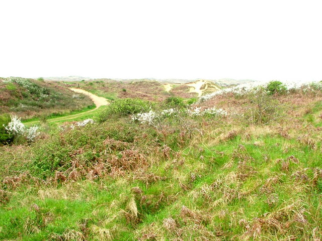
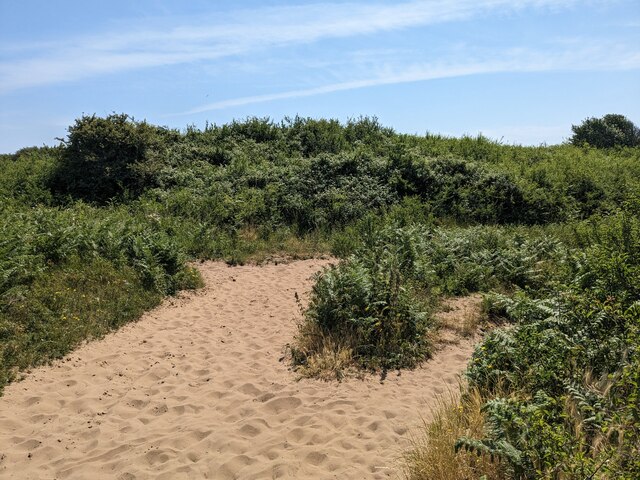
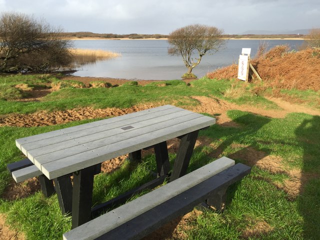
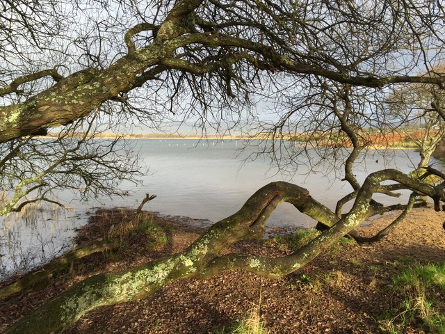
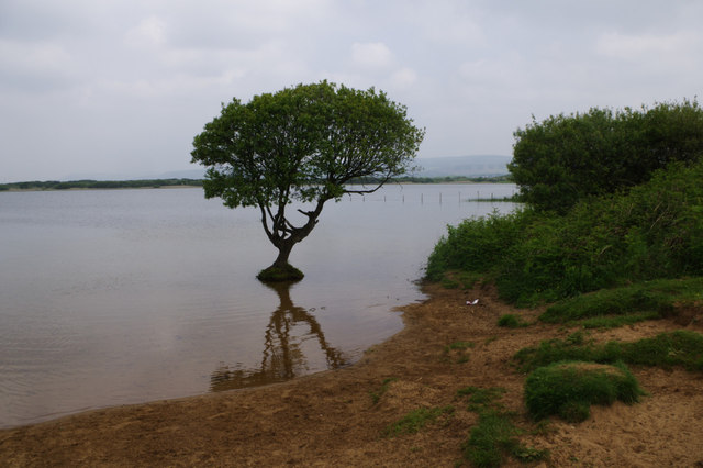
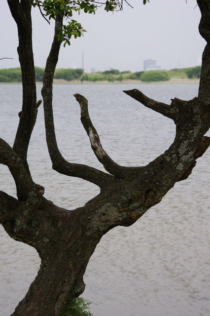
South Cornelly is surrounded by beautiful natural landscapes, with the nearby Kenfig National Nature Reserve providing a haven for wildlife enthusiasts and nature lovers. The reserve includes a large lake and sand dunes, with rare plant species and a diverse range of birdlife.

In terms of amenities, the village offers a range of local shops, including a convenience store, a post office, and a few small businesses. There is also a primary school, providing education for the local children.

Despite its relatively small size, South Cornelly boasts a strong sense of community, with various local events and activities organized throughout the year. The village also benefits from its proximity to the stunning coastline of Glamorgan, offering residents and visitors the opportunity to enjoy beach walks and water sports.

If you have any feedback on the listing, please let us know in the comments section below.

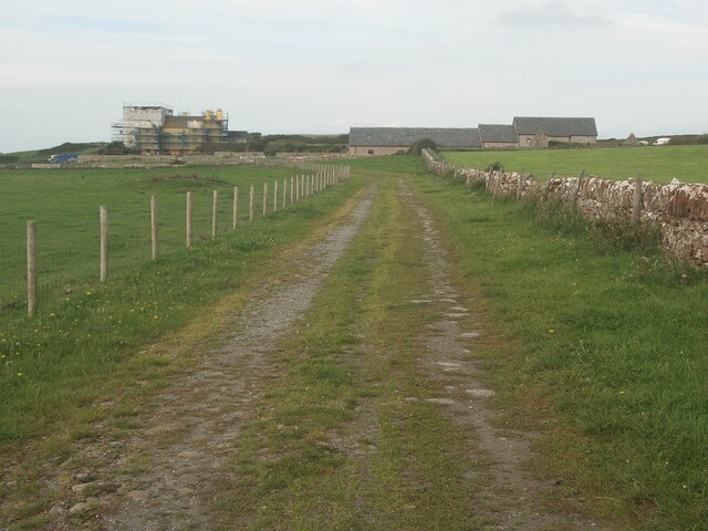
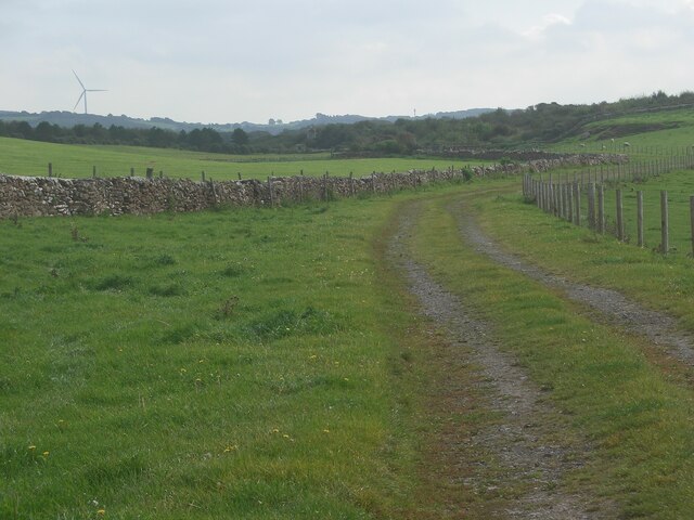
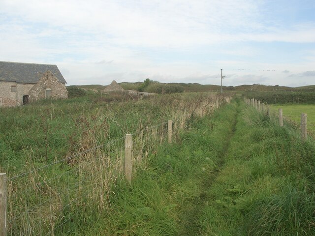
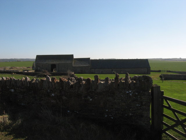
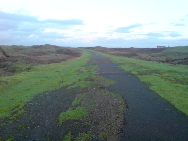
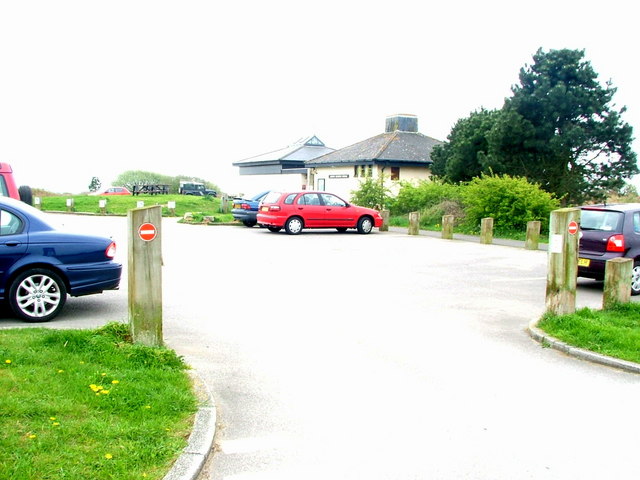
South Cornelly Images

Images are sourced within 2km of 51.510114/-3.708576 or Grid Reference SS8180. Thanks to Geograph Open Source API. All images are credited.

Sker House Atop the wind blasted dunes of Sker Point, a Cistercian monastery founded some 900 years ago became a private house in Tudor times. It has had a chequered history and is surrounded by impossibly romantic tales of ghosts and thwarted love.  This picture was taken just a very few years before the house, derelict for a century, was saved from total collapse and is now saved for the nation as one of the most important historic houses in Wales.
Sker House
Atop the wind blasted dunes of Sker Point, a Cistercian monastery founded some 900 years ago became a private house in Tudor times. It has had a chequered history and is surrounded by impossibly romantic tales of ghosts and thwarted love. This picture was taken just a very few years before the house, derelict for a century, was saved from total collapse and is now saved for the nation as one of the most important historic houses in Wales.
Public footpath approaching Sker House from the east The public footpath, which takes the form of a track, has run here from a spot on the Nottage to Kenfig Road by Parc Newydd Farm.

At the time the picture was taken, extensive work was ongoing at Sker House which was covered with scaffolding. The latter had sheeting attached to it in places.

As well as the house itself, the image shows some of its outbuildings which are known as Ty-yr-ychen and are Grade II listed - see <span class="nowrap"><a title="https://britishlistedbuildings.co.uk/300011360-ty-yr-ychen-also-known-as-sker-house-farm-buildings-cornelly" rel="nofollow ugc noopener" href="https://britishlistedbuildings.co.uk/300011360-ty-yr-ychen-also-known-as-sker-house-farm-buildings-cornelly">Link</a><img style="margin-left:2px;" alt="External link" title="External link - shift click to open in new window" src="https://s1.geograph.org.uk/img/external.png" width="10" height="10"/></span>.
Public footpath approaching Sker House from the east
The public footpath, which takes the form of a track, has run here from a spot on the Nottage to Kenfig Road by Parc Newydd Farm. At the time the picture was taken, extensive work was ongoing at Sker House which was covered with scaffolding. The latter had sheeting attached to it in places. As well as the house itself, the image shows some of its outbuildings which are known as Ty-yr-ychen and are Grade II listed - see LinkExternal link.
Public footpath heading eastwards from Sker House Sker House is situated a short distance behind the camera. The public footpath to the Nottage-Kenfig road by Parc Newydd Farm runs along the track seen, which no doubt will be used by some vehicles, although is not the main road route to and from the House.

The fence seen on the south side of the track is a relatively new feature, and for some walkers will be a welcome barrier between them and any cattle grazing on the land in front of the House.
Public footpath heading eastwards from Sker House
Sker House is situated a short distance behind the camera. The public footpath to the Nottage-Kenfig road by Parc Newydd Farm runs along the track seen, which no doubt will be used by some vehicles, although is not the main road route to and from the House. The fence seen on the south side of the track is a relatively new feature, and for some walkers will be a welcome barrier between them and any cattle grazing on the land in front of the House.
Public footpath by Ty-yr-ychen, Sker This stretch of path runs close to the outbuildings of Sker House known as Ty-yr-ychen which can be seen in the right half of <a href="https://www.geograph.org.uk/photo/7598642">SS7979 : Public footpath approaching Sker House from the east</a>.  For those who have taken the public footpath from the Nottage-Kenfig road by Parc Newydd Farm to Sker House and wish to continue walking without retracing steps, this stretch of path is initially the only option available. Just a short distance ahead, however, there will be choices to be made between different paths to take.
Public footpath by Ty-yr-ychen, Sker
This stretch of path runs close to the outbuildings of Sker House known as Ty-yr-ychen which can be seen in the right half of SS7979 : Public footpath approaching Sker House from the east. For those who have taken the public footpath from the Nottage-Kenfig road by Parc Newydd Farm to Sker House and wish to continue walking without retracing steps, this stretch of path is initially the only option available. Just a short distance ahead, however, there will be choices to be made between different paths to take.
Ty'r-y-ychen: barn near Sker House
Sand Dunes, Kenfig National Nature Reserve This area was once a thriving medieval borough but is now a site of special scientifice interest.
Sand Dunes, Kenfig National Nature Reserve
This area was once a thriving medieval borough but is now a site of special scientifice interest.
Old surfaced road This old road leads into Kenfig Nature Reserve, a large area of sand dunes.  The road was built parallel to the beach of Kenfig Sands in the 1960s for the transport of large quantities of rock from the South Cornelly quarries to the new harbour of the Steel Company at Margam.
Old surfaced road
This old road leads into Kenfig Nature Reserve, a large area of sand dunes. The road was built parallel to the beach of Kenfig Sands in the 1960s for the transport of large quantities of rock from the South Cornelly quarries to the new harbour of the Steel Company at Margam.
Kenfig National Nature Reserve Kenfig Pool is Glamorgan’s largest natural lake close to the steelworks at Port Talbot and to Bridgend.  The reserve is one of the finest wildlife habitats in Wales and one of the last remaining examples of the huge dune system that once stretched along the coast of South Wales from the River Ogmore to the Gower peninsula. Surrounding the pool the dunes are home to a wide variety of wild orchids, as well as insects and other wildlife. Otters have been seen among the reed beds recently and among a variety of wildfowl the site is a regular wintering location for the Bittern and is a summer breeding site for Reed and Sedge Warblers. The scarcer Aquatic Warbler regularly visits in autumn.  Kenfig is therefore one of the most important sites in Britain for nature conservation.
Kenfig National Nature Reserve
Kenfig Pool is Glamorgan’s largest natural lake close to the steelworks at Port Talbot and to Bridgend. The reserve is one of the finest wildlife habitats in Wales and one of the last remaining examples of the huge dune system that once stretched along the coast of South Wales from the River Ogmore to the Gower peninsula. Surrounding the pool the dunes are home to a wide variety of wild orchids, as well as insects and other wildlife. Otters have been seen among the reed beds recently and among a variety of wildfowl the site is a regular wintering location for the Bittern and is a summer breeding site for Reed and Sedge Warblers. The scarcer Aquatic Warbler regularly visits in autumn. Kenfig is therefore one of the most important sites in Britain for nature conservation.
Sandy Pathways
Sandy Pathways
A choice of paths in the south of the Pyle & Kenfig golf course The path ahead in the right half of the image is a track which runs along or, at points, close to the southern boundary of the course, and which can be seen in, for example, <a href="https://www.geograph.org.uk/photo/7600535">SS8080 : Track near the southern edge of the Pyle & Kenfig golf course</a>. Less conspicuous in this view is a path ahead in the left half of the image which from here runs right across the course towards Kenfig village.

These are just two of many paths which run and criss-cross here.
A choice of paths in the south of the Pyle & Kenfig golf course
The path ahead in the right half of the image is a track which runs along or, at points, close to the southern boundary of the course, and which can be seen in, for example, SS8080 : Track near the southern edge of the Pyle & Kenfig golf course. Less conspicuous in this view is a path ahead in the left half of the image which from here runs right across the course towards Kenfig village. These are just two of many paths which run and criss-cross here.
Picnic table - Kenfig Pool Picnic area at Kenfig Pool
Picnic table - Kenfig Pool
Picnic area at Kenfig Pool
Kenfig Pool Pool at Kenfig nature reserve.
Kenfig Pool
Pool at Kenfig nature reserve.
Kenfig Pool Kenfig Pool viewed through trees in winter.
Kenfig Pool
Kenfig Pool viewed through trees in winter.
Kenfig Pool Set among the dunes of the Kenfig Nature Reserve, Kenfig Pool covers about 70 acres. According to local legend, the lake is bottomless; it is not, of course, the maximum depth is about 12 feet.
Kenfig Pool
Set among the dunes of the Kenfig Nature Reserve, Kenfig Pool covers about 70 acres. According to local legend, the lake is bottomless; it is not, of course, the maximum depth is about 12 feet.
Kenfig Pool Looking through the branches of a tree on the southern shore of Kenfig Pool with the steelworks at Port Talbot discernible through the haze in the distance.
Kenfig Pool
Looking through the branches of a tree on the southern shore of Kenfig Pool with the steelworks at Port Talbot discernible through the haze in the distance.
Kenfig Pool Set among the dunes of the Kenfig Nature Reserve, Kenfig Pool covers about 70 acres. According to local legend, the lake is bottomless; it is not, of course, the maximum depth is about 12 feet.
Kenfig Pool
Set among the dunes of the Kenfig Nature Reserve, Kenfig Pool covers about 70 acres. According to local legend, the lake is bottomless; it is not, of course, the maximum depth is about 12 feet.
Kenfig National Nature Reserve Centre and Car Park This reserve is an important area of sand dunes
Kenfig National Nature Reserve Centre and Car Park
This reserve is an important area of sand dunes
Golf at  Kenfig Kenfig golf course - green south of the road very close to the centre of the square
Golf at Kenfig
Kenfig golf course - green south of the road very close to the centre of the square
Show me another place!

South Cornelly is located at Grid Ref: SS8180 (Lat: 51.510114, Lng: -3.708576)

Unitary Authority: Bridgend

Police Authority: South Wales

What 3 Words

///discussed.booth.fatherly. Near Pyle, Bridgend

Related Wikis

South Cornelly

South Cornelly (Welsh: Corneli Waelod) is a village in Cornelly, Bridgend county borough, Wales. The village is close to North Cornelly, Pyle and Porthcawl...
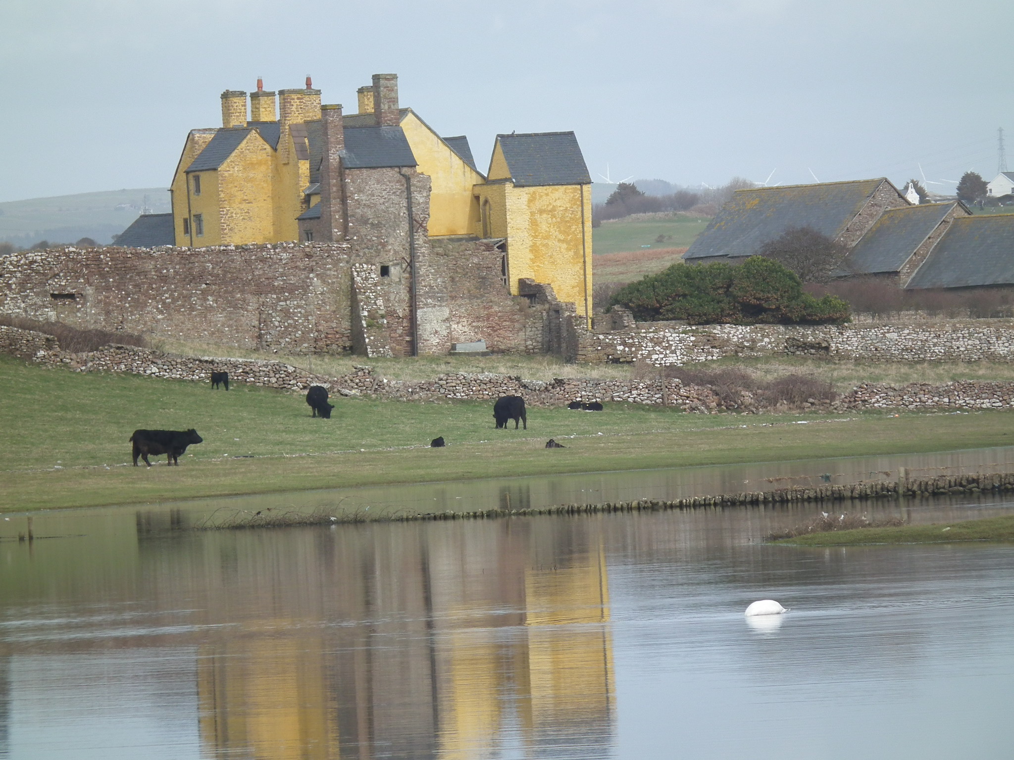
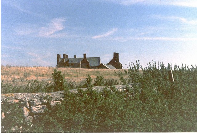
Sker House

Sker House is a historic building in Wales. Originally built as a monastic grange of the Cistercian order over 900 years ago, it is situated just outside...

Cornelly

Cornelly (Welsh: Corneli) is a community and electoral ward in Bridgend County Borough, South Wales. As of 2011 the population of the Cornelly ward was...

North Cornelly

North Cornelly (Welsh: Gogledd Corneli) is a village in Cornelly, Bridgend county borough, Wales. The village is close to South Cornelly, adjoins Pyle...

Nearby Amenities

Located within 500m of 51.510114,-3.708576
Mini Roundabout
Direction: clockwise
Lat/Long: 51.5114599/-3.7026455
South Cornelly
Name Cy: Corneli Waelod
Name En: South Cornelly
Place: village
Wikidata: Q7566900
Lat/Long: 51.5106458/-3.7017001
Power: pole
Lat/Long: 51.5141944/-3.7116194
Power: pole
Lat/Long: 51.5124784/-3.7102568
Power: pole
Lat/Long: 51.511173/-3.7091732
Power: pole
Lat/Long: 51.5099411/-3.7087441
Power: pole
Lat/Long: 51.508689/-3.7082881
Power: pole
Lat/Long: 51.5079578/-3.7079984
Power: pole
Lat/Long: 51.5067358/-3.7075639
Direction: 170
Generator Method: photovoltaic
Generator Output Electricity: yes
Generator Solar Modules: 16
Generator Source: solar
Generator Type: solar_photovoltaic_panel
Location: roof
Power: generator
Lat/Long: 51.5096462/-3.7042745
Direction: SSE
Generator Method: photovoltaic
Generator Output Electricity: yes
Generator Solar Modules: 10
Generator Source: solar
Generator Type: solar_photovoltaic_panel
Location: roof
Power: generator
Lat/Long: 51.5113314/-3.7023668
Direction: SSE
Generator Method: photovoltaic
Generator Output Electricity: yes
Generator Solar Modules: 5
Generator Source: solar
Generator Type: solar_photovoltaic_panel
Location: roof
Power: generator
Lat/Long: 51.5111947/-3.7028351
Direction: 165
Generator Method: photovoltaic
Generator Output Electricity: yes
Generator Solar Modules: 13
Generator Source: solar
Generator Type: solar_photovoltaic_panel
Location: roof
Power: generator
Lat/Long: 51.5110069/-3.7042406
Direction: 165
Generator Method: photovoltaic
Generator Output Electricity: yes
Generator Solar Modules: 12
Generator Source: solar
Generator Type: solar_photovoltaic_panel
Location: roof
Power: generator
Lat/Long: 51.5109863/-3.704361
The data included in this document is from www.openstreetmap.org. The data is made available under ODbL.

Have you been to South Cornelly?

Leave your review of South Cornelly below (or comments, questions and feedback).