Andrew's Wood

Wood, Forest in Shropshire

England

Andrew's Wood

Car park at Cleeton St. Mary The private track in the distance leads to the Blue Stone Farm, north from Magpie Hill. This car park is by the village hall at Cleeton St. Mary.
Car park at Cleeton St. Mary Credit: Fabian Musto

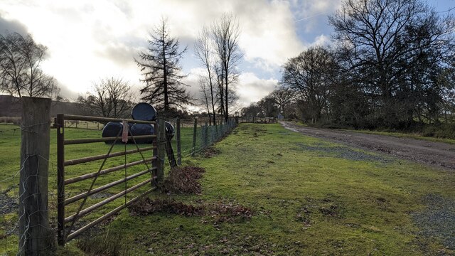
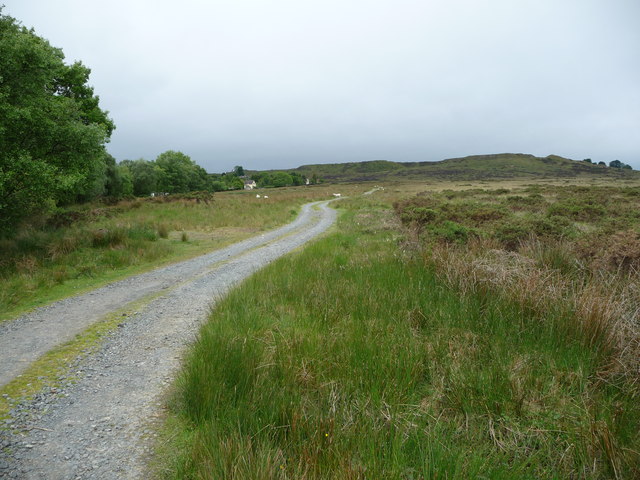
Andrew's Wood is a picturesque forest located in the county of Shropshire, England. Covering an area of approximately 100 acres, it is a popular destination for nature enthusiasts and outdoor lovers. The forest is situated in a rural setting, surrounded by rolling hills and stunning landscapes, providing visitors with a serene and tranquil environment.

The wood is primarily composed of deciduous trees, such as oak, beech, and ash, which create a dense canopy that provides shade and shelter for a variety of wildlife. This vibrant ecosystem is home to a diverse range of flora and fauna, including deer, rabbits, squirrels, and numerous species of birds.

The forest offers a network of well-maintained trails, allowing visitors to explore its beauty on foot. These paths wind through the woodland, offering glimpses of enchanting wildflowers and ancient trees. The terrain is relatively gentle, making it accessible to people of all ages and fitness levels.

Andrew's Wood also boasts a small pond, which adds to its charm and provides a habitat for aquatic creatures. Visitors can enjoy peaceful moments by the pond, observing dragonflies skimming across the water's surface or listening to the gentle croaking of frogs.

The wood is managed by a local conservation organization, which ensures the preservation of its natural beauty and the protection of its wildlife. Educational programs and guided walks are often organized to enhance visitors' understanding of the forest's ecological importance.

Overall, Andrew's Wood is a haven of tranquility and natural beauty, offering visitors a chance to immerse themselves in the wonders of the Shropshire countryside.

If you have any feedback on the listing, please let us know in the comments section below.

Andrew's Wood Images

Images are sourced within 2km of 52.389114/-2.546216 or Grid Reference SO6276. Thanks to Geograph Open Source API. All images are credited.

Car park at Cleeton St. Mary The private track in the distance leads to the Blue Stone Farm, north from Magpie Hill. This car park is by the village hall at Cleeton St. Mary.
Car park at Cleeton St. Mary
The private track in the distance leads to the Blue Stone Farm, north from Magpie Hill. This car park is by the village hall at Cleeton St. Mary.
Trees by Cleeton Lane These trees are north from the village hall at Cleeton St. Mary.
Trees by Cleeton Lane
These trees are north from the village hall at Cleeton St. Mary.
Cleeton St. Mary village hall Here is the village hall at Cleeton Lane in Cleeton St. Mary, built during the late twentieth century.
Cleeton St. Mary village hall
Here is the village hall at Cleeton Lane in Cleeton St. Mary, built during the late twentieth century.
Cleeton St. Mary The village sign for Cleeton St. Mary is by Cleeton Lane, situated northwest from the village hall.
Cleeton St. Mary
The village sign for Cleeton St. Mary is by Cleeton Lane, situated northwest from the village hall.
Catherton Common Lane on Catherton Common.
Catherton Common
Lane on Catherton Common.
Crumps Brook Parapet of bridge over Crumps Brook on Catherton Common.
Crumps Brook
Parapet of bridge over Crumps Brook on Catherton Common.
Crumps Brook Stream on Catherton Common.
Crumps Brook
Stream on Catherton Common.
Catherton Common Lane on Catherton Common at its junction with Stockhall Lane.  Note the Pre-Worboys sign by the shelter - for close up see <a href="https://www.geograph.org.uk/photo/7697018">SO6277 : Sign, Catherton Common</a>.
Catherton Common
Lane on Catherton Common at its junction with Stockhall Lane. Note the Pre-Worboys sign by the shelter - for close up see SO6277 : Sign, Catherton Common.
Sign, Catherton Common Pre-Worboys direction sign on Catherton Common at its junction with Stockhall Lane - see <a href="https://www.geograph.org.uk/photo/7697017">SO6277 : Catherton Common</a> for a wider view.
Sign, Catherton Common
Pre-Worboys direction sign on Catherton Common at its junction with Stockhall Lane - see SO6277 : Catherton Common for a wider view.
Stockhall Lane Stockhall Lane on Catherton Common.
Stockhall Lane
Stockhall Lane on Catherton Common.
Growing crops near the footpath in May The crops seem to be doing better now we've had some showery days.
Growing crops near the footpath in May
The crops seem to be doing better now we've had some showery days.
"Git orf moi land!" The footpath here passes through an extensive (and very well-kept) garden, under the guardianship of this grumpy, territorial and hefty old male Labrador, whose big early wuffs encouraged us to gain the exit gate before him. I don't think he would have appreciated me pointing out the finer points of the fact that we were on a right of way and that he should learn some manners, respect nice visitors and consider moving house if he thinks otherwise. Or I may return with my two Pitbulls.
"Git orf moi land!"
The footpath here passes through an extensive (and very well-kept) garden, under the guardianship of this grumpy, territorial and hefty old male Labrador, whose big early wuffs encouraged us to gain the exit gate before him. I don't think he would have appreciated me pointing out the finer points of the fact that we were on a right of way and that he should learn some manners, respect nice visitors and consider moving house if he thinks otherwise. Or I may return with my two Pitbulls.
Horses from the footpath In a scene reminiscent of a Stubbs portrait these two horses pose against a tree and a dark sky.
Horses from the footpath
In a scene reminiscent of a Stubbs portrait these two horses pose against a tree and a dark sky.
St. Michael & All Angels church, Hopton Wafers A well kept church and churchyard with lots of interesting tombs and memorials.
St. Michael & All Angels church, Hopton Wafers
A well kept church and churchyard with lots of interesting tombs and memorials.
Tomb for Thomas Botfield in Hopton Wafers churchyard A family-style tomb for a Thomas Botfield and Lucy his wife. Born in 1762 he was the local Squire from the 1790's until his demise in 1843. He apparently came from an old Shropshire family and was son of another Thomas Botfield. By the time he bought Hopton Court in 1792 he was already a well established local industrialist, one of four brothers, and could boast coal mining rights on Titterstone Clee, several lime kilns and three local paper mills. He went on to claim patents for products and new inventions associated with the ironworking industry and with one brother was a partner in a banking business. In his spare time he became a recognised geologist and horticulturalist - to the extent that he was a Fellow of the Royal Society. He was also a JP and became Deputy Lieutenant of Shropshire. His Will states that by his death in 1843 he owned manors in not only Hopton Wafers but Cleeton and Whitton in Shropshire and Farlow in Herefordshire, all manorial rights bought rather than inherited. He also owned property in not only Hopton Wafers but Coreley, Milsom, Stottesdon, Farlow, Neen Savage, Cleeton, Oreton, Detton, Whitton, Ludlow, Stanton Lacy, Shrewsbury and last, but by no means least, Brecon. In 1825 he had the old church in Hopton Wafers demolished and the present one built, doing the same in nearby Doddington. His wife endowed the local school.

This large family style tomb reveals that they died sadly childless. None of the other panels on any face are inscribed.
Tomb for Thomas Botfield in Hopton Wafers churchyard
A family-style tomb for a Thomas Botfield and Lucy his wife. Born in 1762 he was the local Squire from the 1790's until his demise in 1843. He apparently came from an old Shropshire family and was son of another Thomas Botfield. By the time he bought Hopton Court in 1792 he was already a well established local industrialist, one of four brothers, and could boast coal mining rights on Titterstone Clee, several lime kilns and three local paper mills. He went on to claim patents for products and new inventions associated with the ironworking industry and with one brother was a partner in a banking business. In his spare time he became a recognised geologist and horticulturalist - to the extent that he was a Fellow of the Royal Society. He was also a JP and became Deputy Lieutenant of Shropshire. His Will states that by his death in 1843 he owned manors in not only Hopton Wafers but Cleeton and Whitton in Shropshire and Farlow in Herefordshire, all manorial rights bought rather than inherited. He also owned property in not only Hopton Wafers but Coreley, Milsom, Stottesdon, Farlow, Neen Savage, Cleeton, Oreton, Detton, Whitton, Ludlow, Stanton Lacy, Shrewsbury and last, but by no means least, Brecon. In 1825 he had the old church in Hopton Wafers demolished and the present one built, doing the same in nearby Doddington. His wife endowed the local school. This large family style tomb reveals that they died sadly childless. None of the other panels on any face are inscribed.
Gate dating from 1825 in Hopton Wafers churchyard A rare style of double kissing-gate taking the footpath away from the church.
Gate dating from 1825 in Hopton Wafers churchyard
A rare style of double kissing-gate taking the footpath away from the church.
Footpath across fields The footpath here climbs a long field with good views back towards Hopton and with distant views towards Abberley Hill in neighbouring Worcestershire.
Footpath across fields
The footpath here climbs a long field with good views back towards Hopton and with distant views towards Abberley Hill in neighbouring Worcestershire.
Track  above Hoptonbank This track carries the footpath up towards more open moorland and the post-industrial scars of Clee Hill.
Track above Hoptonbank
This track carries the footpath up towards more open moorland and the post-industrial scars of Clee Hill.
Show me another place!

Andrew's Wood is located at Grid Ref: SO6276 (Lat: 52.389114, Lng: -2.546216)

Unitary Authority: Shropshire

Police Authority: West Mercia

What 3 Words

///shuts.trifling.bright. Near Cleobury Mortimer, Shropshire

Nearby Locations

Foxwood Andrew's Wood

Related Wikis

A4117 road

The A4117 is a single-carriageway 'A road' in western England, largely in Shropshire, which passes through part of the Wyre Forest and Clee Hills. ��2...

Hopton Wafers

Hopton Wafers is a small village and civil parish in south Shropshire, England. The population of the public parish at the 2011 census was 753. It is located...

Catherton Common

Catherton Common is a nature reserve of the Shropshire Wildlife Trust, between Cleehill and Cleobury Mortimer in Shropshire, England. It is heathland...

Cleeton St Mary

Cleeton St Mary (or Cleeton) is a small village in south Shropshire, England. It lies on the northeast slope of Titterstone Clee Hill, at an elevation...

Nearby Amenities

Located within 500m of 52.389114,-2.546216
Barrier: stile
Lat/Long: 52.3853562/-2.5435782
The data included in this document is from www.openstreetmap.org. The data is made available under ODbL.

Have you been to Andrew's Wood?

Leave your review of Andrew's Wood below (or comments, questions and feedback).