Bankcroft Plantation

Wood, Forest in Westmorland South Lakeland

England

Bankcroft Plantation

Road junction in Barbondale The signpost points left to Barbon and Sedbergh; right to Dent and Hawes; and behind the camera to Casterton and Kirkby Lonsdale. There's also a cycle route sign for the Lakes and Dales Loop.
Road junction in Barbondale Credit: Stephen Craven

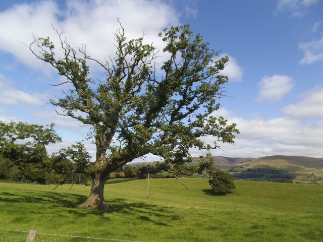
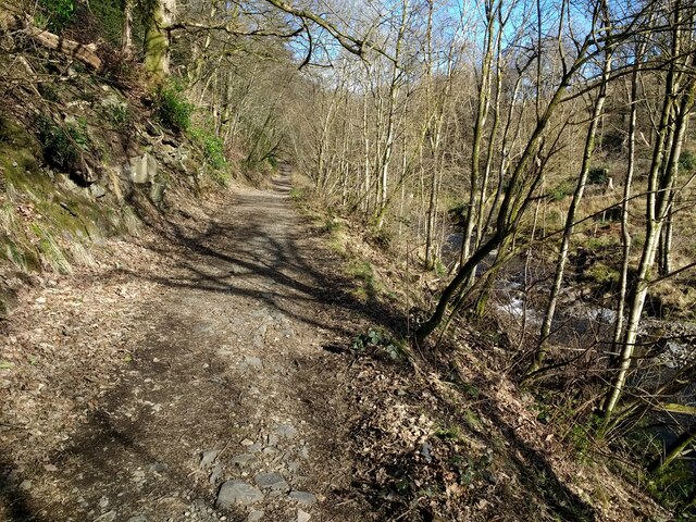
Bankcroft Plantation is a well-preserved woodland located in Westmorland, a county in the northwest of England. Spanning over a vast area, the plantation is known for its rich biodiversity and scenic beauty. The plantation is primarily composed of a variety of trees, including oak, beech, birch, and pine, which create a dense and lush forest.

The woodland is home to numerous species of flora and fauna, making it an important habitat for wildlife in the region. It provides a sanctuary for a diverse range of bird species, such as woodpeckers, owls, and thrushes, and is a popular spot for birdwatching enthusiasts. Various mammals, including foxes, deer, and squirrels, can also be spotted within the woodland.

Bankcroft Plantation offers an ideal destination for nature lovers and outdoor enthusiasts. It features several well-maintained walking trails, allowing visitors to explore the woodland at their own pace. The trails are designed to provide breathtaking views of the surrounding landscape, with occasional clearings that reveal picturesque vistas.

In addition to its natural beauty, the plantation holds historical significance. It is believed to have been established in the early 19th century as a timber plantation, providing a sustainable source of wood for the local economy. Though the plantation is no longer actively managed for timber production, remnants of its past can still be seen in the form of old tree stumps and the occasional sawmill ruins.

Overall, Bankcroft Plantation offers a tranquil and serene environment, making it an idyllic escape from the hustle and bustle of urban life. Its combination of natural beauty, diverse wildlife, and historical significance make it a cherished gem in Westmorland's landscape.

If you have any feedback on the listing, please let us know in the comments section below.

Bankcroft Plantation Images

Images are sourced within 2km of 54.251252/-2.5730996 or Grid Reference SD6284. Thanks to Geograph Open Source API. All images are credited.

Road junction in Barbondale The signpost points left to Barbon and Sedbergh; right to Dent and Hawes; and behind the camera to Casterton and Kirkby Lonsdale. There's also a cycle route sign for the Lakes and Dales Loop.
Road junction in Barbondale
The signpost points left to Barbon and Sedbergh; right to Dent and Hawes; and behind the camera to Casterton and Kirkby Lonsdale. There's also a cycle route sign for the Lakes and Dales Loop.
Barbon St Bartholomew - lychgate The lychgate bears the dates 1872 and 1915. See also <a href="https://www.geograph.org.uk/photo/3503493">SD6382 : Lychgate, St Bartholomew's, Barbon</a>.
Barbon St Bartholomew - lychgate
The lychgate bears the dates 1872 and 1915. See also SD6382 : Lychgate, St Bartholomew's, Barbon.
Barbon St Bartholomew Unusually the tower, which contains six bells, is at the east rather than west end.
Barbon St Bartholomew
Unusually the tower, which contains six bells, is at the east rather than west end.
Barbon St Bartholomew - interior There's a good if brief description on the Church Heritage Record <span class="nowrap"><a title="https://facultyonline.churchofengland.org/CHR/ChurchDetails.aspx?id=2057#Home" rel="nofollow ugc noopener" href="https://facultyonline.churchofengland.org/CHR/ChurchDetails.aspx?id=2057#Home">Link</a><img style="margin-left:2px;" alt="External link" title="External link - shift click to open in new window" src="https://s1.geograph.org.uk/img/external.png" width="10" height="10"/></span> as well as the Historic England listing.
Barbon St Bartholomew - interior
There's a good if brief description on the Church Heritage Record LinkExternal link as well as the Historic England listing.
Barbon St Bartholomew - war memorial Even a small village like this lost seven men in the Great War.
Barbon St Bartholomew - war memorial
Even a small village like this lost seven men in the Great War.
Barbon St Bartholomew - Lord and Lady Shuttleworth's memorial Wooden panelling beneath the west window forms tribute to Ughtred James, 1st Baron Shuttleworth (1844-1939) and his wife Blanche (1851-1924) of Barbon Manor. I presume Lawrence and Edward named on the church's war memorial <a href="https://www.geograph.org.uk/photo/6981118">SD6382 : Barbon St Bartholomew - war memorial</a> were their sons.
Barbon St Bartholomew - Lord and Lady Shuttleworth's memorial
Wooden panelling beneath the west window forms tribute to Ughtred James, 1st Baron Shuttleworth (1844-1939) and his wife Blanche (1851-1924) of Barbon Manor. I presume Lawrence and Edward named on the church's war memorial SD6382 : Barbon St Bartholomew - war memorial were their sons.
Barbon St Bartholomew - west window "This window is  dedicated to Louisa wife of Sir Woodbine Parish KCH by her daughter Blanche M Kay Shuttleworth". The Shuttleworths were Lords of the Manor, and Blanche is in her turn commemorated in the panelling below the window <a href="https://www.geograph.org.uk/photo/6981128">SD6382 : Barbon St Bartholomew - Lord and Lady Shuttleworth's memorial</a>. The central motif is the Good Shepherd, a popular one of the late 19th and early 20th centuries.
Barbon St Bartholomew - west window
"This window is dedicated to Louisa wife of Sir Woodbine Parish KCH by her daughter Blanche M Kay Shuttleworth". The Shuttleworths were Lords of the Manor, and Blanche is in her turn commemorated in the panelling below the window SD6382 : Barbon St Bartholomew - Lord and Lady Shuttleworth's memorial. The central motif is the Good Shepherd, a popular one of the late 19th and early 20th centuries.
Barbon St Bartholomew - small stained glass window "In memory of James Harrison St Stephen's Day 1900". James had been vicar of the parish since 1872.
Barbon St Bartholomew - small stained glass window
"In memory of James Harrison St Stephen's Day 1900". James had been vicar of the parish since 1872.
Barbon St Bartholomew - sundial In the church grounds.
Barbon St Bartholomew - sundial
In the church grounds.
Old oak in a field This is the further tree beyond the pair seen in the foreground of <a href="https://www.geograph.org.uk/photo/6816077">SD6083 : Minor road towards Rigmaden</a> taken in the spring of the same year.
Old oak in a field
This is the further tree beyond the pair seen in the foreground of SD6083 : Minor road towards Rigmaden taken in the spring of the same year.
Rigmaden bridge The grade II listed bridge (list entry 1086894) has an unusual curved girder construction and dates from the 1880s. <a href="https://www.geograph.org.uk/photo/1213202">SD6184 : Rigmaden Bridge</a> shows a side view quite clearly.
Rigmaden bridge
The grade II listed bridge (list entry 1086894) has an unusual curved girder construction and dates from the 1880s. SD6184 : Rigmaden Bridge shows a side view quite clearly.
River Lune north from Rigmaden bridge Photographed towards the end of a fairly dry summer.  <a href="https://www.geograph.org.uk/photo/4395485">SD6184 : River Lune at Rigmaden</a> shows it in late winter with a greater depth of flow.
River Lune north from Rigmaden bridge
Photographed towards the end of a fairly dry summer. SD6184 : River Lune at Rigmaden shows it in late winter with a greater depth of flow.
Woodland track in Barbondale
Barbon Manor One-time home of the historian Roger Fulford,  and featured in the annual Barbon hill-climb challenge.
Barbon Manor
One-time home of the historian Roger Fulford, and featured in the annual Barbon hill-climb challenge.
Barbon road sign Traditional metal posts - spot of rust. Hawes is a long way off. Barbon Manor in the distance.
Barbon road sign
Traditional metal posts - spot of rust. Hawes is a long way off. Barbon Manor in the distance.
The road from Barbon Manor The private access road from Barbon Manor to Barbon village near Pencil Brow; the Lune Valley is in the background.  The road is also a public bridleway.
The road from Barbon Manor
The private access road from Barbon Manor to Barbon village near Pencil Brow; the Lune Valley is in the background. The road is also a public bridleway.
Benchmark, St. Bartholomew's Church Detail of the Ordnance Survey cut benchmark on the south-east angle of the chancel of St. Bartholomew's Church.  The benchmark marks a height of 97.4202m above mean sea level (Ordnance Datum Newlyn) last verified in 1953 (location photograph <a href="https://www.geograph.org.uk/photo/7367250">SD6382 : St. Bartholomew's Churchyard</a>).
Benchmark, St. Bartholomew's Church
Detail of the Ordnance Survey cut benchmark on the south-east angle of the chancel of St. Bartholomew's Church. The benchmark marks a height of 97.4202m above mean sea level (Ordnance Datum Newlyn) last verified in 1953 (location photograph SD6382 : St. Bartholomew's Churchyard).
Sundial, Barbon Churchyard
Show me another place!

Bankcroft Plantation is located at Grid Ref: SD6284 (Lat: 54.251252, Lng: -2.5730996)

Administrative County: Cumbria

District: South Lakeland

Police Authority: Cumbria

What 3 Words

///intricate.punks.mugs. Near Kirkby Lonsdale, Cumbria

Related Wikis

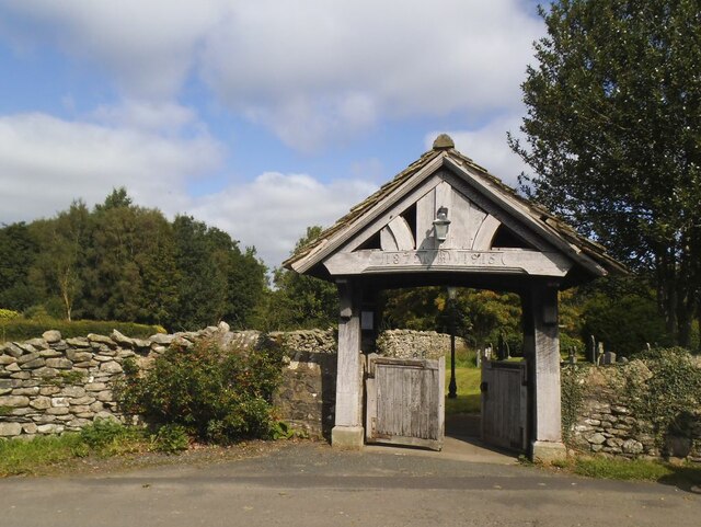
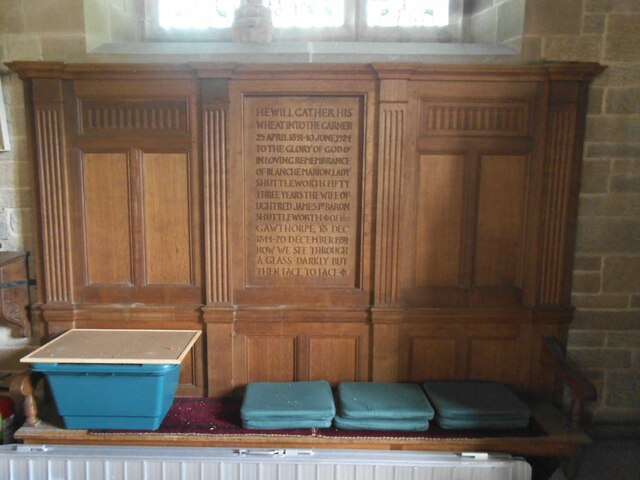
St Bartholomew's Church, Barbon

St Bartholomew's Church is in the village of Barbon, Cumbria, England. It is an active Anglican parish church in the deanery of Kendal, the archdeaconry...

Barbon railway station

Barbon railway station was located in Westmorland (now part of Cumbria), England, serving the town and locale of Barbon on the Ingleton Branch Line....

Middleton, Cumbria

Middleton is a village and a civil parish on the A683 road, in the South Lakeland district, in the county of Cumbria, England. Middleton has a church called...

St Peter's Church, Mansergh

St Peter's Church is in the village of Mansergh, Cumbria, England. It is an active Anglican parish church in the deanery of Kendal, the archdeaconry of...

Mansergh, Cumbria

Mansergh is a village and civil parish in the South Lakeland district of the English county of Cumbria. It includes the village of Mansergh and the hamlet...
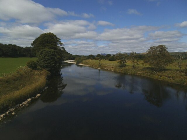
Barbon Beck

Barbon Beck is a small river in Barbondale, Cumbria. It is a tributary of the River Lune. Rising at Weather Ling Hill, where it is known as Barkin Beck...

Barbon

Barbon is a village and civil parish in Westmorland and Furness, England. According to the 2001 census it had a population of 263, reducing to 236 at...

Calf Top

Calf Top is a mountain in the western part of the Yorkshire Dales, England. It is located in the county of Cumbria, although Lancashire and North Yorkshire...

Nearby Amenities

Located within 500m of 54.251252,-2.5730996
Created By: Merkaartor 0.13
Lat/Long: 54.247932/-2.5756361
Created By: Merkaartor 0.13
Lat/Long: 54.2520881/-2.5742686
Created By: Merkaartor 0.13
Lat/Long: 54.2510367/-2.5742399
Power: pole
Lat/Long: 54.2545188/-2.5693148
Power: pole
Lat/Long: 54.2534893/-2.569119
Power: pole
Lat/Long: 54.2524755/-2.5689152
Power: pole
Lat/Long: 54.2507596/-2.5685558
Power: pole
Lat/Long: 54.2499823/-2.5683546
Power: pole
Lat/Long: 54.2492019/-2.5682339
Power: pole
Lat/Long: 54.2482193/-2.5680113
Power: pole
Lat/Long: 54.2474906/-2.5736305
Power: pole
Lat/Long: 54.248235/-2.5731343
Power: pole
Lat/Long: 54.2492489/-2.5724047
Power: pole
Lat/Long: 54.250161/-2.5717127
Power: pole
Lat/Long: 54.2511858/-2.5709778
Power: pole
Lat/Long: 54.2520681/-2.5716162
Power: pole
Lat/Long: 54.2525209/-2.5718951
Power: pole
Lat/Long: 54.2531132/-2.5723001
Power: pole
Lat/Long: 54.2539688/-2.5728929
Power: pole
Lat/Long: 54.2548933/-2.5734964
The data included in this document is from www.openstreetmap.org. The data is made available under ODbL.

Have you been to Bankcroft Plantation?

Leave your review of Bankcroft Plantation below (or comments, questions and feedback).