Beans Butts Wood

Wood, Forest in Herefordshire

England

Beans Butts Wood

Lane towards Woolhope
Lane towards Woolhope Credit: Julian P Guffogg

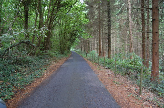
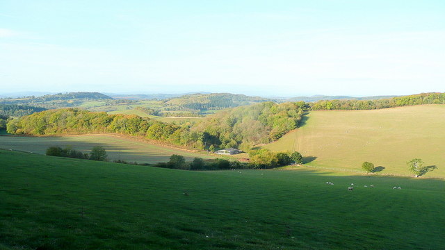
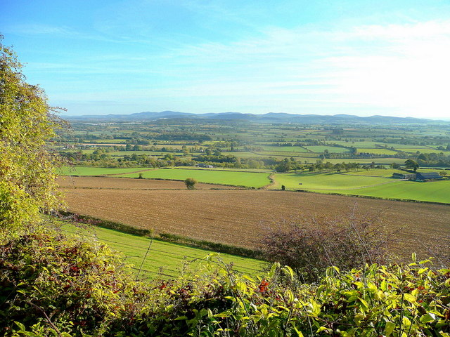
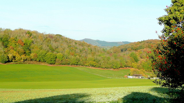
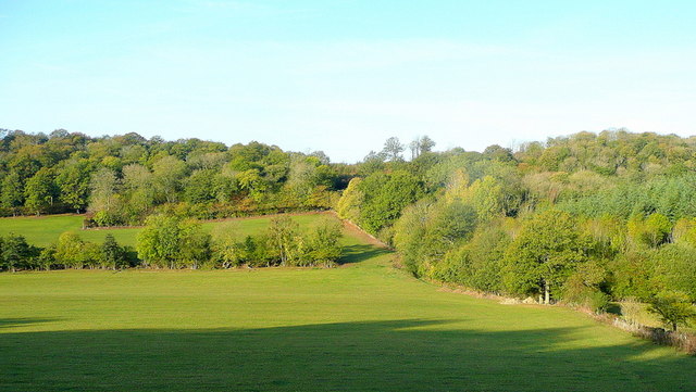
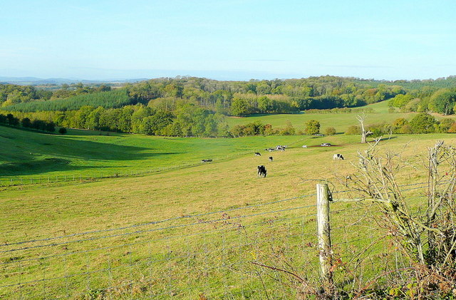
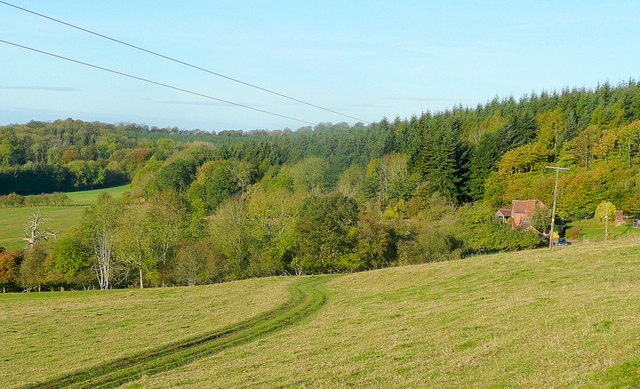
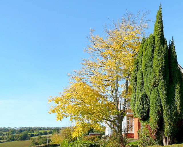
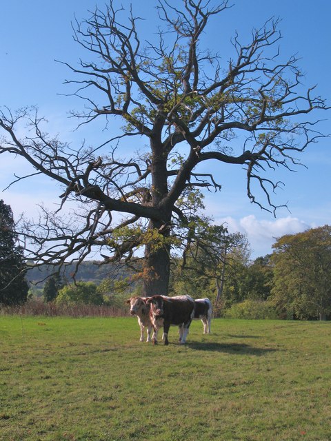
Beans Butts Wood is a captivating woodland located in Herefordshire, England. Nestled in the heart of the county, this enchanting forest spans an area of approximately 200 acres, making it a significant natural landmark within the region. The wood is characterized by its diverse range of trees, including oak, ash, beech, and birch, creating a rich and vibrant landscape.

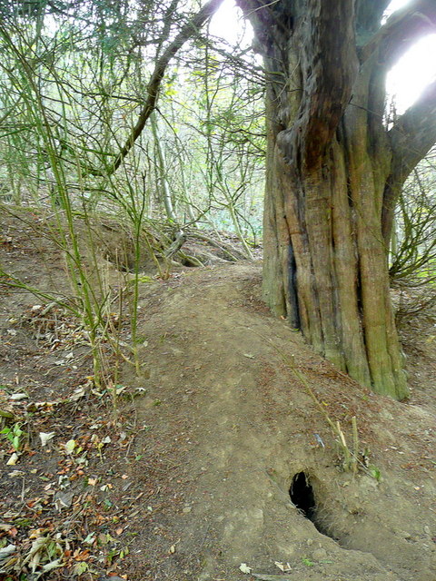
Walking through Beans Butts Wood is a truly mesmerizing experience. The forest floor is adorned with a colorful carpet of wildflowers, creating a picturesque scene during the spring and summer months. The air is filled with the sweet scent of nature, and the tranquil atmosphere is enhanced by the soothing sounds of birdsong.

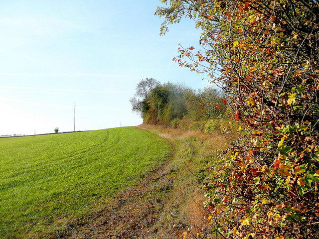
The wood is home to a variety of wildlife, making it a haven for nature enthusiasts and animal lovers alike. Visitors may encounter deer, foxes, rabbits, and a plethora of bird species during their exploration. The forest also provides a habitat for a diverse range of insects, including butterflies and beetles.

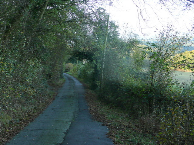
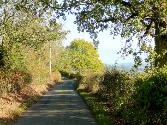
In addition to its natural beauty, Beans Butts Wood offers recreational opportunities for visitors. There are numerous walking trails that wind through the forest, allowing hikers to immerse themselves in the peaceful surroundings. The wood also provides an ideal spot for picnics, with several designated areas equipped with picnic tables and benches.

Beans Butts Wood is a true gem in the Herefordshire countryside, offering a serene escape from the hustle and bustle of everyday life. Whether it's a leisurely stroll, a wildlife encounter, or simply a moment of tranquility, this woodland provides a perfect retreat for nature enthusiasts of all ages.

If you have any feedback on the listing, please let us know in the comments section below.

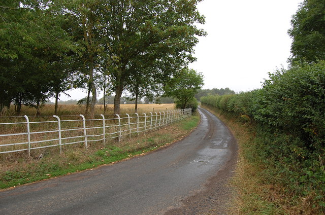
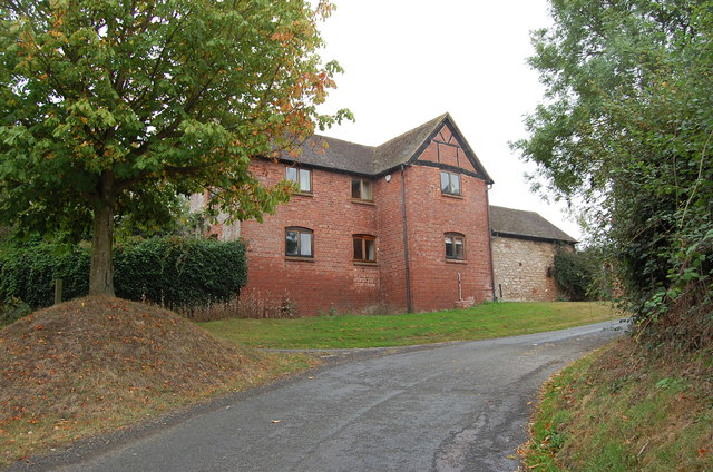
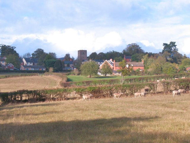
Beans Butts Wood Images

Images are sourced within 2km of 52.020827/-2.5483036 or Grid Reference SO6235. Thanks to Geograph Open Source API. All images are credited.

Lane towards Woolhope
Croose Farm
Croose Farm
Lane through Park Coppice
Ridge Hill The two LDF's, Three Choirs Way and Herefordshire Trail, share this elevated field edge.
Ridge Hill
The two LDF's, Three Choirs Way and Herefordshire Trail, share this elevated field edge.
The Woolhope Hills View west towards Hyde Farm from Glowson Wood Road across most of this gridsquare.
The Woolhope Hills
View west towards Hyde Farm from Glowson Wood Road across most of this gridsquare.
Glowson Wood Road A narrow poorly-maintained lane leading down the western side of Ridge Hill.
Glowson Wood Road
A narrow poorly-maintained lane leading down the western side of Ridge Hill.
Sedimentary rocks The wall of an old quarry near the top of Ridge Hill.
Sedimentary rocks
The wall of an old quarry near the top of Ridge Hill.
Ridge Hill Road Heading north towards Hooper's Oak.
Ridge Hill Road
Heading north towards Hooper's Oak.
View over Kynaston The glorious Herefordshire countryside in autumn.
In the distance are the Malvern Hills.
View over Kynaston
The glorious Herefordshire countryside in autumn. In the distance are the Malvern Hills.
Hooper's Oak Cottage Viewed from the public road.
Hooper's Oak Cottage
Viewed from the public road.
Beans Butts Wood Interestingly-named woodland and farmland in the picturesque Woolhope Hills.
Beans Butts Wood
Interestingly-named woodland and farmland in the picturesque Woolhope Hills.
Wooded hills Nurden Wood to the left and Round Hill Wood to the right.
Wooded hills
Nurden Wood to the left and Round Hill Wood to the right.
View from Woolhope Cockshoot The eye is led towards Round Hill Wood and Devereux Park.
View from Woolhope Cockshoot
The eye is led towards Round Hill Wood and Devereux Park.
Park Coppice Looking west on a fine autumn morning.
Park Coppice
Looking west on a fine autumn morning.
Badger sett, Jones's Coppice Next to a yew tree by the steep public path near the northern edge of the gridsquare.
Badger sett, Jones's Coppice
Next to a yew tree by the steep public path near the northern edge of the gridsquare.
Autumn colour A laburnum and conifer by The Fosbury against a clear October sky.
Autumn colour
A laburnum and conifer by The Fosbury against a clear October sky.
Cattle at Woolhope These appear to be English Longhorn cattle, standing by an old oak at Woolhope.
Cattle at Woolhope
These appear to be English Longhorn cattle, standing by an old oak at Woolhope.
Approaching Woolhope Nearing the end of a circular walk at the village of Woolhope.
Approaching Woolhope
Nearing the end of a circular walk at the village of Woolhope.
Show me another place!

Beans Butts Wood is located at Grid Ref: SO6235 (Lat: 52.020827, Lng: -2.5483036)

Unitary Authority: County of Herefordshire

Police Authority: West Mercia

What 3 Words

///column.vanilla.ownership. Near Brockhampton, Herefordshire

Related Wikis

Woolhope

Woolhope is a village and civil parish in the English county of Herefordshire. The population of the civil parish was 486 at the 2011 census. The civil...

Rushall, Herefordshire

Rushall is a small hamlet in Herefordshire, England. It is approximately halfway between Woolhope and Much Marcle. == Notes == === References ===

Putley

Putley is a village and civil parish 8 miles (13 km) east of Hereford, in the county of Herefordshire, England. In 2011 the parish had a population of...

Ridge Hill transmitting station

The Ridge Hill transmitting station is a broadcasting and telecommunications facility located 8.5 miles SE of Hereford in Herefordshire, and close to the...

Nearby Amenities

Located within 500m of 52.020827,-2.5483036
Bus Stop
The Nurdens
Naptan AtcoCode: 2090A150800
Naptan Bearing: S
Naptan CommonName: The Nurdens
Naptan Indicator: adj
Naptan Landmark: Jc road to Lenacres Fold
Naptan NaptanCode: heragjpj
Naptan Street: The Nurdens
Naptan Verified: no
Source: naptan_import
Lat/Long: 52.0223531/-2.5540771
Power: pole
Lat/Long: 52.0201215/-2.5554089
Power: pole
Lat/Long: 52.02085/-2.5538855
Power: pole
Lat/Long: 52.0215923/-2.5523927
Power: pole
Lat/Long: 52.021841/-2.5502112
Power: pole
Lat/Long: 52.0219947/-2.5488586
Power: pole
Lat/Long: 52.0221489/-2.5475073
Power: pole
Lat/Long: 52.0220753/-2.543394
Gate into field along route of public footpath.
Note: Correct route into the 20 acre field along public footpath is straight up the drive at Lenacre Ford and through the gate as marked.
Source: Ordnance Survey;Landowner;local knowledge
Lat/Long: 52.0206368/-2.5553502
Power: pole
Lat/Long: 52.0221148/-2.5454485
Location Transition: yes
Power: pole
Lat/Long: 52.0214554/-2.5521299
Power: pole
Lat/Long: 52.0216419/-2.5502859
Power: pole
Lat/Long: 52.0215305/-2.5513427
Power: pole
Lat/Long: 52.0217616/-2.5491138
Power: pole
Lat/Long: 52.0217286/-2.5484747
Power: pole
Lat/Long: 52.0216724/-2.5472329
Winslow Mill
Power: pole
Transformer: distribution
Voltage Primary: 11000
Lat/Long: 52.0216473/-2.5463652
Power: pole
Lat/Long: 52.0215903/-2.545122
Power: pole
Lat/Long: 52.0211752/-2.5441001
Power: pole
Lat/Long: 52.0207968/-2.5431868
Power: pole
Lat/Long: 52.0201085/-2.5425055
Power: pole
Lat/Long: 52.019471/-2.5418825
Poplar Cottage
Power: pole
Transformer: distribution
Voltage Primary: 11000
Lat/Long: 52.0186741/-2.5545285
Hollings Hill
Power: pole
Transformer: distribution
Voltage Primary: 11000
Lat/Long: 52.0176285/-2.5516967
Power: pole
Lat/Long: 52.0175393/-2.5527267
Location Transition: yes
Power: pole
Lat/Long: 52.0217673/-2.553919
Power: pole
Lat/Long: 52.0218119/-2.5546727
Location Transition: yes
Power: pole
Lat/Long: 52.0217987/-2.5544541
The data included in this document is from www.openstreetmap.org. The data is made available under ODbL.

Have you been to Beans Butts Wood?

Leave your review of Beans Butts Wood below (or comments, questions and feedback).