Harlosh Island

Island in Inverness-shire

Scotland

Harlosh Island

Grazings, Ardmore The end of the peninsula, with Harlosh Island beyond.
Grazings, Ardmore Credit: Richard Webb

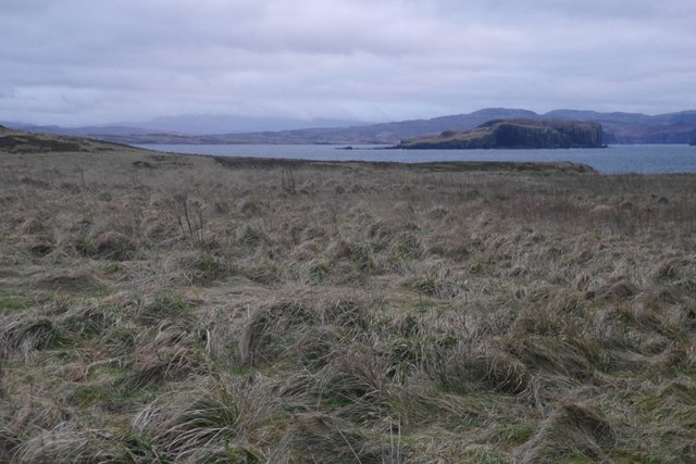
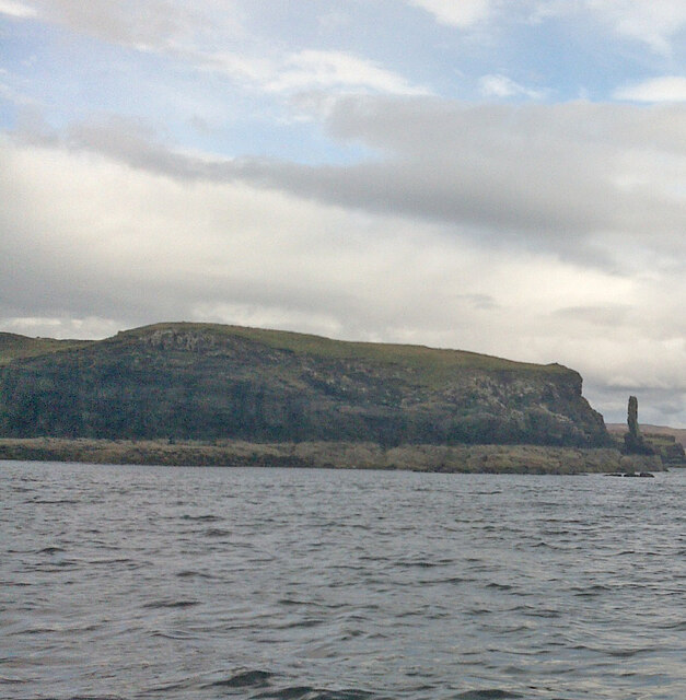
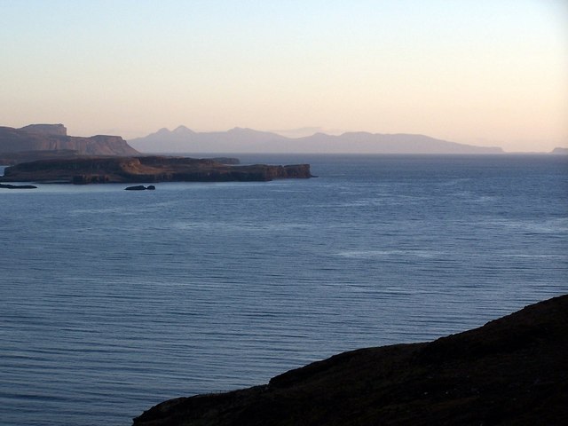
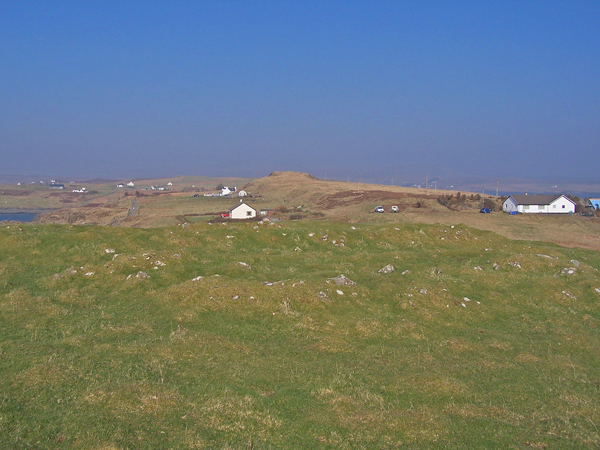
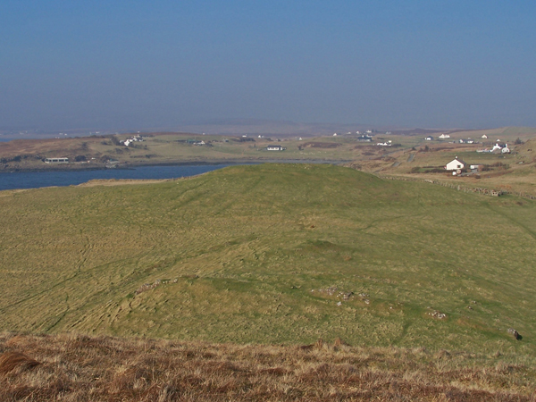
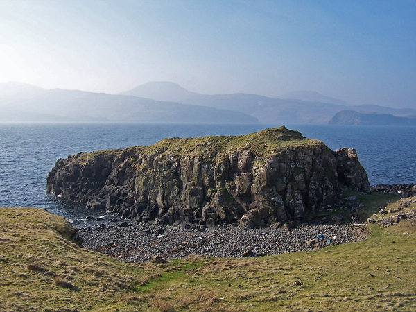
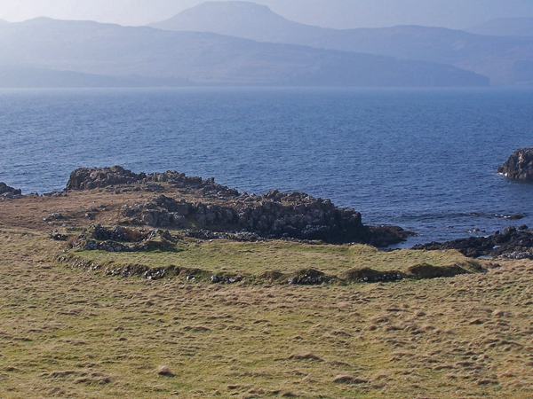
Harlosh Island is a picturesque island located in Inverness-shire, Scotland. Situated off the northwest coast of the mainland, it is part of the Inner Hebrides archipelago. The island spans approximately 3 square miles and is known for its stunning natural beauty and rugged landscapes.

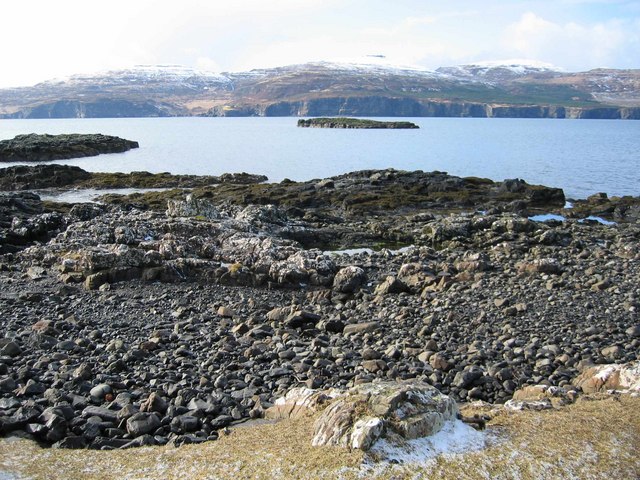
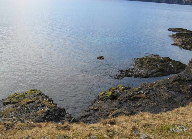
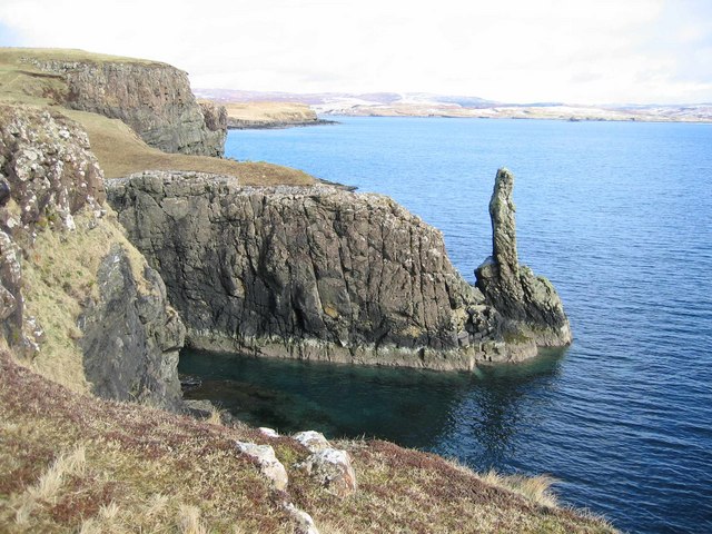
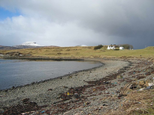
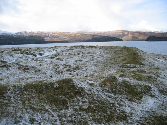
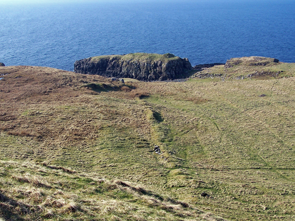
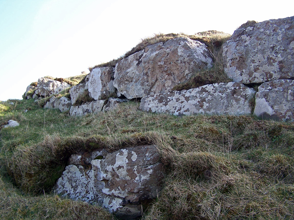
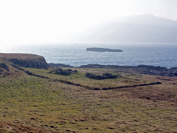
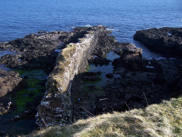
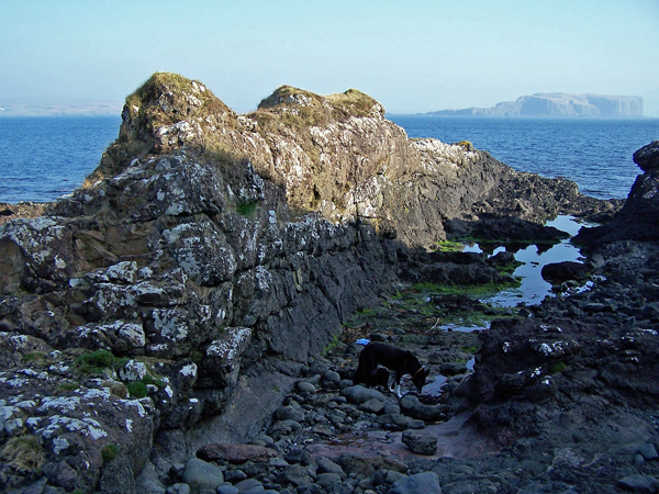
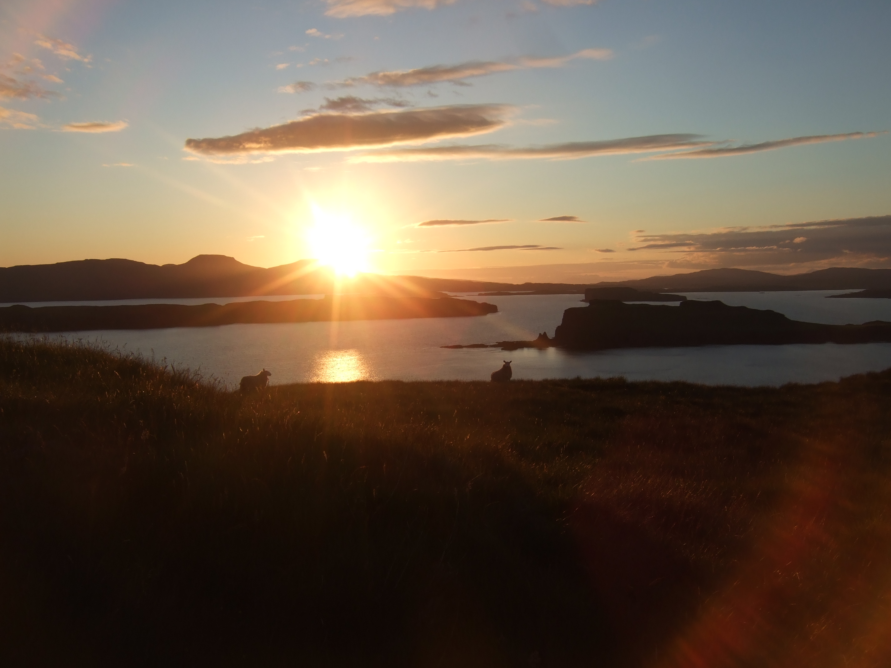
The terrain of Harlosh Island is characterized by rolling hills, rocky cliffs, and expansive moorlands. It boasts breathtaking views of the surrounding sea and neighboring islands. The island is home to a diverse range of flora and fauna, including various species of birds and wildflowers.

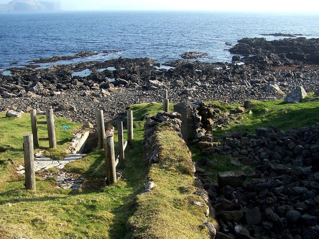
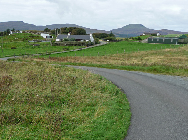
Historically, Harlosh Island was primarily used for agriculture, with small-scale farming being the main occupation of its inhabitants. Today, the island has a small population, with a handful of residents residing in the few scattered houses and cottages.

Harlosh Island is a popular destination for outdoor enthusiasts, offering opportunities for hiking, bird watching, and photography. Visitors can explore the island's numerous walking trails, taking in the stunning vistas and enjoying the tranquility of the natural surroundings. The island's shores also provide excellent spots for fishing and beachcombing.

Access to Harlosh Island is primarily by boat, with regular ferry services available from nearby ports. The island is a haven for those seeking a peaceful retreat amidst the beauty of the Scottish Highlands and offers a unique glimpse into the traditional rural life of the region.

If you have any feedback on the listing, please let us know in the comments section below.

Harlosh Island Images

Images are sourced within 2km of 57.363607/-6.5266435 or Grid Reference NG2739. Thanks to Geograph Open Source API. All images are credited.

Grazings, Ardmore The end of the peninsula, with Harlosh Island beyond.
Grazings, Ardmore
The end of the peninsula, with Harlosh Island beyond.
Harlosh Point
Harlosh Point
Harlosh Skerry The beach in the foreground and the skerry beyond are the only bits of land in this square.
Harlosh Skerry
The beach in the foreground and the skerry beyond are the only bits of land in this square.
Harlosh Point The southern extremity of Harlosh Point in Loch Bracadale.
Harlosh Point
The southern extremity of Harlosh Point in Loch Bracadale.
Sea Stack near Harlosh Point A pretty impressive stack to be unmarked on the OS. Looking NW up Loch Caroy.
Sea Stack near Harlosh Point
A pretty impressive stack to be unmarked on the OS. Looking NW up Loch Caroy.
Camas Ban Another Camas Ban - this time at Harlosh. A snow topped Healabhal Beag is in the distance.
Camas Ban
Another Camas Ban - this time at Harlosh. A snow topped Healabhal Beag is in the distance.
Remains of Chapel on Harlosh Point The outline of the building is clear in the recently fallen hail. Looking NW toward Loch Bharcasaig.
Remains of Chapel on Harlosh Point
The outline of the building is clear in the recently fallen hail. Looking NW toward Loch Bharcasaig.
Loch Bracadale and Harlosh Island Viewed from a hilltop in Greep, the small rock in Loch Bracadale is Harlosh Skerry, with Harlosh Island behind it.
On the horizon is the Isle of Rùm, looking close in spite of being some 25 miles to the south.
Loch Bracadale and Harlosh Island
Viewed from a hilltop in Greep, the small rock in Loch Bracadale is Harlosh Skerry, with Harlosh Island behind it. On the horizon is the Isle of Rùm, looking close in spite of being some 25 miles to the south.
Chapel remains on Cnoc a' Cladh On the summit of a small hill to the south of the township of Balmore, at about 100' above sea-level is the site of a chapel and burying ground. Two rectangular foundations of buildings can be traced lying almost parallel to each other about 4' apart. The smaller building measures 31' in length and 18' in breadth externally, the larger structure measures externally 54' by 29'.
The smaller of the two buildings is a chapel. It is orientated NW - SE with walling of roughly squared masonry, approx 0.8m wide, bonded with shell-lime mortar. The possible footings of the altar are visible at the E end. The other 'building' is a disused graveyard. No graves survive and according to local tradition they were removed many years ago for reburial at Kilmuir, Dunvegan. The small hill on which the chapel and graveyard are situated is called Cnoc a' Cladh.
(Source - Highland Environmental Record)
Chapel remains on Cnoc a' Cladh
On the summit of a small hill to the south of the township of Balmore, at about 100' above sea-level is the site of a chapel and burying ground. Two rectangular foundations of buildings can be traced lying almost parallel to each other about 4' apart. The smaller building measures 31' in length and 18' in breadth externally, the larger structure measures externally 54' by 29'. The smaller of the two buildings is a chapel. It is orientated NW - SE with walling of roughly squared masonry, approx 0.8m wide, bonded with shell-lime mortar. The possible footings of the altar are visible at the E end. The other 'building' is a disused graveyard. No graves survive and according to local tradition they were removed many years ago for reburial at Kilmuir, Dunvegan. The small hill on which the chapel and graveyard are situated is called Cnoc a' Cladh. (Source - Highland Environmental Record)
Cnoc a' Cladh The small hill in the centre of this picture is Cnoc a' Cladh. On the top of it are remains of a chapel and burial ground. 
More information: <a href="https://www.geograph.org.uk/photo/1212472">NG2840 : Chapel remains on Cnoc a' Cladh</a> .
Cnoc a' Cladh
The small hill in the centre of this picture is Cnoc a' Cladh. On the top of it are remains of a chapel and burial ground. More information: NG2840 : Chapel remains on Cnoc a' Cladh .
Ancient remains on Harlosh Point The line of an ancient wall leads to the rock on top of which lie the more ancient remains of Dùn Neill.
Ancient remains on Harlosh Point
The line of an ancient wall leads to the rock on top of which lie the more ancient remains of Dùn Neill.
Site of Dùn Nèill Dun Neill, a dun overlying the scant remains of a fort on a cliff girt coastal rock.

The dun, oval on plan, measures 24.0m ENE-WSW by about 12.0m overall, with the wall 2.8m thick at the E end where parts of both the inner and outer wall faces can be seen. Four base stones of the outer face survive in the W and others are visible intermittently along the edge of the cliff in the S with the wall core suggesting a similar wall thickness for most of the extent. In the N the wall is a confused turf-covered spread of stones which have encroached well into the interior of the dun. A well-defined straight wall face visible intermittently within the core of the wall in the W may be a stabilizing wall, or possibly part of a later structure. The entrance passage in the NE, 1.4m wide, is visible at its outer end only, with the base course of the outer wall face continuing across it forming a level threshold. The access route to the entrance up a gap in the crag to the N shows signs of lateral revetment, and one step of a stair remains in situ. Within the dun is a turf-covered circular structure, 3.0m internal diameter, with an ill-defined entrance in the E it is uncertain whether it is built against the inner face of the dun wall or overlies it, and is of uncertain period or purpose.

Outside the dun in the W, a heavily robbed wall encloses the remainder of the summit of the rock. No wall faces survive and its thickness cannot be ascertained. Traces of what is probably the same wall are visible outside the dun in the E and there is little doubt that this represents the remains of an earlier fort measuring about 43.0m ENE-WSW by c.12.0m, transversely, robbed to build the dun.

(Source - Highland Environmental Record). (See also <a href="https://www.geograph.org.uk/photo/1212502">NG2840 : Remains of Dùn Nèill</a> ).
Site of Dùn Nèill
Dun Neill, a dun overlying the scant remains of a fort on a cliff girt coastal rock. The dun, oval on plan, measures 24.0m ENE-WSW by about 12.0m overall, with the wall 2.8m thick at the E end where parts of both the inner and outer wall faces can be seen. Four base stones of the outer face survive in the W and others are visible intermittently along the edge of the cliff in the S with the wall core suggesting a similar wall thickness for most of the extent. In the N the wall is a confused turf-covered spread of stones which have encroached well into the interior of the dun. A well-defined straight wall face visible intermittently within the core of the wall in the W may be a stabilizing wall, or possibly part of a later structure. The entrance passage in the NE, 1.4m wide, is visible at its outer end only, with the base course of the outer wall face continuing across it forming a level threshold. The access route to the entrance up a gap in the crag to the N shows signs of lateral revetment, and one step of a stair remains in situ. Within the dun is a turf-covered circular structure, 3.0m internal diameter, with an ill-defined entrance in the E it is uncertain whether it is built against the inner face of the dun wall or overlies it, and is of uncertain period or purpose. Outside the dun in the W, a heavily robbed wall encloses the remainder of the summit of the rock. No wall faces survive and its thickness cannot be ascertained. Traces of what is probably the same wall are visible outside the dun in the E and there is little doubt that this represents the remains of an earlier fort measuring about 43.0m ENE-WSW by c.12.0m, transversely, robbed to build the dun. (Source - Highland Environmental Record). (See also NG2840 : Remains of Dùn Nèill ).
Remains of Dùn Nèill Just a few stones of the wall of the dun remain in place. 
More information - <a href="https://www.geograph.org.uk/photo/1212496">NG2840 : Site of Dùn Nèill</a> .
Remains of Dùn Nèill
Just a few stones of the wall of the dun remain in place. More information - NG2840 : Site of Dùn Nèill .
Remains of habitation Harlosh Point provides well drained soil, and sheltered coves. It has been inhabited on and off for centuries. 
Here can be seen remains of two rectangular buildings enclosed by an almost circular wall.
The water beyond is Loch Bracadale.
Remains of habitation
Harlosh Point provides well drained soil, and sheltered coves. It has been inhabited on and off for centuries. Here can be seen remains of two rectangular buildings enclosed by an almost circular wall. The water beyond is Loch Bracadale.
Remains of habitation Here, a rectangular enclosure contains the ruins of two rectangular buildings.
 There are other ruins of similar age nearby as well as a more ancient dun, fort and chapel.
The water is Loch Bracadale, and the small island is Harlosh Skerry.
Remains of habitation
Here, a rectangular enclosure contains the ruins of two rectangular buildings. There are other ruins of similar age nearby as well as a more ancient dun, fort and chapel. The water is Loch Bracadale, and the small island is Harlosh Skerry.
Disused sheep dip This sheep dip is located on the shore of Loch Bracadale, on the eastward facing side of Harlosh point.
The dip looks to have been in use until fairly recently, though the stone barn at the side has been a ruin for many years.
Disused sheep dip
This sheep dip is located on the shore of Loch Bracadale, on the eastward facing side of Harlosh point. The dip looks to have been in use until fairly recently, though the stone barn at the side has been a ruin for many years.
Dyke on the shore This basalt dyke resists erosion on the eastern side of Harlosh Point.
The water is Loch Bracadale.
Dyke on the shore
This basalt dyke resists erosion on the eastern side of Harlosh Point. The water is Loch Bracadale.
Dyke from the shore This basalt dyke stands some 15 feet high above the slightly softer rock that surrounds it.
Its height is sufficient to keep the top above the high tide mark, and grass is growing well there.
The water is Loch Bracadale. The island in the background to the right is Tarner.
See also <a href="https://www.geograph.org.uk/photo/1213416">NG2840 : Dyke on the shore</a> .
Dyke from the shore
This basalt dyke stands some 15 feet high above the slightly softer rock that surrounds it. Its height is sufficient to keep the top above the high tide mark, and grass is growing well there. The water is Loch Bracadale. The island in the background to the right is Tarner. See also NG2840 : Dyke on the shore .
Show me another place!

Harlosh Island is located at Grid Ref: NG2739 (Lat: 57.363607, Lng: -6.5266435)

Unitary Authority: Highland

Police Authority: Highlands and Islands

What 3 Words

///mailboxes.mooring.best. Near Dunvegan, Highland

Nearby Locations

Harlosh Island

Related Wikis

Harlosh Island

Harlosh Island is one of four islands to be found in Skye's Loch Bracadale. Harlosh Island is one mile (1.5 kilometres) from the coast of the Duirinish...

Tarner Island

Tarner Island is a triangular shaped island in Loch Bracadale just off the coast off the Harlosh peninsula of Skye in Scotland. It is about 28 hectares...

Harlosh

Harlosh (Scottish Gaelic: Heàrrlois) is a settlement on the island of Skye off the west coast of Scotland. The settlement is on a peninsula of the same...

Loch Bracadale

Loch Bracadale (Scottish Gaelic: Loch Bhràcadail) is a sea loch on the west coast of Skye in Scotland. It separates the Minginish Peninsula in the south...

Nearby Amenities

Located within 500m of 57.363607,-6.5266435
Source: PGS
Lat/Long: 57.3602828/-6.5309099
Source: PGS
Lat/Long: 57.361527/-6.5310967
Source: PGS
Lat/Long: 57.3628972/-6.5319186
Source: PGS
Lat/Long: 57.363149/-6.5318345
Source: PGS
Lat/Long: 57.3635419/-6.5306203
Source: PGS
Lat/Long: 57.3637182/-6.5304148
Source: PGS
Lat/Long: 57.3639348/-6.5299945
Created By: dmgroom_coastlines
Source: PGS
Lat/Long: 57.36398/-6.52952
Source: PGS
Lat/Long: 57.363965/-6.529238
Created By: dmgroom_coastlines
Source: PGS
Lat/Long: 57.36409/-6.52881
Source: PGS
Lat/Long: 57.3645695/-6.5288364
Source: PGS
Lat/Long: 57.3650379/-6.5284348
Source: PGS
Lat/Long: 57.3652193/-6.5276782
Source: PGS
Lat/Long: 57.3657179/-6.5277716
Source: PGS
Lat/Long: 57.365592/-6.5285468
Source: PGS
Lat/Long: 57.3656776/-6.528743
Source: PGS
Lat/Long: 57.365869/-6.5287243
Created By: dmgroom_coastlines
Source: PGS
Lat/Long: 57.36613/-6.52844
Created By: dmgroom_coastlines
Source: PGS
Lat/Long: 57.36621/-6.52811
Created By: dmgroom_coastlines
Source: PGS
Lat/Long: 57.36637/-6.52771
Created By: dmgroom_coastlines
Source: PGS
Lat/Long: 57.36662/-6.52721
Source: PGS
Lat/Long: 57.3668008/-6.5272953
Source: PGS
Lat/Long: 57.3670677/-6.5267816
Source: PGS
Lat/Long: 57.3672037/-6.5261184
Source: PGS
Lat/Long: 57.3667404/-6.525941
Source: PGS
Lat/Long: 57.3663777/-6.5253899
Created By: dmgroom_coastlines
Source: PGS
Lat/Long: 57.36618/-6.52463
Created By: dmgroom_coastlines
Source: PGS
Lat/Long: 57.36618/-6.52416
Created By: dmgroom_coastlines
Source: PGS
Lat/Long: 57.36642/-6.52367
Source: PGS
Lat/Long: 57.3665389/-6.5231483
Source: PGS
Lat/Long: 57.3666598/-6.5224759
Source: PGS
Lat/Long: 57.3665137/-6.5222143
Source: PGS
Lat/Long: 57.3659345/-6.5225506
Source: PGS
Lat/Long: 57.3659194/-6.5230082
Source: PGS
Lat/Long: 57.3651133/-6.5231114
Source: PGS
Lat/Long: 57.3648362/-6.5227786
Source: PGS
Lat/Long: 57.3645276/-6.5222594
Source: PGS
Lat/Long: 57.364337/-6.5219547
Source: PGS
Lat/Long: 57.3642581/-6.5218271
Created By: dmgroom_coastlines
Source: PGS
Lat/Long: 57.36421/-6.52169
Created By: dmgroom_coastlines
Source: PGS
Lat/Long: 57.36395/-6.5217
Source: PGS
Lat/Long: 57.3628921/-6.5221023
Source: PGS
Lat/Long: 57.3624086/-6.5222424
Source: PGS
Lat/Long: 57.3608873/-6.5224572
Source: PGS
Lat/Long: 57.3605901/-6.5221023
Source: PGS
Lat/Long: 57.3595926/-6.5230549
Source: PGS
Lat/Long: 57.3597488/-6.5235406
Created By: dmgroom_coastlines
Source: PGS
Lat/Long: 57.36055/-6.52454
Created By: dmgroom_coastlines
Source: PGS
Lat/Long: 57.36068/-6.52477
Created By: dmgroom_coastlines
Source: PGS
Lat/Long: 57.36081/-6.525
Created By: dmgroom_coastlines
Source: PGS
Lat/Long: 57.36082/-6.52547
Created By: dmgroom_coastlines
Source: PGS
Lat/Long: 57.3607/-6.52572
Source: PGS
Lat/Long: 57.3603281/-6.5260157
Source: PGS
Lat/Long: 57.3600662/-6.5263986
Source: PGS
Lat/Long: 57.3593004/-6.526847
Source: PGS
Lat/Long: 57.3591241/-6.5270524
Ele: 53
Natural: peak
Lat/Long: 57.363175/-6.5271833
The data included in this document is from www.openstreetmap.org. The data is made available under ODbL.

Have you been to Harlosh Island?

Leave your review of Harlosh Island below (or comments, questions and feedback).