Lochnagar Hills

Range Of Mountains, Range Of Hills in Aberdeenshire

Scotland

Lochnagar Hills

Coire Boidheach in winter During winter, a narrowing of the coire fills with deep snow, and large cornices form. In February 2023, there was less snow than usual, exposing the stream which would normally be buried under many feet of snow at this time of year
Coire Boidheach in winter Credit: Mike Duguid

Lochnagar Hills, located in Aberdeenshire, Scotland, is a range of mountains or hills that forms part of the Grampian Mountains. Situated within the Cairngorms National Park, the hills are a popular destination for outdoor enthusiasts, offering breathtaking views and a variety of recreational activities.

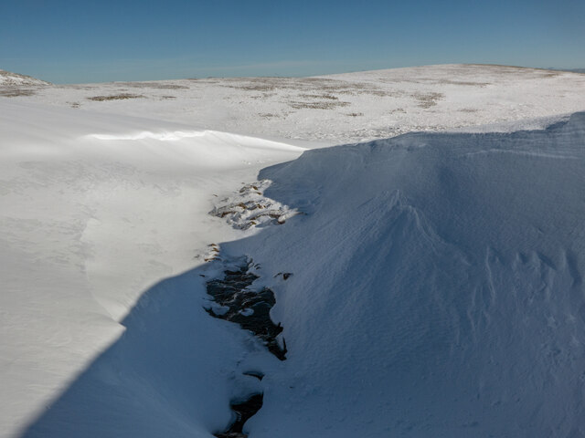
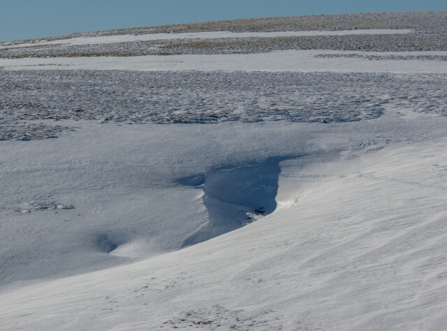
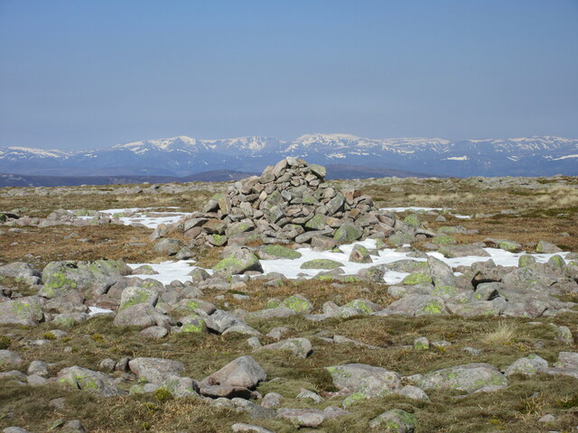
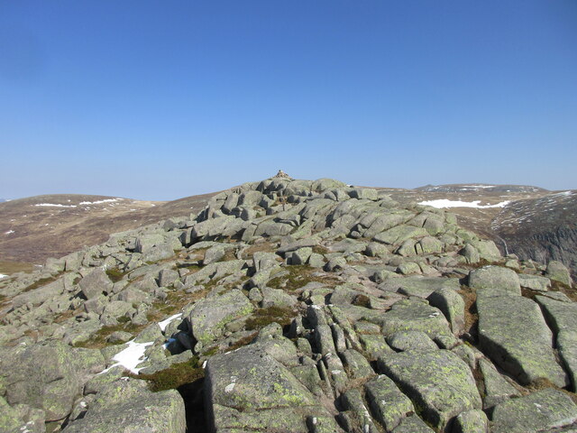
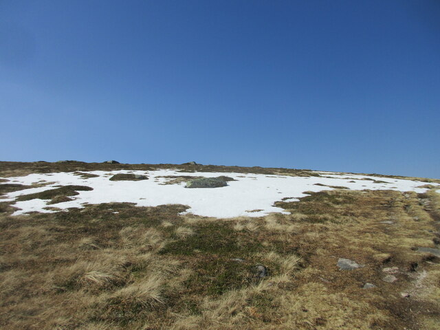
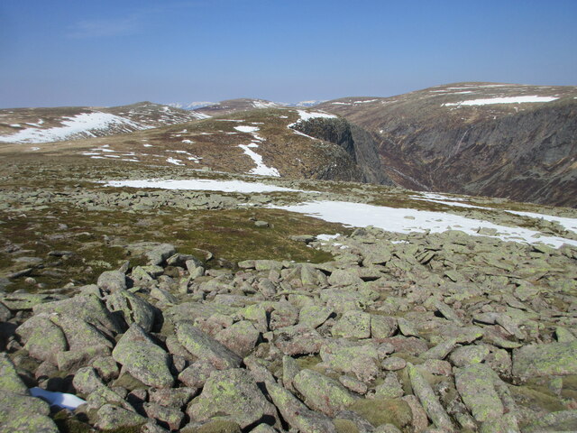
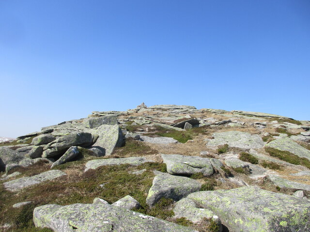
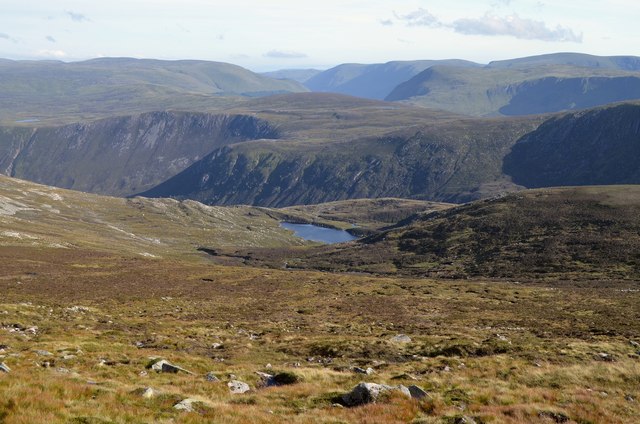
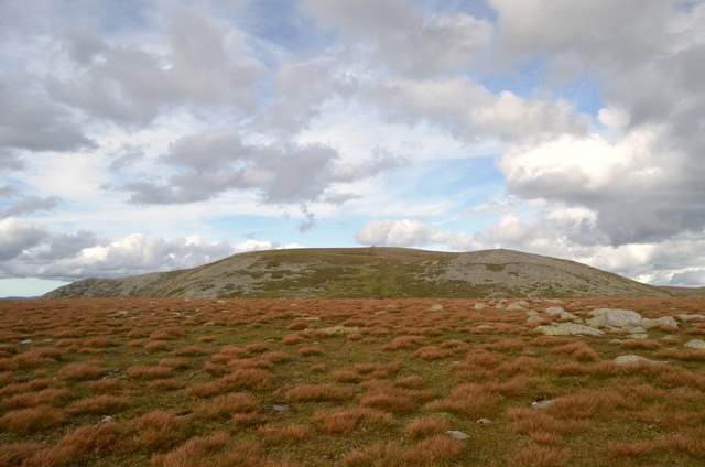
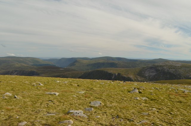
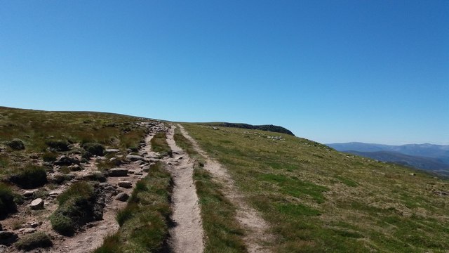
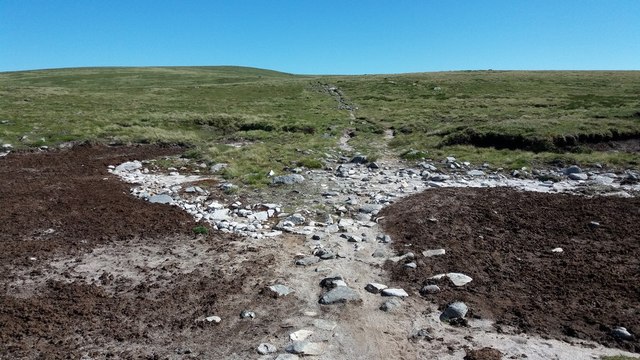
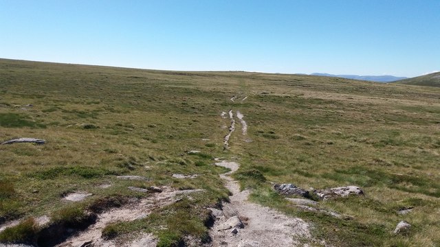
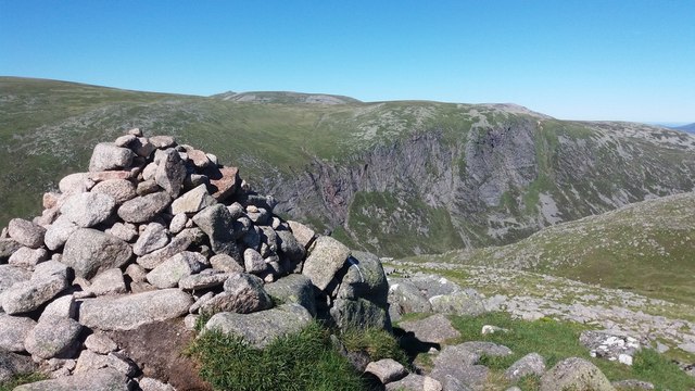
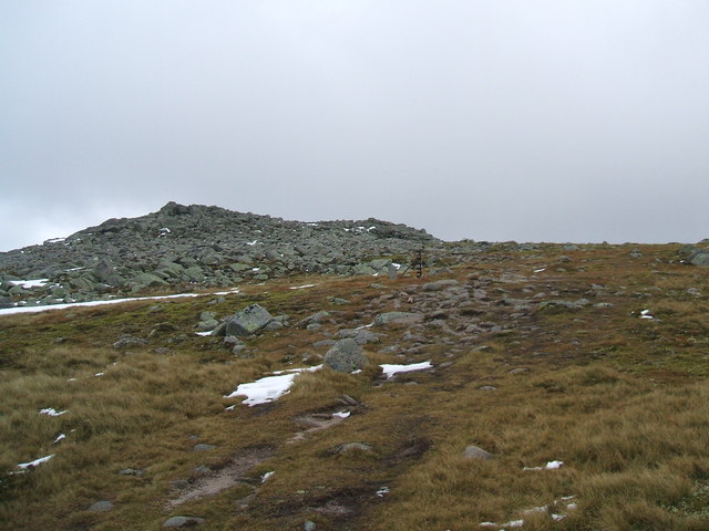
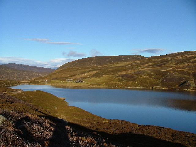
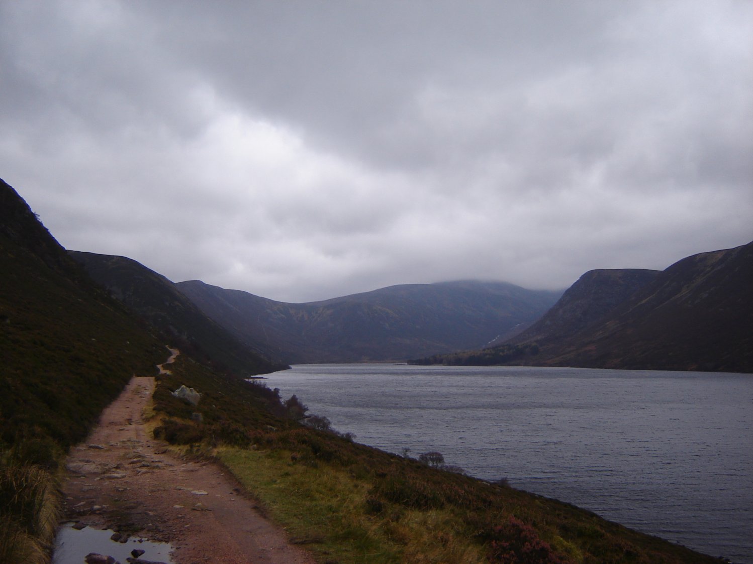
The Lochnagar Hills stretch for approximately 8 miles, with the highest peak being Cac Carn Beag, standing at an impressive 3,786 feet. The range is characterized by its rugged terrain, deep corries, and stunning lochs, including the iconic Loch Muick. These features were shaped by the movement of glaciers during the last Ice Age, leaving behind a dramatic landscape that attracts hikers, climbers, and nature lovers alike.

The area is home to a diverse range of wildlife, including red deer, golden eagles, ptarmigans, and mountain hares. The hills are also renowned for their flora, with heather, bilberry, and crowberry covering the slopes during the summer months.

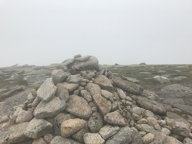
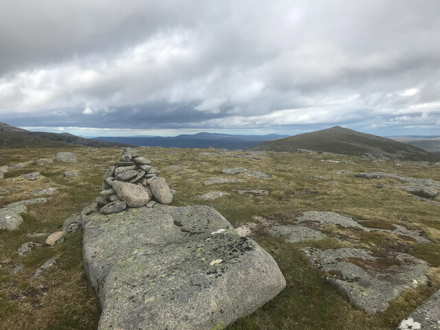
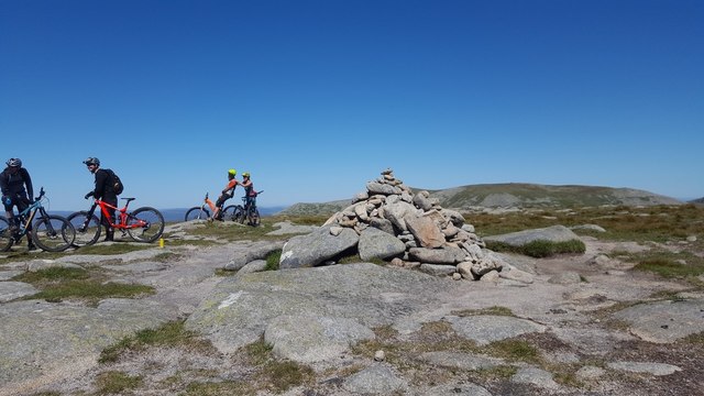
There are numerous walking routes and trails available, catering to all levels of experience and fitness. The most popular route is the circular walk around Loch Muick, providing stunning views of the surrounding hills and the chance to spot wildlife. For more experienced hikers, the ascent of Lochnagar itself is a challenging but rewarding endeavor, offering panoramic vistas over the surrounding countryside.

In addition to hiking, the Lochnagar Hills offer opportunities for mountaineering, rock climbing, fishing, and camping, making it a haven for outdoor enthusiasts seeking an adventure in the Scottish Highlands.

If you have any feedback on the listing, please let us know in the comments section below.

Lochnagar Hills Images

Images are sourced within 2km of 56.933984/-3.2672848 or Grid Reference NO2283. Thanks to Geograph Open Source API. All images are credited.

Coire Boidheach in winter During winter, a narrowing of the coire fills with deep snow, and large cornices form. In February 2023, there was less snow than usual, exposing the stream which would normally be buried under many feet of snow at this time of year
Coire Boidheach in winter
During winter, a narrowing of the coire fills with deep snow, and large cornices form. In February 2023, there was less snow than usual, exposing the stream which would normally be buried under many feet of snow at this time of year
Coire Boidheach in winter A narrowing of Coire Boidheach on the plateau catches snow, and the resulting cornices cast shadow making the coire more readily visible from distance. In summer, the terrain is boggy and unremarkable: was the original meaning of the name "beautiful corrie" conceived in summer or winter?
Coire Boidheach in winter
A narrowing of Coire Boidheach on the plateau catches snow, and the resulting cornices cast shadow making the coire more readily visible from distance. In summer, the terrain is boggy and unremarkable: was the original meaning of the name "beautiful corrie" conceived in summer or winter?
Summit Carn a' Choire Bhoidheach A Munro defined as a mountain in Scotland with a height over 3,000 feet (914.4 m), and which is on the Scottish Mountaineering Club (SMC) official list of Munros; there is no explicit topographical prominence requirement.
Summit Carn a' Choire Bhoidheach
A Munro defined as a mountain in Scotland with a height over 3,000 feet (914.4 m), and which is on the Scottish Mountaineering Club (SMC) official list of Munros; there is no explicit topographical prominence requirement.
Summit Cairn of Gowal Munro top 983m
Summit Cairn of Gowal
Munro top 983m
Cairn on Fafernie Looking north to the cairn on Fafernie, with the Alpine-like Cairngorms on the horizon.
Cairn on Fafernie
Looking north to the cairn on Fafernie, with the Alpine-like Cairngorms on the horizon.
Summit of Cairn Bannoch Stony summit of Cairn Bannoch from the south.
Summit of Cairn Bannoch
Stony summit of Cairn Bannoch from the south.
Snow bank on the Cairn of Gowal Snow on the north side of the Cairn of Gowal.
Snow bank on the Cairn of Gowal
Snow on the north side of the Cairn of Gowal.
North-west slope of Broad Cairn Looking down the north-western slope of Broad Cairn from beneath the summit, with Creag an Dubh-loch ahead.
North-west slope of Broad Cairn
Looking down the north-western slope of Broad Cairn from beneath the summit, with Creag an Dubh-loch ahead.
Summit of Broad Cairn Looking up to the summit of Broad Cairn from the north-east.
Summit of Broad Cairn
Looking up to the summit of Broad Cairn from the north-east.
South Slopes of Creag a' Ghlas-Uillt The view at approximately 1km above sea level (1000 m, 3280 ft) from the south side of Creag a' Ghlas-Uillt, one of the summits on Lochnagar, Scotland.  Glen Muick and Glen Clova are visible.
South Slopes of Creag a' Ghlas-Uillt
The view at approximately 1km above sea level (1000 m, 3280 ft) from the south side of Creag a' Ghlas-Uillt, one of the summits on Lochnagar, Scotland. Glen Muick and Glen Clova are visible.
South Face of Lochnagar, Aberdeenshire High moorland (over 1km above sea level) to the south of Lochnagar.
South Face of Lochnagar, Aberdeenshire
High moorland (over 1km above sea level) to the south of Lochnagar.
View from Creag a' Ghlas-uillt, Lochnagar View facing south from the summit of Creag a' Ghlas-uillt (1060 m)
View from Creag a' Ghlas-uillt, Lochnagar
View facing south from the summit of Creag a' Ghlas-uillt (1060 m)
Path towards The Stuic In the shadow of the Carn a' Coire Bhoidheach.
Path towards The Stuic
In the shadow of the Carn a' Coire Bhoidheach.
Carn a' Coire Bhoidheach I shared the summit with some mountain bikers this day.  Just to walk it was enough for me...
Carn a' Coire Bhoidheach
I shared the summit with some mountain bikers this day. Just to walk it was enough for me...
Fording the Allt an Da Craobh Bheath Beneath the Carn an t-Sagairt Beag.
Fording the Allt an Da Craobh Bheath
Beneath the Carn an t-Sagairt Beag.
Crossing paths on the White Mounth plateau Just to the southeast of Carn an t-Sagairt Mor.
Crossing paths on the White Mounth plateau
Just to the southeast of Carn an t-Sagairt Mor.
Path towards Fafernie
Cairn Bannoch Its position above the Coire Uilleim Mhoir gives a fantastic view of the Eagle's Rock.
Cairn Bannoch
Its position above the Coire Uilleim Mhoir gives a fantastic view of the Eagle's Rock.
Show me another place!

Lochnagar Hills is located at Grid Ref: NO2283 (Lat: 56.933984, Lng: -3.2672848)

Unitary Authority: Aberdeenshire

Police Authority: North East

What 3 Words

///glow.rephrase.burying. Near Inverey, Aberdeenshire

Nearby Locations

Lochnagar Hills

Related Wikis

Cairn Bannoch

Cairn Bannoch (Scottish Gaelic: Càrn a' Bheannaich) is a mountain in the White Mounth, a mountainous plateau in the Scottish Highlands. It is about seventeen...

Dubh Loch (Glen Muick)

Dubh Loch is a small upland loch situated within the Balmoral Estate, in Aberdeenshire, Scotland. It is at an altitude of 637 metres (2,090 ft), with a...

Broad Cairn

Broad Cairn is a mountain in the Grampians of Scotland, located about sixteen miles south of the River Dee near Balmoral.

Lochnagar

Lochnagar or Beinn Chìochan is a mountain in the Mounth, in the Grampians of Scotland. It is about five miles (eight kilometres) south of the River Dee...

Falls of Glas Allt

Falls of Glas Allt is a 50-metre (160 ft) waterfall near the head of Loch Muick, Aberdeenshire, Scotland. Queen Victoria liked to take walks here beside...

Loch Callater

Loch Callater is an upland, freshwater loch lying approximately 5 miles (8 km) south of Braemar, Scotland. The loch trends in a northwest to southeast...
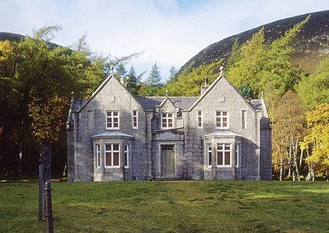
Glas-allt-Shiel

Glas-allt-Shiel is a lodge on the Balmoral Estate by the shore of Loch Muick in Aberdeenshire, Scotland. In its present form it was built in 1868 by Queen...

Loch Muick

Loch Muick (; Gaelic: Uisge Muice (pronounced [ɯʃkʲəˈmɯçkʲə])) is an upland, freshwater loch lying approximately 5 mi (8.0 km) south of Braemar, Scotland...

Related Videos

Hiking 5 White Mounth Munros Scotland in One Day, Scotland Countryside – Part 1

Hiking 5 White Mounth Munros Scotland in One Day, Scotland Countryside. According to Walkhighlands, this route is a long ...

Walking Scotland with Larking About - lochnagar 5

I was on limited battery life so sadly no video of coming back down. although I would recommend coming down the waterfall and ...

4K White Mounth Munros Walk, Scottish Countryside – Part 1 [short preview]

Short preview 4K White Mounth Munros, Glen Muick, Scottish Countryside with no added music and nature sounds ASMR.

Nearby Amenities

Located within 500m of 56.933984,-3.2672848
Waterway: waterfall
Lat/Long: 56.9368859/-3.2650423
Waterway: waterfall
Lat/Long: 56.9347302/-3.2698662
Ford: yes
Lat/Long: 56.9341015/-3.2644831
Waterway: waterfall
Lat/Long: 56.9342634/-3.2692513
The data included in this document is from www.openstreetmap.org. The data is made available under ODbL.

Have you been to Lochnagar Hills?

Leave your review of Lochnagar Hills below (or comments, questions and feedback).