Beinn an Fhraoich

Hill, Mountain in Inverness-shire

Scotland

Beinn an Fhraoich
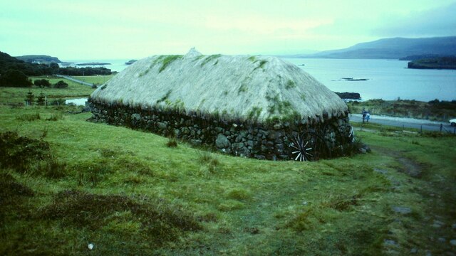
Blackhouse Museum, Colbost The croft museum in the township of Colbost, on the west shore of Loch Dunvegan, was established in 1969 by local man Peter MacAskill as the first of several heritage projects in the area. Its centrepiece was a restored island blackhouse (Taigh Dubh), constructed of rough unmortared stone and replicating typical living conditions in 19th-century rural Skye. There were two doors, one for the crofter's family who occupied two thirds of the building and the other for the animals housed in the byre which took up the remaining space. There were no windows or chimneys; daylight entered through the doorways and smoke from the central peat fire, continuously burning in its hearth on the floor of the living room, escaped though a raised opening in the thatched roof. The interior was thus dark and smoky and the floor was of beaten earth. Kettles and cooking pots were hung on a slabhraidh (chain) suspended from the rafters over the fire, and crockery and utensils was kept in a dresser and presses (cupboards) against the walls. A replica of an illicit whisky still could be seen to the rear of the museum.

The adjoining Three Chimneys restaurant was also opened by Peter, initially to provide refreshments for visitors to the museum, and takes its name from the Kent hamlet near Sevenoaks where Peter had formerly lived.

Sadly the museum was not able to reopen following its closure just before the Covid pandemic of 2020, and by 2023 it stood derelict with the neglected roof thatch disintegrating.
Blackhouse Museum, Colbost Credit: Sandy Gerrard

Beinn an Fhraoich, also known as Hill of the Heather, is a prominent hill/mountain located in Inverness-shire, Scotland. It is situated approximately 10 miles south of the town of Inverness, near the village of Kiltarlity.

Standing at a height of 391 meters (1,283 feet), Beinn an Fhraoich offers stunning panoramic views of the surrounding countryside. Its location on the edge of the Great Glen provides visitors with a unique perspective of the nearby mountains, including Ben Wyvis and the Monadhliath Mountains.

The hill itself is covered in heather, hence its Gaelic name, which translates to "Heather Hill." The vibrant purple hues of the heather create a beautiful contrast against the green landscape, especially during the summer months. Beinn an Fhraoich is also home to a variety of other plant species, including juniper and blaeberry.

The hill is a popular destination for outdoor enthusiasts, offering a range of activities such as hiking, hillwalking, and birdwatching. There are several well-marked trails that lead to the summit, providing visitors with a challenging yet rewarding experience. Along the way, one may encounter wildlife such as red deer, mountain hares, and various bird species, including golden eagles and peregrine falcons.

Beinn an Fhraoich is easily accessible, with parking available near the village of Kiltarlity. It is a great option for those seeking a memorable outdoor adventure and a chance to appreciate the natural beauty of the Scottish Highlands.

If you have any feedback on the listing, please let us know in the comments section below.

Beinn an Fhraoich Images

Images are sourced within 2km of 57.430394/-6.6534876 or Grid Reference NG2047. Thanks to Geograph Open Source API. All images are credited.

Blackhouse Museum, Colbost The croft museum in the township of Colbost, on the west shore of Loch Dunvegan, was established in 1969 by local man Peter MacAskill as the first of several heritage projects in the area. Its centrepiece was a restored island blackhouse (Taigh Dubh), constructed of rough unmortared stone and replicating typical living conditions in 19th-century rural Skye. There were two doors, one for the crofter's family who occupied two thirds of the building and the other for the animals housed in the byre which took up the remaining space. There were no windows or chimneys; daylight entered through the doorways and smoke from the central peat fire, continuously burning in its hearth on the floor of the living room, escaped though a raised opening in the thatched roof. The interior was thus dark and smoky and the floor was of beaten earth. Kettles and cooking pots were hung on a slabhraidh (chain) suspended from the rafters over the fire, and crockery and utensils was kept in a dresser and presses (cupboards) against the walls. A replica of an illicit whisky still could be seen to the rear of the museum.

The adjoining Three Chimneys restaurant was also opened by Peter, initially to provide refreshments for visitors to the museum, and takes its name from the Kent hamlet near Sevenoaks where Peter had formerly lived.

Sadly the museum was not able to reopen following its closure just before the Covid pandemic of 2020, and by 2023 it stood derelict with the neglected roof thatch disintegrating.
Blackhouse Museum, Colbost
The croft museum in the township of Colbost, on the west shore of Loch Dunvegan, was established in 1969 by local man Peter MacAskill as the first of several heritage projects in the area. Its centrepiece was a restored island blackhouse (Taigh Dubh), constructed of rough unmortared stone and replicating typical living conditions in 19th-century rural Skye. There were two doors, one for the crofter's family who occupied two thirds of the building and the other for the animals housed in the byre which took up the remaining space. There were no windows or chimneys; daylight entered through the doorways and smoke from the central peat fire, continuously burning in its hearth on the floor of the living room, escaped though a raised opening in the thatched roof. The interior was thus dark and smoky and the floor was of beaten earth. Kettles and cooking pots were hung on a slabhraidh (chain) suspended from the rafters over the fire, and crockery and utensils was kept in a dresser and presses (cupboards) against the walls. A replica of an illicit whisky still could be seen to the rear of the museum. The adjoining Three Chimneys restaurant was also opened by Peter, initially to provide refreshments for visitors to the museum, and takes its name from the Kent hamlet near Sevenoaks where Peter had formerly lived. Sadly the museum was not able to reopen following its closure just before the Covid pandemic of 2020, and by 2023 it stood derelict with the neglected roof thatch disintegrating.
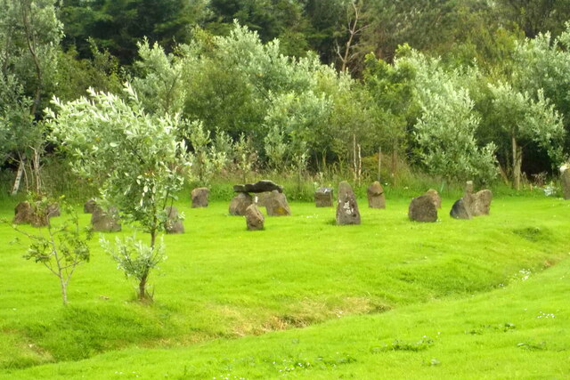
Stone circle, Upper Colbost In the garden of a house called Middle Earth. It may not be very ancient.
Stone circle, Upper Colbost
In the garden of a house called Middle Earth. It may not be very ancient.
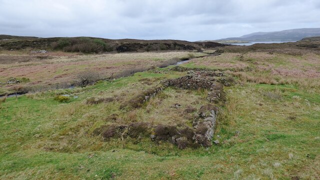
Ruined Blackhouse Settlement
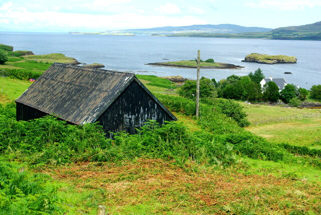
Willie Alec's shed A corrugated building stands in the angle between the Upper Colbost road and the B884. In the background are the Colbost islands in Loch Dunvegan and in the misty distance the peninsula of Waternish on the far side of the loch.
Willie Alec's shed
A corrugated building stands in the angle between the Upper Colbost road and the B884. In the background are the Colbost islands in Loch Dunvegan and in the misty distance the peninsula of Waternish on the far side of the loch.
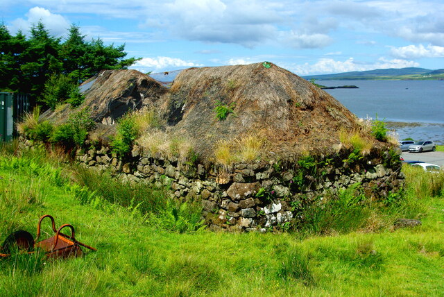
Folk Museum in decline Three years on from the closure enforced by Covid, the restored black house at the centre of the Colbost Croft Museum is showing sad signs of severe neglect.  The central section of the thatched roof has given way, leaving only the retaining wire netting, while rank weeds have invaded the remaining parts of the thatch. An upturned wheelbarrow is quietly rusting away in the foreground.
Folk Museum in decline
Three years on from the closure enforced by Covid, the restored black house at the centre of the Colbost Croft Museum is showing sad signs of severe neglect. The central section of the thatched roof has given way, leaving only the retaining wire netting, while rank weeds have invaded the remaining parts of the thatch. An upturned wheelbarrow is quietly rusting away in the foreground.
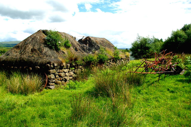
Decline of the Colbost Folk Museum Three years on from the closure enforced by Covid, the restored black house is showing sad signs of severe neglect.  The central section of the thatched roof has given way, leaving only the retaining wire netting, while rank weeds have invaded the remaining parts of the thatch. Agricultural machinery and an old wheel lie among the long grass.
Decline of the Colbost Folk Museum
Three years on from the closure enforced by Covid, the restored black house is showing sad signs of severe neglect. The central section of the thatched roof has given way, leaving only the retaining wire netting, while rank weeds have invaded the remaining parts of the thatch. Agricultural machinery and an old wheel lie among the long grass.
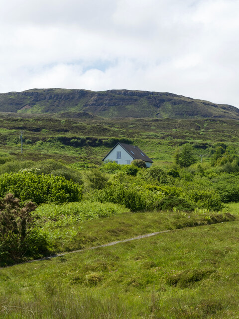
An astonishing hillside, Cnoc a' Bhonnaich Beag, and its incredibly ordinary house
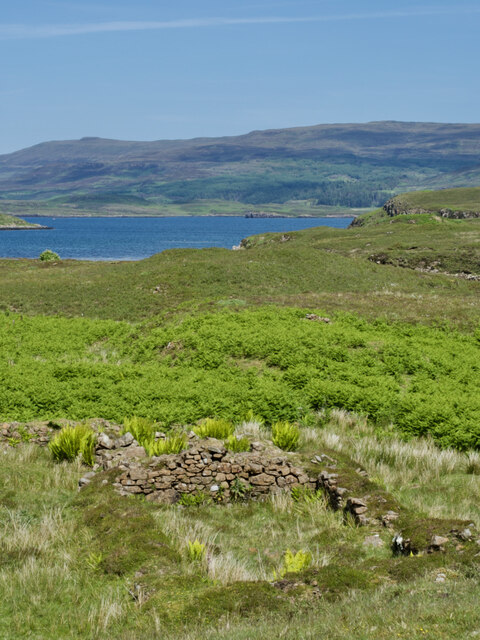
A sunny day view of a ruined shieling amidst a sea of bracken
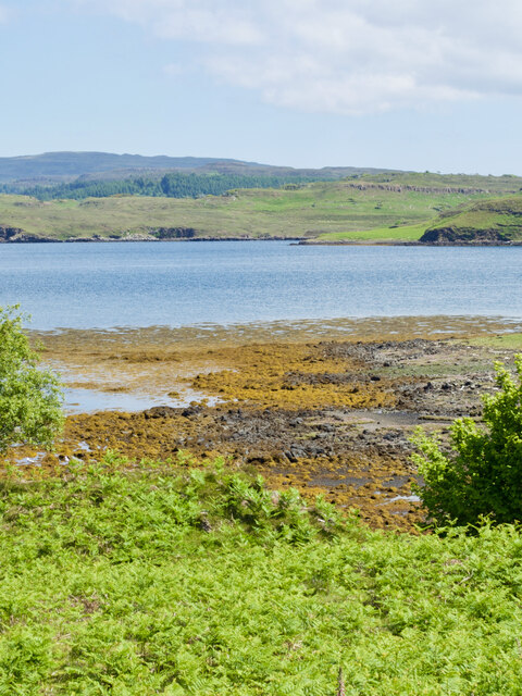
Tràigh Bheag, the 'little beach' that hides its sands
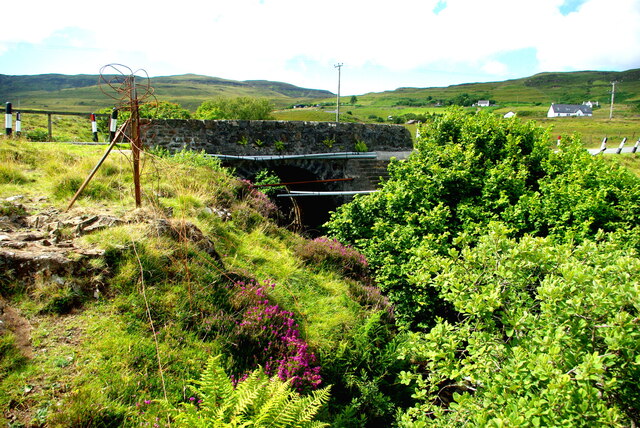
Drochaid Peigi Siosalaiche (1) Peggy Chisholm's Bridge carries the B884 Glendale road over the Brunigill Burn near its outflow into Loch Erghallan, just south of the township of Skinidin (Sgianaidin).  In the early 20th century Peggy lived in a house near the bridge, of which no traces remain. The parapets have frequently had to be rebuilt following impacts by vehicles on the narrow road.

The Ordnance Survey Name Books of 1876-8 record Brunigill as the name "applied to a house one Storey high thatched and in ordinary repair Situated about ½ mile to the South-east of Skinidin Property of McLeod of Mcleod"; this may have been Peggy's home. Alexander Forbes in his 1923 work on the place names of Skye  derives the name from the Norse "Brunnr" indicating a ravine.

This image shows the downstream side of the bridge. For the view from upstream see <a href="https://www.geograph.org.uk/photo/7560297">NG2247 : Drochaid Peigi Siosalaiche (2)</a>.
Drochaid Peigi Siosalaiche (1)
Peggy Chisholm's Bridge carries the B884 Glendale road over the Brunigill Burn near its outflow into Loch Erghallan, just south of the township of Skinidin (Sgianaidin). In the early 20th century Peggy lived in a house near the bridge, of which no traces remain. The parapets have frequently had to be rebuilt following impacts by vehicles on the narrow road. The Ordnance Survey Name Books of 1876-8 record Brunigill as the name "applied to a house one Storey high thatched and in ordinary repair Situated about ½ mile to the South-east of Skinidin Property of McLeod of Mcleod"; this may have been Peggy's home. Alexander Forbes in his 1923 work on the place names of Skye derives the name from the Norse "Brunnr" indicating a ravine. This image shows the downstream side of the bridge. For the view from upstream see NG2247 : Drochaid Peigi Siosalaiche (2).
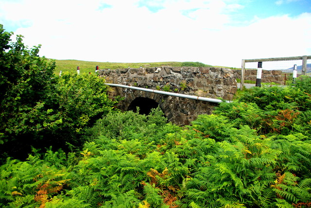
Drochaid Peigi Siosalaiche (2) Peggy Chisholm's Bridge carries the B884 Glendale road over the Brunigill Burn near its outflow into Loch Erghallan, just south of the township of Skinidin (Sgianaidin). In the early 20th century Peggy lived in a house near the bridge, of which no traces remain. The parapets have frequently had to be rebuilt following impacts by vehicles on the narrow road.

The Ordnance Survey Name Books of 1876-8 record Brunigill as the name "applied to a house one Storey high thatched and in ordinary repair Situated about ½ mile to the South-east of Skinidin Property of McLeod of Mcleod"; this may have been Peggy's home. Alexander Forbes in his 1923 work on the place names of Skye derives the name from the Norse "Brunnr" indicating a ravine.

This image shows the view from upstream. For downstream side of the bridge see <a href="https://www.geograph.org.uk/photo/7560294">NG2247 : Drochaid Peigi Siosalaiche (1)</a>.
Drochaid Peigi Siosalaiche (2)
Peggy Chisholm's Bridge carries the B884 Glendale road over the Brunigill Burn near its outflow into Loch Erghallan, just south of the township of Skinidin (Sgianaidin). In the early 20th century Peggy lived in a house near the bridge, of which no traces remain. The parapets have frequently had to be rebuilt following impacts by vehicles on the narrow road. The Ordnance Survey Name Books of 1876-8 record Brunigill as the name "applied to a house one Storey high thatched and in ordinary repair Situated about ½ mile to the South-east of Skinidin Property of McLeod of Mcleod"; this may have been Peggy's home. Alexander Forbes in his 1923 work on the place names of Skye derives the name from the Norse "Brunnr" indicating a ravine. This image shows the view from upstream. For downstream side of the bridge see NG2247 : Drochaid Peigi Siosalaiche (1).
Hamara River The map shows this point, just south of Fasach, as a ford. It looks like the occasional shepherd on a quad bike crosses here, though it is very rocky. It is easy to keep your boots dry at times of low rainfall!
Hamara River
The map shows this point, just south of Fasach, as a ford. It looks like the occasional shepherd on a quad bike crosses here, though it is very rocky. It is easy to keep your boots dry at times of low rainfall!
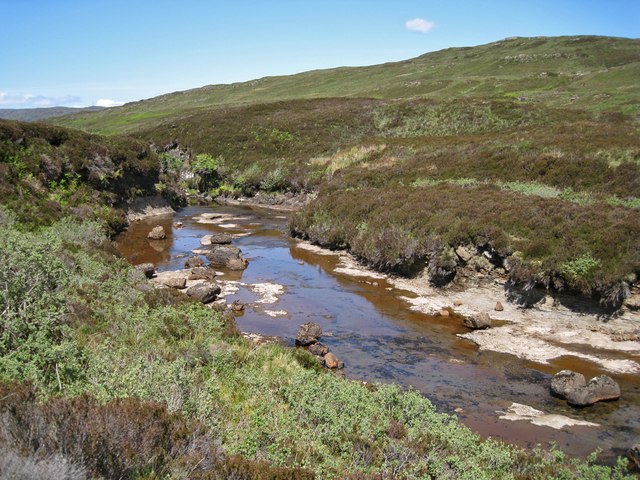
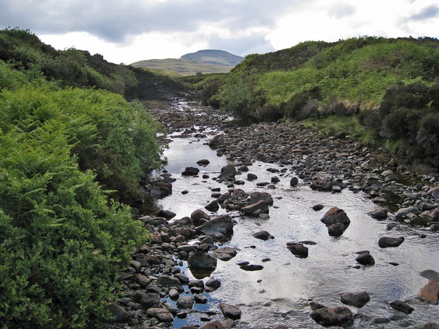
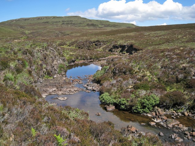
Hamara River The water level is lower than usual following a prolonged spell of dry weather on Skye. The river flows north west and through Glendale before meeting the sea in Loch Pooltiel.
Hamara River
The water level is lower than usual following a prolonged spell of dry weather on Skye. The river flows north west and through Glendale before meeting the sea in Loch Pooltiel.
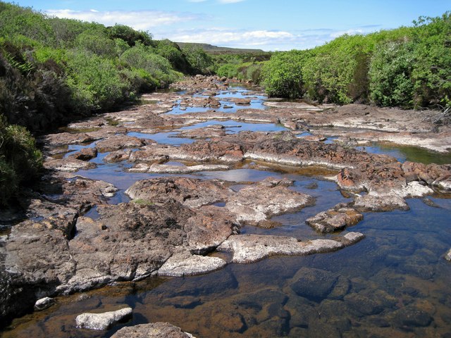
Hamara River - smooth bed It is not often so much of the river bed is exposed. As can be seen, the bed is mostly smooth rock just here. In contrast, just a few metres downstream, the bed is full of boulders - <a href="https://www.geograph.org.uk/photo/3003479">NG1946 : Hamara River - boulder bed</a>. There has been very little rainfall for the past ten weeks or so on Skye.
Hamara River - smooth bed
It is not often so much of the river bed is exposed. As can be seen, the bed is mostly smooth rock just here. In contrast, just a few metres downstream, the bed is full of boulders - NG1946 : Hamara River - boulder bed. There has been very little rainfall for the past ten weeks or so on Skye.
Hamara River - boulder bed In contrast with <a href="https://www.geograph.org.uk/photo/3003476">NG1946 : Hamara River - smooth bed</a>, the river bed here, just a few metres downstream is full of boulders. The water level is unusually low following a prolonged dry spell on Skye.
Hamara River - boulder bed
In contrast with NG1946 : Hamara River - smooth bed, the river bed here, just a few metres downstream is full of boulders. The water level is unusually low following a prolonged dry spell on Skye.
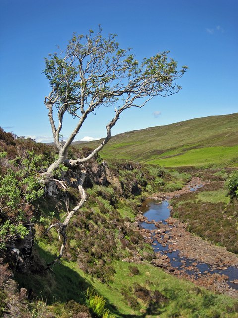
Tough tree The trunk of this Rowan tree starts out horizontally from a crack in the rock. It is the only tree of its size amid miles of heather moorland. It is growing on the bank of the Hamara River.
Tough tree
The trunk of this Rowan tree starts out horizontally from a crack in the rock. It is the only tree of its size amid miles of heather moorland. It is growing on the bank of the Hamara River.
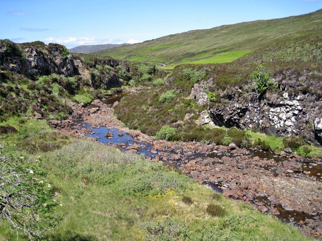
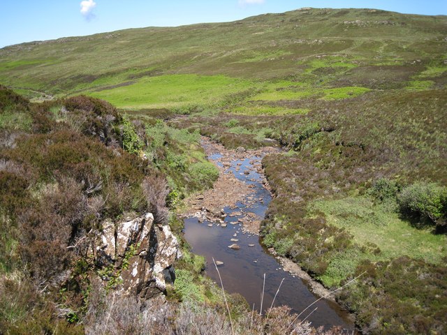
Hamara River The bright green patches on the hillside beyond the river are bracken. The river level is unusually low, after an extended period of little rainfall on Skye.
Hamara River
The bright green patches on the hillside beyond the river are bracken. The river level is unusually low, after an extended period of little rainfall on Skye.
Easy crossing today A lengthy period of little rainfall on Skye has left river levels much lower than usual. This makes the crossing of the Hamara River an easy task, with so much of its rocky bed exposed.
Easy crossing today
A lengthy period of little rainfall on Skye has left river levels much lower than usual. This makes the crossing of the Hamara River an easy task, with so much of its rocky bed exposed.
Show me another place!

Beinn an Fhraoich is located at Grid Ref: NG2047 (Lat: 57.430394, Lng: -6.6534876)

Unitary Authority: Highland

Police Authority: Highlands and Islands

What 3 Words

///nosedive.golf.novelist. Near Glendale, Highland

Nearby Locations

Beinn an Fhraoich

Related Wikis

Duirinish, Skye

Duirinish (Scottish Gaelic: Diùirinis) is a peninsula and civil parish on the island of Skye in Scotland. It is situated in the north west between Loch...

Colbost

Colbost (Scottish Gaelic: Cealabost) is a scattered hamlet on the B884 road, in the Glendale estate, overlooking Loch Dunvegan on the Scottish island of...

The Three Chimneys

The Three Chimneys is a restaurant in Colbost, Isle of Skye, Scotland. While in operation beforehand, the restaurant came to prominence after being taken...

Eilean Mòr, Loch Dunvegan

Eilean Mòr is an uninhabited island in Loch Dunvegan in north west Skye, Scotland. At low water the island is connected to Eilean Dubh. == Footnotes ==

Nearby Amenities

Located within 500m of 57.430394,-6.6534876
Beinn an Fhraoich
Ele: 237
Natural: peak
Lat/Long: 57.4297973/-6.6549796
The data included in this document is from www.openstreetmap.org. The data is made available under ODbL.

Have you been to Beinn an Fhraoich?

Leave your review of Beinn an Fhraoich below (or comments, questions and feedback).