Halley Moor

Downs, Moorland in Northumberland

England

Halley Moor

Ruin south of Fairplay
Ruin south of Fairplay Credit: Mike Quinn

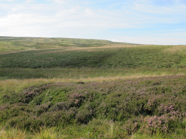
Halley Moor, located in Northumberland, England, is a picturesque expanse of downs and moorland that spans over a vast area. Situated within the Northumberland National Park, it is renowned for its natural beauty and diverse wildlife.

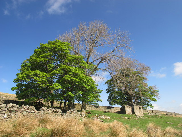
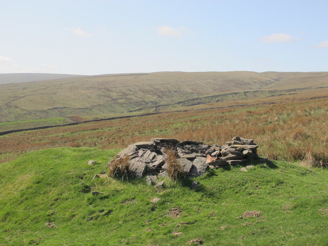
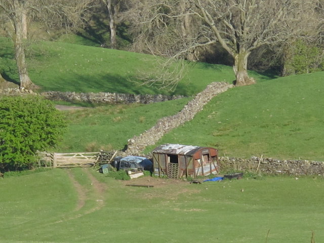
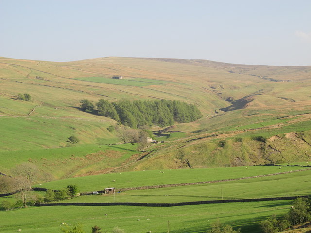
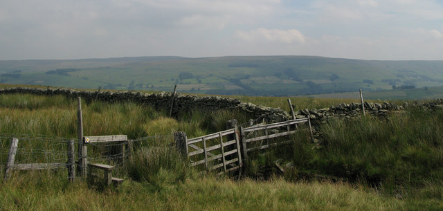
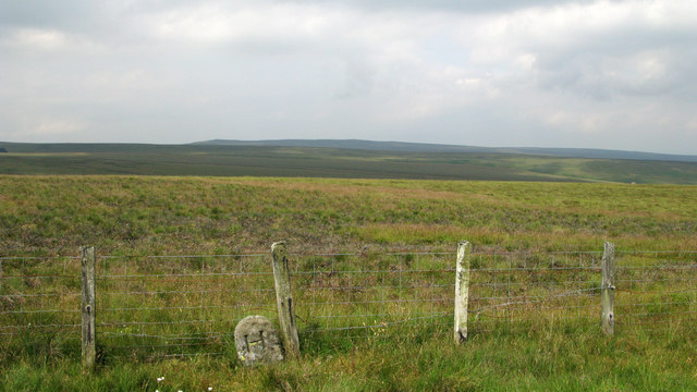
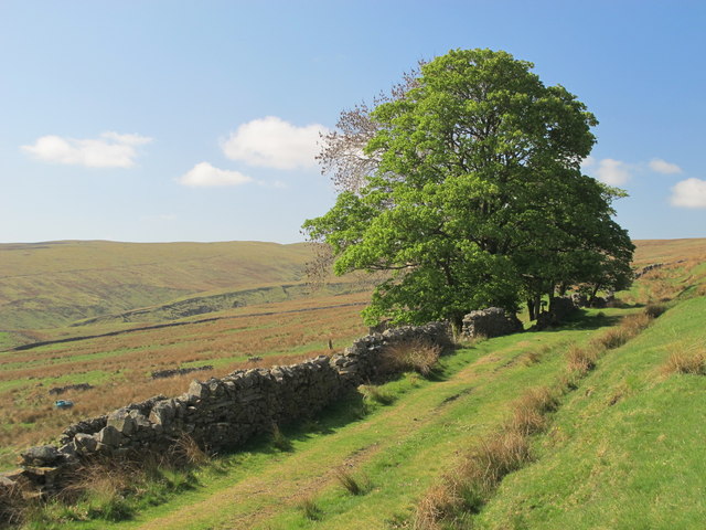
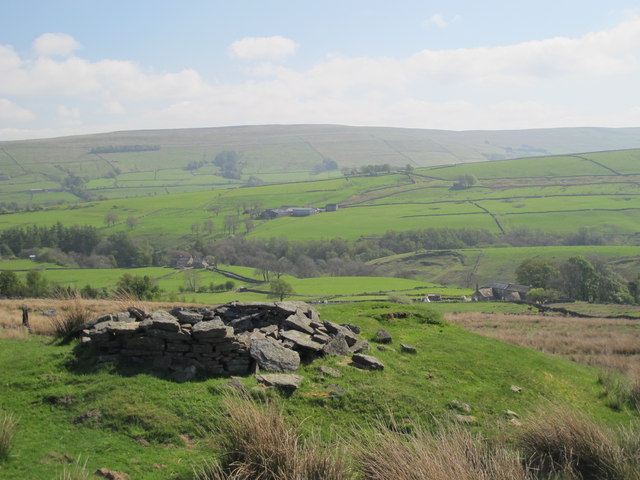
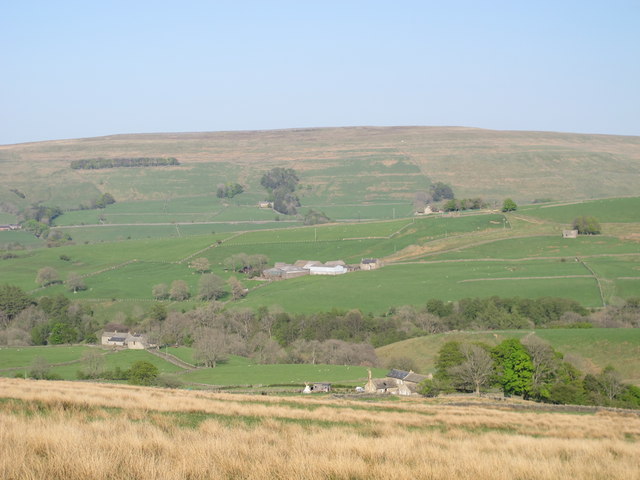
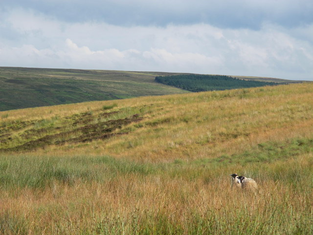
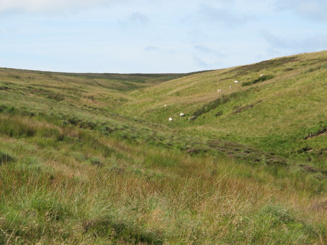
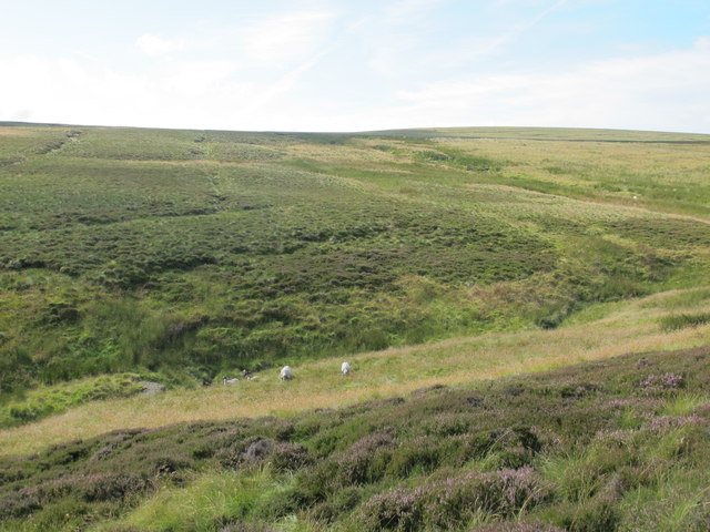
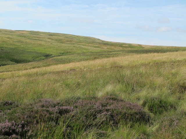
The moorland of Halley Moor is characterized by its rolling hills, heather-covered landscapes, and scattered woodlands. The area is known for its remote and untouched feel, providing visitors with a sense of tranquility and solitude. The moorland is interspersed with streams and small lakes, adding to the scenic charm of the region.

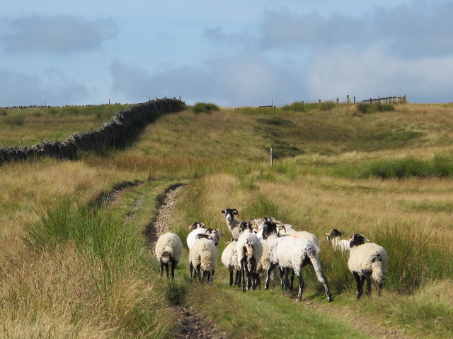
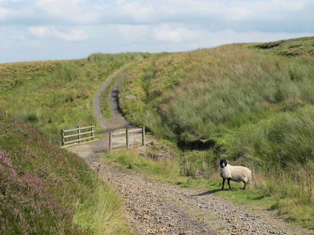
Halley Moor boasts a rich biodiversity, with various species of birds, including grouse, curlews, and skylarks, making it a haven for birdwatching enthusiasts. The moorland also supports a range of mammals, such as red squirrels, foxes, and deer, which can often be spotted amidst the verdant surroundings.

The downs of Halley Moor offer panoramic views of the surrounding countryside, with distant hills and valleys providing a stunning backdrop. Walking and hiking trails crisscross the area, allowing visitors to explore the moorland at their own pace. These trails cater to all abilities, from leisurely strolls to more challenging hikes, making Halley Moor accessible to a wide range of outdoor enthusiasts.

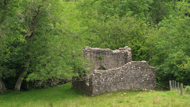
Halley Moor is also steeped in history, with ancient archaeological remains scattered throughout the landscape. The moorland is home to ancient burial mounds, stone circles, and remnants of prehistoric settlements, providing a glimpse into the area's past.

Overall, Halley Moor in Northumberland offers a captivating blend of natural beauty, wildlife, and historical significance that makes it a must-visit destination for nature lovers and history enthusiasts alike.

If you have any feedback on the listing, please let us know in the comments section below.

Halley Moor Images

Images are sourced within 2km of 54.835517/-2.3653958 or Grid Reference NY7649. Thanks to Geograph Open Source API. All images are credited.

Ruin south of Fairplay
Disused mine shaft south of Fairplay
Old railway goods van near Mohope Head (2) See also <a href="https://www.geograph.org.uk/photo/692103">NY7750 : Old railway goods van near Mohope Head</a>.
Old railway goods van near Mohope Head (2)
The upper Mohope valley Shows the location of <a href="https://www.geograph.org.uk/photo/2384495">NY7750 : Old railway goods van near Mohope Head (2)</a>. In the middle distance (centre) is <a href="https://www.geograph.org.uk/photo/136467">NY7749 : Appletree Shield</a> and on the far side of the valley above the woodland is <a href="https://www.geograph.org.uk/photo/135202">NY7848 : New House</a> (both photographed by Andrew Smith).
The upper Mohope valley
Shows the location of NY7750 : Old railway goods van near Mohope Head (2). In the middle distance (centre) is NY7749 : Appletree Shield and on the far side of the valley above the woodland is NY7848 : New House (both photographed by Andrew Smith).
Fence and wall junction with stile In West Allendale a rough lane leads onto a ridge above Keirsleywell Row. A byway follows that lane and from the byway branches a path which crosses the fence by the stile in the photograph.
Fence and wall junction with stile
In West Allendale a rough lane leads onto a ridge above Keirsleywell Row. A byway follows that lane and from the byway branches a path which crosses the fence by the stile in the photograph.
Boundary stone and fence on moorland above West Allendale A line of boundary stones follows a ridge towards Hard Rigg on the watershed between the Rivers Nent and West Allen; the stones are deeply cut with the letter H on one side and W on the other; the stones generally are numbered on top, this being number 10. The view beyond is to the north and Whitfield Moor.
Boundary stone and fence on moorland above West Allendale
A line of boundary stones follows a ridge towards Hard Rigg on the watershed between the Rivers Nent and West Allen; the stones are deeply cut with the letter H on one side and W on the other; the stones generally are numbered on top, this being number 10. The view beyond is to the north and Whitfield Moor.
Ruined building at confluence of Mohope and Wellhope Burns The Mohope Burn is below to the left, the Wellhope to the right. The ruin is in the angle of the confluence; its purpose unknown.
Ruined building at confluence of Mohope and Wellhope Burns
The Mohope Burn is below to the left, the Wellhope to the right. The ruin is in the angle of the confluence; its purpose unknown.
Mohope Head Shows the location of <a href="https://www.geograph.org.uk/photo/2384495">NY7750 : Old railway goods van near Mohope Head (2)</a> (just right of centre, at the far end of the field beyond the line of trees).
Mohope Head
Shows the location of NY7750 : Old railway goods van near Mohope Head (2) (just right of centre, at the far end of the field beyond the line of trees).
Track and rough pastures south of Fairplay With Mohope Moor beyond. For a view back from the other side of the trees, see <a href="https://www.geograph.org.uk/photo/2383721">NY7650 : Ruin south of Fairplay</a>.
Track and rough pastures south of Fairplay
With Mohope Moor beyond. For a view back from the other side of the trees, see NY7650 : Ruin south of Fairplay.
Old mine shaft above Mohope Head Looking across the Mohope valley towards <a href="https://www.geograph.org.uk/photo/413226">NY7750 : Hesleywell Farm</a>.
Old mine shaft above Mohope Head
Looking across the Mohope valley towards NY7750 : Hesleywell Farm.
Mohope Head (2) Looking across the valley towards <a href="https://www.geograph.org.uk/photo/413226">NY7750 : Hesleywell Farm</a>.
Mohope Head (2)
Looking across the valley towards NY7750 : Hesleywell Farm.
Swaledales on Ouston Fell
Sandy Ford
Sandy Ford
Ouston Fell northeast of Sandy Ford In the distance (half right) on the far side of Long Cleugh is the roughly square-shaped plantation above Herd's House; another view of the plantation is shown in <a href="https://www.geograph.org.uk/photo/1454671">NY7652 : Herd's House</a> (photographed by Peter McDermott).
Ouston Fell northeast of Sandy Ford
In the distance (half right) on the far side of Long Cleugh is the roughly square-shaped plantation above Herd's House; another view of the plantation is shown in NY7652 : Herd's House (photographed by Peter McDermott).
Valley of a tributary of Sandyford Sike
High Banks Moss
High Banks Moss
The headwaters of Sandyford Sike
Long Moss (2) Looking towards Hard Rigg in <a href="https://www.geograph.org.uk/gridref/NY7448">NY7448</a> / <a href="https://www.geograph.org.uk/gridref/NY7548">NY7548</a>.
Long Moss (2)
Looking towards Hard Rigg in NY7448 / NY7548.
Show me another place!

Halley Moor is located at Grid Ref: NY7649 (Lat: 54.835517, Lng: -2.3653958)

Unitary Authority: Northumberland

Police Authority: Northumbria

What 3 Words

///keep.newspaper.suckle. Near Alston, Cumbria

Related Wikis

Throssel Hole Buddhist Abbey

Throssel Hole Buddhist Abbey is a Buddhist monastery and retreat centre located in Northumberland, in northern England. The monastic order is equally for...

Ouston, Ninebanks

Ouston is a small settlement in south west Northumberland, England in the North Pennines Area of Outstanding Natural Beauty 8 miles (13 km) north-east...

Carr Shield

Carrshield is a village in Northumberland, in England. It is situated in the Pennines approximately between Penrith and Hexham. It is a small village with...

Ninebanks

Ninebanks is a small village in south west Northumberland, England in the North Pennines Area of Outstanding Natural Beauty 8 miles (13 km) north-east...

Allendale Moors

Allendale Moors is a Site of Special Scientific Interest (SSSI) in Northumberland, England. The upland moorland ridge site is listed for its heath, flush...

Ayle

Ayle is a village in Northumberland, England, situated to the north of Alston. There are six residences in the hamlet. == Governance == Ayle is in the...

Coalcleugh

Coalcleugh is a hamlet in Northumberland, England. It is situated in the Pennines between Penrith and Hexham. In the past it was well known as a lead mining...

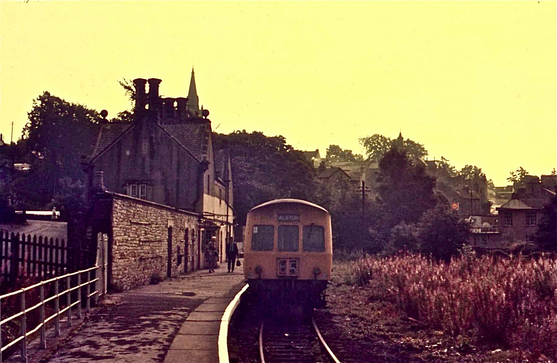
Alston railway station

Alston is a heritage railway station on the South Tynedale Railway. The station, situated 13 miles (21 km) south of Haltwhistle, is in the market town...

Nearby Amenities

Located within 500m of 54.835517,-2.3653958
Halley Moor
Natural: heath
Lat/Long: 54.8371995/-2.3630728
The data included in this document is from www.openstreetmap.org. The data is made available under ODbL.

Have you been to Halley Moor?

Leave your review of Halley Moor below (or comments, questions and feedback).