Hall Cliffe
Settlement in Yorkshire
England
Hall Cliffe

Hall Cliffe is a small village located in the county of Yorkshire, England. Situated on the eastern edge of the Pennines, it falls within the metropolitan borough of Kirklees. The village is nestled in a picturesque valley, surrounded by rolling hills and lush green fields, offering breathtaking views of the Yorkshire countryside.
Historically, Hall Cliffe was primarily an agricultural community, with farming being the main occupation of its residents. However, in recent years, the village has seen some diversification in its economy, with a few small businesses and services emerging.
The heart of Hall Cliffe is its quaint village center, characterized by charming stone cottages and a small village green. The community is tight-knit, with a friendly and welcoming atmosphere. The village has a local pub, serving traditional Yorkshire ales and hearty meals, which acts as a social hub for residents and visitors alike.
Nature lovers are drawn to Hall Cliffe for its proximity to the Peak District National Park, which is only a short drive away. This allows for easy access to a range of outdoor activities, including hiking, cycling, and bird watching.
Transportation in Hall Cliffe is mainly reliant on private vehicles, as the village lacks direct access to major public transportation routes. However, nearby towns and cities are easily accessible by car or bus.
In summary, Hall Cliffe offers a peaceful and idyllic setting, perfect for those seeking a rural retreat in the heart of Yorkshire. Its natural beauty, strong community spirit, and proximity to the stunning Peak District make it an appealing destination for residents and visitors alike.
If you have any feedback on the listing, please let us know in the comments section below.
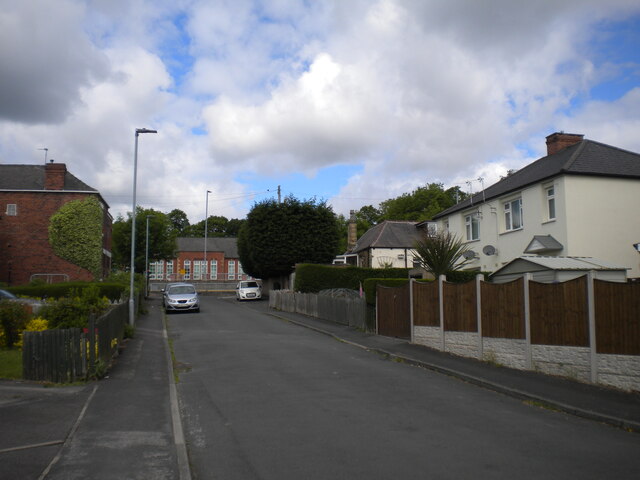
Hall Cliffe Images
Images are sourced within 2km of 53.666207/-1.557276 or Grid Reference SE2918. Thanks to Geograph Open Source API. All images are credited.


Hall Cliffe is located at Grid Ref: SE2918 (Lat: 53.666207, Lng: -1.557276)
Division: West Riding
Unitary Authority: Wakefield
Police Authority: West Yorkshire
What 3 Words
///inflation.happen.coconuts. Near Horbury, West Yorkshire
Nearby Locations
Related Wikis
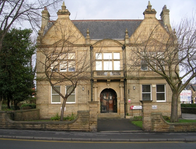
Horbury Town Hall
Horbury Town Hall is a former municipal building in Westfield Road, Horbury, West Yorkshire, England. The structure, which is now used as business centre...
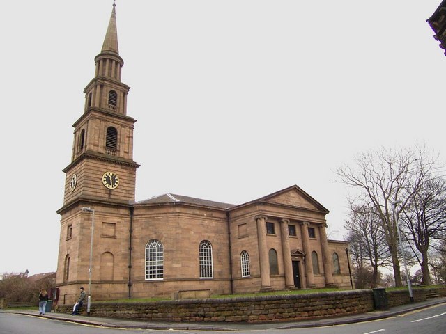
St Peter and St Leonard's Church, Horbury
St Peter and St Leonard's Church, Horbury is in Horbury, West Yorkshire, England. It is an active Church of England parish church and part of the Wakefield...

Horbury
Horbury is a town in the City of Wakefield in West Yorkshire, England. Historically in the West Riding of Yorkshire, it is situated north of the River...
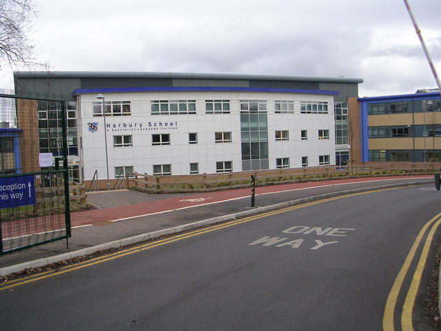
Horbury Academy
Horbury Academy (formerly Horbury School) is a mixed secondary school located in Horbury in the City of Wakefield, West Yorkshire, England.The school...
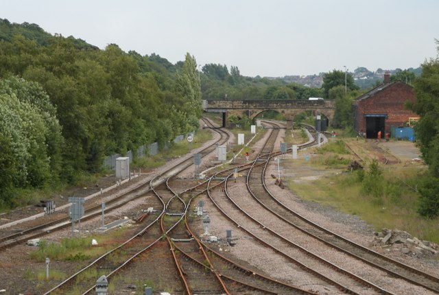
Horbury and Ossett railway station
Horbury and Ossett railway station formerly served the town of Horbury in West Yorkshire, England. It was located on the Manchester and Leeds Railway...

Horbury Town F.C.
Horbury Town Football Club is a football club based in Horbury, West Yorkshire, England. They play at the Slazengers Sports Complex. == History == The...
Horbury Millfield Road railway station
Horbury Millfield Road railway station served the village of Horbury, West Yorkshire, England from 1927 to 1961 on the Manchester and Leeds Railway....
Ossett Academy
Ossett Academy and Sixth Form College (formerly Ossett Grammar School) is the only secondary school, and also a Sixth form college, in Ossett, a town in...
Related Videos

Family recreate summer holiday trip in their house and garden | SWNS
A family-of-six whose summer holiday abroad is in jeopardy because of coronavirus have shot a hilarious video - recreating the ...

GREENWAY - Ossett to Dewsbury Walk (Vlog #58)
A morning walk along the Greenway from Ossett town centre to Savile Town Wharf Marina in Dewsbury, West Yorkshire.

ASMR Walking In the Park In The Snow
Just me trying out my Willcell ice cleats for the first time, I bought them last year but never got round to using them. £10 from ...

OSSETT Market 2021 ⎯ Filmed In 4K Ultra HD
In this video, we take a walk around the market in Ossett, which is a town near Wakefield in West Yorkshire. Markets are held in ...
Nearby Amenities
Located within 500m of 53.666207,-1.557276Have you been to Hall Cliffe?
Leave your review of Hall Cliffe below (or comments, questions and feedback).