Bad na Gualainn

Downs, Moorland in Argyllshire

Scotland

Bad na Gualainn

Gorton Bothy Gorton bothy in the wilds of Rannoch Moor on a dry morning and a nice contrast to the day before's deluge. The Black Mount hills can be seen above the bothy, while the Bridge of Orchy hills are at left in cloud.
Gorton Bothy Credit: Adam Ward

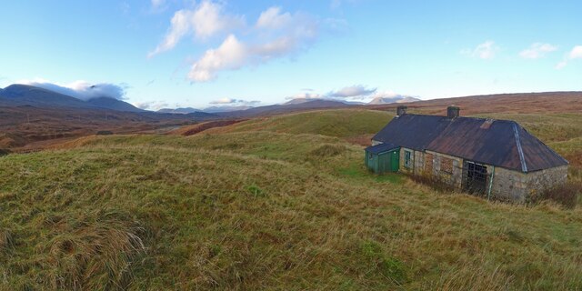
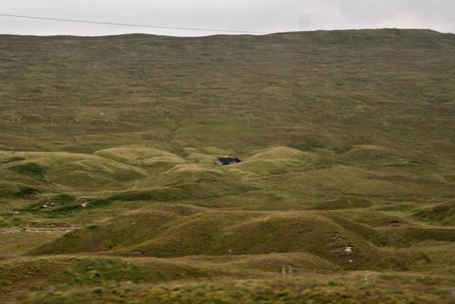
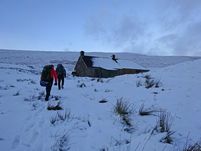
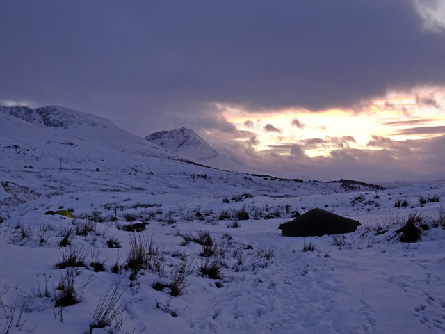
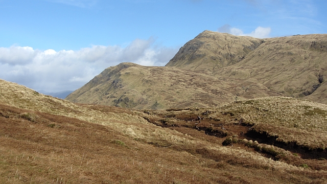
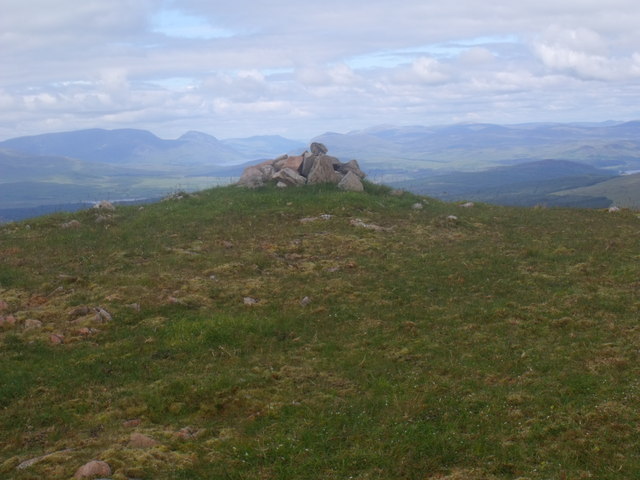
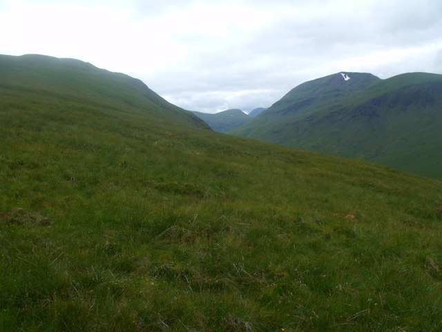
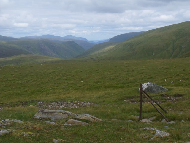
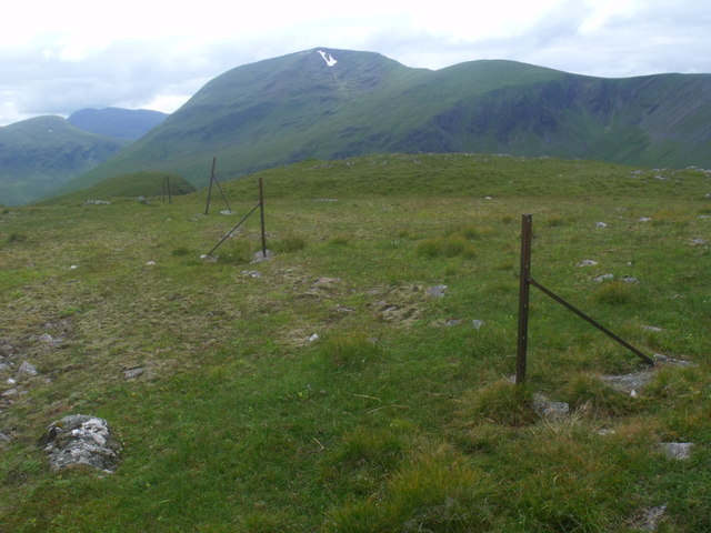
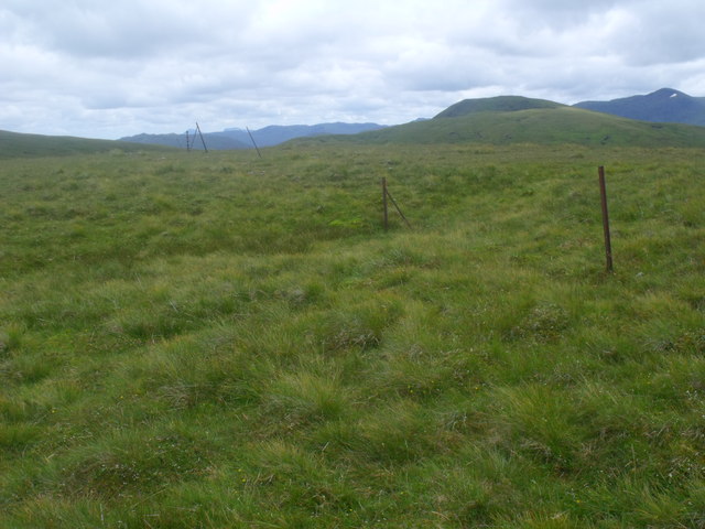
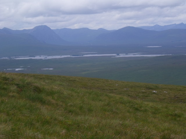
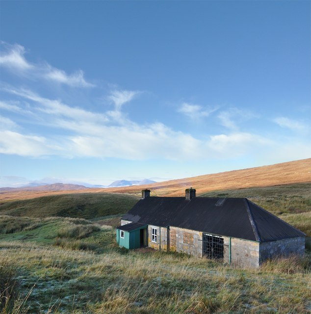
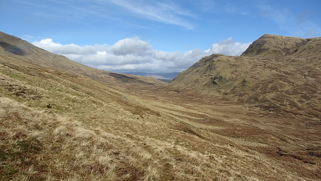
Bad na Gualainn is a region located in Argyllshire, Scotland, known for its picturesque landscape and diverse natural features. Nestled in the heart of the Highlands, this area predominantly consists of downs and moorland, offering visitors a unique and tranquil experience.

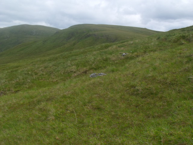
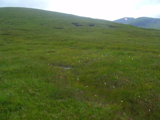
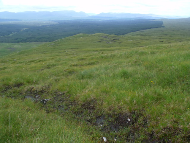
The downs of Bad na Gualainn are characterized by their rolling hills and vast open spaces. These grassy areas are often dotted with wildflowers, providing a colorful and scenic backdrop. The gentle slopes of the downs make it a popular spot for hiking and picnicking, offering visitors breathtaking panoramic views of the surrounding countryside.

Adjacent to the downs, Bad na Gualainn boasts extensive moorland. This rugged and wild terrain is covered in heather and bracken, creating a rich tapestry of colors throughout the seasons. Moorland birds such as curlews and grouse can frequently be spotted, adding to the area's natural charm.

The region is also home to several small lochs and streams, adding to the beauty and serenity of the landscape. Visitors can enjoy activities such as fishing or simply take a leisurely stroll along the shores, immersing themselves in the tranquility of the surroundings.

Bad na Gualainn is a haven for nature enthusiasts and outdoor adventurers alike. Its downs and moorland offer a peaceful escape from the hustle and bustle of everyday life, allowing visitors to connect with nature and experience the raw beauty of Scotland's countryside.

If you have any feedback on the listing, please let us know in the comments section below.

Bad na Gualainn Images

Images are sourced within 2km of 56.585215/-4.6241545 or Grid Reference NN3846. Thanks to Geograph Open Source API. All images are credited.

Gorton Bothy Gorton bothy in the wilds of Rannoch Moor on a dry morning and a nice contrast to the day before's deluge. The Black Mount hills can be seen above the bothy, while the Bridge of Orchy hills are at left in cloud.
Gorton Bothy
Gorton bothy in the wilds of Rannoch Moor on a dry morning and a nice contrast to the day before's deluge. The Black Mount hills can be seen above the bothy, while the Bridge of Orchy hills are at left in cloud.
Window at Gorton A walker's poles are ready for the off in between a pair of antlers in the porch of Gorton bothy.
Window at Gorton
A walker's poles are ready for the off in between a pair of antlers in the porch of Gorton bothy.
Lumps and bumps on Rannoch Moor and  view over Gorton Gorton is in NN3748.
Lumps and bumps on Rannoch Moor and view over Gorton
Gorton is in NN3748.
Gorton, Wintry Saturday Late November arriving at the cosy haven of Gorton bothy with much harsher conditions than the benign weather here:-
<a title="https://www.geograph.org.uk/photo/2692871" href="https://www.geograph.org.uk/photo/2692871">Link</a>
Gorton, Wintry Saturday
Late November arriving at the cosy haven of Gorton bothy with much harsher conditions than the benign weather here:- Link
Winter Afternoon, Gorton It may be November and officially still Autumn but winter has very much arrived in the Scottish Mountains - here seen from outside Gorton Bothy. 
Bitterly cold late afternoon and its time to head into the bothy to warm the hands after pitching the tent.
Winter Afternoon, Gorton
It may be November and officially still Autumn but winter has very much arrived in the Scottish Mountains - here seen from outside Gorton Bothy. Bitterly cold late afternoon and its time to head into the bothy to warm the hands after pitching the tent.
Creag Mhòr A sharp ending to the plateau west of Meall Buidhe, it overlooks Rannoch Moor.
Creag Mhòr
A sharp ending to the plateau west of Meall Buidhe, it overlooks Rannoch Moor.
Pile of stones - often known as a cairn - at summit of Creag Mhor above Rannoch Moor
On Guala Mhor above Rannoch Moor
Corner of Strathclyde Region boundary on top of Creag Mhor above Rannoch Moor A view down east through Gleann Daimh. To be accurate this is likely an estate boundary which is coincident with the county - now regional - boundary.
Corner of Strathclyde Region boundary on top of Creag Mhor above Rannoch Moor
A view down east through Gleann Daimh. To be accurate this is likely an estate boundary which is coincident with the county - now regional - boundary.
Strathclyde Region boundary marching south-west from Creag Mhor above Rannoch Moor
Strathclyde Region boundary marching in from the south-east on Creag Mhor above Rannoch Moor A modern metal manifestation of territorial boundaries which have embroiled McGregors, Campbells and Menzies and plenty others over a thousand years of history and other thousands previous, no doubt.
Strathclyde Region boundary marching in from the south-east on Creag Mhor above Rannoch Moor
A modern metal manifestation of territorial boundaries which have embroiled McGregors, Campbells and Menzies and plenty others over a thousand years of history and other thousands previous, no doubt.
Grassy slopes of Creag Mhor above Rannoch Moor Rannoch Moor with Glencoe behind.
Grassy slopes of Creag Mhor above Rannoch Moor
Rannoch Moor with Glencoe behind.
Grassy slopes of Creag Mhor above Rannoch Moor  Looking east to the north aspect of Meall na Feithe Faide and Meall Buidhe beyond that.
Grassy slopes of Creag Mhor above Rannoch Moor
Looking east to the north aspect of Meall na Feithe Faide and Meall Buidhe beyond that.
Guala Mhor above Rannoch Moor
Looking down Guala Mhor above Rannoch Moor
Gorton, Sunny Sunday A glorious late autumnal day, early Sunday morning outside Gorton bothy, looking across the fringes of Rannoch Moor to the Black Mount Hills.
Gorton, Sunny Sunday
A glorious late autumnal day, early Sunday morning outside Gorton bothy, looking across the fringes of Rannoch Moor to the Black Mount Hills.
Do Not Disturb An amusing sign on the door of Gorton bothy and a lucky horseshoe to guide walkers safely back to civilisation.
Do Not Disturb
An amusing sign on the door of Gorton bothy and a lucky horseshoe to guide walkers safely back to civilisation.
Gleann Meurain A pass between Glen Lyon and Rannoch Moor. There were once plans for a road through here.
Gleann Meurain
A pass between Glen Lyon and Rannoch Moor. There were once plans for a road through here.
Show me another place!

Bad na Gualainn is located at Grid Ref: NN3846 (Lat: 56.585215, Lng: -4.6241545)

Unitary Authority: Argyll and Bute

Police Authority: Argyll and West Dunbartonshire

What 3 Words

///sponsors.later.goose. Near Pubil, Perth & Kinross

Nearby Locations

Bad na Gualainn

Related Wikis

Gorton railway station (Scotland)

Gorton railway station or Gortan railway station, named for the nearby Meall a Ghortain area of high ground, was a remote rural private railway station...

Beinn a' Chreachain

Beinn a' Chreachain (lit. "Mountain of Scallops") is a Scottish mountain, with a conical top, to the north-west of Loch Lyon. == References == The Munros...

Meall Buidhe (Corbett)

Meall Buidhe is a Corbett situated in the southern highlands of Scotland. It forms part of the ridge line separating Glen Daimh, an offshoot of Glen Lyon...

Beinn Achaladair

Beinn Achaladair is a Scottish mountain situated six kilometres north east of the hamlet of Bridge of Orchy. The mountain stands on the border of the...

Beinn Mhanach

Beinn Mhanach (Scottish Gaelic for 'monks' mountain'), also anglicized Ben Vannoch, is a mountain in the Breadalbane region of the Scottish Highlands....

Loch Lyon

Loch Lyon (Scottish Gaelic, Loch Lìobhann) is a freshwater loch in Glen Lyon, located in Perthshire, Scotland, which feeds the River Lyon, a tributary...

The Soldiers' Trenches, Moor of Rannoch

The Soldiers' Trenches on Rannoch Moor are drainage ditches dug by British army soldiers in 1763-64 in an attempt to drain part of the Moor of Rannoch...
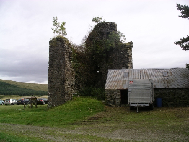
Achallader Castle

Achallader Castle (Scottish Gaelic: Caisteal Achaladair) is a ruined 16th-century tower house under the shadow of Beinn Achaladair, about 3.5 miles north...

Have you been to Bad na Gualainn?

Leave your review of Bad na Gualainn below (or comments, questions and feedback).