Black Wood

Wood, Forest in Cumberland Copeland

England

Black Wood

Sowermyrr farm Looking across a grass paddock towards the small farm at Sowermyrr.
Sowermyrr farm Credit: Graham Robson

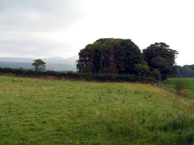
Black Wood is a renowned forest located in the county of Cumberland, England. Stretching over an impressive area of approximately 2,000 acres, this ancient woodland is a haven for nature enthusiasts and a cherished gem of the region. The forest is nestled within the idyllic surroundings of the Lake District National Park, adding to its scenic beauty and tranquil ambiance.

Black Wood is predominantly composed of native deciduous trees, such as oak, birch, and ash, which create a dense canopy overhead, providing shade and shelter for an array of wildlife species. The forest floor is adorned with a plethora of vibrant wildflowers, including bluebells, primroses, and wood anemones, creating a picturesque carpet of color during the spring months.

The woodland is crisscrossed by a network of well-maintained walking trails, allowing visitors to explore its natural wonders at their own pace. These paths offer breathtaking views of the surrounding countryside, including glimpses of nearby lakes and rolling hills. The forest is also intersected by a babbling brook, adding to its enchanting atmosphere.

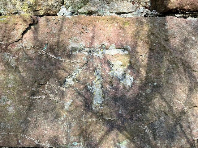
Black Wood is not only a haven for flora and fauna but also a site of historical significance. The forest has been in existence for centuries, and remnants of old stone walls and ancient boundaries can still be seen, hinting at its rich past. Furthermore, the woodland has been carefully managed to preserve its biodiversity and cultural heritage, ensuring it remains a cherished natural asset for future generations.

In conclusion, Black Wood in Cumberland is a captivating forest that captivates visitors with its natural beauty, diverse wildlife, and rich history. It stands as a testament to the enduring charm of England's woodlands and serves as a valuable resource for both recreational activities and environmental conservation efforts.

If you have any feedback on the listing, please let us know in the comments section below.
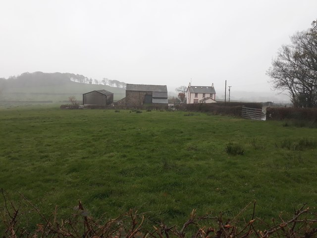
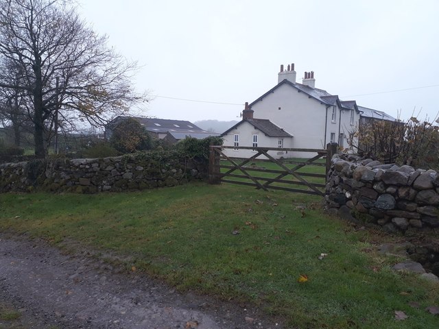
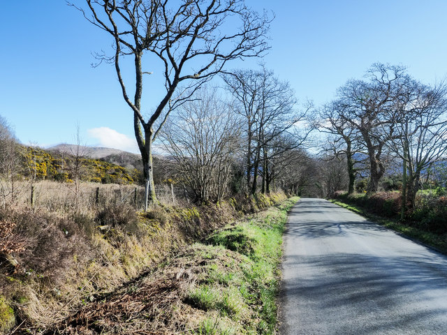
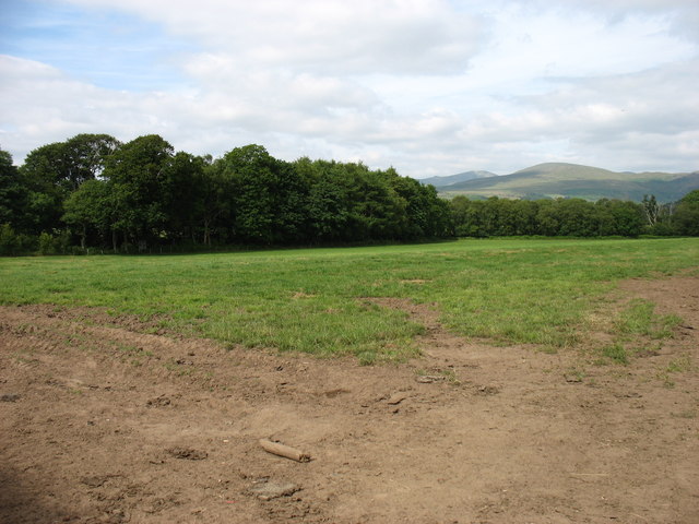
Black Wood Images

Images are sourced within 2km of 54.421617/-3.3821287 or Grid Reference NY1003. Thanks to Geograph Open Source API. All images are credited.

Sowermyrr farm Looking across a grass paddock towards the small farm at Sowermyrr.
Sowermyrr farm
Looking across a grass paddock towards the small farm at Sowermyrr.
Bolton Head The farmhouse and adjacent buildings at Bolton Head.
Bolton Head
The farmhouse and adjacent buildings at Bolton Head.
Bridleway at Bolton Head A narrow track east of Bolton House. Further along it was very wet underfoot.
Bridleway at Bolton Head
A narrow track east of Bolton House. Further along it was very wet underfoot.
Track junction south of Bolton Head A junction of farm tracks south of Bolton Head.
Track junction south of Bolton Head
A junction of farm tracks south of Bolton Head.
Farm track east of Rainors A farm track passing between the farms of Rainors and Julian Holme. A public bridleway follows the track.
Farm track east of Rainors
A farm track passing between the farms of Rainors and Julian Holme. A public bridleway follows the track.
Hawkbarrow Farm Looking down the short lane to the farm buildings and house at Hawkbarrow Farm. The large pond in front of the steading appears to be a recent addition.
Hawkbarrow Farm
Looking down the short lane to the farm buildings and house at Hawkbarrow Farm. The large pond in front of the steading appears to be a recent addition.
Minor road north of Hawkbarrow Farm The minor road passing to the north of Hawkbarrow Farm.
Minor road north of Hawkbarrow Farm
The minor road passing to the north of Hawkbarrow Farm.
Minor road heading west The road connects Wasdale Head with Gosforth.
Seatallan is the hill on the horizon to the left of the most prominent tree.
Minor road heading west
The road connects Wasdale Head with Gosforth. Seatallan is the hill on the horizon to the left of the most prominent tree.
Fields near Santon
Fields near Santon
Julian Holme Farm The Denwoods are clearly proud of their herd.
Julian Holme Farm
The Denwoods are clearly proud of their herd.
Hawkbarrow Farm Just off the minor road that leads from Gosforth to Nether Wasdale.
Hawkbarrow Farm
Just off the minor road that leads from Gosforth to Nether Wasdale.
Open country and woodland, Wasdale This photo was taken near the intriguingly named 'Sorrowstones'. The hills around Wasdale are visible behind.
Open country and woodland, Wasdale
This photo was taken near the intriguingly named 'Sorrowstones'. The hills around Wasdale are visible behind.
Rainors Farm. Can you spot the false window 3rd along from this end at the top!
Rainors Farm.
Can you spot the false window 3rd along from this end at the top!
Between Guards Farm. Possibly something to stop the rustlers but I cannot be certain.
Between Guards Farm.
Possibly something to stop the rustlers but I cannot be certain.
Hall Bolton Restored premises that have been divided into separate units.
Hall Bolton
Restored premises that have been divided into separate units.
Wasdale Wall Looking towards the road which leads to Nether Wasdale.
Wasdale Wall
Looking towards the road which leads to Nether Wasdale.
Benchmark, Hermons Hill Detail of the Ordnance Survey cut benchmark on the corner of a barn at Hermons Hill.  The benchmark appears to have been filled and this was possibly done to indicate cancellation when it was superseded by flush bracket benchmark G3100, below this benchmark on the same wall (photograph <a href="https://www.geograph.org.uk/photo/7118351">NY1004 : Flush bracket benchmark, Hermons Hill</a>).
The 1899 edition Ordnance Survey map shows this benchmark marking a height of 157.9ft above mean sea level, Ordnance Datum Newlyn.
Location photograph <a href="https://www.geograph.org.uk/photo/7118657">NY1004 : Corner of the barn, Hermons Hill</a>.
Benchmark, Hermons Hill
Detail of the Ordnance Survey cut benchmark on the corner of a barn at Hermons Hill. The benchmark appears to have been filled and this was possibly done to indicate cancellation when it was superseded by flush bracket benchmark G3100, below this benchmark on the same wall (photograph NY1004 : Flush bracket benchmark, Hermons Hill). The 1899 edition Ordnance Survey map shows this benchmark marking a height of 157.9ft above mean sea level, Ordnance Datum Newlyn. Location photograph NY1004 : Corner of the barn, Hermons Hill.
Flush bracket benchmark, Hermons Hill Detail of the Ordnance Survey flush bracket benchmark number G3100 on the corner of a barn at Hermons Hill.  The benchmark marks a height of 47.793m above mean sea level (Ordnance Datum Newlyn) last levelled and verified in 1954.
There is an older, cancelled Ordnance Survey cut benchmark on the same wall directly above this benchmark (photograph <a href="https://www.geograph.org.uk/photo/7118276">NY1004 : Benchmark, Hermons Hill</a>).
Location photograph <a href="https://www.geograph.org.uk/photo/7118657">NY1004 : Corner of the barn, Hermons Hill</a>.
Flush bracket benchmark, Hermons Hill
Detail of the Ordnance Survey flush bracket benchmark number G3100 on the corner of a barn at Hermons Hill. The benchmark marks a height of 47.793m above mean sea level (Ordnance Datum Newlyn) last levelled and verified in 1954. There is an older, cancelled Ordnance Survey cut benchmark on the same wall directly above this benchmark (photograph NY1004 : Benchmark, Hermons Hill). Location photograph NY1004 : Corner of the barn, Hermons Hill.
Show me another place!

Black Wood is located at Grid Ref: NY1003 (Lat: 54.421617, Lng: -3.3821287)

Administrative County: Cumbria

District: Copeland

Police Authority: Cumbria

What 3 Words

///salsa.zapped.angry. Near Seascale, Cumbria

Related Wikis

River Bleng

The River Bleng is a tributary of the River Irt in the county of Cumbria in northern England.The river gives its name to the valley that it flows through...

Borough of Copeland

The Borough of Copeland was a local government district with borough status in western Cumbria, England. Its council was based in Whitehaven. It was...

Copeland (UK Parliament constituency)

Copeland is a constituency in Cumbria created in 1983 and represented in the House of Commons of the UK Parliament. The constituency is represented in...

Bamse's Wood

Bamse's Wood is a newly planted forest and nature reserve that sits between Gosforth and Nether Wasdale in the Lake District, Cumbria, England. The 17...

Nether Wasdale

Nether Wasdale is a village in Cumbria, England, located in the valley and civil parish of Wasdale, near the River Irt and just over a mile to the west...

St Michael & All Angels, Nether Wasdale

St Michael & All Angels' Church in Nether Wasdale, Cumbria, England, is an active Anglican parish church in the deanery of Calder, and the diocese of Carlisle...

Wasdale

Wasdale (; traditionally ) is a valley and civil parish in the western part of the Lake District National Park in Cumbria, England. The River Irt flows...

Wasdale, Eskdale and Duddon

Wasdale, Eskdale and Duddon is an area of protected countryside, now held as National Trust property: it is part of the Lake District, located in south...

Nearby Amenities

Located within 500m of 54.421617,-3.3821287
Gaterigghow
Place: locality
Lat/Long: 54.4229801/-3.3768016
Power: pole
Lat/Long: 54.4237538/-3.3889249
Power: pole
Lat/Long: 54.4185363/-3.3770353
Power: pole
Lat/Long: 54.4195896/-3.3773287
Power: pole
Lat/Long: 54.4206474/-3.3775841
Power: pole
Lat/Long: 54.4213602/-3.3768866
Power: pole
Lat/Long: 54.422082/-3.376174
The data included in this document is from www.openstreetmap.org. The data is made available under ODbL.

Have you been to Black Wood?

Leave your review of Black Wood below (or comments, questions and feedback).