Badgemoor Wood

Wood, Forest in Devon Teignbridge

England

Badgemoor Wood

Old Guide Stone at Five Lanes Cross, Stickwick Hill, Hennock Dartmoor granite guidepost by the UC road, in parish of Hennock (Teignbridge District), Five Lanes Cross, just off Stickwick Hill, a quarter mile South of Hennock; junction to Warmhill, in hedgerow on grass bank.

Inscription reads:-
South-west side: TO / S. BOVEY, North-west side: TO / MORETON, North-east side: TO / HENNOCK, East side: TO / EXETER, South-east side: TO / CHUDLEIGH.

Grade II listed. List Entry Number: 1165927
<span class="nowrap"><a title="https://historicengland.org.uk/listing/the-list/list-entry/1165927" rel="nofollow ugc noopener" href="https://historicengland.org.uk/listing/the-list/list-entry/1165927">Link</a><img style="margin-left:2px;" alt="External link" title="External link - shift click to open in new window" src="https://s1.geograph.org.uk/img/external.png" width="10" height="10"/></span>

Surveyed

Milestone Society National ID: DV_XHEN01.
Old Guide Stone at Five Lanes Cross, Stickwick Hill, Hennock Credit: Sheron Vowden

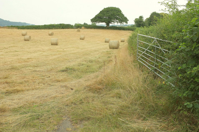
Badgemoor Wood, located in Devon, is a captivating woodland area that offers a serene and enchanting experience for nature lovers and outdoor enthusiasts. This ancient forest covers a substantial area and is characterized by its dense canopy of towering trees, diverse wildlife, and tranquil atmosphere.

The wood is predominantly made up of native broadleaf trees, such as oak, beech, and ash, which provide a rich and varied habitat for a range of flora and fauna. The forest floor is adorned with a lush carpet of mosses, ferns, and wildflowers, creating a picturesque and enchanting scene throughout the year.

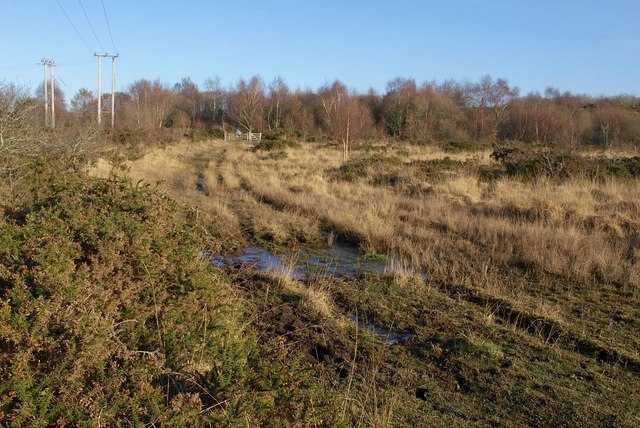
Badgemoor Wood is a haven for wildlife, with numerous species calling it home. Visitors may have the opportunity to spot various birds, including woodpeckers, owls, and songbirds, as well as woodland mammals like badgers, foxes, and deer. The wood is also home to a variety of insects and small reptiles and provides an ideal habitat for many rare and protected species.

Walking trails wind their way through the wood, allowing visitors to explore its beauty at their own pace. These paths offer a chance to immerse oneself in the tranquility of the forest and enjoy the sounds of nature. The wood is a popular spot for hiking, birdwatching, and nature photography, attracting visitors from near and far.

Badgemoor Wood, with its ancient trees, diverse wildlife, and peaceful ambiance, is a true gem of Devon. It offers a unique opportunity to connect with nature and experience the beauty of a traditional English woodland.

If you have any feedback on the listing, please let us know in the comments section below.

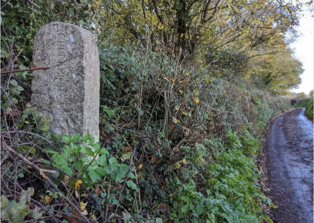
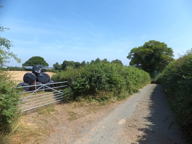
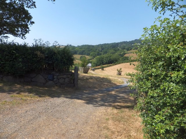
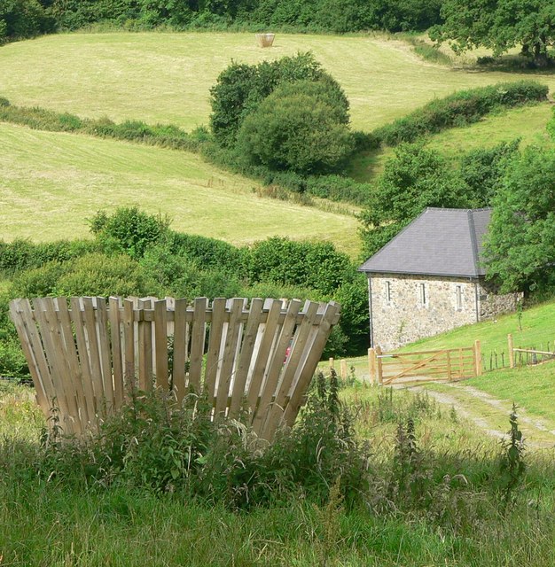
Badgemoor Wood Images

Images are sourced within 2km of 50.595031/-3.6462302 or Grid Reference SX8378. Thanks to Geograph Open Source API. All images are credited.

Old Guide Stone at Five Lanes Cross, Stickwick Hill, Hennock Dartmoor granite guidepost by the UC road, in parish of Hennock (Teignbridge District), Five Lanes Cross, just off Stickwick Hill, a quarter mile South of Hennock; junction to Warmhill, in hedgerow on grass bank.

Inscription reads:-
South-west side: TO / S. BOVEY, North-west side: TO / MORETON, North-east side: TO / HENNOCK, East side: TO / EXETER, South-east side: TO / CHUDLEIGH.

Grade II listed. List Entry Number: 1165927
<span class="nowrap"><a title="https://historicengland.org.uk/listing/the-list/list-entry/1165927" rel="nofollow ugc noopener" href="https://historicengland.org.uk/listing/the-list/list-entry/1165927">Link</a><img style="margin-left:2px;" alt="External link" title="External link - shift click to open in new window" src="https://s1.geograph.org.uk/img/external.png" width="10" height="10"/></span>

Surveyed

Milestone Society National ID: DV_XHEN01.
Old Guide Stone at Five Lanes Cross, Stickwick Hill, Hennock
Dartmoor granite guidepost by the UC road, in parish of Hennock (Teignbridge District), Five Lanes Cross, just off Stickwick Hill, a quarter mile South of Hennock; junction to Warmhill, in hedgerow on grass bank. Inscription reads:- South-west side: TO / S. BOVEY, North-west side: TO / MORETON, North-east side: TO / HENNOCK, East side: TO / EXETER, South-east side: TO / CHUDLEIGH. Grade II listed. List Entry Number: 1165927 LinkExternal link Surveyed Milestone Society National ID: DV_XHEN01.
Old Guide Stone south of Hennock Dartmoor granite guidepost by the UC road, in parish of Hennock (Teignbridge District), Shameface Lane, Y-junction with old dirt lane, on bank above junction.

Inscription reads:-
: TO / CHUDLEIGH : : TO / HENNOCK : : TO / ?? :

Surveyed

Milestone Society National ID: DV_XHEN07
Old Guide Stone south of Hennock
Dartmoor granite guidepost by the UC road, in parish of Hennock (Teignbridge District), Shameface Lane, Y-junction with old dirt lane, on bank above junction. Inscription reads:- : TO / CHUDLEIGH : : TO / HENNOCK : : TO / ?? : Surveyed Milestone Society National ID: DV_XHEN07
Bales above Higher Crockham Farm
Road to New Barn Farm The farm is in the valley of a small stream that flows north-eastward to the Teign
Road to New Barn Farm
The farm is in the valley of a small stream that flows north-eastward to the Teign
View from Bottor Rock Looking south by east through the trees from the tor.
View from Bottor Rock
Looking south by east through the trees from the tor.
Bridleway near Hennock Looking north-west up this old track climbing steeply from the Five Lanes junction. Ramsons growing in abundance.
Bridleway near Hennock
Looking north-west up this old track climbing steeply from the Five Lanes junction. Ramsons growing in abundance.
New Barn Looking from the road. I like the deluxe tree guards.
New Barn
Looking from the road. I like the deluxe tree guards.
Valley below Hennock A view from the lane between Huish Cross and Trusham Quarry. Hennock is the village on the hill, in <a href="https://www.geograph.org.uk/gridref/SX8380">SX8380</a>.
Valley below Hennock
A view from the lane between Huish Cross and Trusham Quarry. Hennock is the village on the hill, in SX8380.
Farmland and lane southeast of Hennock The lane is dropping from Huish Cross to Trusham Quarry. In the distance is the white of Canonteign House.
Farmland and lane southeast of Hennock
The lane is dropping from Huish Cross to Trusham Quarry. In the distance is the white of Canonteign House.
Straw bales near Higher Crockham Farm This is the field behind the gate shown in <a href="https://www.geograph.org.uk/photo/3553550">SX8480 : Bales above Higher Crockham Farm</a>.
Straw bales near Higher Crockham Farm
This is the field behind the gate shown in SX8480 : Bales above Higher Crockham Farm.
Towards Hennock From where <a href="https://www.geograph.org.uk/photo/5845472">SX8480 : Straw bales near Higher Crockham Farm</a> was taklen, looking left. Hennock lies along the hillside.
Towards Hennock
From where SX8480 : Straw bales near Higher Crockham Farm was taklen, looking left. Hennock lies along the hillside.
Old Guide Stone at Five Lanes Cross, Stickwick Hill, Hennock Dartmoor granite guidepost by the UC road, in parish of Hennock (Teignbridge District), Five Lanes Cross, just off Stickwick Hill, a quarter mile South of Hennock; junction to Warmhill, in hedgerow on grass bank.

Inscription reads:-
South-west side: TO / S. BOVEY, North-west side: TO / MORETON, North-east side: TO / HENNOCK, East side: TO / EXETER, South-east side: TO / CHUDLEIGH.

Grade II listed. List Entry Number: 1165927
<span class="nowrap"><a title="https://historicengland.org.uk/listing/the-list/list-entry/1165927" rel="nofollow ugc noopener" href="https://historicengland.org.uk/listing/the-list/list-entry/1165927">Link</a><img style="margin-left:2px;" alt="External link" title="External link - shift click to open in new window" src="https://s1.geograph.org.uk/img/external.png" width="10" height="10"/></span>

Surveyed

Milestone Society National ID: DV_XHEN01.
Old Guide Stone at Five Lanes Cross, Stickwick Hill, Hennock
Dartmoor granite guidepost by the UC road, in parish of Hennock (Teignbridge District), Five Lanes Cross, just off Stickwick Hill, a quarter mile South of Hennock; junction to Warmhill, in hedgerow on grass bank. Inscription reads:- South-west side: TO / S. BOVEY, North-west side: TO / MORETON, North-east side: TO / HENNOCK, East side: TO / EXETER, South-east side: TO / CHUDLEIGH. Grade II listed. List Entry Number: 1165927 LinkExternal link Surveyed Milestone Society National ID: DV_XHEN01.
Old Guide Stone south of Hennock Dartmoor granite guidepost by the UC road, in parish of Hennock (Teignbridge District), Shameface Lane, Y-junction with old dirt lane, on bank above junction.

Inscription reads:-
: TO / CHUDLEIGH : : TO / HENNOCK : : TO / ?? :
 
Surveyed

Milestone Society National ID: DV_XHEN07
Old Guide Stone south of Hennock
Dartmoor granite guidepost by the UC road, in parish of Hennock (Teignbridge District), Shameface Lane, Y-junction with old dirt lane, on bank above junction. Inscription reads:- : TO / CHUDLEIGH : : TO / HENNOCK : : TO / ?? : Surveyed Milestone Society National ID: DV_XHEN07
Bovey Tracey - Churchyard Cross The parish church is St Peter, St Paul, and St Thomas of Canterbury (PPT) and a church has been on this hilltop site since the 10th century. The cross stands to the south of the church, facing East Street.
<span class="nowrap"><a title="www.boveytracey.gov.uk" rel="nofollow ugc noopener" href="http://www.boveytracey.gov.uk">Link</a><img style="margin-left:2px;" alt="External link" title="External link - shift click to open in new window" src="https://s1.geograph.org.uk/img/external.png" width="10" height="10"/></span>
Bovey Tracey - Churchyard Cross
The parish church is St Peter, St Paul, and St Thomas of Canterbury (PPT) and a church has been on this hilltop site since the 10th century. The cross stands to the south of the church, facing East Street. LinkExternal link
Bovey Tracey - Church The parish church of St Peter, St Paul, and St Thomas of Canterbury (PPT) - a church occupied this hilltop site since the 10th century.
<span class="nowrap"><a title="www.boveytracey.gov.uk" rel="nofollow ugc noopener" href="http://www.boveytracey.gov.uk">Link</a><img style="margin-left:2px;" alt="External link" title="External link - shift click to open in new window" src="https://s1.geograph.org.uk/img/external.png" width="10" height="10"/></span>
Bovey Tracey - Church
The parish church of St Peter, St Paul, and St Thomas of Canterbury (PPT) - a church occupied this hilltop site since the 10th century. LinkExternal link
Bovey Tracey - Town Hall The old Market Cross by the Town Hall (1866) has been restored as a War Memorial. 
<span class="nowrap"><a title="www.boveytracey.gov.uk" rel="nofollow ugc noopener" href="http://www.boveytracey.gov.uk">Link</a><img style="margin-left:2px;" alt="External link" title="External link - shift click to open in new window" src="https://s1.geograph.org.uk/img/external.png" width="10" height="10"/></span>
Bovey Tracey - Town Hall
The old Market Cross by the Town Hall (1866) has been restored as a War Memorial. LinkExternal link
Bovey Tracey - The Bell Inn Old pub on Town Hall Place facing the war memorial.
<span class="nowrap"><a title="www.boveytracey.gov.uk" rel="nofollow ugc noopener" href="http://www.boveytracey.gov.uk">Link</a><img style="margin-left:2px;" alt="External link" title="External link - shift click to open in new window" src="https://s1.geograph.org.uk/img/external.png" width="10" height="10"/></span>
Bovey Tracey - The Bell Inn
Old pub on Town Hall Place facing the war memorial. LinkExternal link
Bovey Tracey - King of Prussia Pictorial plaque of Frederick the Great on the wall of the former pub, "King of Prussia". The building is now "Bovey Paradiso", an arts centre.
<span class="nowrap"><a title="www.boveytracey.gov.uk" rel="nofollow ugc noopener" href="http://www.boveytracey.gov.uk">Link</a><img style="margin-left:2px;" alt="External link" title="External link - shift click to open in new window" src="https://s1.geograph.org.uk/img/external.png" width="10" height="10"/></span>     <span class="nowrap"><a title="www.paradiso.org.uk" rel="nofollow ugc noopener" href="http://www.paradiso.org.uk">Link</a><img style="margin-left:2px;" alt="External link" title="External link - shift click to open in new window" src="https://s1.geograph.org.uk/img/external.png" width="10" height="10"/></span>
Bovey Tracey - King of Prussia
Pictorial plaque of Frederick the Great on the wall of the former pub, "King of Prussia". The building is now "Bovey Paradiso", an arts centre. LinkExternal link LinkExternal link
Show me another place!

Badgemoor Wood is located at Grid Ref: SX8378 (Lat: 50.595031, Lng: -3.6462302)

Administrative County: Devon

District: Teignbridge

Police Authority: Devon and Cornwall

What 3 Words

///skirt.cautious.saved. Near Chudleigh Knighton, Devon

Related Wikis

Chudleigh Knighton Heath

Chudleigh Knighton Heath, near Chudleigh Knighton, Devon is a Site of Special Scientific Interest, so designated because of its rare lowland heath vegetation...
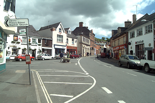
Chudleigh Knighton

Chudleigh Knighton is a small village in Devon, England, near to Newton Abbot and Bovey Tracey. == Amenities == Chudleigh Knighton Church of England Primary...

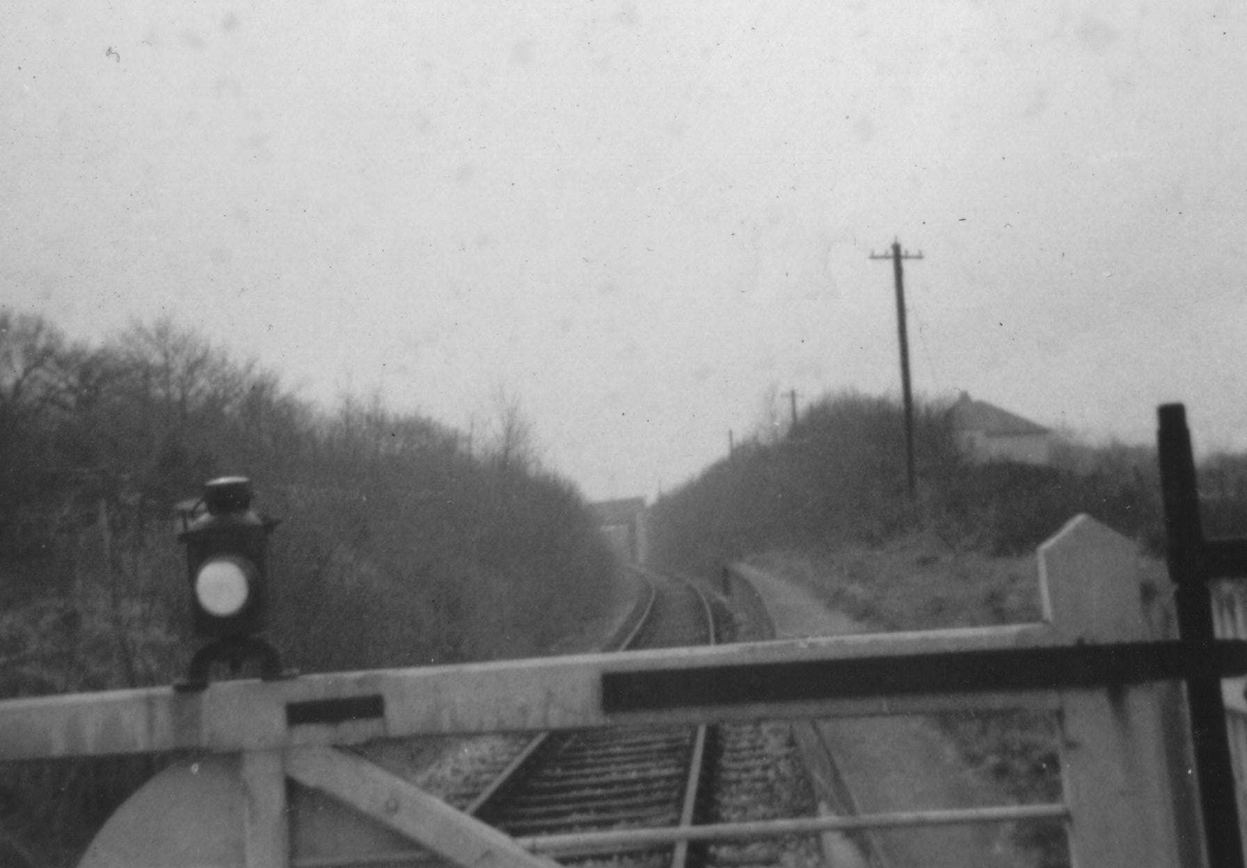
Chudleigh Knighton Halt railway station

Chudleigh Knighton Halt was on the Teign Valley Line serving the small village of Chudleigh Knighton, Devon, England. The halt, built by the Great Western...

Bovey Tracey

Bovey Tracey () is a small town and civil parish in Devon, England, on the edge of Dartmoor, its proximity to which gives rise to the slogan used on the...

Harbourne River

The Harbourne River is a river in Devon in England. Its estuary is known as Bow Creek, and flows into the River Dart near Stoke Gabriel. The river rises...

Bovey Tracey Town Hall

Bovey Tracey Town Hall is a municipal building in Town Hall Place, Bovey Tracey, Devon, England. The town hall, which is the meeting place of Bovey Tracey...

Stokelake

Stokelake Residential School was in Chudleigh, South Devon. It was classed as the senior school of Pitt House School Ltd and the chairman was Mr. M. C...

Teignbridge

Teignbridge is a local government district in Devon, England. Its council is based in the town of Newton Abbot. The district also includes the towns of...

Nearby Amenities

Located within 500m of 50.595031,-3.6462302
Design: barrel
Power: tower
Lat/Long: 50.5953674/-3.6406391
Design: barrel
Power: tower
Lat/Long: 50.5926677/-3.6429247
Power: pole
Lat/Long: 50.5966823/-3.6523104
Power: pole
Lat/Long: 50.596701/-3.6510846
Power: pole
Lat/Long: 50.5966652/-3.6467394
Power: pole
Lat/Long: 50.5966465/-3.645114
Power: pole
Lat/Long: 50.5963417/-3.644312
Power: pole
Lat/Long: 50.5956879/-3.6431855
Power: pole
Lat/Long: 50.5952452/-3.6424023
Power: pole
Lat/Long: 50.5946732/-3.6415038
Power: pole
Lat/Long: 50.5941913/-3.6407125
Power: pole
Lat/Long: 50.5942798/-3.6394814
The data included in this document is from www.openstreetmap.org. The data is made available under ODbL.

Have you been to Badgemoor Wood?

Leave your review of Badgemoor Wood below (or comments, questions and feedback).