Childerley

Civil Parish in Cambridgeshire South Cambridgeshire

England

Childerley

Scotland Farm entrance Looking west from Scotland Road, Dry Drayton. Time about 5pm.
Scotland Farm entrance Credit: Jeff Bronks

Childerley is a civil parish located in the county of Cambridgeshire, England. It is situated about 5 miles southwest of the city of Cambridge, making it a part of the Cambridge non-metropolitan district. The parish covers an area of approximately 7 square kilometers and has a population of around 150 residents.

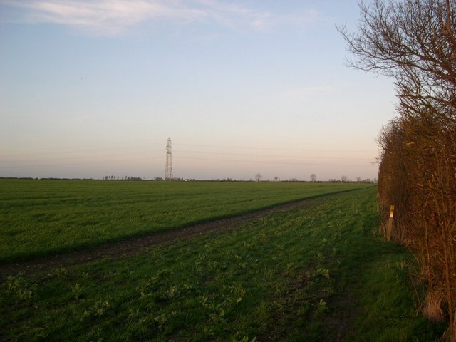
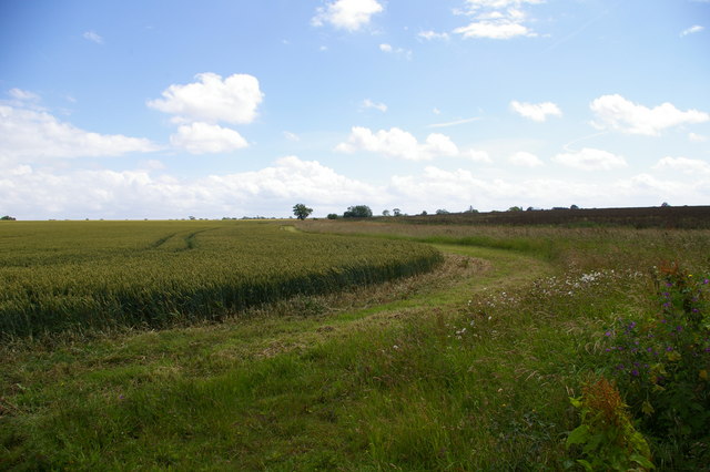
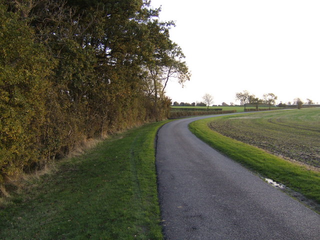
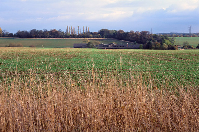
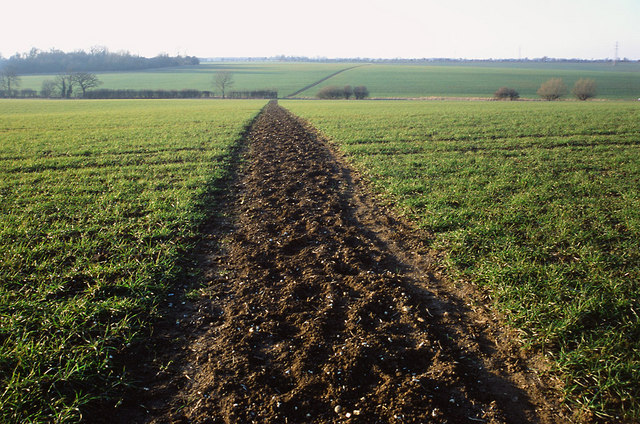
The village of Childerley is known for its picturesque rural setting and is surrounded by beautiful countryside. The area is characterized by its rolling hills, open fields, and charming farmland, offering a peaceful and tranquil atmosphere for residents and visitors alike.

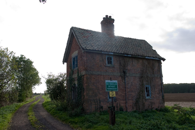
The village itself is small and compact, with a handful of traditional cottages and houses, giving it a quaint and historic feel. The centerpiece of Childerley is the Grade I listed St. Peter's Church, which dates back to the 12th century and features stunning medieval architecture.

Childerley is also home to Childerley Hall, a Grade II listed country house built in the 17th century. The hall is set within extensive grounds and is privately owned, contributing to the village's sense of exclusivity and charm.

The parish offers limited amenities, with no shops or schools within its boundaries. However, being in close proximity to Cambridge provides residents with easy access to a wider range of services and facilities.

Overall, Childerley is a small, idyllic village in Cambridgeshire, offering a peaceful and rural lifestyle within reach of the bustling city of Cambridge.

If you have any feedback on the listing, please let us know in the comments section below.

Childerley Images

Images are sourced within 2km of 52.236473/-0.014625 or Grid Reference TL3561. Thanks to Geograph Open Source API. All images are credited.

Scotland Farm entrance Looking west from Scotland Road, Dry Drayton. Time about 5pm.
Scotland Farm entrance
Looking west from Scotland Road, Dry Drayton. Time about 5pm.
Power line north of Childerley Hall Probably the most interesting feature of this square! Cambridgeshire certainly has its fair share of flat cornfields.
Power line north of Childerley Hall
Probably the most interesting feature of this square! Cambridgeshire certainly has its fair share of flat cornfields.
The chapel at Childerley Hall A private chapel, but opened for Christmas and Harvest Festival services, apparently. The rest of the hall looks interesting, but not much is visible without trespassing.
The chapel at Childerley Hall
A private chapel, but opened for Christmas and Harvest Festival services, apparently. The rest of the hall looks interesting, but not much is visible without trespassing.
LPG store, Childerley Hall farm Formerly a grain store (note the stilts designed to raise it away from the rats), this building now holds more explosive contents.
LPG store, Childerley Hall farm
Formerly a grain store (note the stilts designed to raise it away from the rats), this building now holds more explosive contents.
Field scale lysimeters A lysimeter measures water penetration in the soil, apparently. The things you learn through Geograph.
Field scale lysimeters
A lysimeter measures water penetration in the soil, apparently. The things you learn through Geograph.
Derelict building at Battle Gate This is at the end of the southern road out of Boxworth which can be driven down, but not beyond this point. The surrounding fields are on one of the highest parts of the clay 'uplands' (nearby spot height is 67m) which form the southern border of the Fens.
Derelict building at Battle Gate
This is at the end of the southern road out of Boxworth which can be driven down, but not beyond this point. The surrounding fields are on one of the highest parts of the clay 'uplands' (nearby spot height is 67m) which form the southern border of the Fens.
Line of the Greenwich Meridian The Greenwich Meridian intersects the bend in the footpath marked by the yellow tipped sign and passes directly under the central electricity pylon. This view is true north (and not grid north!).
Line of the Greenwich Meridian
The Greenwich Meridian intersects the bend in the footpath marked by the yellow tipped sign and passes directly under the central electricity pylon. This view is true north (and not grid north!).
Footpath and field boundary Quiet and unremarkable Cambridgeshire agricultural land.
Footpath and field boundary
Quiet and unremarkable Cambridgeshire agricultural land.
Footpath to nowhere The 1:25,000 OS map shows this footpath petering out as it approaches Boxworth. It is the only right of way in TL3563 and apparently come to a dead end.
Footpath to nowhere
The 1:25,000 OS map shows this footpath petering out as it approaches Boxworth. It is the only right of way in TL3563 and apparently come to a dead end.
Courses for horses Horse jumping practice ring at Bird's Pastures Farm, near Knapwell. The surface of the practice ring is made from chopped up car tyres. Very green.
Courses for horses
Horse jumping practice ring at Bird's Pastures Farm, near Knapwell. The surface of the practice ring is made from chopped up car tyres. Very green.
Farmland The edge of a wheat (I think) field near Bird's Pastures Farm.
Farmland
The edge of a wheat (I think) field near Bird's Pastures Farm.
Old orchard near Childerley This small stand of old apple trees sits central to the grid square by the road to Childerley Hall.
Old orchard near Childerley
This small stand of old apple trees sits central to the grid square by the road to Childerley Hall.
Road to Childerley Gate A ploughed field beside a well-maintained estate road.
Road to Childerley Gate
A ploughed field beside a well-maintained estate road.
Fields of Rectory Farm A view back towards Dry Drayton from the footpath from Dry Drayton towards Lolworth
Fields of Rectory Farm
A view back towards Dry Drayton from the footpath from Dry Drayton towards Lolworth
Footpath to Childerley from Dry Drayton The footpath is muddy in the winter and a battle between towering rape crops in the summer!
Footpath to Childerley from Dry Drayton
The footpath is muddy in the winter and a battle between towering rape crops in the summer!
Concreted area by Battle Gate Road The concrete pad was laid down in the Second World War as a base for a search light that formed part of the air defences for Cambridge.  It is now used for general agricultural hard standing.
Concreted area by Battle Gate Road
The concrete pad was laid down in the Second World War as a base for a search light that formed part of the air defences for Cambridge. It is now used for general agricultural hard standing.
Footpath and power lines south of Boxworth The power lines connect <a href="https://www.geograph.org.uk/photo/222025">TL1857 : Little Barford Power Station</a> near St Neots to the <a href="https://www.geograph.org.uk/photo/654296">TL4561 : Arbury Grid Substation Project</a> in north Cambridge.
Footpath and power lines south of Boxworth
The power lines connect TL1857 : Little Barford Power Station near St Neots to the TL4561 : Arbury Grid Substation Project in north Cambridge.
Pathfinder Long Distance Walk sign A 46-mile loop, this walk links the historic RAF Pathfinder stations at Wyton, Graveley, Oakington and Warboys.
Pathfinder Long Distance Walk sign
A 46-mile loop, this walk links the historic RAF Pathfinder stations at Wyton, Graveley, Oakington and Warboys.
Show me another place!

Childerley is located at Grid Ref: TL3561 (Lat: 52.236473, Lng: -0.014625)

Administrative County: Cambridgeshire

District: South Cambridgeshire

Police Authority: Cambridgeshire

What 3 Words

///painting.simulator.petted. Near Bar Hill, Cambridgeshire

Related Wikis

Childerley

Childerley, also known as Great Childerley and Little Childerly, was a small rural village in the county of Cambridgeshire in the East of England, United...

Overhall Grove

Overhall Grove is a 17.4-hectare (43-acre) biological Site of Special Scientific Interest to the east of Knapwell in Cambridgeshire. It is a Nature Conservation...

Dry Drayton

Dry Drayton is a village and civil parish about 5 miles (8 km) northwest of Cambridge in Cambridgeshire, England, listed as Draitone in the Domesday Book...

Boxworth

Boxworth is a village in South Cambridgeshire, situated about eight miles to the north-west of Cambridge. It falls under the Papworth Everard and Caxton...

Lolworth

Lolworth is a small village and civil parish in the district of South Cambridgeshire, in the county of Cambridgeshire, England, located approximately 8...

Knapwell

Knapwell is a hamlet in Cambridgeshire situated about 10 miles (16 km) west of Cambridge. It is within the diocese of Ely. Its population was estimated...

RAF Bourn

Royal Air Force Bourn or more simply RAF Bourn is a former Royal Air Force station located 2 miles (3.2 km) north of Bourn, Cambridgeshire and 6.9 miles...

Hardwick, Cambridgeshire

Hardwick is a village and civil parish in the county of Cambridgeshire, England with a large housing estate located about 6 miles (9.7 km) west of the...

Related Videos

Simon’s stocking fille

Simon from The Ski Exchange talks about a few Xmas stocking ideas now that the store is re-open. Take a look at these & many ...

No more hip escape!

In this short video, BJJ black belt, Tom Barlow show how to counter the hip escape from mount and then use the position to ...

Cozy Pets Hotel in Caldecote, Cambridgeshire

Aerial drone footage of Cozy Pets Hotel in Caldecote, Cambridgeshire. If you'd like photography or video for your business, feel ...

Minimum Standards in Your BJJ Gym with Neil Williams

In this video, I'm joined by Neil Williams, chairman of the UKBJJA and BJJ Black Belt. This discussion is all best practices and ...

Nearby Amenities

Located within 500m of 52.236473,-0.014625
Power: pole
Source: Maxar
Lat/Long: 52.2350269/-0.0179064
Line Management: split
Power: pole
Source: Maxar
Lat/Long: 52.2360379/-0.01829
Addr Housenumber: 4
Addr Street: Childerley Cottages
Lat/Long: 52.236483/-0.0153744
Addr Housenumber: 3
Addr Street: Childerley Cottages
Lat/Long: 52.2364576/-0.0154938
Power: pole
Lat/Long: 52.232902/-0.016501
Power: pole
Lat/Long: 52.2340125/-0.0175296
Power: pole
Lat/Long: 52.2359557/-0.0173284
Power: pole
Lat/Long: 52.2361356/-0.0192797
Power: pole
Lat/Long: 52.2366686/-0.0199583
Power: pole
Lat/Long: 52.2372099/-0.0206678
Power: pole
Lat/Long: 52.2377314/-0.0213316
The data included in this document is from www.openstreetmap.org. The data is made available under ODbL.

Have you been to Childerley?

Leave your review of Childerley below (or comments, questions and feedback).