Bournmoor
Civil Parish in Durham
England
Bournmoor

Bournmoor is a civil parish located in Durham County, in the northeast of England. Situated approximately 8 miles southwest of the city of Durham, the parish covers an area of around 3 square miles. Bournmoor is a rural area with a population of approximately 1,200 people, according to the latest available data.
The landscape of Bournmoor is characterized by rolling hills, fields, and small woodlands. It is surrounded by several other civil parishes, including those of West Rainton, Great Lumley, and Fencehouses. The area is predominantly residential, with a mix of housing types ranging from traditional cottages to modern developments.
Bournmoor benefits from its close proximity to Durham city, which offers a range of amenities and services. The parish itself has a village hall that serves as a community hub, hosting various events and activities. There is also a primary school, providing education for local children.
The parish is well-connected to the rest of the region by road, with the A690 passing through the area and providing links to Durham, Sunderland, and other nearby towns. Public transportation options include bus services, which connect Bournmoor to neighboring areas.
Overall, Bournmoor offers a peaceful and picturesque setting, making it an attractive place to live for those seeking a rural lifestyle within reach of urban amenities.
If you have any feedback on the listing, please let us know in the comments section below.
Bournmoor Images
Images are sourced within 2km of 54.862721/-1.527581 or Grid Reference NZ3052. Thanks to Geograph Open Source API. All images are credited.


Bournmoor is located at Grid Ref: NZ3052 (Lat: 54.862721, Lng: -1.527581)
Unitary Authority: County Durham
Police Authority: Durham
What 3 Words
///proper.novel.trio. Near Chester-le-Street, Co. Durham
Related Wikis

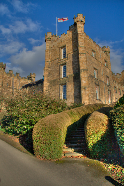
Lambton Castle
Lambton Castle stands above Chester-le-Street, County Durham and is a stately home, the ancestral seat of the Lambton family, the Earls of Durham. It is...

Bournmoor
Bournmoor ( or ) is a village in County Durham, England, and is situated a short distance from Chester-le-Street. It contains St Barnabas' Church, which...

New Lambton, County Durham
New Lambton is a village in County Durham, England, although the postal address is Tyne and Wear. It lies between the villages of Bournmoor and Fencehouses...
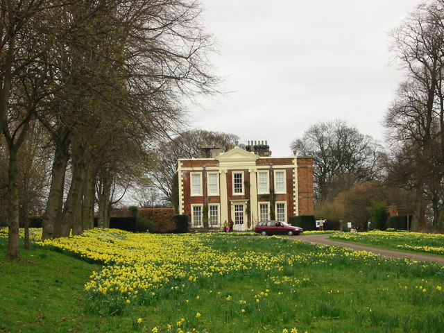
Biddick Hall (house)
Biddick Hall is a small privately owned 18th-century country mansion at Bournmoor, County Durham, near the City of Sunderland and Chester-le-Street. It...
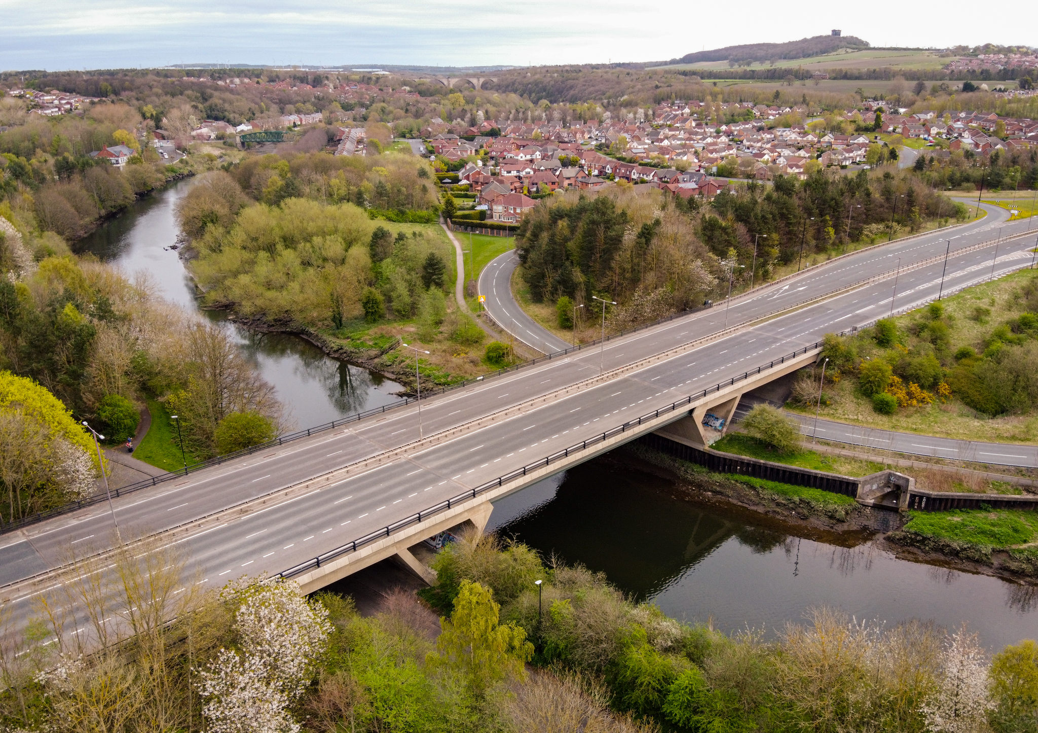
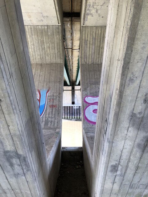
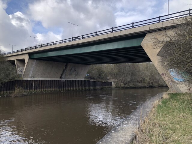
Chartershaugh Bridge
Chartershaugh Bridge is a road traffic bridge spanning the River Wear in North East England, linking Penshaw with Fatfield as part of the A182 road. The...
Lumley Thicks
Lumley Thicks is a small village in County Durham, in England. It is situated between Chester-le-Street and Houghton-le-Spring, north of Great Lumley.
Lumley Castle
Lumley Castle is a 14th-century quadrangular castle at Chester-le-Street in the North of England, near the city of Durham and a property of the Earl of...

Woodstone Village
Woodstone Village is a hamlet in the civil parish of Little Lumley, in the County Durham district, in the ceremonial county of Durham, England. It neighbours...
Nearby Amenities
Located within 500m of 54.862721,-1.527581Have you been to Bournmoor?
Leave your review of Bournmoor below (or comments, questions and feedback).