Orasaigh

Settlement in Ross-shire

Scotland

Orasaigh

Caolas a Tuath A panoramic view down the length of the channel.
Caolas a Tuath Credit: Rob Burke

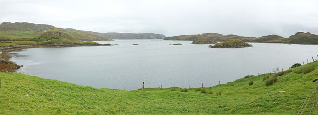
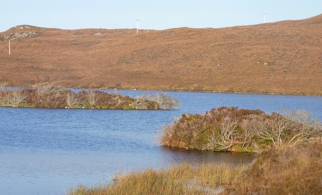
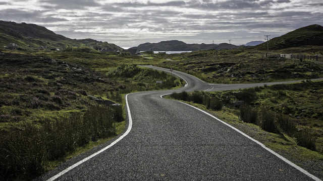
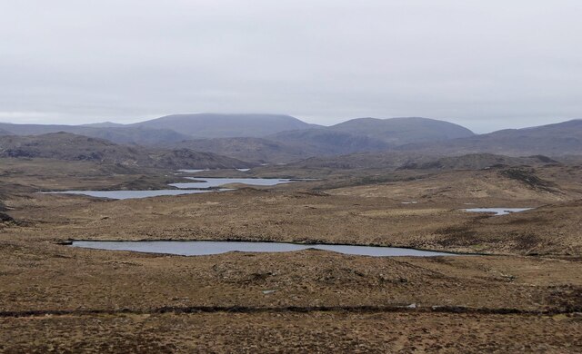
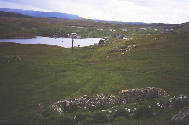
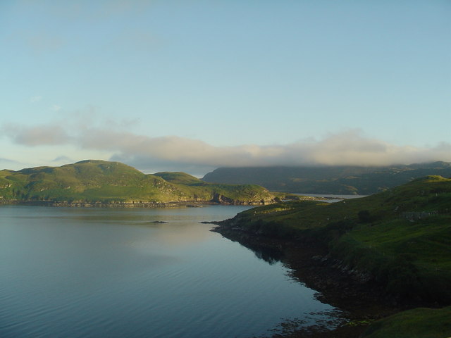
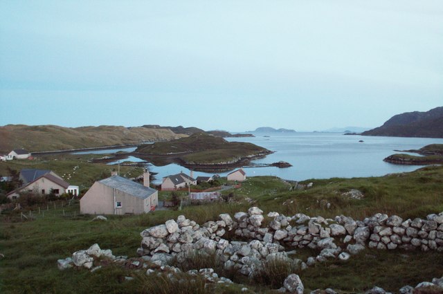
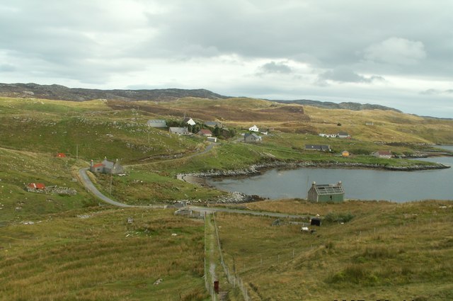
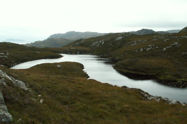
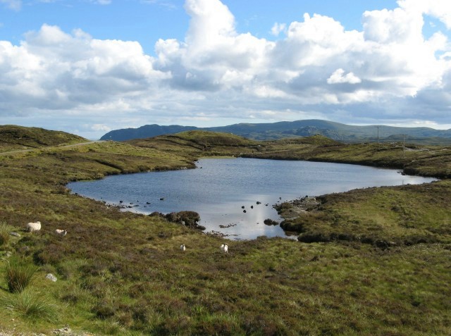
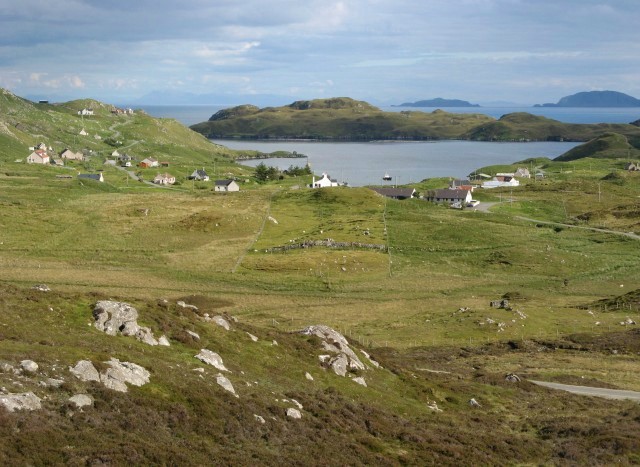
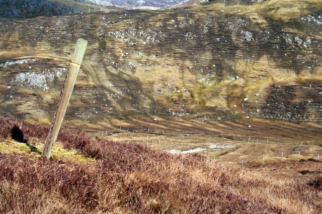
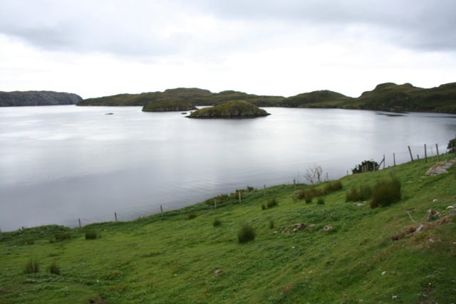
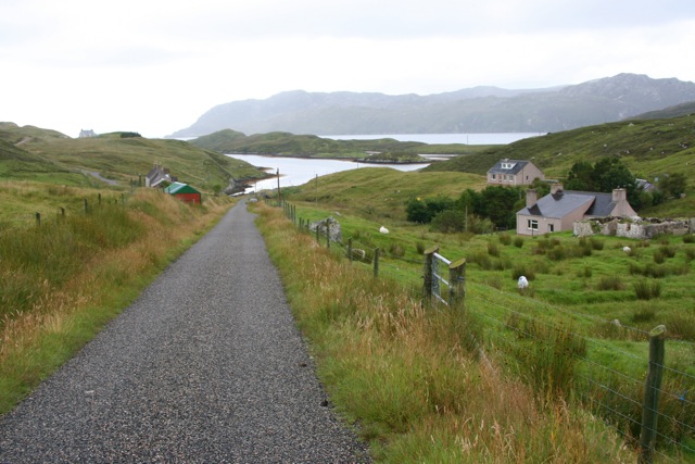
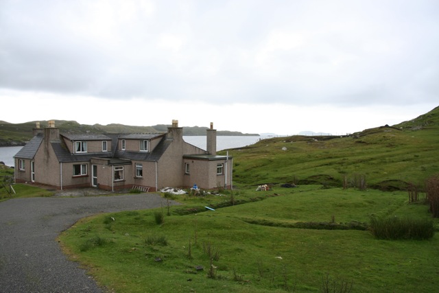
Orasaigh is a small village located in Ross-shire, in the Highlands of Scotland. Situated on the shores of Loch Ewe, Orasaigh is known for its stunning natural beauty and picturesque surroundings. The village is surrounded by rolling hills and lush greenery, making it a popular destination for outdoor enthusiasts and nature lovers.

Orasaigh is a close-knit community, with a population of around 200 residents. The village has a primary school, a church, and a few small shops and cafes. The locals are known for their friendly and welcoming nature, making visitors feel right at home.

One of the main attractions in Orasaigh is the nearby Inverewe Garden, a world-renowned botanical garden that showcases a diverse collection of plants from around the world. The garden is a popular spot for tourists and locals alike, offering a peaceful retreat and stunning views of the surrounding landscape.

Overall, Orasaigh is a charming and tranquil village that offers a perfect escape from the hustle and bustle of city life. Its natural beauty, friendly residents, and vibrant community make it a hidden gem in the Scottish Highlands.

If you have any feedback on the listing, please let us know in the comments section below.

Orasaigh Images

Images are sourced within 2km of 58.020693/-6.4598043 or Grid Reference NB3612. Thanks to Geograph Open Source API. All images are credited.

Caolas a Tuath A panoramic view down the length of the channel.
Caolas a Tuath
A panoramic view down the length of the channel.
Islands on Loch Shaghachain
B8060 nearing Leumrabhagh
Loch na Cuilee, Isle of Lewis Approximately half of the loch lies within the grid square.  Its name means Bulrush Loch.
Loch na Cuilee, Isle of Lewis
Approximately half of the loch lies within the grid square. Its name means Bulrush Loch.
Dyke below Sidhean Loch na Cuilee, Isle of Lewis The dyke appears on the 2nd edition OS six inch map, surveyed in 1895, but not on the 1st edition, surveyed 1850-1853, and so, presumably, was originally built between some time between 1850 and 1895.
Dyke below Sidhean Loch na Cuilee, Isle of Lewis
The dyke appears on the 2nd edition OS six inch map, surveyed in 1895, but not on the 1st edition, surveyed 1850-1853, and so, presumably, was originally built between some time between 1850 and 1895.
Leumrabhagh Crofting/fishing community in Pairc. ruin of old house in foreground. The crofters here are currently pusueing a buyout of the land they work.
Leumrabhagh
Crofting/fishing community in Pairc. ruin of old house in foreground. The crofters here are currently pusueing a buyout of the land they work.
Leumrabhagh A pretty port in a sheltered inlet of Loch Sealg.
Leumrabhagh
A pretty port in a sheltered inlet of Loch Sealg.
Lemreway Island - Eilean Iubhaird A stunning view from the road end at Aird a' Chaolais looking across the sea loch to Eilean Iubhaird
Lemreway Island - Eilean Iubhaird
A stunning view from the road end at Aird a' Chaolais looking across the sea loch to Eilean Iubhaird
Orasaigh with view of Shiant Islands
Orasaigh from top of footpath steps
Loch near Giearol
Loch near Giearol
Northern Marsh Orchid (Dactylorhiza purpurella) Northern Marsh Orchids are commonly found in the Outer Hebrides, where the wet peaty conditions suit it.
Northern Marsh Orchid (Dactylorhiza purpurella)
Northern Marsh Orchids are commonly found in the Outer Hebrides, where the wet peaty conditions suit it.
Roadside lochan Loch a' Bhùiridh, near the road leading to Leumrabhagh.
Roadside lochan
Loch a' Bhùiridh, near the road leading to Leumrabhagh.
Near Leumrabhagh Looking towards the village of Leumrabhagh from a vantage point to the north of the village.
Near Leumrabhagh
Looking towards the village of Leumrabhagh from a vantage point to the north of the village.
Glen Orinsay A marker post on the footpath to the deserted village of Stiomrabhaigh in front of the greens and browns of Glen Orinsay.
Glen Orinsay
A marker post on the footpath to the deserted village of Stiomrabhaigh in front of the greens and browns of Glen Orinsay.
Caolas a Tuath bay Leumrabhagh looking out to Eilean Liubhaird (Edward's Isle), past the islands of Sgeir Ghlas (Green Isle) and Sgeir Fraoich (Heather Isle) in Caolas a'Tuath (North Strait).
Caolas a Tuath bay
Leumrabhagh looking out to Eilean Liubhaird (Edward's Isle), past the islands of Sgeir Ghlas (Green Isle) and Sgeir Fraoich (Heather Isle) in Caolas a'Tuath (North Strait).
The road to Orasaigh Looking towards Orinsay Island
The road to Orasaigh
Looking towards Orinsay Island
House at Orasaigh Looking towards Shiant Islands
House at Orasaigh
Looking towards Shiant Islands
Show me another place!

Orasaigh is located at Grid Ref: NB3612 (Lat: 58.020693, Lng: -6.4598043)

Unitary Authority: Na h-Eileanan an Iar

Police Authority: Highlands and Islands

Also known as: Orinsay

What 3 Words

///armful.excavate.stop. Near Leurbost, Na h-Eileanan Siar

Related Wikis

Orinsay

Orinsay (Scottish Gaelic: Orasaigh) is a crofting village on the Isle of Lewis in the district of Pairc, in the Outer Hebrides, Scotland. The settlement...

Stiomrabhaig

Stiomrabhaig is an abandoned crofter's village on the Isle of Lewis in the Outer Hebrides. == History == The United Kingdom Census 1851 shows that the...

Eilean Liubhaird

Eilean Liubhaird or Eilean Iubhard is an island in the Outer Hebrides, to the east of Lewis. == Geography and geology == The rock is "gneiss bedrock with...

Gravir

Gravir (Scottish Gaelic: Grabhair), is a village on the shore of Loch Odhairn (a sea loch) in the Park district of the Isle of Lewis. Gravir is within...

Nearby Amenities

Located within 500m of 58.020693,-6.4598043
Created By: dmgroom_coastlines
Lat/Long: 58.0169/-6.46391
Created By: dmgroom_coastlines
Lat/Long: 58.01702/-6.46342
Bus Stop
Orinsay
Naptan AtcoCode: 6010731773
Naptan Bearing: W
Naptan CommonName: Orinsay
Naptan Indicator: Village
Naptan Landmark: Village
Naptan NaptanCode: 94723723
Naptan Street: Village
Naptan Verified: no
Public Transport: platform
Source: naptan_import
Lat/Long: 58.018753/-6.4651202
Barrier: cattle_grid
Lat/Long: 58.023644/-6.4601683
Orasaigh
Name En: Orinsay
Name Gd: Orasaigh
Place: village
Lat/Long: 58.0193477/-6.4650399
Turning Circle
Lat/Long: 58.017982/-6.4654817
Barrier: cattle_grid
Lat/Long: 58.0188397/-6.4647278
Turning Circle
Lat/Long: 58.017573/-6.457117
Passing Place
Lat/Long: 58.0204491/-6.45978
Rubha Mhic Eòin
Place: locality
Lat/Long: 58.0179266/-6.4637288
Barrier: cattle_grid
Lat/Long: 58.018831/-6.4655585
Passing Place
Lat/Long: 58.0214908/-6.4598775
Passing Place
Lat/Long: 58.0239273/-6.4603117
Power: pole
Lat/Long: 58.0190125/-6.4674605
Power: pole
Lat/Long: 58.0189349/-6.467035
Power: pole
Lat/Long: 58.0187016/-6.4660319
Power: pole
Lat/Long: 58.0190043/-6.4630152
Power: pole
Lat/Long: 58.0191094/-6.4626521
Power: pole
Lat/Long: 58.0193498/-6.4617205
Power: pole
Lat/Long: 58.0195016/-6.4611309
Power: pole
Lat/Long: 58.0196869/-6.4603835
Power: pole
Lat/Long: 58.0198426/-6.459596
Power: pole
Lat/Long: 58.0199165/-6.4591738
Power: pole
Lat/Long: 58.0190248/-6.4586752
Power: pole
Lat/Long: 58.0180066/-6.4580952
Power: pole
Lat/Long: 58.0174962/-6.4578043
Power: pole
Lat/Long: 58.0182469/-6.4629152
Power: pole
Lat/Long: 58.0245806/-6.4556518
Power: pole
Lat/Long: 58.0241984/-6.4564323
Power: pole
Lat/Long: 58.0237152/-6.4574125
Power: pole
Lat/Long: 58.0236104/-6.4578622
Power: pole
Lat/Long: 58.0232762/-6.4594559
Power: pole
Lat/Long: 58.0225781/-6.460289
Power: pole
Lat/Long: 58.0218309/-6.461189
Power: pole
Lat/Long: 58.0212938/-6.4604516
Power: pole
Lat/Long: 58.020863/-6.4600535
Power: pole
Lat/Long: 58.0204245/-6.4596527
Passing Place
Lat/Long: 58.0238138/-6.4543377
Power: pole
Lat/Long: 58.0193796/-6.4634574
Power: pole
Lat/Long: 58.0197866/-6.4636747
Passing Place
Lat/Long: 58.0187481/-6.4644768
Passing Place
Lat/Long: 58.023261/-6.4577526
Passing Place
Lat/Long: 58.0234225/-6.4558084
Power: pole
Lat/Long: 58.0208166/-6.4624265
The data included in this document is from www.openstreetmap.org. The data is made available under ODbL.

Have you been to Orasaigh?

Leave your review of Orasaigh below (or comments, questions and feedback).