Biddick, North

Settlement in Durham

England

Biddick, North

Washington from the air The Nissan car factory dominates the scene.

Taken at around 37,000 feet by mobile phone, from a Prague bound flight from Edinburgh.
Washington from the air Credit: Thomas Nugent

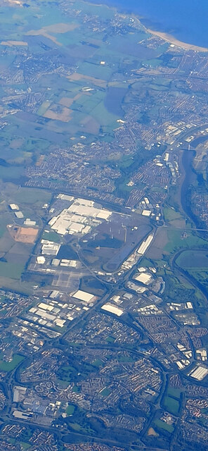
Biddick is a small village located in the North Durham district of County Durham, England. Situated approximately 3 miles south of Washington and 8 miles west of Sunderland, Biddick is surrounded by picturesque countryside and offers a peaceful rural setting.

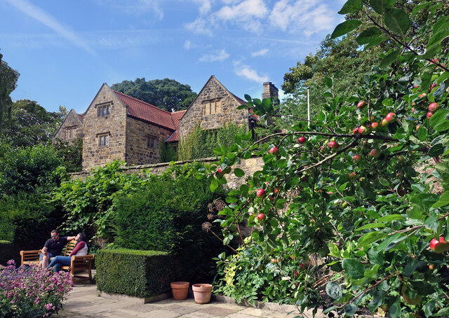
The village is known for its historical significance, with evidence of human activity dating back to the Bronze Age. Biddick Hall, a former manor house, is a prominent landmark in the area and has a rich history spanning several centuries.

Today, Biddick retains its rural charm and offers a close-knit community atmosphere. The village is mainly residential, with a mix of traditional stone cottages and more modern housing developments. The local primary school, Biddick School Sports College, provides education for children in the area.

Despite its tranquil setting, Biddick benefits from its proximity to larger towns and cities. The nearby Washington offers a range of amenities, including shops, restaurants, and leisure facilities. Additionally, the bustling city of Sunderland is within easy reach, providing residents with access to a wider range of services and entertainment options.

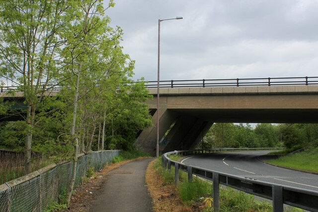
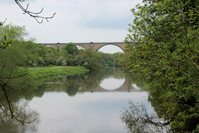
For those seeking outdoor activities, Biddick is surrounded by beautiful countryside, making it an ideal location for nature walks, cycling, and exploring the nearby parks and woodlands.

In summary, Biddick is a small village in North Durham with a rich history and a close-knit community. Surrounded by picturesque countryside, the village offers a peaceful setting while still providing easy access to nearby towns and cities.

If you have any feedback on the listing, please let us know in the comments section below.

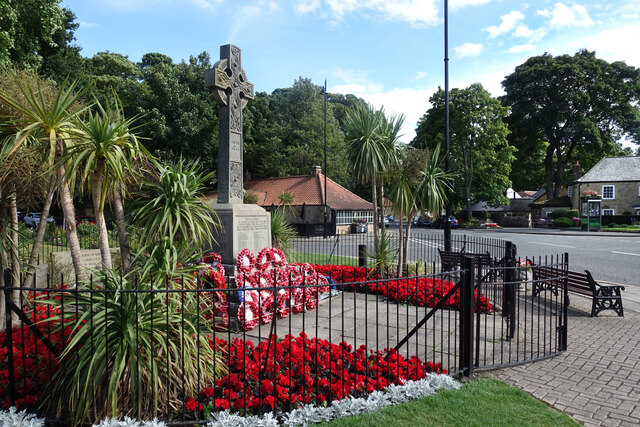
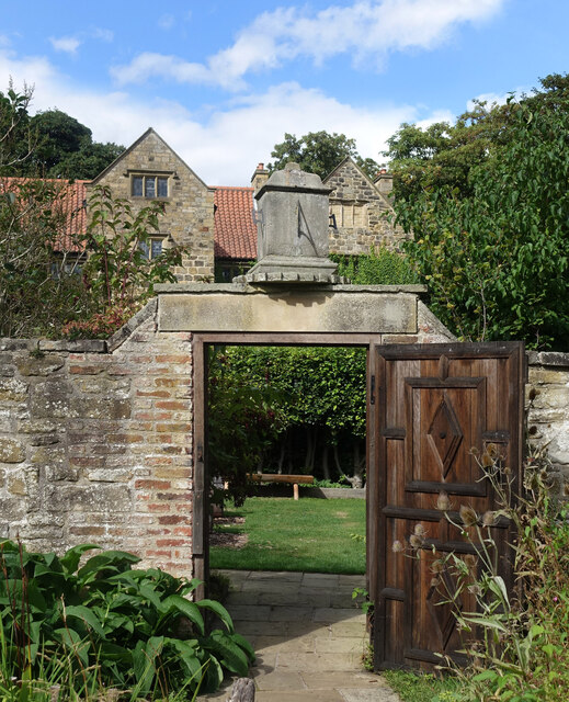
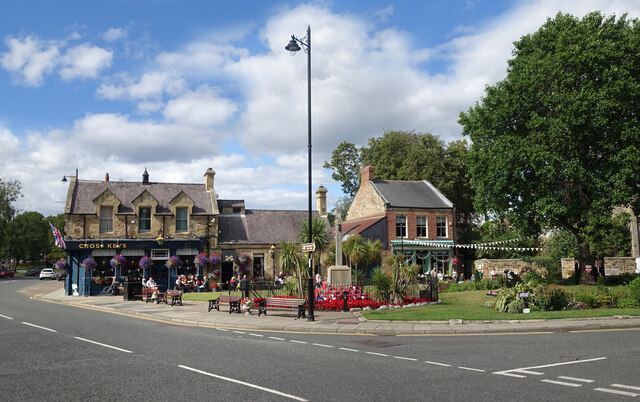
Biddick, North Images

Images are sourced within 2km of 54.885735/-1.513765 or Grid Reference NZ3154. Thanks to Geograph Open Source API. All images are credited.

Washington from the air The Nissan car factory dominates the scene.

Taken at around 37,000 feet by mobile phone, from a Prague bound flight from Edinburgh.
Washington from the air
The Nissan car factory dominates the scene. Taken at around 37,000 feet by mobile phone, from a Prague bound flight from Edinburgh.
Colourful Memorial, Washington Traditional poppy wreaths and very healthy geraniums round the war memorial in the centre of Washington Village.
Colourful Memorial, Washington
Traditional poppy wreaths and very healthy geraniums round the war memorial in the centre of Washington Village.
Sundial over the Gate In the garden at Washington Old Hall.
A sundial site which looks a bit odd, if not actually unsafe. I guess it's OK. Just don't slam the gate.
Sundial over the Gate
In the garden at Washington Old Hall. A sundial site which looks a bit odd, if not actually unsafe. I guess it's OK. Just don't slam the gate.
Washington Village Green
Apples at the Old Hall In the garden at Washington Old Hall.
Apples at the Old Hall
In the garden at Washington Old Hall.
Washington Village Centre Over the road from the very well tended and floral village green are some more flower beds.
Even the phone box has a garden on the roof.
Washington Village Centre
Over the road from the very well tended and floral village green are some more flower beds. Even the phone box has a garden on the roof.
Footbridge across River Wear at Cox Green
Adit in riverbank near Cox Green One of several adits in the vicinity of Cox Green. The tunnels were used to extract sandstone from beneath Penshaw Hill for loading onto boats moored on the adjacent River Wear,
Adit in riverbank near Cox Green
One of several adits in the vicinity of Cox Green. The tunnels were used to extract sandstone from beneath Penshaw Hill for loading onto boats moored on the adjacent River Wear,
Victoria Viaduct crossing the River Wear Victoria Viaduct. Built by the Durham Junction Railway and opened in 1838 to take coal from the Houghton-le-Spring area to the Tyne. As the railways expanded the viaduct became part of the main line from Darlington to Newcastle, before being relegated to a secondary route when the main line took the new route via Durham and Team Valley in 1872. By the 1980s the route was little used except when work on the main line required diversions, finally closing in 1991. Though the track is lifted the line retains a ‘mothballed’ status so has not been severed or built on, and is frequently proposed for reopening either as a heavy rail route or part of the Tyne and Wear Metro.
Victoria Viaduct crossing the River Wear
Victoria Viaduct. Built by the Durham Junction Railway and opened in 1838 to take coal from the Houghton-le-Spring area to the Tyne. As the railways expanded the viaduct became part of the main line from Darlington to Newcastle, before being relegated to a secondary route when the main line took the new route via Durham and Team Valley in 1872. By the 1980s the route was little used except when work on the main line required diversions, finally closing in 1991. Though the track is lifted the line retains a ‘mothballed’ status so has not been severed or built on, and is frequently proposed for reopening either as a heavy rail route or part of the Tyne and Wear Metro.
Beneath Chartershaugh Bridge The bridge carries the A182 Washington Highway across the River Wear.
Beneath Chartershaugh Bridge
The bridge carries the A182 Washington Highway across the River Wear.
Chartershaugh Bridge The bridge carries the A182 Washington Highway across the River Wear.
Chartershaugh Bridge
The bridge carries the A182 Washington Highway across the River Wear.
Riverside footpath, West Bridge Street
Penshaw Bridge Bridge built 1890 connecting Penshaw and Fatfield across the River Wear.
Penshaw Bridge
Bridge built 1890 connecting Penshaw and Fatfield across the River Wear.
Weardale Way beside the A182 The long distance footpath has been granted a segregated channel to guide its trail back to the River Wear at Chartershaugh Bridge
Weardale Way beside the A182
The long distance footpath has been granted a segregated channel to guide its trail back to the River Wear at Chartershaugh Bridge
Weardale Way in a Green Tunnel beside the A182 A 77 mile route following the River Wear from the sea at the Lindesfarne Memorial, Sunderland to the headwaters in the east Pennines, keeping as close as is possible to the river. It visits Lumley Castle, Durham (where the Castle and Cathedral forms a World Heritage Site), Bishop Auckland and Stanhope. After Stanhope the Way makes a northward loop to Rookhope to take in part of a tributary, Rookhope Burn.
Weardale Way in a Green Tunnel beside the A182
A 77 mile route following the River Wear from the sea at the Lindesfarne Memorial, Sunderland to the headwaters in the east Pennines, keeping as close as is possible to the river. It visits Lumley Castle, Durham (where the Castle and Cathedral forms a World Heritage Site), Bishop Auckland and Stanhope. After Stanhope the Way makes a northward loop to Rookhope to take in part of a tributary, Rookhope Burn.
Weardale Way approaching Chartershaugh Bridge The bridge carries the A182 over the River Wear
Weardale Way approaching Chartershaugh Bridge
The bridge carries the A182 over the River Wear
Looking across the River Wear from Mount Pleasant A long row of terraced houses on South View, as seen from the Weardale Way on the opposite bank.
Looking across the River Wear from Mount Pleasant
A long row of terraced houses on South View, as seen from the Weardale Way on the opposite bank.
Weardale Way approaching Victoria Viaduct A slightly misty scene looking down the River Wear towards the Victoria Viaduct.
Completed in 1836 on a design based on the Alcantara Bridge in Spain, as part of the Durham Junction Railway.
The Beeching axe fell in 1964, when passenger services ceased. 1991 saw the last freight crossing the viaduct, and it has been mothballed ever since.
Grade II Listed.
Weardale Way approaching Victoria Viaduct
A slightly misty scene looking down the River Wear towards the Victoria Viaduct. Completed in 1836 on a design based on the Alcantara Bridge in Spain, as part of the Durham Junction Railway. The Beeching axe fell in 1964, when passenger services ceased. 1991 saw the last freight crossing the viaduct, and it has been mothballed ever since. Grade II Listed.
Show me another place!

Biddick, North is located at Grid Ref: NZ3154 (Lat: 54.885735, Lng: -1.513765)

Unitary Authority: Sunderland

Police Authority: Northumbria

What 3 Words

///decay.oppose.towns. Near Washington, Tyne & Wear

Related Wikis

Biddick Lane railway station

Biddick Lane railway station served the Fatfield area of Washington, in Tyne and Wear (historically County Durham), England. It was on the former Stanhope...

St Robert of Newminster Catholic School

St Robert of Newminster Catholic School is a co-educational secondary school and sixth form located in Washington in the City of Sunderland, Tyne and Wear...
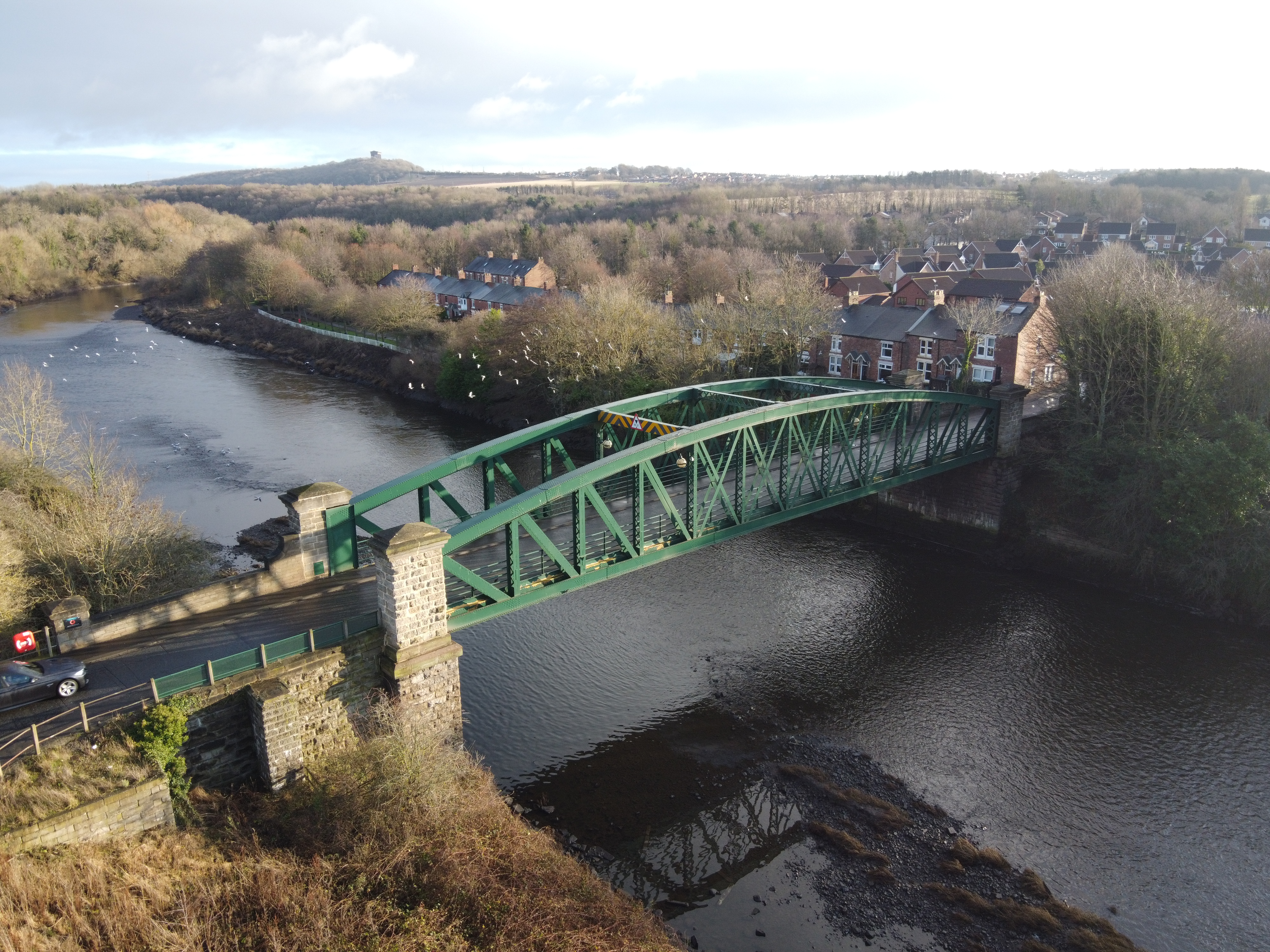
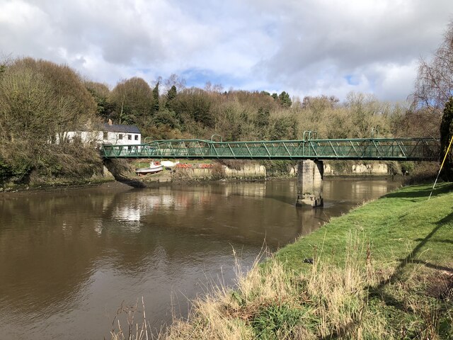
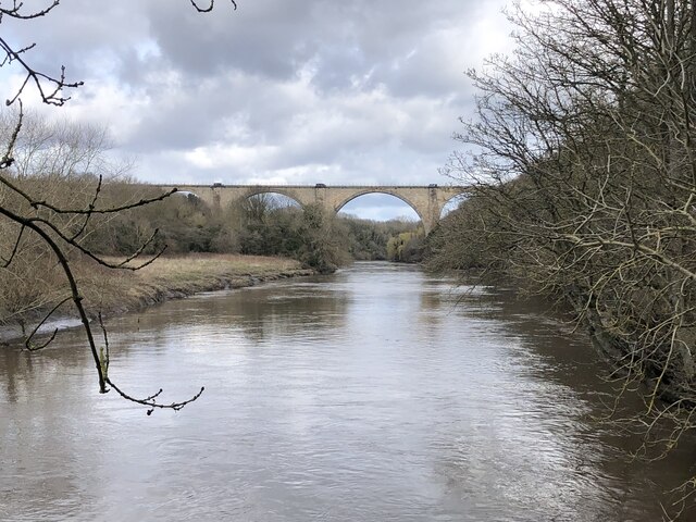
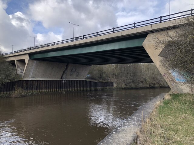
Penshaw Bridge

Penshaw Bridge, also known as Fatfield Bridge, is a road traffic bridge spanning the River Wear in North East England, linking Penshaw with Fatfield. The...
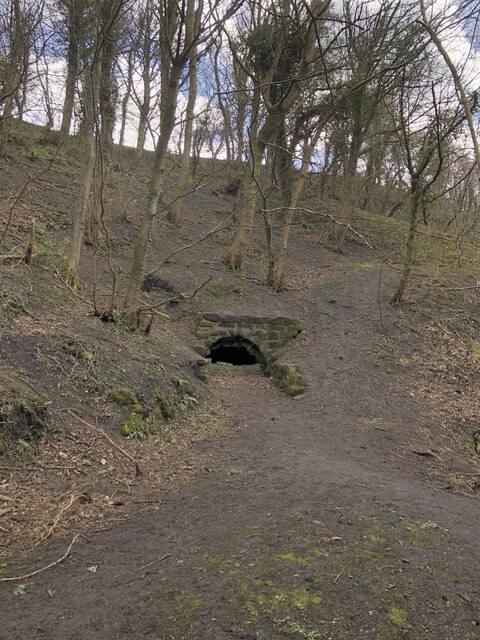
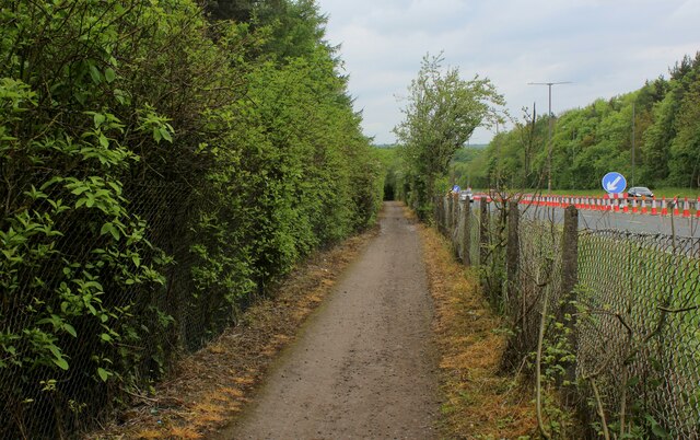
Fatfield Woods

Fatfield Woods is a woodland in Tyne and Wear, England, near Washington. It covers a total area of 8.99 hectares (22.21 acres). It is owned and managed...

Nearby Amenities

Located within 500m of 54.885735,-1.513765
Crossing
Crossing: unmarked
Crossing Island: no
Supervised: yes
Tactile Paving: no
Lat/Long: 54.8869205/-1.5199295
Barrier: height_restrictor
Maxheight: 2.1
Lat/Long: 54.8857243/-1.5075416
Arts Centre
Washington Arts Centre
Addr City: Washington
Addr Postcode: NE38 8AB
Addr Street: Biddick Lane
Phone: +44 191 219 3455
Website: www.artscentrewashington.co.uk
Wikidata: Q58345729
Lat/Long: 54.8858377/-1.5194062
Cafe
Arts Centre Cafe
Addr City: Washington
Addr Street: Biddick Lane
Lat/Long: 54.8856685/-1.5194557
Bench
Lat/Long: 54.8856434/-1.5198484
Bus Stop
WASHINGTON ARTS CENTRE
Local Ref: E
Naptan AtcoCode: 410000028500
Naptan Bearing: E
Naptan CommonName: WASHINGTON ARTS CENTRE
Naptan Indicator: E
Naptan Landmark: OPPOSITE THE WASHINGTON ARTS CENTRE
Naptan NaptanCode: twrgdjta
Naptan Street: NEWRIGGS
Naptan Verified: no
Source: naptan_import
Lat/Long: 54.8863013/-1.5193387
Bus Stop
WASHINGTON ARTS CENTRE
Local Ref: W
Naptan AtcoCode: 410000028501
Naptan Bearing: W
Naptan CommonName: WASHINGTON ARTS CENTRE
Naptan Indicator: W
Naptan Landmark: OUTSIDE ARTS CENTRE
Naptan NaptanCode: twrgdjtd
Naptan Street: NEWRIGGS
Naptan Verified: no
Source: naptan_import
Lat/Long: 54.8862278/-1.5189343
Bus Stop
FALLOWFIELD WAY-FOOTBRIDGE-E/B
Local Ref: E
Naptan AtcoCode: 410000028502
Naptan Bearing: E
Naptan CommonName: FALLOWFIELD WAY-FOOTBRIDGE-E/B
Naptan Indicator: E
Naptan Landmark: OPPOSITE FOOTBRIDGE TO FIELDS AND BIDDICK SCHOOL
Naptan NaptanCode: twrgdjtg
Naptan Street: FALLOWFIELD WAY
Naptan Verified: no
Source: naptan_import
Lat/Long: 54.8876183/-1.5160648
Bus Stop
Fallowfield Way-Farrier Close
Bus: yes
Local Ref: N
Naptan AtcoCode: 410000028503
Naptan Bearing: NW
Naptan Indicator: NW-Bound
Naptan Landmark: Outside Farrier Close Junction
Naptan NaptanCode: twrgdjtj
Naptan Street: Fallowfield Way
Naptan Verified: no
Public Transport: platform
Shelter: no
Source: naptan_import
Lat/Long: 54.8871047/-1.5132083
Bus Stop
FALLOWFIELD WAY-FARRIER CLOSE-S/B
Local Ref: S
Naptan AtcoCode: 410000028504
Naptan Bearing: S
Naptan CommonName: FALLOWFIELD WAY-FARRIER CLOSE-S/B
Naptan Indicator: S
Naptan Landmark: OPPOSITE FARRIER ROAD JUNCTION 35M SOUTH
Naptan NaptanCode: twrgdjtm
Naptan Street: FALLOWFIELD WAY
Naptan Verified: no
Shelter: no
Source: naptan_import
Lat/Long: 54.8870579/-1.5130005
Bus Stop
FATFIELD FALLOWFIELD WAY
Local Ref: SW
Naptan AtcoCode: 410000028505
Naptan Bearing: SW
Naptan CommonName: FATFIELD FALLOWFIELD WAY
Naptan Indicator: SW
Naptan Landmark: 60M SOUTH WEST OF FERNLEA CLOSE
Naptan NaptanCode: twrgdjtp
Naptan Street: FALLOWFIELD WAY
Naptan Verified: no
Source: naptan_import
Lat/Long: 54.8853174/-1.5137386
Bus Stop
FATFIELD FALLOWFIELD WAY
Local Ref: N
Naptan AtcoCode: 410000028506
Naptan Bearing: N
Naptan CommonName: FATFIELD FALLOWFIELD WAY
Naptan Indicator: N
Naptan Landmark: OPPOSITE FERNLEA CLOSE
Naptan NaptanCode: twrgdjtw
Naptan Street: FALLOWFIELD WAY
Naptan Verified: no
Source: naptan_import
Lat/Long: 54.8856281/-1.5127683
Bus Stop
Fallowfield Way-Rivermead
Bus: yes
Local Ref: SW
Naptan AtcoCode: 410000028507
Naptan Bearing: SW
Naptan Indicator: SW-Bound
Naptan Landmark: Opposite Rivermead 30m South West
Naptan NaptanCode: twrgdjwa
Naptan Street: Fallowfield Way
Naptan Verified: no
Public Transport: platform
Shelter: yes
Source: naptan_import
Lat/Long: 54.8824599/-1.5160487
Bus Stop
Washington Arts Centre
Bus: yes
Departures Board: timetable
Local Ref: S
Naptan AtcoCode: 410000028510
Naptan Bearing: S
Naptan Indicator: S-Bound
Naptan Landmark: Outside Washington Art Centre
Naptan NaptanCode: twrgdjwg
Naptan Street: Biddick Lane
Naptan Verified: yes
Public Transport: platform
Shelter: yes
Source: naptan_import; survey
Lat/Long: 54.885841/-1.5200076
Bus Stop
WASHINGTON ARTS CENTRE
Local Ref: N
Naptan AtcoCode: 410000028511
Naptan Bearing: N
Naptan CommonName: WASHINGTON ARTS CENTRE
Naptan Indicator: N
Naptan Landmark: OPPOSITE WASHINGTON ART CENTRE 50N NORTH
Naptan NaptanCode: twrgdjwj
Naptan Street: BIDDICK LANE
Naptan Verified: no
Source: naptan_import
Lat/Long: 54.8863673/-1.5201173
Bus Stop
BIDDICK LANE-FALLOWFIELD WAY-S/B
Local Ref: S
Naptan AtcoCode: 410000028512
Naptan Bearing: S
Naptan CommonName: BIDDICK LANE-FALLOWFIELD WAY-S/B
Naptan Indicator: S
Naptan Landmark: 55M NORTH OF FALLOWFIELD WAY
Naptan NaptanCode: twrgdjwm
Naptan Street: BIDDICK LANE
Naptan Verified: yes
Source: naptan_import; survey
Lat/Long: 54.8838216/-1.5203001
Mini Roundabout
Direction: clockwise
Lat/Long: 54.8862825/-1.5199735
Turning Loop
Lat/Long: 54.8861947/-1.5132397
Mini Roundabout
Direction: clockwise
Lat/Long: 54.8835149/-1.516216
Crossing
Crossing: unmarked
Crossing Island: yes
Tactile Paving: yes
Lat/Long: 54.8860806/-1.5200631
Crossing
Crossing: uncontrolled
Crossing Ref: zebra
Lat/Long: 54.883274/-1.5191116
Crossing
Crossing: uncontrolled
Crossing Ref: zebra
Lat/Long: 54.8836005/-1.5189913
Give Way
Direction: forward
Lat/Long: 54.8871309/-1.5202593
Post Box
Ref: NE38 496
Lat/Long: 54.8858685/-1.5192795
Nisa
Addr City: Washington
Addr Street: Fallowfield Way
Shop: convenience
Lat/Long: 54.8860238/-1.51807
Fast Food
Mick's Grill
Addr City: Washington
Addr Housename: The Keel Boat
Addr Postcode: NE38 8RU
Addr Street: Fallowfield Way
Cuisine: english
Drive Through: no
Phone: +44 191 415 3835
Takeaway: yes
Website: https://micksgrillstockfold.co.uk/
Lat/Long: 54.885769/-1.517992
Post Box
Collection Times: Mo-Fr 17:00; Sa 12:15
Colour: red
Operator: Royal Mail
Post Box Type: lamp
Ref: NE38 501
Lat/Long: 54.8854154/-1.5082558
Waste Basket
Lat/Long: 54.8856894/-1.5076604
Waste Basket
Lat/Long: 54.88598/-1.5070411
Crossing
Crossing: unmarked
Crossing Island: yes
Tactile Paving: yes
Lat/Long: 54.8890411/-1.5123502
Generator Method: photovoltaic
Generator Output Electricity: yes
Generator Source: solar
Generator Type: solar_photovoltaic_panel
Location: roof
Power: generator
Lat/Long: 54.8847526/-1.5212108
Generator Method: photovoltaic
Generator Output Electricity: yes
Generator Source: solar
Generator Type: solar_photovoltaic_panel
Location: roof
Power: generator
Lat/Long: 54.8846261/-1.5212886
Generator Method: photovoltaic
Generator Output Electricity: yes
Generator Source: solar
Generator Type: solar_photovoltaic_panel
Location: roof
Power: generator
Lat/Long: 54.8846307/-1.5212269
Generator Method: photovoltaic
Generator Output Electricity: yes
Generator Source: solar
Generator Type: solar_photovoltaic_panel
Location: roof
Power: generator
Lat/Long: 54.8847217/-1.5212859
Generator Method: photovoltaic
Generator Output Electricity: yes
Generator Source: solar
Generator Type: solar_photovoltaic_panel
Location: roof
Power: generator
Lat/Long: 54.8830384/-1.5167181
Generator Method: photovoltaic
Generator Output Electricity: yes
Generator Source: solar
Generator Type: solar_photovoltaic_panel
Location: roof
Power: generator
Lat/Long: 54.88304/-1.516879
Generator Method: photovoltaic
Generator Output Electricity: yes
Generator Source: solar
Generator Type: solar_photovoltaic_panel
Location: roof
Power: generator
Lat/Long: 54.8831387/-1.5179117
Generator Method: photovoltaic
Generator Output Electricity: yes
Generator Source: solar
Generator Type: solar_photovoltaic_panel
Location: roof
Power: generator
Lat/Long: 54.8830168/-1.5176542
Generator Method: photovoltaic
Generator Output Electricity: yes
Generator Source: solar
Generator Type: solar_photovoltaic_panel
Location: roof
Power: generator
Lat/Long: 54.8833563/-1.517225
Generator Method: photovoltaic
Generator Output Electricity: yes
Generator Source: solar
Generator Type: solar_photovoltaic_panel
Location: roof
Power: generator
Lat/Long: 54.8831279/-1.5181906
Generator Method: photovoltaic
Generator Output Electricity: yes
Generator Source: solar
Generator Type: solar_photovoltaic_panel
Location: roof
Power: generator
Lat/Long: 54.8833671/-1.5166537
Generator Method: photovoltaic
Generator Output Electricity: yes
Generator Source: solar
Generator Type: solar_photovoltaic_panel
Location: roof
Power: generator
Lat/Long: 54.8833609/-1.5165437
Generator Method: photovoltaic
Generator Output Electricity: yes
Generator Source: solar
Generator Type: solar_photovoltaic_panel
Location: roof
Power: generator
Lat/Long: 54.8837512/-1.5167261
Generator Method: photovoltaic
Generator Output Electricity: yes
Generator Source: solar
Generator Type: solar_photovoltaic_panel
Location: roof
Power: generator
Lat/Long: 54.8837003/-1.5167208
Generator Method: photovoltaic
Generator Output Electricity: yes
Generator Source: solar
Generator Type: solar_photovoltaic_panel
Location: roof
Power: generator
Lat/Long: 54.883634/-1.5167181
Generator Method: photovoltaic
Generator Output Electricity: yes
Generator Source: solar
Generator Type: solar_photovoltaic_panel
Location: roof
Power: generator
Lat/Long: 54.8836726/-1.5163587
Generator Method: photovoltaic
Generator Output Electricity: yes
Generator Source: solar
Generator Type: solar_photovoltaic_panel
Location: roof
Power: generator
Lat/Long: 54.8834751/-1.515959
Generator Method: photovoltaic
Generator Output Electricity: yes
Generator Source: solar
Generator Type: solar_photovoltaic_panel
Location: roof
Power: generator
Lat/Long: 54.8838191/-1.5173189
Generator Method: photovoltaic
Generator Output Electricity: yes
Generator Source: solar
Generator Type: solar_photovoltaic_panel
Location: roof
Power: generator
Lat/Long: 54.8839811/-1.5171902
Generator Method: photovoltaic
Generator Output Electricity: yes
Generator Source: solar
Generator Type: solar_photovoltaic_panel
Location: roof
Power: generator
Lat/Long: 54.8841401/-1.516997
Generator Method: photovoltaic
Generator Output Electricity: yes
Generator Source: solar
Generator Type: solar_photovoltaic_panel
Location: roof
Power: generator
Lat/Long: 54.8842882/-1.5161843
Generator Method: photovoltaic
Generator Output Electricity: yes
Generator Source: solar
Generator Type: solar_photovoltaic_panel
Location: roof
Power: generator
Lat/Long: 54.8842295/-1.5161039
Generator Method: photovoltaic
Generator Output Electricity: yes
Generator Source: solar
Generator Type: solar_photovoltaic_panel
Location: roof
Power: generator
Lat/Long: 54.8841339/-1.5159537
Generator Method: photovoltaic
Generator Output Electricity: yes
Generator Source: solar
Generator Type: solar_photovoltaic_panel
Location: roof
Power: generator
Lat/Long: 54.8843807/-1.5172948
Generator Method: photovoltaic
Generator Output Electricity: yes
Generator Source: solar
Generator Type: solar_photovoltaic_panel
Location: roof
Power: generator
Lat/Long: 54.8853929/-1.5170051
Generator Method: photovoltaic
Generator Output Electricity: yes
Generator Source: solar
Generator Type: solar_photovoltaic_panel
Location: roof
Power: generator
Lat/Long: 54.8853635/-1.5172813
Generator Method: photovoltaic
Generator Output Electricity: yes
Generator Source: solar
Generator Type: solar_photovoltaic_panel
Location: roof
Power: generator
Lat/Long: 54.8853821/-1.5168361
Generator Method: photovoltaic
Generator Output Electricity: yes
Generator Source: solar
Generator Type: solar_photovoltaic_panel
Location: roof
Power: generator
Lat/Long: 54.8863803/-1.5173189
Generator Method: photovoltaic
Generator Output Electricity: yes
Generator Source: solar
Generator Type: solar_photovoltaic_panel
Location: roof
Power: generator
Lat/Long: 54.8863309/-1.5173135
Generator Method: photovoltaic
Generator Output Electricity: yes
Generator Source: solar
Generator Type: solar_photovoltaic_panel
Location: roof
Power: generator
Lat/Long: 54.8860763/-1.5161253
Generator Method: photovoltaic
Generator Output Electricity: yes
Generator Source: solar
Generator Type: solar_photovoltaic_panel
Location: roof
Power: generator
Lat/Long: 54.8867012/-1.5159402
Generator Method: photovoltaic
Generator Output Electricity: yes
Generator Source: solar
Generator Type: solar_photovoltaic_panel
Location: roof
Power: generator
Lat/Long: 54.8866009/-1.5159107
Generator Method: photovoltaic
Generator Output Electricity: yes
Generator Source: solar
Generator Type: solar_photovoltaic_panel
Location: roof
Power: generator
Lat/Long: 54.8868231/-1.5161495
Generator Method: photovoltaic
Generator Output Electricity: yes
Generator Source: solar
Generator Type: solar_photovoltaic_panel
Location: roof
Power: generator
Lat/Long: 54.8871301/-1.5158437
Generator Method: photovoltaic
Generator Output Electricity: yes
Generator Source: solar
Generator Type: solar_photovoltaic_panel
Location: roof
Power: generator
Lat/Long: 54.8870282/-1.5158383
Generator Method: photovoltaic
Generator Output Electricity: yes
Generator Source: solar
Generator Type: solar_photovoltaic_panel
Location: roof
Power: generator
Lat/Long: 54.8870884/-1.5166671
Generator Method: photovoltaic
Generator Output Electricity: yes
Generator Source: solar
Generator Type: solar_photovoltaic_panel
Location: roof
Power: generator
Lat/Long: 54.8875643/-1.5150859
Generator Method: photovoltaic
Generator Output Electricity: yes
Generator Source: solar
Generator Type: solar_photovoltaic_panel
Location: roof
Power: generator
Lat/Long: 54.8873762/-1.5152295
Generator Method: photovoltaic
Generator Output Electricity: yes
Generator Source: solar
Generator Type: solar_photovoltaic_panel
Location: roof
Power: generator
Lat/Long: 54.887596/-1.5146098
Generator Method: photovoltaic
Generator Output Electricity: yes
Generator Source: solar
Generator Type: solar_photovoltaic_panel
Location: roof
Power: generator
Lat/Long: 54.887596/-1.5144918
Generator Method: photovoltaic
Generator Output Electricity: yes
Generator Source: solar
Generator Type: solar_photovoltaic_panel
Location: roof
Power: generator
Lat/Long: 54.8870089/-1.5138227
Generator Method: photovoltaic
Generator Output Electricity: yes
Generator Source: solar
Generator Type: solar_photovoltaic_panel
Location: roof
Power: generator
Lat/Long: 54.8868469/-1.5142706
Generator Method: photovoltaic
Generator Output Electricity: yes
Generator Source: solar
Generator Type: solar_photovoltaic_panel
Location: roof
Power: generator
Lat/Long: 54.8867799/-1.5146246
Generator Method: photovoltaic
Generator Output Electricity: yes
Generator Source: solar
Generator Type: solar_photovoltaic_panel
Location: roof
Power: generator
Lat/Long: 54.8863756/-1.5145361
Generator Method: photovoltaic
Generator Output Electricity: yes
Generator Source: solar
Generator Type: solar_photovoltaic_panel
Location: roof
Power: generator
Lat/Long: 54.8861068/-1.5138649
Generator Method: photovoltaic
Generator Output Electricity: yes
Generator Source: solar
Generator Type: solar_photovoltaic_panel
Location: roof
Power: generator
Lat/Long: 54.8863371/-1.513545
Generator Method: photovoltaic
Generator Output Electricity: yes
Generator Source: solar
Generator Type: solar_photovoltaic_panel
Location: roof
Power: generator
Lat/Long: 54.8858689/-1.5149076
Generator Method: photovoltaic
Generator Output Electricity: yes
Generator Source: solar
Generator Type: solar_photovoltaic_panel
Location: roof
Power: generator
Lat/Long: 54.8858234/-1.5148218
Generator Method: photovoltaic
Generator Output Electricity: yes
Generator Source: solar
Generator Type: solar_photovoltaic_panel
Location: roof
Power: generator
Lat/Long: 54.8861065/-1.5150712
Generator Method: photovoltaic
Generator Output Electricity: yes
Generator Source: solar
Generator Type: solar_photovoltaic_panel
Location: roof
Power: generator
Lat/Long: 54.8863726/-1.5133613
Generator Method: photovoltaic
Generator Output Electricity: yes
Generator Source: solar
Generator Type: solar_photovoltaic_panel
Location: roof
Power: generator
Lat/Long: 54.8863988/-1.5135101
Generator Method: photovoltaic
Generator Output Electricity: yes
Generator Source: solar
Generator Type: solar_photovoltaic_panel
Location: roof
Power: generator
Lat/Long: 54.8863942/-1.5132031
Generator Method: photovoltaic
Generator Output Electricity: yes
Generator Source: solar
Generator Type: solar_photovoltaic_panel
Location: roof
Power: generator
Lat/Long: 54.8860748/-1.5130274
Generator Method: photovoltaic
Generator Output Electricity: yes
Generator Source: solar
Generator Type: solar_photovoltaic_panel
Location: roof
Power: generator
Lat/Long: 54.8857308/-1.5133023
Generator Method: photovoltaic
Generator Output Electricity: yes
Generator Source: solar
Generator Type: solar_photovoltaic_panel
Location: roof
Power: generator
Lat/Long: 54.8856806/-1.5133559
Generator Method: photovoltaic
Generator Output Electricity: yes
Generator Source: solar
Generator Type: solar_photovoltaic_panel
Location: roof
Power: generator
Lat/Long: 54.8855109/-1.5136966
Generator Method: photovoltaic
Generator Output Electricity: yes
Generator Source: solar
Generator Type: solar_photovoltaic_panel
Location: roof
Power: generator
Lat/Long: 54.8854909/-1.5138602
Generator Method: photovoltaic
Generator Output Electricity: yes
Generator Source: solar
Generator Type: solar_photovoltaic_panel
Location: roof
Power: generator
Lat/Long: 54.884589/-1.5136872
Generator Method: photovoltaic
Generator Output Electricity: yes
Generator Source: solar
Generator Type: solar_photovoltaic_panel
Location: roof
Power: generator
Lat/Long: 54.8858079/-1.5102459
Generator Method: photovoltaic
Generator Output Electricity: yes
Generator Source: solar
Generator Type: solar_photovoltaic_panel
Location: roof
Power: generator
Lat/Long: 54.8880634/-1.51152
Generator Method: photovoltaic
Generator Output Electricity: yes
Generator Source: solar
Generator Type: solar_photovoltaic_panel
Location: roof
Power: generator
Lat/Long: 54.8870838/-1.517968
Generator Method: photovoltaic
Generator Output Electricity: yes
Generator Source: solar
Generator Type: solar_photovoltaic_panel
Location: roof
Power: generator
Lat/Long: 54.8867753/-1.5188666
Generator Method: photovoltaic
Generator Output Electricity: yes
Generator Source: solar
Generator Type: solar_photovoltaic_panel
Location: roof
Power: generator
Lat/Long: 54.8885587/-1.5104524
Generator Method: photovoltaic
Generator Output Electricity: yes
Generator Source: solar
Generator Type: solar_photovoltaic_panel
Location: roof
Power: generator
Lat/Long: 54.8840729/-1.5074819
Generator Method: photovoltaic
Generator Output Electricity: yes
Generator Source: solar
Generator Type: solar_photovoltaic_panel
Location: roof
Power: generator
Lat/Long: 54.8841424/-1.5073049
Generator Method: photovoltaic
Generator Output Electricity: yes
Generator Source: solar
Generator Type: solar_photovoltaic_panel
Location: roof
Power: generator
Lat/Long: 54.8830855/-1.5092361
Generator Method: photovoltaic
Generator Output Electricity: yes
Generator Source: solar
Generator Type: solar_photovoltaic_panel
Location: roof
Power: generator
Lat/Long: 54.8820872/-1.5102499
Generator Method: photovoltaic
Generator Output Electricity: yes
Generator Source: solar
Generator Type: solar_photovoltaic_panel
Location: roof
Power: generator
Lat/Long: 54.8834974/-1.5115106
Generator Method: photovoltaic
Generator Output Electricity: yes
Generator Source: solar
Generator Type: solar_photovoltaic_panel
Location: roof
Power: generator
Lat/Long: 54.8853504/-1.5086647
Generator Method: photovoltaic
Generator Output Electricity: yes
Generator Source: solar
Generator Type: solar_photovoltaic_panel
Location: roof
Power: generator
Lat/Long: 54.8868346/-1.5113259
Generator Method: photovoltaic
Generator Output Electricity: yes
Generator Source: solar
Generator Type: solar_photovoltaic_panel
Location: roof
Power: generator
Lat/Long: 54.8869448/-1.5107641
Generator Method: photovoltaic
Generator Output Electricity: yes
Generator Source: solar
Generator Type: solar_photovoltaic_panel
Location: roof
Power: generator
Lat/Long: 54.8835962/-1.508751
Ncn Milepost: mills
Sustrans Ref: MP320
Lat/Long: 54.8868469/-1.520185
Noexit: yes
Lat/Long: 54.8872236/-1.5201177
Crossing
Crossing: unmarked
Crossing Island: no
Tactile Paving: yes
Lat/Long: 54.8865304/-1.5200059
Crossing
Crossing: unmarked
Crossing Island: yes
Crossing Markings: no
Tactile Paving: yes
Lat/Long: 54.8889413/-1.5117686
Crossing
Crossing: unmarked
Crossing Island: no
Tactile Paving: yes
Lat/Long: 54.8887425/-1.5119109
Crossing
Crossing: unmarked
Crossing Island: yes
Tactile Paving: yes
Lat/Long: 54.8887874/-1.5123591
Direction: both
Surface: asphalt
Traffic Calming: hump
Lat/Long: 54.8896161/-1.512192
Direction: both
Surface: asphalt
Traffic Calming: hump
Lat/Long: 54.8900709/-1.5127485
Direction: both
Surface: asphalt
Traffic Calming: hump
Lat/Long: 54.8897682/-1.5115337
Crossing
Crossing: unmarked
Crossing Island: no
Tactile Paving: yes
Lat/Long: 54.8844627/-1.509726
Crossing
Crossing: unmarked
Crossing Island: no
Tactile Paving: no
Lat/Long: 54.8833602/-1.5086281
Bicycle Parking
Bicycle Parking: stands
Capacity: 5
Covered: no
Fee: no
Lat/Long: 54.8857038/-1.5195271
Barrier: cycle_barrier
Bicycle: yes
Motor Vehicle: no
Lat/Long: 54.8868821/-1.5200831
Barrier: cycle_barrier
Bicycle: yes
Motor Vehicle: no
Lat/Long: 54.8870126/-1.5197831
Generator Method: photovoltaic
Generator Output Electricity: yes
Generator Source: solar
Generator Type: solar_photovoltaic_panel
Location: roof
Power: generator
Lat/Long: 54.8869577/-1.5135465
Generator Method: photovoltaic
Generator Output Electricity: yes
Generator Source: solar
Generator Type: solar_photovoltaic_panel
Location: roof
Power: generator
Lat/Long: 54.8865434/-1.5135918
Generator Method: photovoltaic
Generator Output Electricity: yes
Generator Source: solar
Generator Type: solar_photovoltaic_panel
Location: roof
Power: generator
Lat/Long: 54.8853588/-1.5124902
Generator Method: photovoltaic
Generator Output Electricity: yes
Generator Source: solar
Generator Type: solar_photovoltaic_panel
Location: roof
Power: generator
Lat/Long: 54.8850549/-1.507394
Generator Method: photovoltaic
Generator Output Electricity: yes
Generator Source: solar
Generator Type: solar_photovoltaic_panel
Location: roof
Power: generator
Lat/Long: 54.8844849/-1.5090424
Generator Method: photovoltaic
Generator Output Electricity: yes
Generator Source: solar
Generator Type: solar_photovoltaic_panel
Location: roof
Power: generator
Lat/Long: 54.8823083/-1.5107493
Generator Method: photovoltaic
Generator Output Electricity: yes
Generator Source: solar
Generator Type: solar_photovoltaic_panel
Location: roof
Power: generator
Lat/Long: 54.8814651/-1.5128871
Generator Method: photovoltaic
Generator Output Electricity: yes
Generator Source: solar
Generator Type: solar_photovoltaic_panel
Location: roof
Power: generator
Lat/Long: 54.8815981/-1.5123417
Post Box
Collection Times: Mo-Fr 09:00; Sa 07:00
Colour: red
Drive Through: no
Operator: Royal Mail
Post Box Type: wall
Ref: NE38 496
Lat/Long: 54.8855497/-1.5181788
Crossing
Crossing: marked
Lat/Long: 54.8868058/-1.5211545
Crossing
Crossing: marked
Lat/Long: 54.888276/-1.5199006
Give Way
Direction: forward
Lat/Long: 54.8871327/-1.5199469
Crossing
Crossing: marked
Lat/Long: 54.8873729/-1.5202638
Give Way
Direction: backward
Lat/Long: 54.8877803/-1.5141928
Give Way
Direction: backward
Lat/Long: 54.8883416/-1.5131347
Crossing
Crossing: unmarked
Crossing Island: yes
Tactile Paving: yes
Lat/Long: 54.8890881/-1.5122373
Give Way
Direction: forward
Lat/Long: 54.8854147/-1.5132196
Crossing
Crossing: unmarked
Crossing Island: yes
Tactile Paving: yes
Lat/Long: 54.8890008/-1.5117999
Crossing
Crossing: unmarked
Crossing Island: yes
Tactile Paving: yes
Lat/Long: 54.888743/-1.5122712
Biddick Lane Crossing
Historic Railway: level_crossing
Lat/Long: 54.8869046/-1.5199327
Biddick Lane
Historic Railway: station
Railway: site
Lat/Long: 54.8869551/-1.5197161
Parking Space
Capacity: 1
Parking Space: disabled
Lat/Long: 54.8857579/-1.5076136
Direction: both
Surface: asphalt
Traffic Calming: cushion
Lat/Long: 54.8883978/-1.519634
Direction: both
Surface: asphalt
Traffic Calming: cushion
Lat/Long: 54.8873946/-1.5198365
Direction: both
Surface: asphalt
Traffic Calming: cushion
Lat/Long: 54.8868545/-1.5199429
Addr City: Washington
Addr Housenumber: 36
Addr Postcode: NE38 8RW
Addr Street: Fallowfield Way
Lat/Long: 54.8873731/-1.5140373
Addr City: Washington
Addr Housenumber: 35
Addr Postcode: NE38 8RW
Addr Street: Fallowfield Way
Lat/Long: 54.8874368/-1.5140607
Addr City: Washington
Addr Housenumber: 34
Addr Postcode: NE38 8RW
Addr Street: Fallowfield Way
Lat/Long: 54.8874927/-1.5141445
Addr City: Washington
Addr Housenumber: 33
Addr Postcode: NE38 8RW
Addr Street: Fallowfield Way
Lat/Long: 54.8875363/-1.514221
Addr City: Washington
Addr Housenumber: 32
Addr Postcode: NE38 8RW
Addr Street: Fallowfield Way
Lat/Long: 54.8875706/-1.5142699
Addr City: Washington
Addr Housenumber: 31
Addr Postcode: NE38 8RW
Addr Street: Fallowfield Way
Lat/Long: 54.8876026/-1.5143571
Addr City: Washington
Addr Housenumber: 30
Addr Postcode: NE38 8RW
Addr Street: Fallowfield Way
Lat/Long: 54.887608/-1.5144999
Addr City: Washington
Addr Housenumber: 29
Addr Postcode: NE38 8RW
Addr Street: Fallowfield Way
Lat/Long: 54.8876103/-1.5146146
Addr City: Washington
Addr Housenumber: 28
Addr Postcode: NE38 8RW
Addr Street: Fallowfield Way
Lat/Long: 54.8876053/-1.5147286
Addr City: Washington
Addr Housenumber: 27
Addr Postcode: NE38 8RW
Addr Street: Fallowfield Way
Lat/Long: 54.887608/-1.5148003
Addr City: Washington
Addr Housenumber: 26
Addr Postcode: NE38 8RW
Addr Street: Fallowfield Way
Lat/Long: 54.8876049/-1.5149318
Addr City: Washington
Addr Housenumber: 25
Addr Postcode: NE38 8RW
Addr Street: Fallowfield Way
Lat/Long: 54.8876076/-1.5150324
Addr City: Washington
Addr Housenumber: 24
Addr Postcode: NE38 8RW
Addr Street: Fallowfield Way
Lat/Long: 54.8875733/-1.5151168
Addr City: Washington
Addr Housenumber: 23
Addr Postcode: NE38 8RW
Addr Street: Fallowfield Way
Lat/Long: 54.8875425/-1.515196
Addr City: Washington
Addr Housenumber: 14
Addr Postcode: NE38 8RW
Addr Street: Farrier Close
Lat/Long: 54.8870364/-1.5149747
Addr City: Washington
Addr Housenumber: 15
Addr Postcode: NE38 8RW
Addr Street: Farrier Close
Lat/Long: 54.8870966/-1.5150632
Addr City: Washington
Addr Housenumber: 16
Addr Postcode: NE38 8RW
Addr Street: Farrier Close
Lat/Long: 54.8871529/-1.5151262
Addr City: Washington
Addr Housenumber: 17
Addr Postcode: NE38 8RW
Addr Street: Farrier Close
Lat/Long: 54.8872208/-1.5151879
Addr City: Washington
Addr Housenumber: 13
Addr Postcode: NE38 8RW
Addr Street: Farrier Close
Lat/Long: 54.887473/-1.5149163
Addr City: Washington
Addr Housenumber: 37
Addr Postcode: NE38 8RW
Addr Street: Farrier Close
Lat/Long: 54.887328/-1.5140319
Addr City: Washington
Addr Housenumber: 22
Addr Postcode: NE38 8RW
Addr Street: Fallowfield Way
Lat/Long: 54.8875008/-1.5152738
Addr City: Washington
Addr Housenumber: 21
Addr Postcode: NE38 8RW
Addr Street: Farrier Close
Lat/Long: 54.8874414/-1.5152805
Addr City: Washington
Addr Housenumber: 20
Addr Postcode: NE38 8RW
Addr Street: Farrier Close
Lat/Long: 54.8873828/-1.5152764
Addr City: Washington
Addr Housenumber: 19
Addr Postcode: NE38 8RW
Addr Street: Farrier Close
Lat/Long: 54.8873242/-1.5152738
Addr City: Washington
Addr Housenumber: 18
Addr Postcode: NE38 8RW
Addr Street: Farrier Close
Lat/Long: 54.8872655/-1.5152496
Direction: both
Surface: asphalt
Traffic Calming: cushion
Lat/Long: 54.88597/-1.520074
Direction: both
Surface: asphalt
Traffic Calming: cushion
Lat/Long: 54.8851982/-1.5201537
Direction: both
Surface: asphalt
Traffic Calming: cushion
Lat/Long: 54.8846482/-1.5202159
Direction: both
Surface: asphalt
Traffic Calming: cushion
Lat/Long: 54.883802/-1.5203841
Defibrillator
Access: yes
Check Date: 2023-04-02
Defibrillator Location En: The Keelboat Inn
Emergency: defibrillator
Indoor: no
Lat/Long: 54.8856723/-1.5181106
Communication Mobile Phone: yes
Man Made: mast
Tower Type: communication
Lat/Long: 54.8868284/-1.5127064
Man Made: street_cabinet
Utility: telecom
Lat/Long: 54.8891388/-1.511935
The data included in this document is from www.openstreetmap.org. The data is made available under ODbL.

Have you been to Biddick, North?

Leave your review of Biddick, North below (or comments, questions and feedback).