Dunnottar Castle

Heritage Site in Kincardineshire

Scotland

Dunnottar Castle

Downie Point This is the 'island' forming the end of Downie Point.  The flat topped island-like end of the headland isn't easily reachable on foot due to the steep gorge.
Downie Point Credit: Peter Robinson

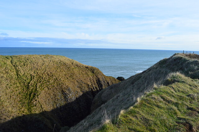
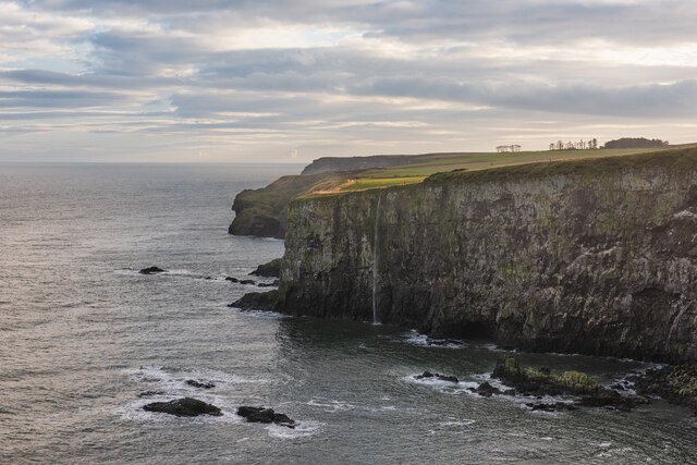
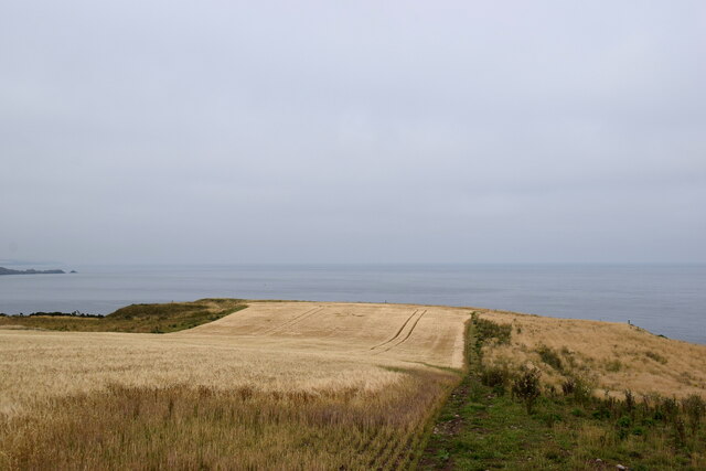
Dunnottar Castle is a historic fortress located on a dramatic cliff-top setting in Kincardineshire, Scotland. Perched atop a rugged headland overlooking the North Sea, it is considered one of the most iconic and picturesque castles in the country. The castle's strategic position provides breathtaking views of the surrounding landscape.

Dating back to the Early Middle Ages, Dunnottar Castle has a rich and fascinating history. It served as a defensive stronghold, protecting the northeastern coast of Scotland from invasions during various periods of conflict. The castle witnessed significant events, including the battles between the Scottish and English armies, during which it played a vital role in shaping Scotland's destiny.

The castle's architecture is a blend of different styles and periods, reflecting its long history and the multiple modifications it underwent over the centuries. The surviving structures include the 14th-century tower house, the 16th-century palace complex, and the 17th-century additions. Visitors can explore the various rooms, including the grand hall, chapel, and several chambers, offering a glimpse into the castle's past.

In addition to its historical significance, Dunnottar Castle is also renowned for its dramatic appearance. The cliffside location, surrounded by sheer cliffs and crashing waves, creates a truly awe-inspiring atmosphere. It has been a popular filming location for movies and television shows due to its striking beauty.

Today, Dunnottar Castle is a popular heritage site, attracting visitors from around the world. Guided tours provide insights into its history, and visitors can wander through the castle's grounds, admiring the stunning views and imagining life within its ancient walls.

If you have any feedback on the listing, please let us know in the comments section below.

Dunnottar Castle Images

Images are sourced within 2km of 56.943/-2.188 or Grid Reference NO8883. Thanks to Geograph Open Source API. All images are credited.

Downie Point This is the 'island' forming the end of Downie Point.  The flat topped island-like end of the headland isn't easily reachable on foot due to the steep gorge.
Downie Point
This is the 'island' forming the end of Downie Point. The flat topped island-like end of the headland isn't easily reachable on foot due to the steep gorge.
Dunnottar Castle Dunnottar Castle, near Stonehaven, Aberdeenshire.
Dunnottar Castle
Dunnottar Castle, near Stonehaven, Aberdeenshire.
Waterfall in Tremuda Bay The water from small burn draining the fields above forms the small but prominent waterfall.
Waterfall in Tremuda Bay
The water from small burn draining the fields above forms the small but prominent waterfall.
No way through The coast road from Dunnottar to Stonehaven has been blocked off and traffic must now take the A92 and the A957 farther inland.
No way through
The coast road from Dunnottar to Stonehaven has been blocked off and traffic must now take the A92 and the A957 farther inland.
Stonehaven war memorial Despite its striking design as a 'Greek temple ruin', it only merits a C-listing by Historic Environment Scotland: LB2918 <span class="nowrap"><a title="http://portal.historicenvironment.scot/designation/LB2918" rel="nofollow ugc noopener" href="http://portal.historicenvironment.scot/designation/LB2918">Link</a><img style="margin-left:2px;" alt="External link" title="External link - shift click to open in new window" src="https://s1.geograph.org.uk/img/external.png" width="10" height="10"/></span> .
Stonehaven war memorial
Despite its striking design as a 'Greek temple ruin', it only merits a C-listing by Historic Environment Scotland: LB2918 LinkExternal link .
Looking towards Downie Point... ...from Stonehaven war memorial.  The sea and sky have merged into one as a haar (sea fog) starts to develop.
Looking towards Downie Point...
...from Stonehaven war memorial. The sea and sky have merged into one as a haar (sea fog) starts to develop.
Looking towards Strathlethan Bay... ...from Stonehaven war memorial.  The dark rocks in the background are part of the Dunnottar Castle conglomerate formation (interbedded conglomerate and sandstone), being sedimentary bedrock formed between 443.8 and 393.3 million years ago during the Silurian and Devonian periods.  The ruins of Dunnottar Castle can just be seen in the distance.
Looking towards Strathlethan Bay...
...from Stonehaven war memorial. The dark rocks in the background are part of the Dunnottar Castle conglomerate formation (interbedded conglomerate and sandstone), being sedimentary bedrock formed between 443.8 and 393.3 million years ago during the Silurian and Devonian periods. The ruins of Dunnottar Castle can just be seen in the distance.
Looking at Dunnottar Castle Yet another view caught in very strange light as a haar (sea fog) thickens.  The castle, which sits on an impregnable outcrop of conglomerate rock, is a scheduled monument and was designated as such as early as 1920: SM986 <span class="nowrap"><a title="http://portal.historicenvironment.scot/designation/SM986" rel="nofollow ugc noopener" href="http://portal.historicenvironment.scot/designation/SM986">Link</a><img style="margin-left:2px;" alt="External link" title="External link - shift click to open in new window" src="https://s1.geograph.org.uk/img/external.png" width="10" height="10"/></span> .
Looking at Dunnottar Castle
Yet another view caught in very strange light as a haar (sea fog) thickens. The castle, which sits on an impregnable outcrop of conglomerate rock, is a scheduled monument and was designated as such as early as 1920: SM986 LinkExternal link .
Dunnottar Lodge Typical sandstone construction: the sign below the window says 'purchase tickets at the castle'.
Dunnottar Lodge
Typical sandstone construction: the sign below the window says 'purchase tickets at the castle'.
Outbuildings at Mains of Dunnottar
Conglomerate rocks at Castle Haven Part of the Dunnottar Castle conglomerate formation (conglomerate and sandstone, interbedded): sedimentary bedrock formed between 443.8 and 393.3 million years ago during the Silurian and Devonian periods.
Conglomerate rocks at Castle Haven
Part of the Dunnottar Castle conglomerate formation (conglomerate and sandstone, interbedded): sedimentary bedrock formed between 443.8 and 393.3 million years ago during the Silurian and Devonian periods.
Walking the beach at Castle Haven Bay The cliffs are made up of conglomerate rock (<span class="nowrap"><a title="https://en.wikipedia.org/wiki/Conglomerate_(geology)" rel="nofollow ugc noopener" href="https://en.wikipedia.org/wiki/Conglomerate_(geology)">Link</a><img style="margin-left:2px;" alt="External link" title="External link - shift click to open in new window" src="https://s1.geograph.org.uk/img/external.png" width="10" height="10"/></span> ), which consist of rounded clasts of rock embedded in a matrix of hardened sediment.
Walking the beach at Castle Haven Bay
The cliffs are made up of conglomerate rock (LinkExternal link ), which consist of rounded clasts of rock embedded in a matrix of hardened sediment.
Conglomerate cliffs at Bowdun Head
Crops growing above Downie Point
Welcome to Stonehaven The sign on the now-closed coastal road notes the town's most famous son and displays the burgh arms: Per fess: in chief paly of six or and gules, in base azure.  The town was made a burgh of barony in 1587 but the arms were not granted by Lord Lyon until 1929.  The arms are inspired by the Keith arms (argent, a chief gules three pallets or) but the tincture (colour) of the lower part of the shield is changed from silver to blue, to emphasise Stonehaven's status as a seaport.
Welcome to Stonehaven
The sign on the now-closed coastal road notes the town's most famous son and displays the burgh arms: Per fess: in chief paly of six or and gules, in base azure. The town was made a burgh of barony in 1587 but the arms were not granted by Lord Lyon until 1929. The arms are inspired by the Keith arms (argent, a chief gules three pallets or) but the tincture (colour) of the lower part of the shield is changed from silver to blue, to emphasise Stonehaven's status as a seaport.
Watersports near Downie Point Paddleboarders and kayakers having fun...
Watersports near Downie Point
Paddleboarders and kayakers having fun...
Looking down the gorge towards the castle
The Bore Stone Arch The OS Namebook says the Bore Stone is "A high ridge of rocks, extending from the base of the cliff to high water mark. Bored through for a passage for cattle &c." 
This is therefore a man-made arch.
The cliff on the other side of Strathlethan Bay (at low tide) is called Back Doo Thirl.
The Bore Stone Arch
The OS Namebook says the Bore Stone is "A high ridge of rocks, extending from the base of the cliff to high water mark. Bored through for a passage for cattle &c." This is therefore a man-made arch. The cliff on the other side of Strathlethan Bay (at low tide) is called Back Doo Thirl.
Show me another place!

Dunnottar Castle is located at Grid Ref: NO8883 (Lat: 56.943, Lng: -2.188)

Unitary Authority: Aberdeenshire

Police Authority: North East

What 3 Words

///families.pranced.pocket. Near Stonehaven, Aberdeenshire

Related Wikis

Dunnottar Castle

Dunnottar Castle (Scottish Gaelic: Dùn Fhoithear, "fort on the shelving slope") is a ruined medieval fortress located upon a rocky headland on the north...

Bowdun Head

Bowdun Head is a headland landform on the North Sea coast approximately one kilometre south of Stonehaven, Scotland.(Ordnance Survey, 2004) Slightly to...

Dunnicaer

Dunnicaer, or Dun-na-caer, is a precipitous sea stack just off the coast of Aberdeenshire, Scotland, between Dunnottar Castle and Stonehaven. Despite the...

Thornyhive Bay

Thornyhive Bay is an embayment along the North Sea coast in Aberdeenshire, Scotland. This bay is situated approximately 2.5 miles south of the town of...

Nearby Amenities

Located within 500m of 56.943,-2.188
Source: PGS
Lat/Long: 56.9416901/-2.1957481
The data included in this document is from www.openstreetmap.org. The data is made available under ODbL.

Have you been to Dunnottar Castle?

Leave your review of Dunnottar Castle below (or comments, questions and feedback).