Barnaugh

Island in Wigtownshire

Scotland

Barnaugh

Portpatrick From the coast path to the north west, the start of the Southern Upland Way to Cockburnspath on the east coast.
Portpatrick Credit: Andy Stephenson

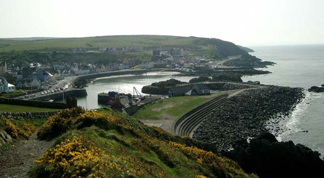
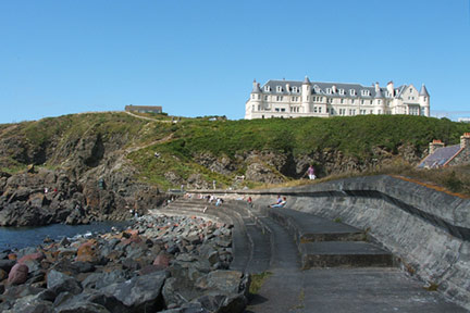
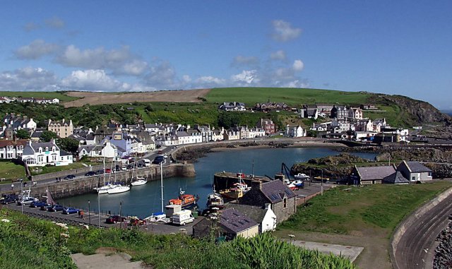
Barnaugh is a small island located off the western coast of Scotland in Wigtownshire. It is a charming and picturesque island that stretches over an area of approximately 2 square miles. Barnaugh is accessible via a short boat ride from the mainland, making it a popular destination for tourists and nature enthusiasts.

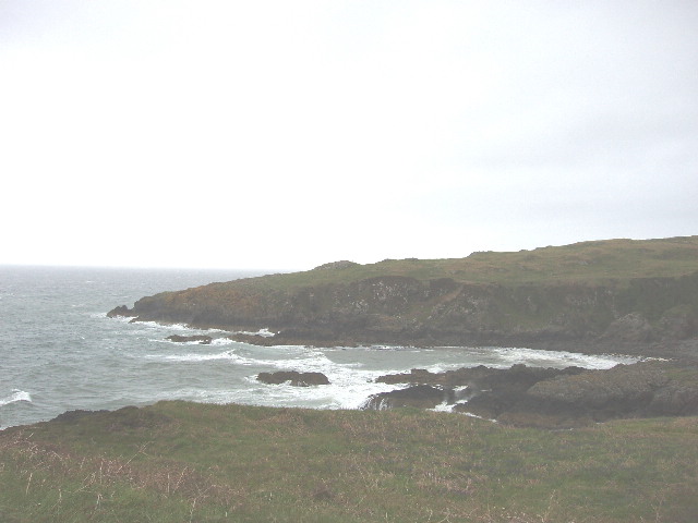
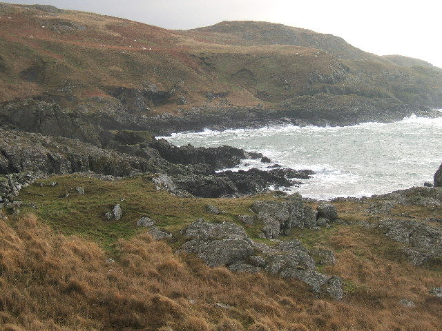
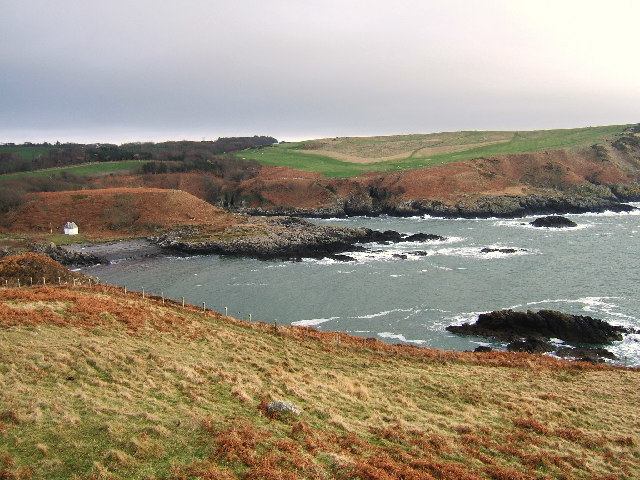
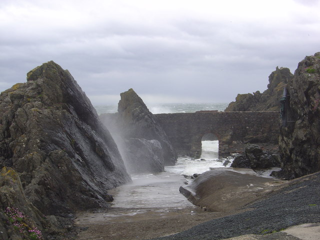
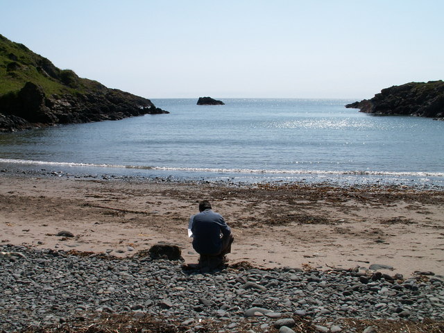
The island is known for its stunning natural beauty, with rugged cliffs, sandy beaches, and rolling green hills. It is a haven for wildlife, with a diverse range of bird species, seals, and occasionally dolphins and whales can be spotted in the surrounding waters.

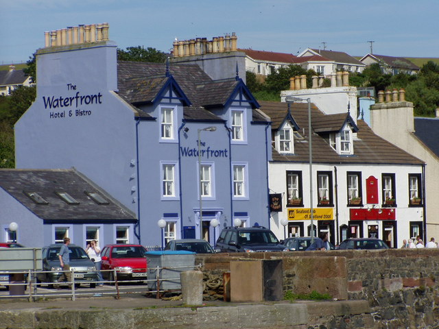
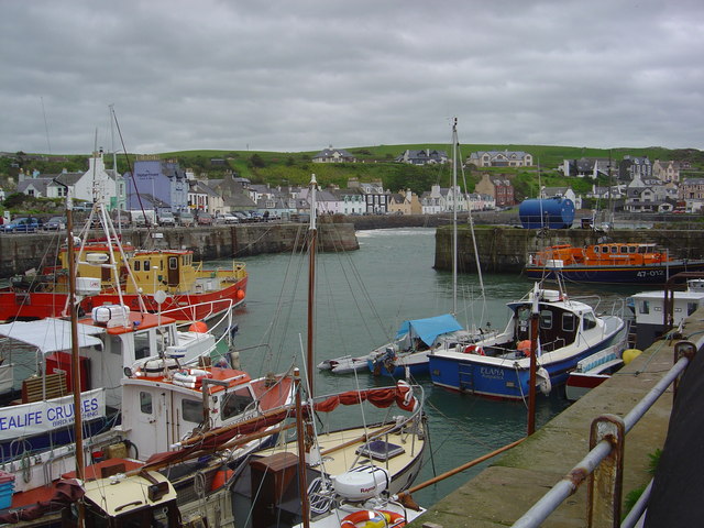
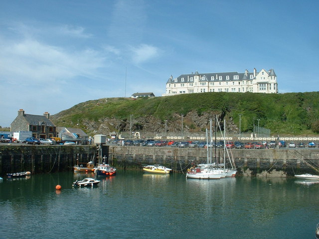
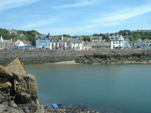
Barnaugh is sparsely populated, with only a handful of residents who mainly rely on fishing and agriculture for their livelihoods. The island's economy is also supported by tourism, with visitors flocking to experience its tranquil and unspoiled environment.

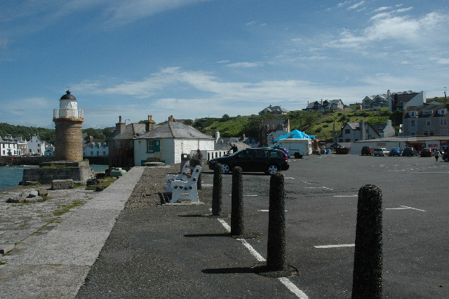
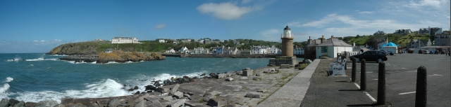
One of the main attractions on Barnaugh is its historic lighthouse, which has been guiding ships safely along the coast since the early 19th century. The lighthouse offers guided tours, providing visitors with a glimpse into the island's maritime history and offering breathtaking views from its tower.

For those seeking outdoor activities, Barnaugh offers ample opportunities for hiking, birdwatching, and beachcombing. The island is also a popular spot for camping and picnicking, as its untouched landscapes provide a serene and peaceful setting.

Overall, Barnaugh is a hidden gem in Wigtownshire, offering visitors a chance to escape the hustle and bustle of city life and immerse themselves in the beauty of nature.

If you have any feedback on the listing, please let us know in the comments section below.

Barnaugh Images

Images are sourced within 2km of 54.843562/-5.1259326 or Grid Reference NW9954. Thanks to Geograph Open Source API. All images are credited.

Portpatrick From the coast path to the north west, the start of the Southern Upland Way to Cockburnspath on the east coast.
Portpatrick
From the coast path to the north west, the start of the Southern Upland Way to Cockburnspath on the east coast.
Across Port Kale to Catebraid, near Portpatrick The inlet is the bottom of Dunskey Glen. The headland is near the start of the Southern Upland Way.
Across Port Kale to Catebraid, near Portpatrick
The inlet is the bottom of Dunskey Glen. The headland is near the start of the Southern Upland Way.
Dunskey Glen, near Portpatrick
A tribute to the Lifeboatmen of Portpatrick This is in memory of the Lifeboatmen of Portpatrick who, in January 1953, risked their lives to save the passengers and crew of the BR/S Princess Victoria during The Great Storm.
A tribute to the Lifeboatmen of Portpatrick
This is in memory of the Lifeboatmen of Portpatrick who, in January 1953, risked their lives to save the passengers and crew of the BR/S Princess Victoria during The Great Storm.
Car park at south end of Portpatrick Harbour Car park at south end of Portpatrick Harbour.
Car park at south end of Portpatrick Harbour
Car park at south end of Portpatrick Harbour.
Portpatrick This is a panoramic view on Portpatrick. Four pictures were used for this view and were stitched together using Panavue.
Portpatrick
This is a panoramic view on Portpatrick. Four pictures were used for this view and were stitched together using Panavue.
Portavaddie Bay South of Killantringan Lighthouse Portavaddie Bay, South of Killantringan lighthouse and passed by on the Southern Upland Way towards Portpatrick.
Portavaddie Bay South of Killantringan Lighthouse
Portavaddie Bay, South of Killantringan lighthouse and passed by on the Southern Upland Way towards Portpatrick.
Port Kale and Port Mora Bays from Catebraid near Portpatrick Port Kale (foreground) and Port Mora (known locally as Sandeel Bay) Bays near Portpatrick. This location covers three ordnance survey squares but I have chosen the furthest away for the location.
Port Kale and Port Mora Bays from Catebraid near Portpatrick
Port Kale (foreground) and Port Mora (known locally as Sandeel Bay) Bays near Portpatrick. This location covers three ordnance survey squares but I have chosen the furthest away for the location.
A waterfall over caves at the end of Sandeel Bay (Port Mora Bay) near Portpatrick.
Port Patrick Hotel Taken from the old Harbour in Portpatrick up towards the hotel
Port Patrick Hotel
Taken from the old Harbour in Portpatrick up towards the hotel
Portpatrick Harbour My yacht 'Makushla' is the large yacht moored against the wall with the smaller one rafted against it.
Portpatrick Harbour
My yacht 'Makushla' is the large yacht moored against the wall with the smaller one rafted against it.
Portpatrick Waterfront Hotel
Portpatrick Harbour
Portpatrick Harbour
View from Portpatrick
Port Mora
Port Mora
The Portpatrick Hotel The hotel in the picture dominates the village of Portpatrick, and is The Portpatrick Hotel. It is late Victorian and is now owned by the Wallace Arnold Shearings Group.
The Portpatrick Hotel
The hotel in the picture dominates the village of Portpatrick, and is The Portpatrick Hotel. It is late Victorian and is now owned by the Wallace Arnold Shearings Group.
Portpatrick waterfront
The south side of Portpatrick Harbour
Show me another place!

Barnaugh is located at Grid Ref: NW9954 (Lat: 54.843562, Lng: -5.1259326)

Unitary Authority: Dumfries and Galloway

Police Authority: Dumfries and Galloway

What 3 Words

///instilled.install.situation. Near Stranraer, Dumfries & Galloway

Related Wikis

Portpatrick

Portpatrick is a village and civil parish in the historical county of Wigtownshire, Dumfries and Galloway, Scotland. It is located on the west coast of...

Dunskey

Dunskey Estate (also known as Portree Estate) is north of Portpatrick on the west coast of Scotland. The B-listed mansion dates from the start of the twentieth...

Portpatrick railway station

Portpatrick railway station was a railway station serving the village of Portpatrick, Dumfries & Galloway, Scotland. Opened in 1862 the station served...

Dunskey Castle

Dunskey Castle is a ruined, 12th-century tower house or castle, located 0.5 miles (0.80 km) south of the village of Portpatrick, Rhinns, Wigtownshire,...

Nearby Amenities

Located within 500m of 54.843562,-5.1259326
Source: PGS
Lat/Long: 54.8438423/-5.1257671
Source: PGS
Lat/Long: 54.8433666/-5.1253808
Source: PGS
Lat/Long: 54.8431071/-5.1248981
Created By: dmgroom_coastlines
Source: PGS
Lat/Long: 54.843153/-5.124582
Source: PGS
Lat/Long: 54.8428168/-5.1241578
Source: PGS
Lat/Long: 54.8428044/-5.1235462
Created By: dmgroom_coastlines
Source: PGS
Lat/Long: 54.842796/-5.123008
Created By: dmgroom_coastlines
Source: PGS
Lat/Long: 54.842673/-5.122781
Created By: dmgroom_coastlines
Source: PGS
Lat/Long: 54.842548/-5.122552
Source: PGS
Lat/Long: 54.8424182/-5.1210834
Source: PGS
Lat/Long: 54.8422757/-5.1208513
Source: PGS
Lat/Long: 54.8417294/-5.1204456
Source: PGS
Lat/Long: 54.8417859/-5.1188067
Source: PGS
Lat/Long: 54.8413614/-5.1193427
Source: PGS
Lat/Long: 54.8414208/-5.1198639
Source: PGS
Lat/Long: 54.8421093/-5.1190215
Source: PGS
Lat/Long: 54.8421781/-5.1191692
Source: PGS
Lat/Long: 54.8420953/-5.1194843
Source: PGS
Lat/Long: 54.842588/-5.1199764
Source: PGS
Lat/Long: 54.8428489/-5.1191763
Source: PGS
Lat/Long: 54.8423614/-5.11866
Portpatrick Harbour
Abandoned Railway: station
Railway: site
Source: http://www.railbrit.co.uk/Portpatrick_Railway
Start Date: 1868-09-11
Lat/Long: 54.8427976/-5.1202449
Toilets
Fee: yes
Lat/Long: 54.8425542/-5.1203189
Man Made: mast
Lat/Long: 54.8451336/-5.1264751
Man Made: antenna
Lat/Long: 54.8440634/-5.1244238
Portpatrick Harbour
Harbour: yes
Leisure: marina
Seamark Harbour Category: marina
Seamark Type: harbour
Lat/Long: 54.8424326/-5.1192967
Tourism: information
Lat/Long: 54.8427198/-5.1203873
Tourism: picnic_site
Lat/Long: 54.8426916/-5.1205285
Shower
Lat/Long: 54.8425248/-5.1203479
John Buchanan Barr
Water Rescue
Emergency: water_rescue
Operator: Royal National Lifeboat Institution
Operator Short: RNLI
Operator Wikidata: Q2166873
Ref: 16-21
Seamark Name: John Buchanan Barr
Seamark Rescue Station Category: lifeboat_on_mooring
Seamark Source: Bing; https://rnli.org/find-my-nearest
Seamark Type: rescue_station
Website: https://rnli.org/find-my-nearest/lifeboat-stations/portpatrick-lifeboat-station/our-lifeboat-portpatrick
Lat/Long: 54.84192/-5.1193426
Seamark Mooring Category: buoy
Seamark Mooring Colour: orange
Seamark Name: RNLI
Seamark Source: Bing
Seamark Type: mooring
Lat/Long: 54.841947/-5.1191635
Seamark Mooring Category: buoy
Seamark Mooring Colour: orange
Seamark Name: RNLI
Seamark Source: Bing
Seamark Type: mooring
Lat/Long: 54.841881/-5.1195163
Charging Station
Lat/Long: 54.8426112/-5.1199828
Defibrillator
Defibrillator Location: External wall, left hand side of Harbour Office door
Emergency: defibrillator
Indoor: no
Lat/Long: 54.8422018/-5.1198684
Man Made: storage_tank
Lat/Long: 54.8438122/-5.1206354
Man Made: storage_tank
Lat/Long: 54.8438258/-5.1206089
Man Made: storage_tank
Lat/Long: 54.8438341/-5.1205795
Bench
Lat/Long: 54.8428039/-5.1209276
Bench
Lat/Long: 54.8427196/-5.1211975
Bench
Lat/Long: 54.8431459/-5.1222444
The data included in this document is from www.openstreetmap.org. The data is made available under ODbL.

Have you been to Barnaugh?

Leave your review of Barnaugh below (or comments, questions and feedback).