Staca Còrr

Island in Ross-shire

Scotland

Staca Còrr

Houses at Islibhig An interesting juxtaposition of old and new.
Houses at Islibhig Credit: Sandy Gerrard

Staca Còrr is a small uninhabited island located off the coast of Ross-shire, in the northern part of Scotland. It is situated in the North Atlantic Ocean, specifically in the Inner Sound, between the mainland and the Isle of Skye. The island is part of the Inner Hebrides archipelago.

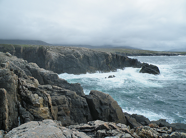
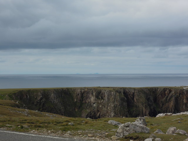
Covering an area of approximately 4 hectares, Staca Còrr is a rocky outcrop with rugged cliffs rising to a height of about 50 meters. Its name, which translates to "pillar of the round," describes its distinctive geological formation. The island is mainly composed of basalt, formed through volcanic activity millions of years ago.

Staca Còrr is known for its rich wildlife and serves as an important breeding ground for seabirds. It is home to a large colony of guillemots, razorbills, and fulmars, which nest on the cliffs during the breeding season. Puffins can also be spotted on the island, adding to its ecological significance.

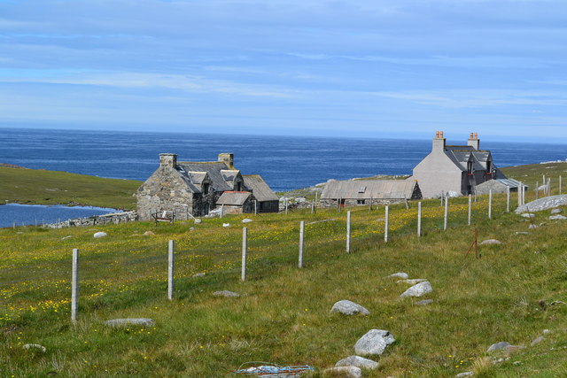
Due to its remote location and lack of amenities, Staca Còrr is not accessible to the public. However, it is often visited by birdwatchers, researchers, and wildlife enthusiasts who are interested in observing the diverse avian species that inhabit the island.

The waters surrounding Staca Còrr are renowned for their biodiversity, attracting divers and snorkelers who explore the underwater world teeming with marine life. The island is also a notable landmark for boaters and sailors navigating the Inner Sound.

In summary, Staca Còrr is a small, rocky island off the coast of Ross-shire, known for its unique geological formation, diverse seabird colonies, and rich marine ecosystem.

If you have any feedback on the listing, please let us know in the comments section below.

Staca Còrr Images

Images are sourced within 2km of 58.138168/-7.1310718 or Grid Reference NA9828. Thanks to Geograph Open Source API. All images are credited.

Houses at Islibhig An interesting juxtaposition of old and new.
Houses at Islibhig
An interesting juxtaposition of old and new.
Small pond beside the road to Islibhig This probably represents the site of a small quarry cut for stone when the road was being constructed.
Small pond beside the road to Islibhig
This probably represents the site of a small quarry cut for stone when the road was being constructed.
Geodh' an Fhithich Sea Stacks
Aird Feinis A deep rock pool in a cleft on the top of Aird Feinis.
Aird Feinis
A deep rock pool in a cleft on the top of Aird Feinis.
Cairn on Aird Feinis A cairn marks the highest point on the relatively level summit of Aird Feinis, with Aird Mangarstadh in the background.
Cairn on Aird Feinis
A cairn marks the highest point on the relatively level summit of Aird Feinis, with Aird Mangarstadh in the background.
Boulder-strewn Hillside These strange rounded boulders lie on the hill slope above the road opposite Aird Feinis. They have been rounded and polished by the movement of ice during the last Ice Age, which ended about 10,000 years ago.
Boulder-strewn Hillside
These strange rounded boulders lie on the hill slope above the road opposite Aird Feinis. They have been rounded and polished by the movement of ice during the last Ice Age, which ended about 10,000 years ago.
Geodha an Fhithich Several ridges of rock have been eroded to form a series of jagged rock stacks north of Aird Feinis.
Geodha an Fhithich
Several ridges of rock have been eroded to form a series of jagged rock stacks north of Aird Feinis.
Geodha an Fhithich Several ridges of rock have been eroded to form a series of jagged rock stacks north of Aird Feinis.
Geodha an Fhithich
Several ridges of rock have been eroded to form a series of jagged rock stacks north of Aird Feinis.
Geodha an Fhithich The sea north of Aird Feinis is studded with jagged sea stacks formed from granite intruded into the local Lewisian gneiss.
Geodha an Fhithich
The sea north of Aird Feinis is studded with jagged sea stacks formed from granite intruded into the local Lewisian gneiss.
Roseroot (Sedum rosea) This plant needs the shelter of the crevices between the stones on the clifftop at Aird Feinis.
Roseroot (Sedum rosea)
This plant needs the shelter of the crevices between the stones on the clifftop at Aird Feinis.
Aird Feinis The vegetation on this patch on the clifftop has been blown clean away by storms. Thrift (Armeria maritima) is recolonising the sand, and will eventually form a new sward.
Aird Feinis
The vegetation on this patch on the clifftop has been blown clean away by storms. Thrift (Armeria maritima) is recolonising the sand, and will eventually form a new sward.
Geological Conundrum This feature on Aird Feinis is significant, because the dark vein can be shown to cut across the gneiss, therefore proving the relative ages of the different rocks. The whole formation is a shear zone. Geologist for scale.
Geological Conundrum
This feature on Aird Feinis is significant, because the dark vein can be shown to cut across the gneiss, therefore proving the relative ages of the different rocks. The whole formation is a shear zone. Geologist for scale.
Aird Feinis Cliffs on the north side of Aird Feinis are battered by the sea in a strong westerly wind.
Aird Feinis
Cliffs on the north side of Aird Feinis are battered by the sea in a strong westerly wind.
Coastal houses at Islibhig
St Kilda from Uig Ok you need to really squint but St Kilda is just visible over the headland at Geodha Sgoilte.
St Kilda from Uig
Ok you need to really squint but St Kilda is just visible over the headland at Geodha Sgoilte.
Geodha Sgoilte 12 Apostles on the Great Ocean Road eat your heart out.  This is the dramatic site of the proposed St Kilda Centre near Mangersta.
Geodha Sgoilte
12 Apostles on the Great Ocean Road eat your heart out. This is the dramatic site of the proposed St Kilda Centre near Mangersta.
Ruin at Breinis
Ruin at Breinis
Heading north from Breanais on the far west of Lewis Towards Islibhig.
Heading north from Breanais on the far west of Lewis
Towards Islibhig.
Show me another place!

Staca Còrr is located at Grid Ref: NA9828 (Lat: 58.138168, Lng: -7.1310718)

Unitary Authority: Na h-Eileanan an Iar

Police Authority: Highlands and Islands

What 3 Words

///vandalism.stoppage.valve. Near Carloway, Na h-Eileanan Siar

Related Wikis

Brenish

Brenish (Scottish Gaelic: Brèinis) is a small village situated on the west coast of the Isle of Lewis, which is part of the Outer Hebrides of Scotland...

Game pieces of the Lewis chessmen hoard

Game pieces of the Lewis chessmen hoard include the ninety-three game pieces of the Lewis chessmen hoard found on the Isle of Lewis in the Outer Hebrides...

Mealista

Mealista (Scottish Gaelic: Mealasta) was a township in the west of the Isle of Lewis. It is currently largely uninhabited due to the Highland Clearances...

Stac Dhòmhnaill Chaim

Stac Dhòmnuill Chaim, or Stac Dhòmhnaill Chaim, or Stac Domhnuill Chaim, is a fortified promontory located near Mangursta (or Mangersta, Scottish Gaelic...

Nearby Amenities

Located within 500m of 58.138168,-7.1310718
Created By: dmgroom_coastlines
Lat/Long: 58.13924/-7.12607
Geodha Cam
Natural: bay
Lat/Long: 58.1339563/-7.1306291
Geodha´ a´ Gharaidh
Natural: bay
Lat/Long: 58.1351542/-7.1294865
The data included in this document is from www.openstreetmap.org. The data is made available under ODbL.

Have you been to Staca Còrr?

Leave your review of Staca Còrr below (or comments, questions and feedback).