Eilean a' Bhradain

Island in Argyllshire

Scotland

Eilean a' Bhradain

A seat with a view The coast near to Hynish.
A seat with a view Credit: Peter Mackenzie

Eilean a' Bhradain is a small island located in Argyllshire, Scotland. It is situated in the Firth of Lorn, approximately 5 miles south of Oban. The island is privately owned and covers an area of about 10 hectares.

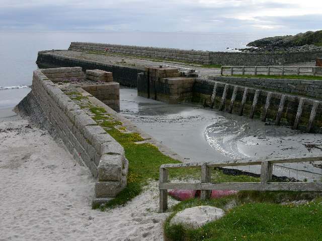
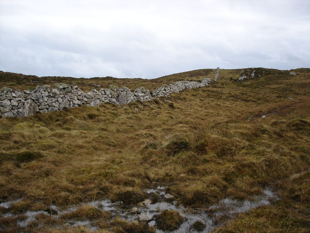
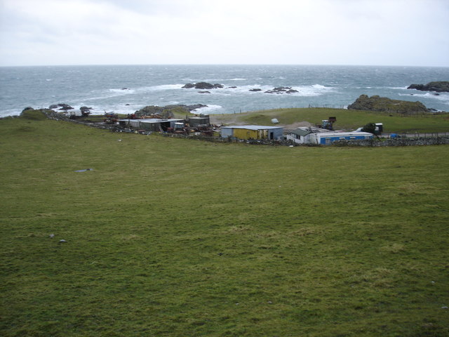
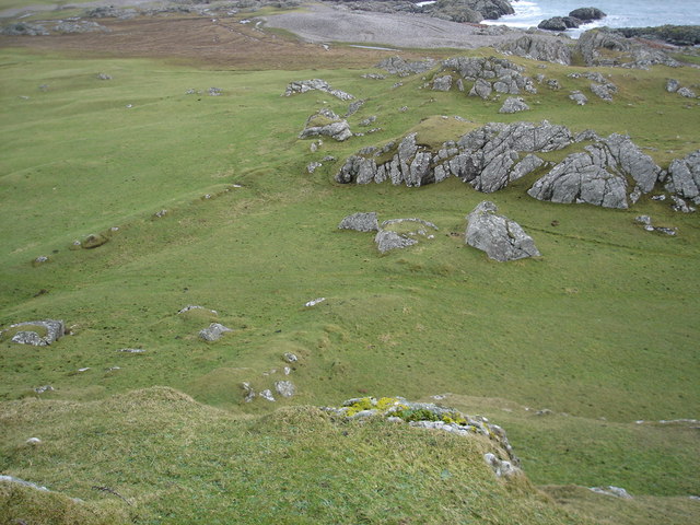
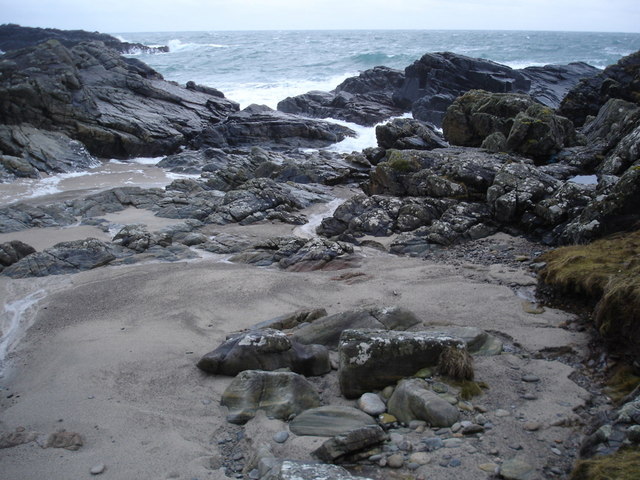
Eilean a' Bhradain is known for its natural beauty and stunning landscapes. The island is characterized by rugged cliffs, rocky shores, and lush greenery. It offers breathtaking views of the surrounding sea and nearby islands.

The island is home to a variety of wildlife, including seabirds, seals, and otters. The diverse ecosystem attracts nature enthusiasts and birdwatchers from around the world. Visitors can enjoy peaceful walks along the island's paths, taking in the scenic beauty and observing the local wildlife.

Eilean a' Bhradain has a rich history dating back centuries. It has been inhabited since ancient times and has been a site of human activity throughout the ages. The island has remnants of ancient structures, such as stone circles and burial cairns, which provide insight into its past.

In recent years, Eilean a' Bhradain has become a popular destination for tourists seeking a tranquil escape. The island offers limited accommodation options, including a small cottage for those looking to stay overnight. Visitors can also arrange boat trips to explore the surrounding waters and discover the neighboring islands.

Overall, Eilean a' Bhradain is a hidden gem in Argyllshire, offering visitors a unique and serene experience amidst stunning natural beauty and a rich historical backdrop.

If you have any feedback on the listing, please let us know in the comments section below.

Eilean a' Bhradain Images

Images are sourced within 2km of 56.443185/-6.9017245 or Grid Reference NL9838. Thanks to Geograph Open Source API. All images are credited.

A seat with a view The coast near to Hynish.
A seat with a view
The coast near to Hynish.
A walk to Hynish, Tiree
Rock south coast of Tiree
B8066 approaching Hynish The Skerryvore shore station on the skyline.
B8066 approaching Hynish
The Skerryvore shore station on the skyline.
Hynish On a rocky shoreline without a fertile machair there is a small settlement, it was the shore station for the Skerryvore lighthouse.
Hynish
On a rocky shoreline without a fertile machair there is a small settlement, it was the shore station for the Skerryvore lighthouse.
End of the B8066, Hynish Roads end on the southern tip of Tiree.
End of the B8066, Hynish
Roads end on the southern tip of Tiree.
Road to The Golf Ball The radome was emerging from low cloud, so I was able to get a view from Càrnan Mòr, the summit of Ben Hynish.  The hill and radar building feature in a lot views from other islands too.  The ring feeder suggests that this is Winter pasture for cattle.
Road to The Golf Ball
The radome was emerging from low cloud, so I was able to get a view from Càrnan Mòr, the summit of Ben Hynish. The hill and radar building feature in a lot views from other islands too. The ring feeder suggests that this is Winter pasture for cattle.
Semaphore tower, Hynish The signalling tower for communicating with the builders of the Skerryvore lighthouse, 20km out to sea from here.
Semaphore tower, Hynish
The signalling tower for communicating with the builders of the Skerryvore lighthouse, 20km out to sea from here.
Dockside at Hynish An old photo from the early 1990s showing the pier and village which was constructed in association with the Skerryvore Lighthouse.
The same view as in <a href="https://www.geograph.org.uk/photo/4508020">NL9839 : Hynish from the end of the pier</a> taken some twenty years later, which shows the place has been repaired and smartened up a bit.
Dockside at Hynish
An old photo from the early 1990s showing the pier and village which was constructed in association with the Skerryvore Lighthouse. The same view as in NL9839 : Hynish from the end of the pier taken some twenty years later, which shows the place has been repaired and smartened up a bit.
Rocky Ground at Hynish Showing the signal tower which was used for communicating with the Skerryvore lighthouse.
The original lighthouse keepers' cottages are adjacent.
From a print, date not exact.
Rocky Ground at Hynish
Showing the signal tower which was used for communicating with the Skerryvore lighthouse. The original lighthouse keepers' cottages are adjacent. From a print, date not exact.
Hynish, Isle of Tiree - Pier The disused dock of the former shore station for the Skerryvore Lighthouse
Hynish, Isle of Tiree - Pier
The disused dock of the former shore station for the Skerryvore Lighthouse
Old CEL Roller at West Hynish
Dry stone dyke on Beinn Hynish A very popular location for wall is along the ridge line of hills, and in terms of Tiree this is a big as it gets.
Dry stone dyke on Beinn Hynish
A very popular location for wall is along the ridge line of hills, and in terms of Tiree this is a big as it gets.
Farm buildings near Hynish A collection of tin buildings and mobile homes complete with sheepdogs.  It did have the feeling that the whole lot would blow away when a serious wind blew.
Farm buildings near Hynish
A collection of tin buildings and mobile homes complete with sheepdogs. It did have the feeling that the whole lot would blow away when a serious wind blew.
Near the fort When I was here I was convinced that this was the location of the fort on the map.  The high ground on either sided and the parallel ridges remains of ditch systems.      Although it could be that the hill I'm standing on was the site.
Near the fort
When I was here I was convinced that this was the location of the fort on the map. The high ground on either sided and the parallel ridges remains of ditch systems. Although it could be that the hill I'm standing on was the site.
Port Snoig This is typical of this section of coastline.  Small sandy beaches and lots of rocks.
Port Snoig
This is typical of this section of coastline. Small sandy beaches and lots of rocks.
Pebble Quarry The pebbles are crushed and used as aggregate.
Pebble Quarry
The pebbles are crushed and used as aggregate.
Linne Thorramhuill A very heavily reeded lochan, or maybe just very wet bog.  The whole area is rather damp as it seems to be the source of several rivers.
Linne Thorramhuill
A very heavily reeded lochan, or maybe just very wet bog. The whole area is rather damp as it seems to be the source of several rivers.
Show me another place!

Eilean a' Bhradain is located at Grid Ref: NL9838 (Lat: 56.443185, Lng: -6.9017245)

Unitary Authority: Argyll and Bute

Police Authority: Argyll and West Dunbartonshire

What 3 Words

///fewer.condiment.walks. Near Scarinish, Argyll & Bute

Related Wikis

Mannal

Mannal is a coastal hamlet on the west side of Hynish Bay, on the island of Tiree, Scotland. The township of Mannal lies on the southwest corner of Tiree...

Tiree Music Festival

Tiree Music Festival is a Scottish folk music festival held annually on the Island of Tiree in the Inner Hebrides. The festival was founded in 2010 by...

Tiree Airport

Tiree Airport (Scottish Gaelic: Port-adhair Thiriodh) (IATA: TRE, ICAO: EGPU) is located 2.5 nautical miles (4.6 km; 2.9 mi) north northeast of Balemartine...

Scarinish

Scarinish (Scottish Gaelic: Sgairinis [ˈs̪kaɾʲɪnɪʃ]) is the main village on the island of Tiree, in the Inner Hebrides of Scotland. It is located on the...

Tiree

Tiree (; Scottish Gaelic: Tiriodh, pronounced [ˈtʲʰiɾʲəɣ]) is the most westerly island in the Inner Hebrides of Scotland. The low-lying island, southwest...

Nearby Amenities

Located within 500m of 56.443185,-6.9017245
Source: PGS
Lat/Long: 56.445041/-6.896358
Created By: dmgroom_coastlines
Source: PGS
Lat/Long: 56.44471/-6.89657
Source: PGS
Lat/Long: 56.4438292/-6.9018161
Source: PGS
Lat/Long: 56.4437981/-6.9020321
Source: PGS
Lat/Long: 56.4435991/-6.9045631
Power: pole
Lat/Long: 56.4453266/-6.9019285
Power: pole
Lat/Long: 56.4458308/-6.901031
Power: pole
Lat/Long: 56.4462242/-6.9003215
Power: pole
Lat/Long: 56.4466455/-6.8995381
Power: pole
Lat/Long: 56.4469828/-6.8989215
Power: pole
Lat/Long: 56.4457258/-6.8994747
Power: pole
Lat/Long: 56.4455857/-6.8992446
The data included in this document is from www.openstreetmap.org. The data is made available under ODbL.

Have you been to Eilean a' Bhradain?

Leave your review of Eilean a' Bhradain below (or comments, questions and feedback).