Auld Man o Wick

Coastal Marsh, Saltings in Berwickshire

Scotland

Auld Man o Wick

Coldingham Loch
Coldingham Loch Credit: Brian Turner

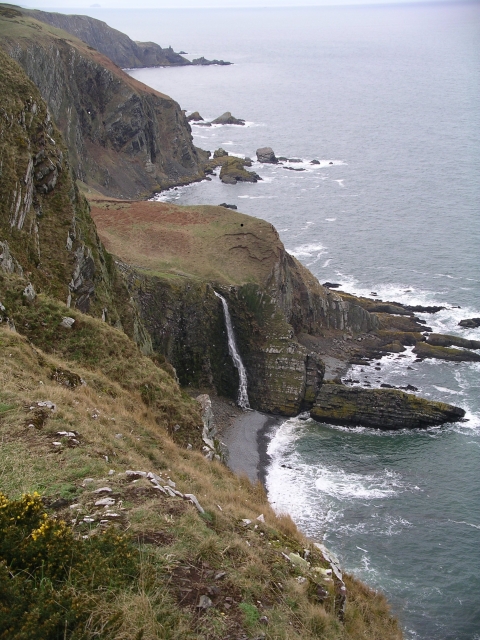
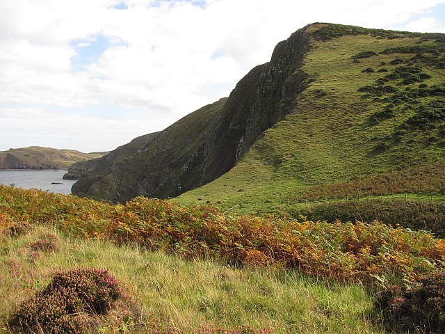
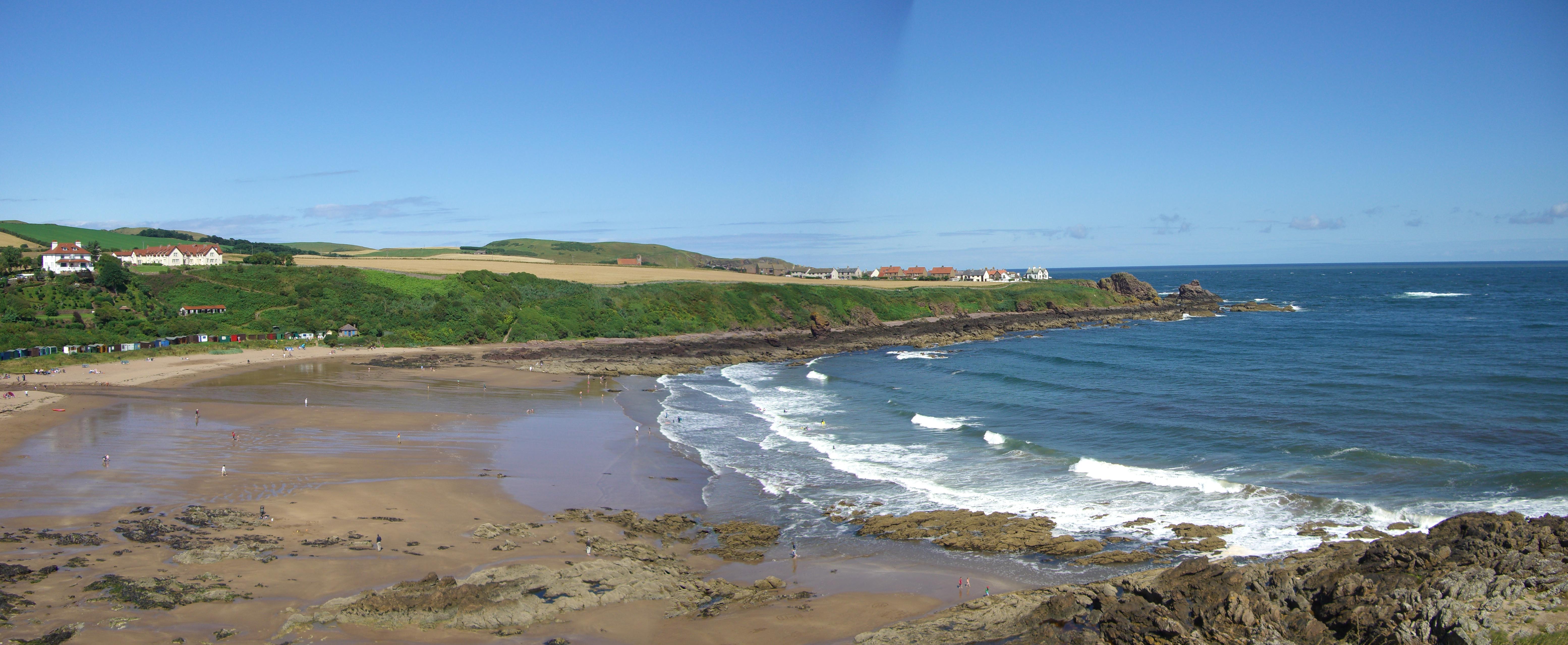
Auld Man o Wick, located in Berwickshire, Scotland, is a prominent feature along the coastal marsh and saltings. This natural formation is highly regarded for its unique geological and ecological features.

The Auld Man o Wick is a rocky outcrop that stands tall on the coast, overlooking the North Sea. Composed of sandstone and conglomerate rock, it has been shaped by the forces of weathering and erosion over millions of years. Its distinctive appearance, resembling a human figure, has earned it the name "Auld Man o Wick" or "Old Man of Wick."

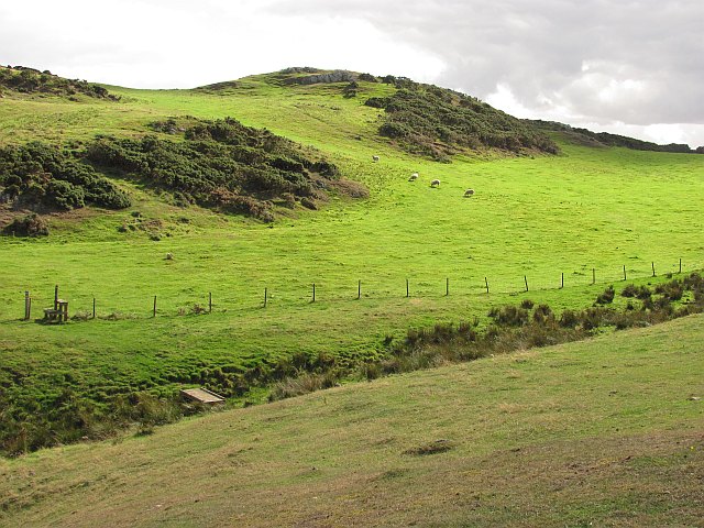
The coastal marsh and saltings surrounding the Auld Man o Wick are an important habitat for a diverse range of plant and animal species. The salt marshes are characterized by their high salinity, which supports the growth of salt-tolerant plants like samphire and sea lavender. These plants provide crucial habitat and food sources for various bird species, including wading birds and waterfowl.

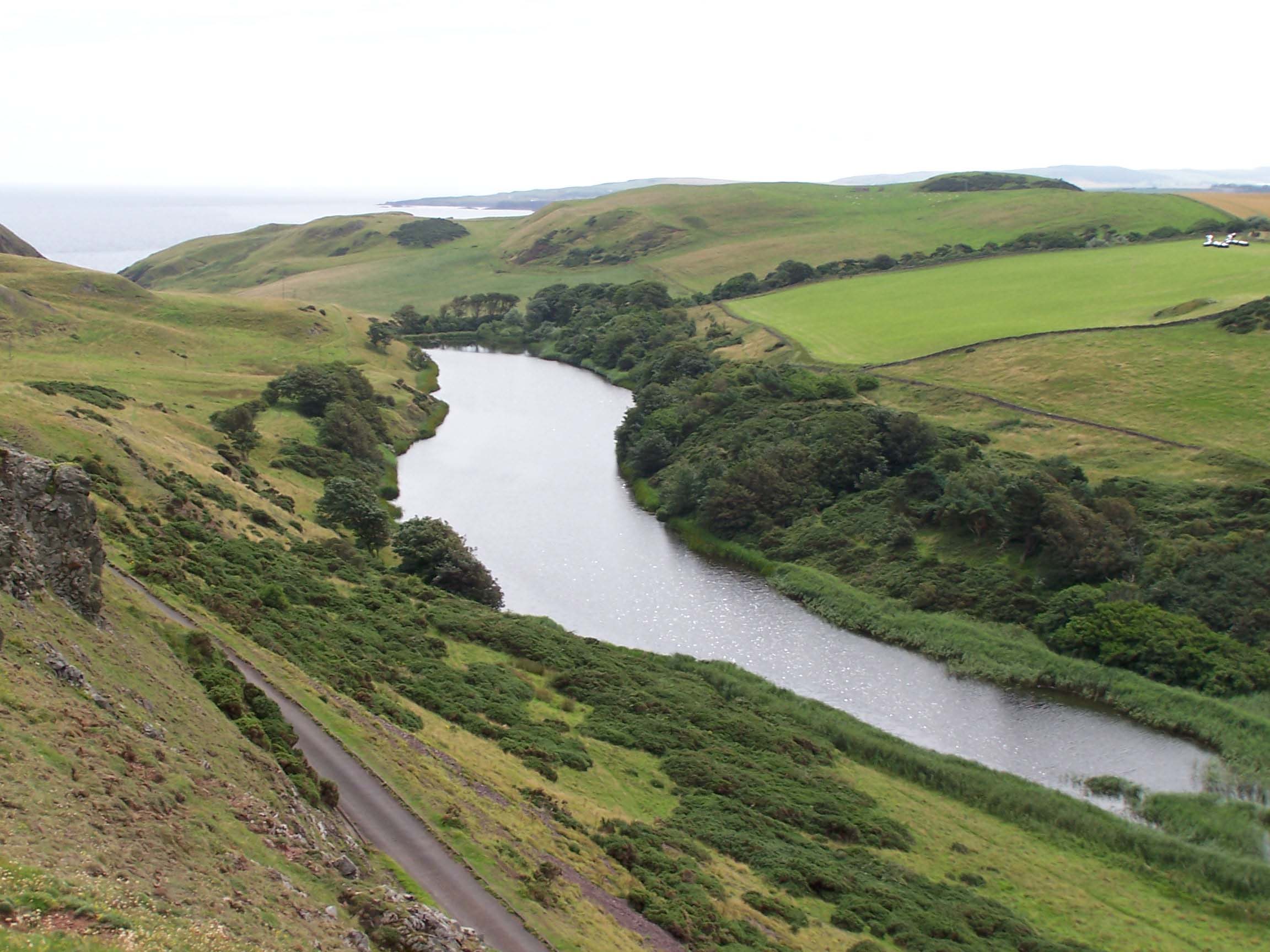
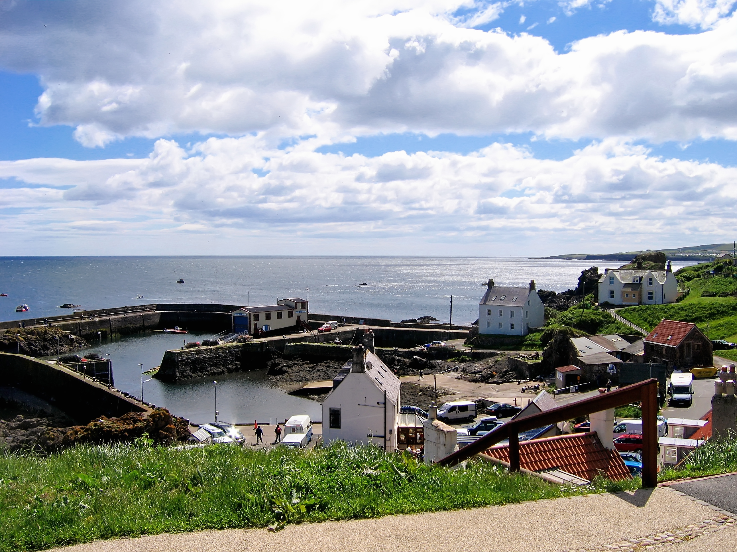
Visitors to Auld Man o Wick can enjoy breathtaking views of the rugged coastline and the North Sea. The area offers opportunities for walking and birdwatching, as well as the chance to explore the fascinating geological features of the rock formations. It is also a popular spot for photographers, who are drawn to the dramatic scenery and the unique silhouette of the Auld Man o Wick.

In conclusion, Auld Man o Wick is a remarkable natural landmark found in Berwickshire, Scotland. Its geological features and diverse ecosystems make it an important site for both nature enthusiasts and those interested in the region's rich history and natural beauty.

If you have any feedback on the listing, please let us know in the comments section below.

Auld Man o Wick Images

Images are sourced within 2km of 55.915362/-2.149625 or Grid Reference NT9069. Thanks to Geograph Open Source API. All images are credited.

Coldingham Loch
Coldingham Loch
Waterfall, Heathery Carr The final leap of the Waterside Dean burn.  Looking WNW from Tun Law
Waterfall, Heathery Carr
The final leap of the Waterside Dean burn. Looking WNW from Tun Law
Gorse hedge near Pilmuir Farm Lining the single track road to Westloch House and Westerside.
Gorse hedge near Pilmuir Farm
Lining the single track road to Westloch House and Westerside.
Road to West Loch From near the entrance to Pilmuir farm.
Road to West Loch
From near the entrance to Pilmuir farm.
Coldingham Loch Panorama Boathouse at Coldingham Loch Summer 2009
Coldingham Loch Panorama
Boathouse at Coldingham Loch Summer 2009
A hill fort near Coldingham Loch To the east-southeast of the loch and with good views to the coast.
A hill fort near Coldingham Loch
To the east-southeast of the loch and with good views to the coast.
On the coastal path near St Abb's Head At the head of Uilystrand Brae looking towards St Abb's Head.
On the coastal path near St Abb's Head
At the head of Uilystrand Brae looking towards St Abb's Head.
Coldingham Loch 2009
Tun Law A steep hill on the Berwickshire coast with a very steep crag falling 140m to the sea. There is the site of a hill fort on the summit.
Tun Law
A steep hill on the Berwickshire coast with a very steep crag falling 140m to the sea. There is the site of a hill fort on the summit.
Tun Law The summit area on the edge of the long drop to the sea. St Abb's Head beyond. This is within the ramparts of a hill fort.hi
Tun Law
The summit area on the edge of the long drop to the sea. St Abb's Head beyond. This is within the ramparts of a hill fort.hi
Sea cliffs, Tun Law View to seaward from Tun Law.
Sea cliffs, Tun Law
View to seaward from Tun Law.
Berwickshire coast path The clifftops where the outlet burn from Coldingham Loch flows steeply to the sea.
Berwickshire coast path
The clifftops where the outlet burn from Coldingham Loch flows steeply to the sea.
Burn draining Coldingham Loch A small burn leads from the loch to a steep plunge off the sea cliffs. The bridge is for the Berwickshire Coast Path.
Burn draining Coldingham Loch
A small burn leads from the loch to a steep plunge off the sea cliffs. The bridge is for the Berwickshire Coast Path.
Wave cut platform Typical of the rock formations at the foot of the crags north of St Abb's Head.
Wave cut platform
Typical of the rock formations at the foot of the crags north of St Abb's Head.
Earthworks, Tun Law A hill fort at the edge of steep crags.
Earthworks, Tun Law
A hill fort at the edge of steep crags.
Tun Law Earthworks of the summit hill fort.
Tun Law
Earthworks of the summit hill fort.
Tun Law Crags falling from Tun Law. Steeper than usual for this coastline.
Tun Law
Crags falling from Tun Law. Steeper than usual for this coastline.
Berwickshire Coast Path A spectacular section along steep and high crags with a wild feel. View towards St Abb's Head.
Berwickshire Coast Path
A spectacular section along steep and high crags with a wild feel. View towards St Abb's Head.
Show me another place!

Auld Man o Wick is located at Grid Ref: NT9069 (Lat: 55.915362, Lng: -2.149625)

Unitary Authority: The Scottish Borders

Police Authority: The Lothians and Scottish Borders

What 3 Words

///unsigned.respond.dustbin. Near Eyemouth, Scottish Borders

Related Wikis

St Abb's Head Lighthouse

St Abb's Head Lighthouse stands on the cliffs at the rocky promontory of St Abb's Head, near the village of St Abbs in Berwickshire. A signal station was...

St Abb's Head

St Abb's Head is a rocky promontory by the village of St Abbs in Scottish Borders, Scotland, and a national nature reserve administered by the National...
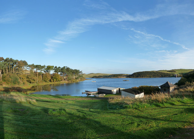
Mire Loch

Mire Loch is a man made freshwater loch situated on St Abb's Head in the Scottish Borders, just over a kilometre NW of the village of St. Abbs at grid...

Coldingham Loch

Coldingham Loch is a freshwater loch in the parish of Coldingham, in the Scottish Borders area of Scotland, in the former Berwickshire, between Coldingham...

St. Abbs and Eyemouth Voluntary Marine Reserve

St. Abbs and Eyemouth Voluntary Marine Reserve is a Voluntary Marine Reserve—the first established in the United Kingdom. Located in the Scottish Borders...

St Abbs Lifeboat Station

St Abbs Lifeboat is an independent marine-rescue facility in St Abbs, Berwickshire, Scotland. == Independent lifeboat == St Abbs Lifeboat is run as an...

St Abbs

St Abbs is a small fishing village on the southeastern coast of Scotland, within the Coldingham parish of Scottish Borders. The village was originally...

Coldingham Bay

Coldingham Bay is an inlet in the North Sea coast, just over three kilometres north of the town of Eyemouth in the Scottish Borders area of Scotland. It...

Nearby Amenities

Located within 500m of 55.915362,-2.149625
Broadhaven Bay
Natural: bay
Lat/Long: 55.9145444/-2.1526571
West in Thirle Bay
Natural: bay
Lat/Long: 55.9151937/-2.1566911
Ele: 94
Natural: peak
Lat/Long: 55.915475/-2.1418028
Barrier: cattle_grid
Lat/Long: 55.9140128/-2.1485269
Information: board
Tourism: information
Lat/Long: 55.9155039/-2.1418176
Pettico Wick Harbour
Natural: bay
Lat/Long: 55.9151258/-2.150024
Skelly Hole
Place: locality
Lat/Long: 55.9187317/-2.1494021
Hpes Heugh Nunnery Point
Place: locality
Lat/Long: 55.9180865/-2.1437751
Barrier: stile
Stile: ladder
Lat/Long: 55.9130629/-2.1557081
Barrier: stile
Stile: stepover
Lat/Long: 55.9132479/-2.1560177
Barrier: kissing_gate
Foot: yes
Lat/Long: 55.9139984/-2.1485714
The data included in this document is from www.openstreetmap.org. The data is made available under ODbL.

Have you been to Auld Man o Wick?

Leave your review of Auld Man o Wick below (or comments, questions and feedback).