Flaess

Coastal Feature, Headland, Point in Shetland

Scotland

Flaess

Ness of Cullivoe from the sea
Ness of Cullivoe from the sea Credit: Mike Pennington

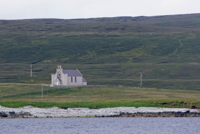
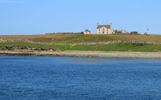
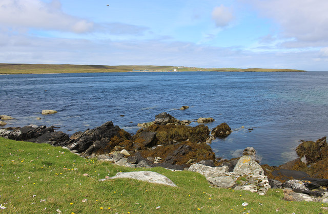
Flaess is a picturesque coastal feature located in the Shetland Islands, an archipelago in the northernmost part of Scotland. It is a prominent headland that juts out into the North Sea, offering stunning panoramic views of the surrounding landscape.

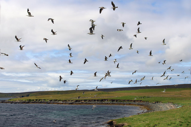
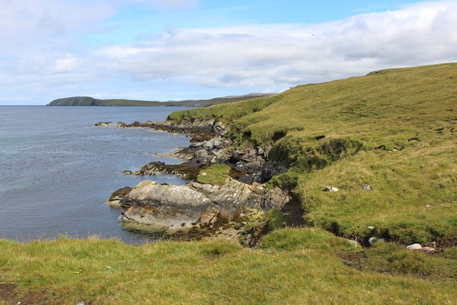
The rugged cliffs of Flaess are composed mainly of sandstone, which has been shaped and eroded over time by the relentless power of the ocean waves. The headland rises steeply from the sea, reaching an impressive height of around 100 meters (330 feet) at its highest point. This elevation provides an ideal vantage point for observing the vast expanse of the sea, as well as the diverse birdlife that is abundant in the area.

One of the defining features of Flaess is its distinctive, jagged coastline. The headland is characterized by numerous small inlets, caves, and rocky outcrops, which have been carved out by the relentless action of the waves. These formations not only add to the visual appeal of Flaess but also provide a habitat for various marine species.

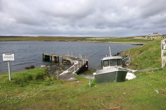
Access to Flaess is possible via a well-maintained footpath that winds its way along the cliff edge. This path offers visitors an opportunity to explore the headland and its surroundings, while also ensuring their safety. The area is popular among hikers, nature enthusiasts, and photographers who are drawn to Flaess for its natural beauty and tranquil atmosphere.

Overall, Flaess is a captivating coastal feature that showcases the raw power of nature and the stunning vistas that can be found in the remote and breathtaking Shetland Islands.

If you have any feedback on the listing, please let us know in the comments section below.

Flaess Images

Images are sourced within 2km of 60.701246/-0.97117989 or Grid Reference HP5602. Thanks to Geograph Open Source API. All images are credited.

Ness of Cullivoe from the sea
Lamba Stack, Blue Mull, from the sea
Cullivoe Kirk from the sea
Geo south of Lamba Stack, Blue Mull
Belmont, Unst This was taken from the Gutcher-Belmont ferry as we come into port at Belmont, Unst, Shetland. We are on the Wick of Belmont and this is Belmont House, a category A-listed Georgian country house which was built in 1775 by Shetland landowner Thomas Mouat of Garth. Restored to its former glory between 1996 and 2010, it is now a private residence though it has been let out occasionally as a venue for cultural events and B&B accommodation.
Belmont, Unst
This was taken from the Gutcher-Belmont ferry as we come into port at Belmont, Unst, Shetland. We are on the Wick of Belmont and this is Belmont House, a category A-listed Georgian country house which was built in 1775 by Shetland landowner Thomas Mouat of Garth. Restored to its former glory between 1996 and 2010, it is now a private residence though it has been let out occasionally as a venue for cultural events and B&B accommodation.
St Olaf's Kirk, Lund I am standing beside the ruins of St Olaf's Kirk at Lund, Unst, Shetland, and looking across Lunda Wick towards the site of Norse ruins (a farmstead and a broch) at Underhoull.
St Olaf's Kirk, Lund
I am standing beside the ruins of St Olaf's Kirk at Lund, Unst, Shetland, and looking across Lunda Wick towards the site of Norse ruins (a farmstead and a broch) at Underhoull.
St Olaf's Kirk, Lund (interior) The ruins of St Olaf's Kirk, Lund, Unst, Shetland, built in the Celtic style and dating back to the C12th.
St Olaf's Kirk, Lund (interior)
The ruins of St Olaf's Kirk, Lund, Unst, Shetland, built in the Celtic style and dating back to the C12th.
Gulls, Wick of Belmont A stony bay next to the ferry terminal.
Gulls, Wick of Belmont
A stony bay next to the ferry terminal.
Unsafe Pier, Belmont This old pier is now a bit crumbly, which is what the warning sign is about.
Unsafe Pier, Belmont
This old pier is now a bit crumbly, which is what the warning sign is about.
Bales at Belmont
Bales at Belmont
Doogers and Bluemull Sound Looking over the Sound to Cullivoe on Yell in the distance.
Doogers is written on the map here. I'm guessing it's these rocks.
Doogers and Bluemull Sound
Looking over the Sound to Cullivoe on Yell in the distance. Doogers is written on the map here. I'm guessing it's these rocks.
Coast near Belmont HP5501 is 90% sea. This shot shows a large part of what land there is.
Coast near Belmont
HP5501 is 90% sea. This shot shows a large part of what land there is.
Chains on the Dockside Piles of chain in the yard at Cullivoe Pier.
Chains on the Dockside
Piles of chain in the yard at Cullivoe Pier.
Cullivoe Church Beside the road down to the pier.
Cullivoe Church
Beside the road down to the pier.
View from Braeside An abandoned homestead overlooking Bluemull Sound.
View from Braeside
An abandoned homestead overlooking Bluemull Sound.
Creeping Thistle (Cirsium arvense), Lund St Olaf's Church in the background.
Creeping Thistle (Cirsium arvense), Lund
St Olaf's Church in the background.
Silage-making at Lund
Norie, one of the Unstfest puffins, Lund Unstfest takes place in July and is the most northerly festival in Britain, growing bigger and attracting more visitors every year. This year, 12 carved puffins were placed around the islands, with clues given to their location. There was a competition to be entered by taking photos of all 12. This position was checked by GPS.
Norie, one of the Unstfest puffins, Lund
Unstfest takes place in July and is the most northerly festival in Britain, growing bigger and attracting more visitors every year. This year, 12 carved puffins were placed around the islands, with clues given to their location. There was a competition to be entered by taking photos of all 12. This position was checked by GPS.
Show me another place!

Flaess is located at Grid Ref: HP5602 (Lat: 60.701246, Lng: -0.97117989)

Unitary Authority: Shetland Islands

Police Authority: Highlands and Islands

What 3 Words

///winemaker.nerve.glows. Near Uyeasound, Shetland Islands

Related Wikis

Belmont House, Shetland

Belmont House is a neo classical Georgian Country House Estate on the island of Unst, the most northerly of the Shetland Islands, [United Kingdom] and...

St Olaf's Church, Unst

St Olaf's Church, Unst is a ruined medieval church located on the island of Unst, in Shetland, Scotland, UK. The church was built in the Celtic style,...

Belmont, Shetland

Belmont is a settlement and ferry terminal in southern Unst in the Shetland Islands. The ferry crosses from here to Gutcher in Yell and to Hamars Ness...

Cullivoe

Cullivoe (Old Norse: Kollavágr - Bay of Kolli), is a village on Yell in the Shetland Islands. It is in the north east of the island, near Bluemull Sound...

Bluemull Sound

Bluemull Sound is the strait between Unst and Yell in Shetland's North Isles. A ferry service crosses it regularly. Cullivoe is on the Yell side, and the...

Uyeasound

Uyeasound is a village on the Isle of Unst, the northernmost island of the Shetland Islands, Scotland. It takes its name from the neighbouring strait of...

Brough Holm

Brough Holm is a small island off Unst, in the North Isles of Shetland. It is off Westing, which as the name implies is on the west coast of Unst. The...

Gutcher

Gutcher is a settlement on the northeast coast of Yell in the Shetland islands. From here, rollon/roll off ferry services to Belmont on Unst and Hamars...

Have you been to Flaess?

Leave your review of Flaess below (or comments, questions and feedback).