Blo Geo

Coastal Feature, Headland, Point in Shetland

Scotland

Blo Geo

Loch of Vatsetter As is very common in Shetland, this freshwater loch is narrowly separated from an arm of the sea by a shingle bar.
Loch of Vatsetter Credit: Oliver Dixon

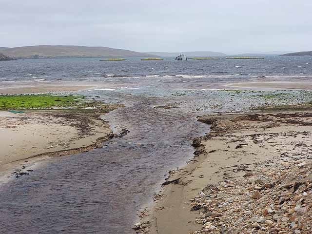
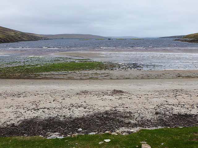
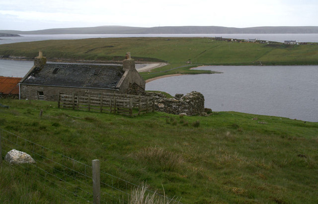
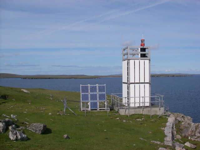
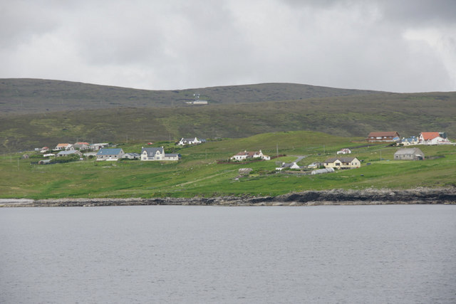
Blo Geo is a prominent coastal feature located on the Shetland Islands, which are part of Scotland. It is specifically categorized as a headland, or a promontory that extends into the sea. Situated on the western coast of the Shetland Mainland, Blo Geo offers stunning views of the surrounding landscape and the North Atlantic Ocean.

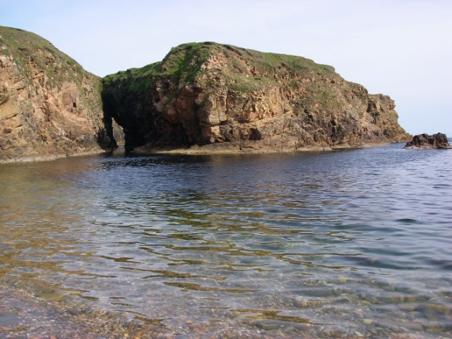
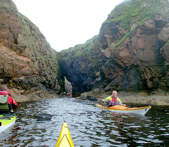
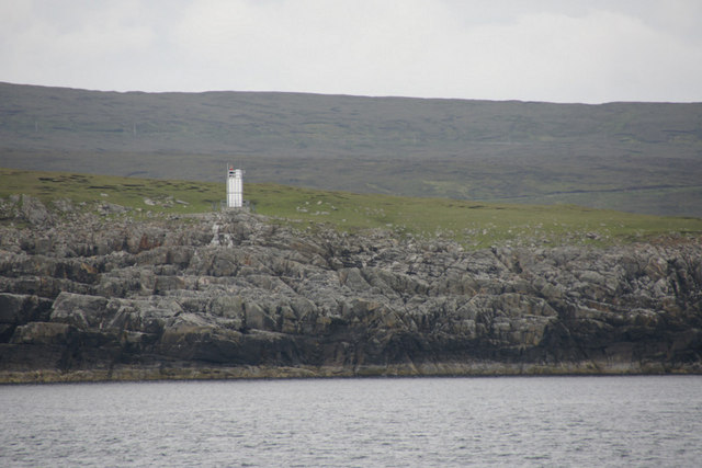
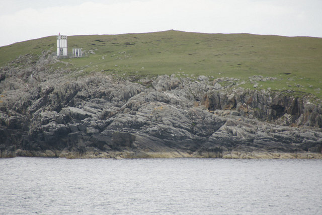
The headland is characterized by its rugged terrain and steep cliffs that rise dramatically from the sea. The cliffs are composed of sedimentary rocks, showcasing layers of different colors and textures. This geological formation provides a glimpse into the ancient history of the area.

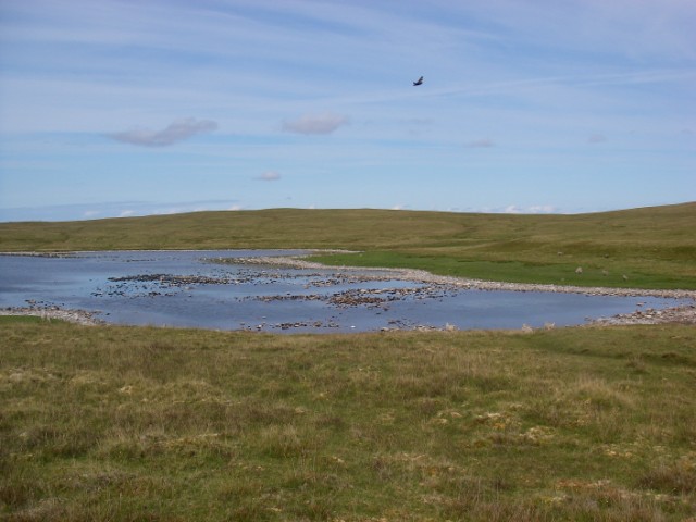
At the base of the headland, there is a small sheltered bay, or a point, which is also known as Blo Geo. The bay features a pebble beach that is accessible during low tide. The beach is often dotted with interesting rock formations, providing opportunities for exploration and discovery. It is a popular spot for beachcombing and fossil hunting.

The area surrounding Blo Geo is abundant in wildlife, making it a haven for birdwatchers and nature enthusiasts. Various species of seabirds, such as puffins, guillemots, and fulmars, can be spotted nesting on the cliffs. Seals and otters are also known to frequent the waters around the headland.

Blo Geo is easily accessible by road, with a nearby car park providing convenient parking for visitors. The headland offers a peaceful escape amidst the rugged beauty of the Shetland Islands, making it a must-visit destination for those seeking tranquility and natural wonders.

If you have any feedback on the listing, please let us know in the comments section below.

Blo Geo Images

Images are sourced within 2km of 60.576287/-1.0044044 or Grid Reference HU5488. Thanks to Geograph Open Source API. All images are credited.

Loch of Vatsetter As is very common in Shetland, this freshwater loch is narrowly separated from an arm of the sea by a shingle bar.
Loch of Vatsetter
As is very common in Shetland, this freshwater loch is narrowly separated from an arm of the sea by a shingle bar.
Wick of Vatsetter With fish farm. The stream in the foreground drains the Loch of Vatsetter which is narrowly separated from the sea by a shingle bar.
Wick of Vatsetter
With fish farm. The stream in the foreground drains the Loch of Vatsetter which is narrowly separated from the sea by a shingle bar.
Beach at the head of the Wick of Vatsetter With fish farms.
Beach at the head of the Wick of Vatsetter
With fish farms.
Roofless building With the Loch (and beyond it the Wick) of Vatsetter in the distance.
Roofless building
With the Loch (and beyond it the Wick) of Vatsetter in the distance.
Loch of Vatsetter A ruined croft above the Loch of Vatsetter, with the narrow ayre separating the loch from the sea just visible beyond.
Loch of Vatsetter
A ruined croft above the Loch of Vatsetter, with the narrow ayre separating the loch from the sea just visible beyond.
Vatsetter Pronounced 'Vatster'; a small group of houses above the loch. Fetlar is in the distance.
Vatsetter
Pronounced 'Vatster'; a small group of houses above the loch. Fetlar is in the distance.
Wreck near Rana The low-lying island of Hascosay is seen across South Sound.
Wreck near Rana
The low-lying island of Hascosay is seen across South Sound.
Ruin at Whitehill An unroofed house standing alone in the landscape - a common sight in Shetland.
Ruin at Whitehill
An unroofed house standing alone in the landscape - a common sight in Shetland.
Whitehill Lighthouse This low light stands about 70ft above the sea and looks north to Hascosay and east to Fetlar.
Whitehill Lighthouse
This low light stands about 70ft above the sea and looks north to Hascosay and east to Fetlar.
Loch of Birrier A dry summer had resulted in a relatively low water level in this shallow loch below the gentle slopes of the White Hill of Vatsetter (to east/right). It was populated by large numbers of birds.
Loch of Birrier
A dry summer had resulted in a relatively low water level in this shallow loch below the gentle slopes of the White Hill of Vatsetter (to east/right). It was populated by large numbers of birds.
Birrier from the bay This broad stack of psammitic rock is linked to mainland Yell by a narrow arch, over which sheep cross to graze its flat top.
Birrier from the bay
This broad stack of psammitic rock is linked to mainland Yell by a narrow arch, over which sheep cross to graze its flat top.
Salt Wick and Vatsetter This north-east facing bay is backed by a beach of shingle and cobbles.
Salt Wick and Vatsetter
This north-east facing bay is backed by a beach of shingle and cobbles.
Sea Cave at Birrier The small island is joined to the mainland of Yell by a narrow strip of grass over this sea cave which is an obvious through-route for passing sea kayakers exploring this exciting stretch of coast.
Sea Cave at Birrier
The small island is joined to the mainland of Yell by a narrow strip of grass over this sea cave which is an obvious through-route for passing sea kayakers exploring this exciting stretch of coast.
North Aywick from the sea
Whitehill Lighthouse, Vatsetter
Gamla and Whitehill Lighthouse, Vatsetter
Rana, Vatsetter Low headland east of Salt Wick.
Rana, Vatsetter
Low headland east of Salt Wick.
Fish farm in Wick of Vatsetter
Show me another place!

Blo Geo is located at Grid Ref: HU5488 (Lat: 60.576287, Lng: -1.0044044)

Unitary Authority: Shetland Islands

Police Authority: Highlands and Islands

What 3 Words

///annual.strictest.treatment. Near Houbie, Shetland Islands

Related Wikis

Aywick

Aywick is a small settlement on the east side of Yell, an island forming part of the Shetland Islands north of Scotland.The naturalist Bobby Tulloch was...

Otterswick

Otterswick is a hamlet on the island of Yell in the Shetland Islands, on the inlet of Otters Wick. It is on the east side of the island. There is also...

Mid Yell

Mid Yell is a coastal settlement on the island of Yell, the second largest of Shetland Islands, Scotland. Mid Yell, the largest settlement on the island...

Hascosay

Hascosay (Scots: Hascosay; Old Norse "Hafskotsey") is a small island lying between Yell and Fetlar in the Shetland Islands, Scotland. == Geography and... ==

Brough Lodge

Brough Lodge is a 19th-century Gothic mansion on Fetlar, one of the Shetland Islands, in northern Scotland. Built by the Nicolson family, who were responsible...

Gossabrough

Gossabrough is a coastal hamlet, wick and ness on the southeast side of the island of Yell, Shetland, Scotland. The Wick of Gossabrough lies between the...

Basta, Shetland

Basta is a hamlet on the island of Yell in the Shetland islands of Scotland. It is on the shores of Basta Voe and is in the parish of Yell. == References... ==

Hamars Ness

Hamars Ness is a headland on the island of Fetlar in Shetland, Scotland. The name is from the Old Norse Hamarsnes meaning "craggy headland". A ro-ro ferry...

Nearby Amenities

Located within 500m of 60.576287,-1.0044044
Seamark Light 1 Character: Fl
Seamark Light 1 Colour: white
Seamark Light 1 Height: 24
Seamark Light 1 Period: 3
Seamark Light 1 Range: 9
Seamark Light 1 Sector End: 163
Seamark Light 1 Sector Start: 100
Seamark Light 1 Sequence: 1+(2)
Seamark Light 2 Character: Fl
Seamark Light 2 Colour: red
Seamark Light 2 Height: 24
Seamark Light 2 Period: 3
Seamark Light 2 Range: 6
Seamark Light 2 Sector End: 211
Seamark Light 2 Sector Start: 163
Seamark Light 2 Sequence: 1+(2)
Seamark Light 3 Character: Fl
Seamark Light 3 Colour: white
Seamark Light 3 Height: 24
Seamark Light 3 Period: 3
Seamark Light 3 Range: 9
Seamark Light 3 Sector End: 349
Seamark Light 3 Sector Start: 211
Seamark Light 3 Sequence: 1+(2)
Seamark Light 4 Character: Fl
Seamark Light 4 Colour: red
Seamark Light 4 Height: 24
Seamark Light 4 Period: 3
Seamark Light 4 Range: 6
Seamark Light 4 Sector End: 0
Seamark Light 4 Sector Start: 349
Seamark Light 4 Sequence: 1+(2)
Seamark Light Reference: A 3824
Seamark Name: Whitehill
Seamark Type: light_major
Source: US NGA Pub. 114. 2011-05-26.
Lat/Long: 60.5799647/-1.0036018
The data included in this document is from www.openstreetmap.org. The data is made available under ODbL.

Have you been to Blo Geo?

Leave your review of Blo Geo below (or comments, questions and feedback).