Blee Geo

Coastal Feature, Headland, Point in Shetland

Scotland

Blee Geo

Gloup Holm from Valla Field The holm is on the right, with the mainland of Yell to the left.
Gloup Holm from Valla Field Credit: Mike Pennington

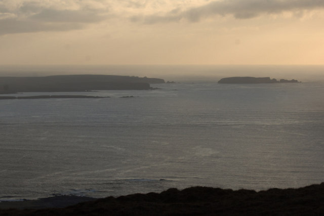
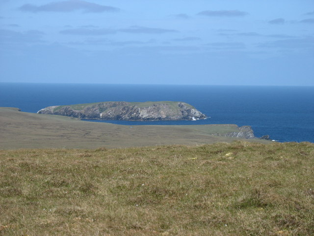
Blee Geo is a prominent coastal feature located on the island of Shetland, which is part of Scotland in the United Kingdom. Specifically, it is situated on the southern coast of Shetland, near the village of Scalloway. Blee Geo can be classified as a headland or a point, depending on how it is defined.

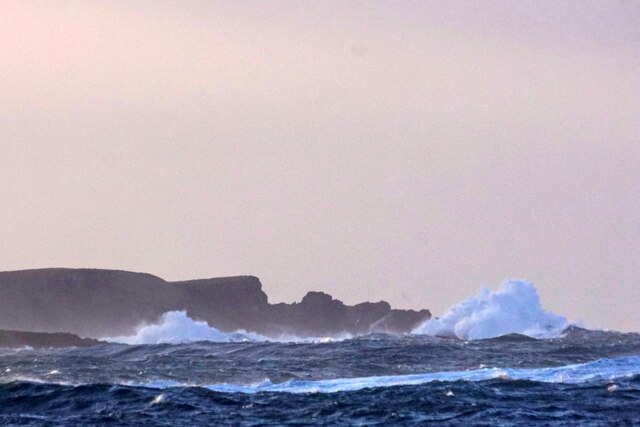
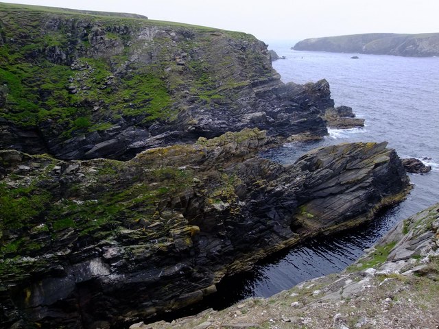
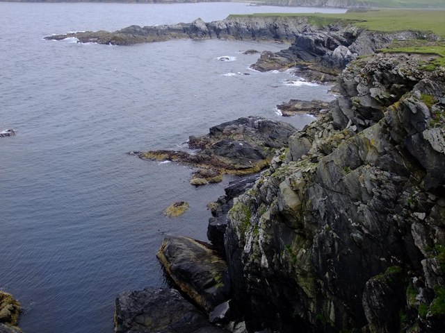
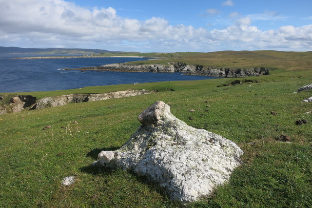
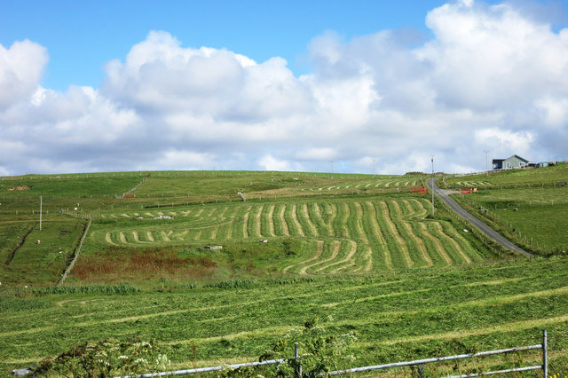
This coastal feature is characterized by its rugged and rocky terrain, with high cliffs that jut out into the North Sea. The cliffs at Blee Geo provide a dramatic backdrop to the surrounding landscape, offering stunning panoramic views of the sea and the nearby islands.

The geology of Blee Geo is primarily composed of sedimentary rocks, including sandstone and shale. Over time, the relentless erosion caused by the crashing waves has shaped the cliffs into their current form, creating unique rock formations and caves.

The area surrounding Blee Geo is also known for its rich biodiversity. The coastal waters are home to a variety of marine life, including seals, dolphins, and various species of seabirds. The cliffs themselves provide nesting sites for seabird colonies, such as puffins, guillemots, and kittiwakes.

Blee Geo is a popular spot for outdoor enthusiasts and nature lovers, who visit to enjoy the scenic beauty and wildlife. Visitors can explore the area on foot, taking in the breathtaking views from the cliff tops or venturing down to the shoreline to observe the marine life. However, caution should be exercised due to the steep and uneven terrain.

Overall, Blee Geo is a captivating coastal feature on the island of Shetland, offering a glimpse into the region's natural beauty, geology, and diverse wildlife.

If you have any feedback on the listing, please let us know in the comments section below.

Blee Geo Images

Images are sourced within 2km of 60.732221/-1.0757854 or Grid Reference HP5005. Thanks to Geograph Open Source API. All images are credited.

Gloup Holm from Valla Field The holm is on the right, with the mainland of Yell to the left.
Gloup Holm from Valla Field
The holm is on the right, with the mainland of Yell to the left.
Gloup Holm and waves from Westing
Gloup Holm Seen from Scordaback Hill.
Gloup Holm
Seen from Scordaback Hill.
Ruined croft, West-a-Firth In 1867, there were 16 families (nearly 120 folk) crofting in West-a-Firth.  By 1871, after the evictions by factor John Walker, there were only four folk left and the land had been converted to sheep pasture.
Ruined croft, West-a-Firth
In 1867, there were 16 families (nearly 120 folk) crofting in West-a-Firth. By 1871, after the evictions by factor John Walker, there were only four folk left and the land had been converted to sheep pasture.
Bligg  from Thistliba These sheltered geos hold a number of seals.
Bligg from Thistliba
These sheltered geos hold a number of seals.
Stouraba from The Smeid
Red Gates at Gloup The farm here has invested in some red paint and brightened up all their gates.
Red Gates at Gloup
The farm here has invested in some red paint and brightened up all their gates.
On a wall at Gloup This is close to the Fishermen's Memorial.
A load of old metal spheres on top of a wall.
Are they old floats for fishing nets? 
The closest I've seen to this was in Italy where they were ripening pumpkins.
That's not much help really.
On a wall at Gloup
This is close to the Fishermen's Memorial. A load of old metal spheres on top of a wall. Are they old floats for fishing nets? The closest I've seen to this was in Italy where they were ripening pumpkins. That's not much help really.
Fishermen's Memorial Sign The memorial is a short walk from the road.
Hay cutting going on in the background.
Fishermen's Memorial Sign
The memorial is a short walk from the road. Hay cutting going on in the background.
On The Point Of Whack The Point of Whack on Gloup Ness, to be precise.
This is a small promontory off the main headland, with the Geo of Whack on the left.
Am I being over imaginative, or is there something sheep-like about that rock?
On The Point Of Whack
The Point of Whack on Gloup Ness, to be precise. This is a small promontory off the main headland, with the Geo of Whack on the left. Am I being over imaginative, or is there something sheep-like about that rock?
Looking at the view, Gloup Ness The name Gloup comes from Old Norse for a ravine.
Looking at the view, Gloup Ness
The name Gloup comes from Old Norse for a ravine.
Inside the Coastguard Hut This is fairly surreal. 
Inside the flimsy hut tied down with wires shown in <a href="https://www.geograph.org.uk/photo/792324">HP5005 : Coastguard hut</a>, you look through the salt stained windows expecting to see dead flies and old beer cans, and there's himself on the phone in his nice pullover. 
A fine effort from somebody in this out of the way place.
Inside the Coastguard Hut
This is fairly surreal. Inside the flimsy hut tied down with wires shown in HP5005 : Coastguard hut, you look through the salt stained windows expecting to see dead flies and old beer cans, and there's himself on the phone in his nice pullover. A fine effort from somebody in this out of the way place.
Inside the Coastguard Hut Again I was so impressed with this I've done two pictures of the same thing. See also <a href="https://www.geograph.org.uk/photo/4675951">HP5005 : Inside the Coastguard Hut</a>
Inside the Coastguard Hut Again
I was so impressed with this I've done two pictures of the same thing. See also HP5005 : Inside the Coastguard Hut
Gates onto the Beach All the gates on this farm have been painted this cheerful red colour.
This is the Burn and Wick of Whallerie.
Gates onto the Beach
All the gates on this farm have been painted this cheerful red colour. This is the Burn and Wick of Whallerie.
Fields beside Gloup Voe View north west from the Fishermans' Memorial.
Fields beside Gloup Voe
View north west from the Fishermans' Memorial.
Cattle Grid at Gloup
Hay at Gloup A good day for making hay while the sun shines.
Hay at Gloup
A good day for making hay while the sun shines.
More Red Gates The farm at Gloup's bright red gates add colour to an otherwise unremarkable scene.
More Red Gates
The farm at Gloup's bright red gates add colour to an otherwise unremarkable scene.
Show me another place!

Blee Geo is located at Grid Ref: HP5005 (Lat: 60.732221, Lng: -1.0757854)

Unitary Authority: Shetland Islands

Police Authority: Highlands and Islands

What 3 Words

///woke.answers.landowner. Near Gutcher, Shetland Islands

Related Wikis

Gloup

Note: Gloup is common in Scottish placenames referring to a sea jet. Gloup is a village in the far north of the island of Yell in the Shetland Islands...

Gloup Holm

Gloup Holm is an islet in the Shetland Islands, lying to the north of Yell. == Geography and geology == Gloup Holm is near to the part of Yell called North...

Cullivoe

Cullivoe (Old Norse: Kollavágr - Bay of Kolli), is a village on Yell in the Shetland Islands. It is in the north east of the island, near Bluemull Sound...

Brough Holm

Brough Holm is a small island off Unst, in the North Isles of Shetland. It is off Westing, which as the name implies is on the west coast of Unst. The...

St Olaf's Church, Unst

St Olaf's Church, Unst is a ruined medieval church located on the island of Unst, in Shetland, Scotland, UK. The church was built in the Celtic style,...

Society of Our Lady of the Isles

The Society of Our Lady of the Isles (SOLI) is a small Anglican religious order for women, founded in the late 20th century. It is located in Shetland...

Bluemull Sound

Bluemull Sound is the strait between Unst and Yell in Shetland's North Isles. A ferry service crosses it regularly. Cullivoe is on the Yell side, and the...

Belmont House, Shetland

Belmont House is a neo classical Georgian Country House Estate on the island of Unst, the most northerly of the Shetland Islands, [United Kingdom] and...

Nearby Amenities

Located within 500m of 60.732221,-1.0757854
Bench
Backrest: no
Seats: 2
Lat/Long: 60.7311507/-1.0736103
Bench
Backrest: no
Lat/Long: 60.7308039/-1.0746047
Artwork Type: sculpture
Tourism: artwork
Lat/Long: 60.7307539/-1.0746317
Wick of Trutis
Natural: bay
Source: OS Open Names
Lat/Long: 60.7310995/-1.0668862
The data included in this document is from www.openstreetmap.org. The data is made available under ODbL.

Have you been to Blee Geo?

Leave your review of Blee Geo below (or comments, questions and feedback).