Balti Geos

Coastal Feature, Headland, Point in Shetland

Scotland

Balti Geos

Ukinsetter, Fladdabister, from the air
Ukinsetter, Fladdabister, from the air Credit: Mike Pennington

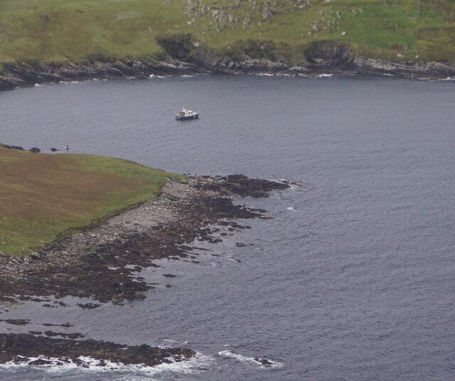
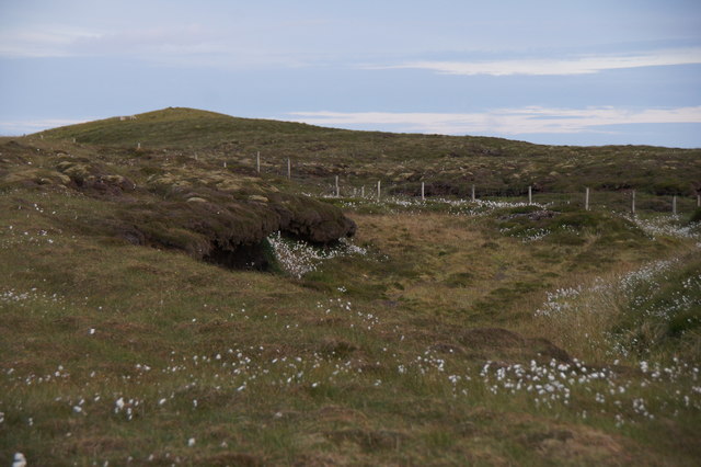
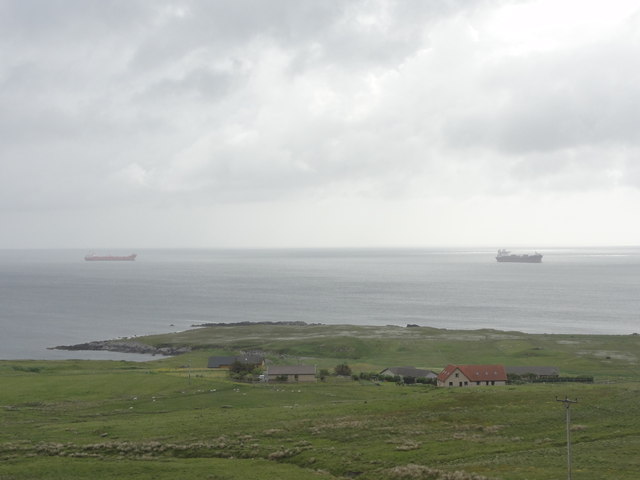
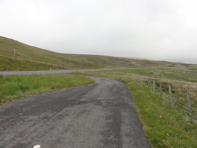
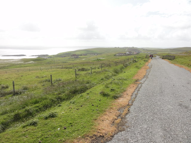
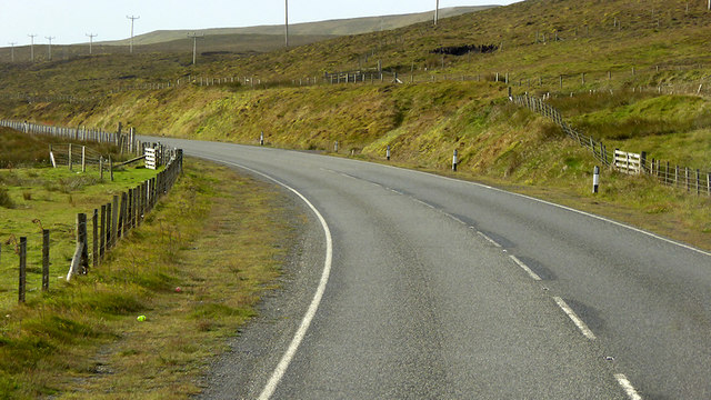
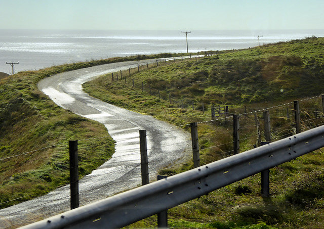
Balti Geos is a prominent coastal feature located in Shetland, Scotland. It is a rugged headland that juts out into the North Sea, forming a distinctive point along the coastline. This geological formation is characterized by its steep cliffs, rocky terrain, and the presence of several sea caves.

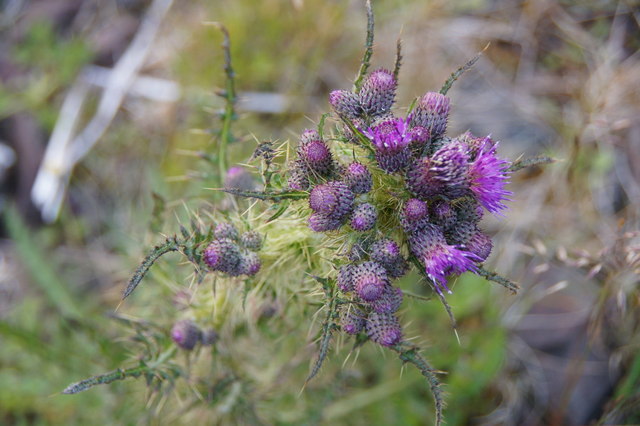
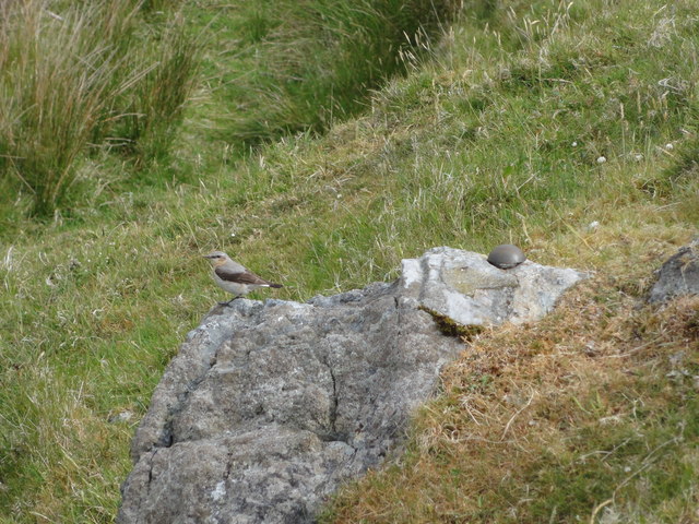
The headland is composed of layers of sedimentary rock, primarily sandstone and shale. These rocks have been shaped by the relentless force of the sea, resulting in the formation of dramatic cliffs that reach heights of up to 60 meters in some areas. The cliffs provide nesting sites for various seabird species, including puffins, guillemots, and fulmars, making it a popular spot for birdwatchers.

Balti Geos is also known for its sea caves, which have been carved out by the constant pounding of waves. These caves provide shelter for seals and other marine life, and they can be explored by experienced divers during low tide. The largest and most well-known cave is known as the "Balti Geo Cave," which is approximately 100 meters long and features an impressive vaulted ceiling.

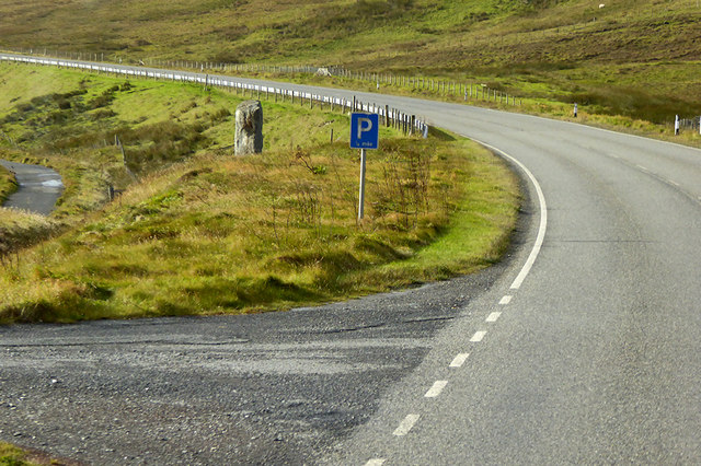
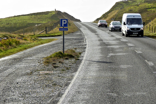
Visitors to Balti Geos can enjoy breathtaking views of the surrounding coastal landscape, with its rugged cliffs, crashing waves, and abundant birdlife. The headland is accessible via a coastal path that runs along the cliff edge, offering opportunities for hiking and photography. Additionally, the area is part of the Shetland Nature Reserve, ensuring its protection and preservation for future generations to enjoy.

If you have any feedback on the listing, please let us know in the comments section below.

Balti Geos Images

Images are sourced within 2km of 60.080699/-1.2114167 or Grid Reference HU4333. Thanks to Geograph Open Source API. All images are credited.

Ukinsetter, Fladdabister, from the air
Bay of Fladdabister from the air
Quarff Leog between Quarff and Fladdabister
Marsh Thistle (Cirsium palustre), Quarff The densely packed flowerheads, and tallness, help distinguish this from other thistles.
Marsh Thistle (Cirsium palustre), Quarff
The densely packed flowerheads, and tallness, help distinguish this from other thistles.
Bay of Fladdabister Bay of Fladdabister with cargo ships passing the coastline
Bay of Fladdabister
Bay of Fladdabister with cargo ships passing the coastline
A970 Road A970 road with a lay-by formed out of the old single lane road.
A970 Road
A970 road with a lay-by formed out of the old single lane road.
Abandoned road near Fladdabister Old road no longer used near Fladdabister
Abandoned road near Fladdabister
Old road no longer used near Fladdabister
New OSBM Bolt Ordnance Survey benchmark bolt, described as: NEW OSBM BOLT ROCK 12.3M NE SIDE RD 5.1M SE C STR (67.718m above Lerwick datum, 2nd order, new 1978).
New OSBM Bolt
Ordnance Survey benchmark bolt, described as: NEW OSBM BOLT ROCK 12.3M NE SIDE RD 5.1M SE C STR (67.718m above Lerwick datum, 2nd order, new 1978).
A970 between Quarff and Fladdabister The A970 runs for 71 miles across most of the length of the "Mainland" in the Shetland Islands. It is a good-quality single-carriageway road for most of its route. Travelling from south to north, the road begins at Grutness near Sumburgh Airport and winds around the many hills and inlets passing close to a number of small villages without going through any large ones before Lerwick. After looping around Lerwick, a short spur runs to Scalloway whilst the main route continues northwards towards Brae where it crosses the narrow isthmus of Mavis Grind. At Sandy Lochs the road splits and a four-mile spur goes through Urafirth to Hillswick. The main route continuing to the right towards its northern terminus at Isbister. This last part of the route tends to be narrower with passing places.

<span class="nowrap"><a title="https://www.sabre-roads.org.uk/wiki/index.php?title=A970" rel="nofollow ugc noopener" href="https://www.sabre-roads.org.uk/wiki/index.php?title=A970">Link</a><img style="margin-left:2px;" alt="External link" title="External link - shift click to open in new window" src="https://s1.geograph.org.uk/img/external.png" width="10" height="10"/></span>  SABRE
A970 between Quarff and Fladdabister
The A970 runs for 71 miles across most of the length of the "Mainland" in the Shetland Islands. It is a good-quality single-carriageway road for most of its route. Travelling from south to north, the road begins at Grutness near Sumburgh Airport and winds around the many hills and inlets passing close to a number of small villages without going through any large ones before Lerwick. After looping around Lerwick, a short spur runs to Scalloway whilst the main route continues northwards towards Brae where it crosses the narrow isthmus of Mavis Grind. At Sandy Lochs the road splits and a four-mile spur goes through Urafirth to Hillswick. The main route continuing to the right towards its northern terminus at Isbister. This last part of the route tends to be narrower with passing places. LinkExternal link SABRE
A970 near to Fladdabister The A970 runs for 71 miles across most of the length of the "Mainland" in the Shetland Islands. It is a good-quality single-carriageway road for most of its route. Travelling from south to north, the road begins at Grutness near Sumburgh Airport and winds around the many hills and inlets passing close to a number of small villages without going through any large ones before Lerwick. After looping around Lerwick, a short spur runs to Scalloway whilst the main route continues northwards towards Brae where it crosses the narrow isthmus of Mavis Grind. At Sandy Lochs the road splits and a four-mile spur goes through Urafirth to Hillswick. The main route continuing to the right towards its northern terminus at Isbister. This last part of the route tends to be narrower with passing places.

<span class="nowrap"><a title="https://www.sabre-roads.org.uk/wiki/index.php?title=A970" rel="nofollow ugc noopener" href="https://www.sabre-roads.org.uk/wiki/index.php?title=A970">Link</a><img style="margin-left:2px;" alt="External link" title="External link - shift click to open in new window" src="https://s1.geograph.org.uk/img/external.png" width="10" height="10"/></span>  SABRE
A970 near to Fladdabister
The A970 runs for 71 miles across most of the length of the "Mainland" in the Shetland Islands. It is a good-quality single-carriageway road for most of its route. Travelling from south to north, the road begins at Grutness near Sumburgh Airport and winds around the many hills and inlets passing close to a number of small villages without going through any large ones before Lerwick. After looping around Lerwick, a short spur runs to Scalloway whilst the main route continues northwards towards Brae where it crosses the narrow isthmus of Mavis Grind. At Sandy Lochs the road splits and a four-mile spur goes through Urafirth to Hillswick. The main route continuing to the right towards its northern terminus at Isbister. This last part of the route tends to be narrower with passing places. LinkExternal link SABRE
Parking Place and Viewpoint, A970 near to Ocraquoy The A970 runs for 71 miles across most of the length of the "Mainland" in the Shetland Islands. It is a good-quality single-carriageway road for most of its route. Travelling from south to north, the road begins at Grutness near Sumburgh Airport and winds around the many hills and inlets passing close to a number of small villages without going through any large ones before Lerwick. After looping around Lerwick, a short spur runs to Scalloway whilst the main route continues northwards towards Brae where it crosses the narrow isthmus of Mavis Grind. At Sandy Lochs the road splits and a four-mile spur goes through Urafirth to Hillswick. The main route continuing to the right towards its northern terminus at Isbister. This last part of the route tends to be narrower with passing places.

<span class="nowrap"><a title="https://www.sabre-roads.org.uk/wiki/index.php?title=A970" rel="nofollow ugc noopener" href="https://www.sabre-roads.org.uk/wiki/index.php?title=A970">Link</a><img style="margin-left:2px;" alt="External link" title="External link - shift click to open in new window" src="https://s1.geograph.org.uk/img/external.png" width="10" height="10"/></span>  SABRE
Parking Place and Viewpoint, A970 near to Ocraquoy
The A970 runs for 71 miles across most of the length of the "Mainland" in the Shetland Islands. It is a good-quality single-carriageway road for most of its route. Travelling from south to north, the road begins at Grutness near Sumburgh Airport and winds around the many hills and inlets passing close to a number of small villages without going through any large ones before Lerwick. After looping around Lerwick, a short spur runs to Scalloway whilst the main route continues northwards towards Brae where it crosses the narrow isthmus of Mavis Grind. At Sandy Lochs the road splits and a four-mile spur goes through Urafirth to Hillswick. The main route continuing to the right towards its northern terminus at Isbister. This last part of the route tends to be narrower with passing places. LinkExternal link SABRE
Old Route of the A970 near to Ocraquoy The A970 runs for 71 miles across most of the length of the "Mainland" in the Shetland Islands. It is a good-quality single-carriageway road for most of its route. Travelling from south to north, the road begins at Grutness near Sumburgh Airport and winds around the many hills and inlets passing close to a number of small villages without going through any large ones before Lerwick. After looping around Lerwick, a short spur runs to Scalloway whilst the main route continues northwards towards Brae where it crosses the narrow isthmus of Mavis Grind. At Sandy Lochs the road splits and a four-mile spur goes through Urafirth to Hillswick. The main route continuing to the right towards its northern terminus at Isbister. This last part of the route tends to be narrower with passing places.

<span class="nowrap"><a title="https://www.sabre-roads.org.uk/wiki/index.php?title=A970" rel="nofollow ugc noopener" href="https://www.sabre-roads.org.uk/wiki/index.php?title=A970">Link</a><img style="margin-left:2px;" alt="External link" title="External link - shift click to open in new window" src="https://s1.geograph.org.uk/img/external.png" width="10" height="10"/></span>  SABRE
Old Route of the A970 near to Ocraquoy
The A970 runs for 71 miles across most of the length of the "Mainland" in the Shetland Islands. It is a good-quality single-carriageway road for most of its route. Travelling from south to north, the road begins at Grutness near Sumburgh Airport and winds around the many hills and inlets passing close to a number of small villages without going through any large ones before Lerwick. After looping around Lerwick, a short spur runs to Scalloway whilst the main route continues northwards towards Brae where it crosses the narrow isthmus of Mavis Grind. At Sandy Lochs the road splits and a four-mile spur goes through Urafirth to Hillswick. The main route continuing to the right towards its northern terminus at Isbister. This last part of the route tends to be narrower with passing places. LinkExternal link SABRE
Old Milestone by the former A970, Cunningsburgh North Shetland concrete by the old A970, in parish of Dunrossness (Mainland District), Cunningsburgh North, on East side of old road, visible from the A970.

Inscription reads:-
: G / 16 : : A970 : : L / 10 :
(To Grutness and Lerwick)

Surveyed

Milestone Society National ID: SH_LWSB09
Old Milestone by the former A970, Cunningsburgh North
Shetland concrete by the old A970, in parish of Dunrossness (Mainland District), Cunningsburgh North, on East side of old road, visible from the A970. Inscription reads:- : G / 16 : : A970 : : L / 10 : (To Grutness and Lerwick) Surveyed Milestone Society National ID: SH_LWSB09
Ukinsetter  Viewed from the cafe and farm shop.
Ukinsetter
Viewed from the cafe and farm shop.
Fladdabister: not much of a view today Looking from a lay-by on the main road across the old road, towards a field of grazing sheep. Without today's thick fog, you would see the southern end of Bressay a few miles distant - but not today.
Fladdabister: not much of a view today
Looking from a lay-by on the main road across the old road, towards a field of grazing sheep. Without today's thick fog, you would see the southern end of Bressay a few miles distant - but not today.
Fladdabister: postbox № ZE2 13 The postbox serving Fladdabister is outside the actual village, and up on the main road by the junction. It is emptied at 9 o'clock each morning except Sunday.
Fladdabister: postbox № ZE2 13
The postbox serving Fladdabister is outside the actual village, and up on the main road by the junction. It is emptied at 9 o'clock each morning except Sunday.
Small ruined croft house at Fladdabister There is a whole collection of ruined abandoned croft houses at Fladdabister. This one is towards the south of the group.
Small ruined croft house at Fladdabister
There is a whole collection of ruined abandoned croft houses at Fladdabister. This one is towards the south of the group.
Show me another place!

Balti Geos is located at Grid Ref: HU4333 (Lat: 60.080699, Lng: -1.2114167)

Unitary Authority: Shetland Islands

Police Authority: Highlands and Islands

What 3 Words

///crown.otters.louder. Near Scalloway, Shetland Islands

Related Wikis

Aithsetter

Aithsetter (Old Norse: Eiðseti, meaning "the farm at the isthmus") is a village on the island of Mainland, in Shetland, Scotland. Aithsetter is in the...

Quarff

Quarff is a small village on Mainland in the Shetland Islands in Scotland. It is located on the main A970 road, 5 miles (8.0 km) south of Shetland's only...

Cunningsburgh

Cunningsburgh, formerly also known as Coningsburgh (Old Norse: Konungsborgr meaning "King's castle"), is a new hamlet and ancient parish in the south of...

South Mainland

The South Mainland of the Shetland Islands is the southern peninsula of Mainland island. It lies south of Hellister (60° 14′N). The greater southern part...

Brindister, South Mainland

Brindister is a village on South Mainland in Shetland, Scotland. Brindister is within the parish of Lerwick, and adjacent to the A970 south of Gulberwick...

Bremirehoull

Bremirehoull is a settlement on the island of Mainland, in Shetland, Scotland. Bremirehoull is situated on the A970 in the Cunningsburgh area. == References... ==

East Burra

East Burra (Scots: East Burra; Old Norse: "Barrey") is one of the Scalloway Islands, a subgroup of the Shetland Islands in Scotland. It is connected by...

Mail, Shetland

Mail is a hamlet on the island of Mainland, in the Shetland Islands, Scotland. == Geography == Mail is located on the south-eastern side of the island...

Have you been to Balti Geos?

Leave your review of Balti Geos below (or comments, questions and feedback).