Long Skerry

Coastal Feature, Headland, Point in Shetland

Scotland

Long Skerry

Crogagarth, Brindister
Crogagarth, Brindister Credit: Mike Pennington

Long Skerry is a prominent coastal feature located in Shetland, an archipelago in Scotland. It is a headland or point that extends out into the North Sea, forming a distinctive landmass in the region. The skerry is situated approximately 2 miles off the coast of Shetland's mainland, near the village of Uyeasound.

Long Skerry is characterized by its elongated shape, stretching approximately 500 meters in length and rising up to 20 meters above sea level. Composed of rugged rock formations, it is mostly barren, with minimal vegetation cover. The skerry is surrounded by deep waters, adding to its dramatic appearance and making it an important navigational landmark for maritime activities in the area.

Due to its exposed position, Long Skerry is often subjected to harsh weather conditions, including strong winds and rough seas. These factors contribute to its challenging and treacherous nature, making it a potential hazard for ships and boats passing by. Consequently, the skerry is marked with navigational aids such as buoys and beacons to ensure safe passage for vessels in the vicinity.

Despite its inhospitable environment, Long Skerry is home to a variety of seabird species, including puffins, guillemots, and razorbills. These birds use the skerry as a breeding ground, taking advantage of its rocky cliffs and crevices for nesting purposes.

Overall, Long Skerry is a significant coastal feature in Shetland, serving as a distinctive headland that plays a crucial role in navigation and supports a diverse range of wildlife.

If you have any feedback on the listing, please let us know in the comments section below.
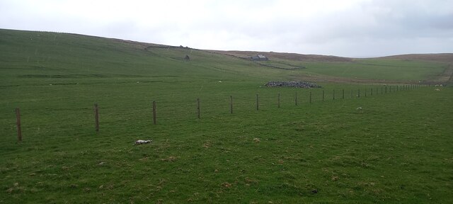
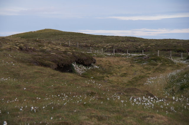
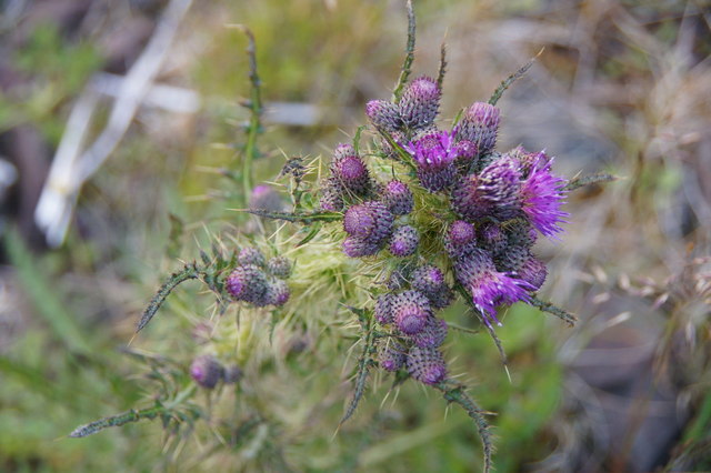
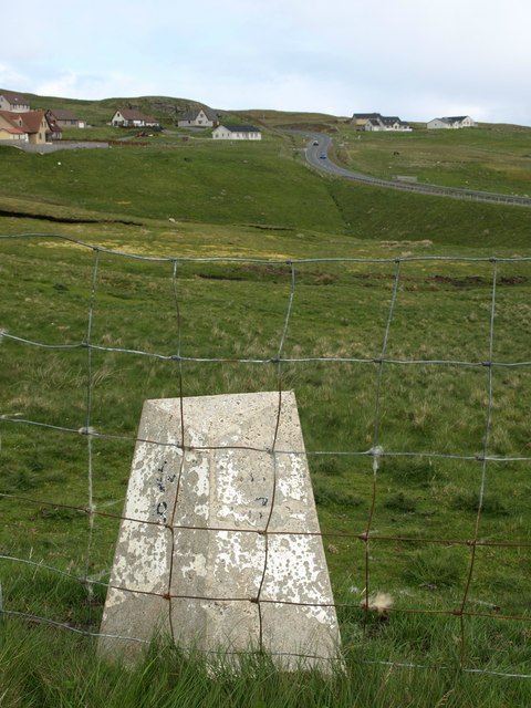
Long Skerry Images

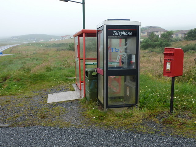
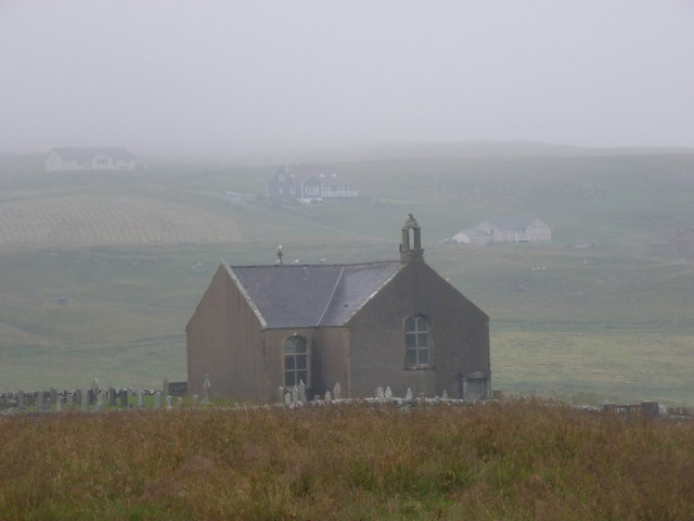
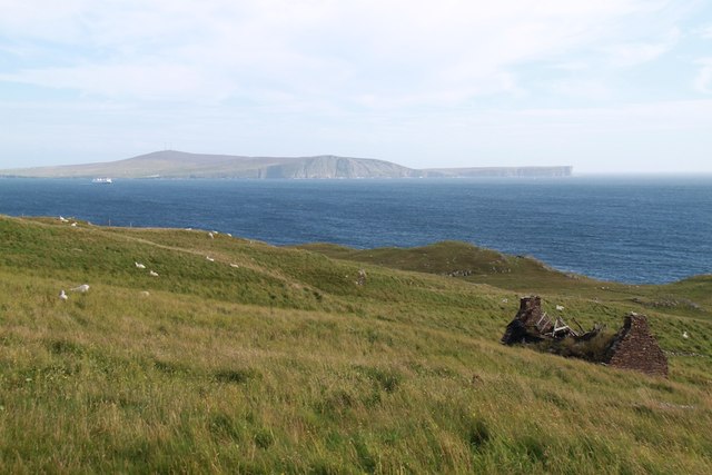
Images are sourced within 2km of 60.09823/-1.2227042 or Grid Reference HU4335. Thanks to Geograph Open Source API. All images are credited.

Crogagarth, Brindister
Quarff Leog between Quarff and Fladdabister
Marsh Thistle (Cirsium palustre), Quarff The densely packed flowerheads, and tallness, help distinguish this from other thistles.
Marsh Thistle (Cirsium palustre), Quarff
The densely packed flowerheads, and tallness, help distinguish this from other thistles.
Milestone Milestone on former A970, Grutness 19 miles, Lerwick 7 miles.
Current A970 in the distance.
Milestone
Milestone on former A970, Grutness 19 miles, Lerwick 7 miles. Current A970 in the distance.
Bus to Sandwick Leasks of Lerwick Volvo B7RLE/Plaxton Centro (T50 JLS) on route number 6 towards Sandwick.
Bus to Sandwick
Leasks of Lerwick Volvo B7RLE/Plaxton Centro (T50 JLS) on route number 6 towards Sandwick.
A970 at Quarff The A970 runs for 71 miles across most of the length of the "Mainland" in the Shetland Islands. It is a good-quality single-carriageway road for most of its route. Travelling from south to north, the road begins at Grutness near Sumburgh Airport and winds around the many hills and inlets passing close to a number of small villages without going through any large ones before Lerwick. After looping around Lerwick, a short spur runs to Scalloway whilst the main route continues northwards towards Brae where it crosses the narrow isthmus of Mavis Grind. At Sandy Lochs the road splits and a four-mile spur goes through Urafirth to Hillswick. The main route continuing to the right towards its northern terminus at Isbister. This last part of the route tends to be narrower with passing places.

<span class="nowrap"><a title="https://www.sabre-roads.org.uk/wiki/index.php?title=A970" rel="nofollow ugc noopener" href="https://www.sabre-roads.org.uk/wiki/index.php?title=A970">Link</a><img style="margin-left:2px;" alt="External link" title="External link - shift click to open in new window" src="https://s1.geograph.org.uk/img/external.png" width="10" height="10"/></span>  SABRE
A970 at Quarff
The A970 runs for 71 miles across most of the length of the "Mainland" in the Shetland Islands. It is a good-quality single-carriageway road for most of its route. Travelling from south to north, the road begins at Grutness near Sumburgh Airport and winds around the many hills and inlets passing close to a number of small villages without going through any large ones before Lerwick. After looping around Lerwick, a short spur runs to Scalloway whilst the main route continues northwards towards Brae where it crosses the narrow isthmus of Mavis Grind. At Sandy Lochs the road splits and a four-mile spur goes through Urafirth to Hillswick. The main route continuing to the right towards its northern terminus at Isbister. This last part of the route tends to be narrower with passing places. LinkExternal link SABRE
Bus Stop on the A970 at Quarff The A970 runs for 71 miles across most of the length of the "Mainland" in the Shetland Islands. It is a good-quality single-carriageway road for most of its route. Travelling from south to north, the road begins at Grutness near Sumburgh Airport and winds around the many hills and inlets passing close to a number of small villages without going through any large ones before Lerwick. After looping around Lerwick, a short spur runs to Scalloway whilst the main route continues northwards towards Brae where it crosses the narrow isthmus of Mavis Grind. At Sandy Lochs the road splits and a four-mile spur goes through Urafirth to Hillswick. The main route continuing to the right towards its northern terminus at Isbister. This last part of the route tends to be narrower with passing places.

<span class="nowrap"><a title="https://www.sabre-roads.org.uk/wiki/index.php?title=A970" rel="nofollow ugc noopener" href="https://www.sabre-roads.org.uk/wiki/index.php?title=A970">Link</a><img style="margin-left:2px;" alt="External link" title="External link - shift click to open in new window" src="https://s1.geograph.org.uk/img/external.png" width="10" height="10"/></span>  SABRE
Bus Stop on the A970 at Quarff
The A970 runs for 71 miles across most of the length of the "Mainland" in the Shetland Islands. It is a good-quality single-carriageway road for most of its route. Travelling from south to north, the road begins at Grutness near Sumburgh Airport and winds around the many hills and inlets passing close to a number of small villages without going through any large ones before Lerwick. After looping around Lerwick, a short spur runs to Scalloway whilst the main route continues northwards towards Brae where it crosses the narrow isthmus of Mavis Grind. At Sandy Lochs the road splits and a four-mile spur goes through Urafirth to Hillswick. The main route continuing to the right towards its northern terminus at Isbister. This last part of the route tends to be narrower with passing places. LinkExternal link SABRE
House at Quarff
House at Quarff
A970, Easter Quarff The A970 runs for 71 miles across most of the length of the "Mainland" in the Shetland Islands. It is a good-quality single-carriageway road for most of its route. Travelling from south to north, the road begins at Grutness near Sumburgh Airport and winds around the many hills and inlets passing close to a number of small villages without going through any large ones before Lerwick. After looping around Lerwick, a short spur runs to Scalloway whilst the main route continues northwards towards Brae where it crosses the narrow isthmus of Mavis Grind. At Sandy Lochs the road splits and a four-mile spur goes through Urafirth to Hillswick. The main route continuing to the right towards its northern terminus at Isbister. This last part of the route tends to be narrower with passing places.

<span class="nowrap"><a title="https://www.sabre-roads.org.uk/wiki/index.php?title=A970" rel="nofollow ugc noopener" href="https://www.sabre-roads.org.uk/wiki/index.php?title=A970">Link</a><img style="margin-left:2px;" alt="External link" title="External link - shift click to open in new window" src="https://s1.geograph.org.uk/img/external.png" width="10" height="10"/></span>  SABRE
A970, Easter Quarff
The A970 runs for 71 miles across most of the length of the "Mainland" in the Shetland Islands. It is a good-quality single-carriageway road for most of its route. Travelling from south to north, the road begins at Grutness near Sumburgh Airport and winds around the many hills and inlets passing close to a number of small villages without going through any large ones before Lerwick. After looping around Lerwick, a short spur runs to Scalloway whilst the main route continues northwards towards Brae where it crosses the narrow isthmus of Mavis Grind. At Sandy Lochs the road splits and a four-mile spur goes through Urafirth to Hillswick. The main route continuing to the right towards its northern terminus at Isbister. This last part of the route tends to be narrower with passing places. LinkExternal link SABRE
Bus Stop on A970 near Easter Quarff The A970 runs for 71 miles across most of the length of the "Mainland" in the Shetland Islands. It is a good-quality single-carriageway road for most of its route. Travelling from south to north, the road begins at Grutness near Sumburgh Airport and winds around the many hills and inlets passing close to a number of small villages without going through any large ones before Lerwick. After looping around Lerwick, a short spur runs to Scalloway whilst the main route continues northwards towards Brae where it crosses the narrow isthmus of Mavis Grind. At Sandy Lochs the road splits and a four-mile spur goes through Urafirth to Hillswick. The main route continuing to the right towards its northern terminus at Isbister. This last part of the route tends to be narrower with passing places.

<span class="nowrap"><a title="https://www.sabre-roads.org.uk/wiki/index.php?title=A970" rel="nofollow ugc noopener" href="https://www.sabre-roads.org.uk/wiki/index.php?title=A970">Link</a><img style="margin-left:2px;" alt="External link" title="External link - shift click to open in new window" src="https://s1.geograph.org.uk/img/external.png" width="10" height="10"/></span>  SABRE
Bus Stop on A970 near Easter Quarff
The A970 runs for 71 miles across most of the length of the "Mainland" in the Shetland Islands. It is a good-quality single-carriageway road for most of its route. Travelling from south to north, the road begins at Grutness near Sumburgh Airport and winds around the many hills and inlets passing close to a number of small villages without going through any large ones before Lerwick. After looping around Lerwick, a short spur runs to Scalloway whilst the main route continues northwards towards Brae where it crosses the narrow isthmus of Mavis Grind. At Sandy Lochs the road splits and a four-mile spur goes through Urafirth to Hillswick. The main route continuing to the right towards its northern terminus at Isbister. This last part of the route tends to be narrower with passing places. LinkExternal link SABRE
A970 between Quarff and Fladdabister The A970 runs for 71 miles across most of the length of the "Mainland" in the Shetland Islands. It is a good-quality single-carriageway road for most of its route. Travelling from south to north, the road begins at Grutness near Sumburgh Airport and winds around the many hills and inlets passing close to a number of small villages without going through any large ones before Lerwick. After looping around Lerwick, a short spur runs to Scalloway whilst the main route continues northwards towards Brae where it crosses the narrow isthmus of Mavis Grind. At Sandy Lochs the road splits and a four-mile spur goes through Urafirth to Hillswick. The main route continuing to the right towards its northern terminus at Isbister. This last part of the route tends to be narrower with passing places.

<span class="nowrap"><a title="https://www.sabre-roads.org.uk/wiki/index.php?title=A970" rel="nofollow ugc noopener" href="https://www.sabre-roads.org.uk/wiki/index.php?title=A970">Link</a><img style="margin-left:2px;" alt="External link" title="External link - shift click to open in new window" src="https://s1.geograph.org.uk/img/external.png" width="10" height="10"/></span>  SABRE
A970 between Quarff and Fladdabister
The A970 runs for 71 miles across most of the length of the "Mainland" in the Shetland Islands. It is a good-quality single-carriageway road for most of its route. Travelling from south to north, the road begins at Grutness near Sumburgh Airport and winds around the many hills and inlets passing close to a number of small villages without going through any large ones before Lerwick. After looping around Lerwick, a short spur runs to Scalloway whilst the main route continues northwards towards Brae where it crosses the narrow isthmus of Mavis Grind. At Sandy Lochs the road splits and a four-mile spur goes through Urafirth to Hillswick. The main route continuing to the right towards its northern terminus at Isbister. This last part of the route tends to be narrower with passing places. LinkExternal link SABRE
Old Milestone by old A970, Loch of Brindister, Lerwick Parish Shetland concrete by the Old A970, in parish of Lerwick (Mainland District), Loch of Brindister, on old road.

Surveyed

Milestone Society National ID: SH_LWSB06
Old Milestone by old A970, Loch of Brindister, Lerwick Parish
Shetland concrete by the Old A970, in parish of Lerwick (Mainland District), Loch of Brindister, on old road. Surveyed Milestone Society National ID: SH_LWSB06
Old Milestone by the old A970, Easter Quarff, Lerwick Shetland concrete by the old A970, in parish of Lerwick (Mainland District), Quarff, on old road through hamlet, behind wire fence.

Inscription reads:- : G / 19 : : (?) / (?) : (To Grutness and ?) 

Surveyed

Milestone Society National ID: SH_LWSB07
Old Milestone by the old A970, Easter Quarff, Lerwick
Shetland concrete by the old A970, in parish of Lerwick (Mainland District), Quarff, on old road through hamlet, behind wire fence. Inscription reads:- : G / 19 : : (?) / (?) : (To Grutness and ?) Surveyed Milestone Society National ID: SH_LWSB07
A970 towards Lerwick The A970 runs for 71 miles across most of the length of the "Mainland" in the Shetland Islands. It is a good-quality single-carriageway road for most of its route. Travelling from south to north, the road begins at Grutness near Sumburgh Airport and winds around the many hills and inlets passing close to a number of small villages without going through any large ones before Lerwick. After looping around Lerwick, a short spur runs to Scalloway whilst the main route continues northwards towards Brae where it crosses the narrow isthmus of Mavis Grind. At Sandy Lochs the road splits and a four-mile spur goes through Urafirth to Hillswick. The main route continuing to the right towards its northern terminus at Isbister. This last part of the route tends to be narrower with passing places.

<span class="nowrap"><a title="https://www.sabre-roads.org.uk/wiki/index.php?title=A970" rel="nofollow ugc noopener" href="https://www.sabre-roads.org.uk/wiki/index.php?title=A970">Link</a><img style="margin-left:2px;" alt="External link" title="External link - shift click to open in new window" src="https://s1.geograph.org.uk/img/external.png" width="10" height="10"/></span>  SABRE
A970 towards Lerwick
The A970 runs for 71 miles across most of the length of the "Mainland" in the Shetland Islands. It is a good-quality single-carriageway road for most of its route. Travelling from south to north, the road begins at Grutness near Sumburgh Airport and winds around the many hills and inlets passing close to a number of small villages without going through any large ones before Lerwick. After looping around Lerwick, a short spur runs to Scalloway whilst the main route continues northwards towards Brae where it crosses the narrow isthmus of Mavis Grind. At Sandy Lochs the road splits and a four-mile spur goes through Urafirth to Hillswick. The main route continuing to the right towards its northern terminus at Isbister. This last part of the route tends to be narrower with passing places. LinkExternal link SABRE
Old milestone One of the concrete milestones on the route from Lerwick to Sumburgh.  The road has been improved over the years and this stone is on the old road through Easter Quarff.  There was in 2010 the remnants of G (Grutness) 18 on the left face and L 7 on the right.
Old milestone
One of the concrete milestones on the route from Lerwick to Sumburgh. The road has been improved over the years and this stone is on the old road through Easter Quarff. There was in 2010 the remnants of G (Grutness) 18 on the left face and L 7 on the right.
Quarff: postbox № ZE2 64 and phone This postbox was probably moved here ten years or so ago when the post office (wherever it was) closed. It stands next to a modern phone box and a bus shelter on the main road, by the chief turning to the village. The postbox is emptied at 9am each weekday and Saturday.
Quarff: postbox № ZE2 64 and phone
This postbox was probably moved here ten years or so ago when the post office (wherever it was) closed. It stands next to a modern phone box and a bus shelter on the main road, by the chief turning to the village. The postbox is emptied at 9am each weekday and Saturday.
Quarff: the church A view from the main road in a drizzle!
Quarff: the church
A view from the main road in a drizzle!
Ruined Croft Small Ruined Croft
Ruined Croft
Small Ruined Croft
Show me another place!

Long Skerry is located at Grid Ref: HU4335 (Lat: 60.09823, Lng: -1.2227042)

Unitary Authority: Shetland Islands

Police Authority: Highlands and Islands

What 3 Words

///oddly.blinking.denim. Near Scalloway, Shetland Islands

Related Wikis

Quarff

Quarff is a small village on Mainland in the Shetland Islands in Scotland. It is located on the main A970 road, 5 miles (8.0 km) south of Shetland's only...

Brindister, South Mainland

Brindister is a village on South Mainland in Shetland, Scotland. Brindister is within the parish of Lerwick, and adjacent to the A970 south of Gulberwick...

Gulberwick

Gulberwick is a village on Mainland, 2.5 mi (4 km) southwest of Lerwick, Shetland, Scotland, which contains approximately 200 houses. In recent years the...

Trondra

Trondra (Scots: Trondra) is one of the Scalloway Islands, a subgroup of the Shetland Islands in Scotland. It shelters the harbour of Scalloway and has...

South Mainland

The South Mainland of the Shetland Islands is the southern peninsula of Mainland island. It lies south of Hellister (60° 14′N). The greater southern part...

Cutts, Shetland

Cutts is a settlement in the Shetland Islands, United Kingdom. It is on the island of Trondra off the west coast of Shetland Mainland. The B9074 crosses...

East Burra

East Burra (Scots: East Burra; Old Norse: "Barrey") is one of the Scalloway Islands, a subgroup of the Shetland Islands in Scotland. It is connected by...

Aithsetter

Aithsetter (Old Norse: Eiðseti, meaning "the farm at the isthmus") is a village on the island of Mainland, in Shetland, Scotland. Aithsetter is in the...

Nearby Amenities

Located within 500m of 60.09823,-1.2227042
Barrier: cattle_grid
Lat/Long: 60.0963289/-1.2300738
Power: pole
Lat/Long: 60.0963879/-1.2238088
Power: pole
Lat/Long: 60.0961339/-1.2249273
Power: pole
Lat/Long: 60.0959025/-1.2259868
Power: pole
Lat/Long: 60.096051/-1.2272018
Power: pole
Lat/Long: 60.0962181/-1.2284195
Power: pole
Lat/Long: 60.0963679/-1.22964
Power: pole
Lat/Long: 60.0965136/-1.2308309
East Voe of Quaff
Natural: bay
Lat/Long: 60.0988951/-1.2195897
Power: pole
Lat/Long: 60.0955665/-1.2287599
Power: pole
Lat/Long: 60.0965603/-1.2271499
Power: pole
Lat/Long: 60.0970866/-1.2270713
Power: pole
Lat/Long: 60.0975576/-1.2269858
Power: pole
Lat/Long: 60.1018861/-1.2259256
Power: pole
Lat/Long: 60.1014232/-1.2248283
Power: pole
Lat/Long: 60.100897/-1.2257269
Power: pole
Lat/Long: 60.1004929/-1.2271291
Power: pole
Lat/Long: 60.1002107/-1.2266417
Power: pole
Lat/Long: 60.0999263/-1.2261196
Power: pole
Lat/Long: 60.0995348/-1.2254382
Power: pole
Lat/Long: 60.1022569/-1.2248722
Power: pole
Lat/Long: 60.1023697/-1.2243017
The data included in this document is from www.openstreetmap.org. The data is made available under ODbL.

Have you been to Long Skerry?

Leave your review of Long Skerry below (or comments, questions and feedback).