Sandy Geo

Coastal Feature, Headland, Point in Shetland

Scotland

Sandy Geo

Sheepfold on Burki Hill
Sheepfold on Burki Hill Credit: Oliver Dixon

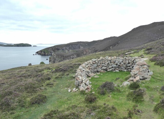
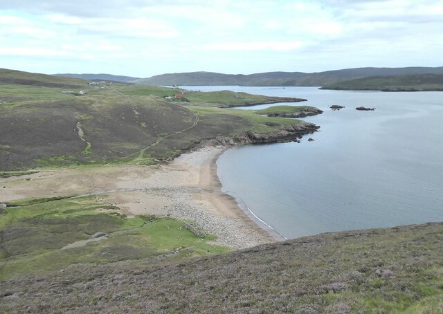
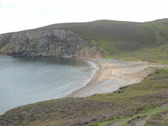
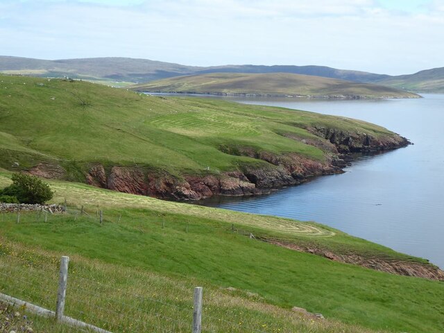
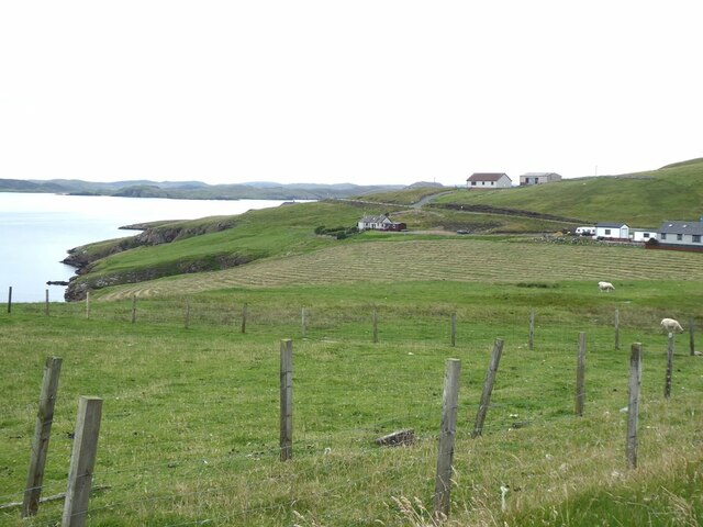
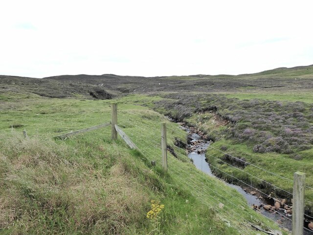
Sandy Geo is a coastal feature located in the Shetland Islands, Scotland. It is a picturesque headland that juts out into the North Sea, forming a prominent point along the coastline. The name "Sandy Geo" refers to the sandy beach that stretches along the base of the headland, offering a beautiful and tranquil setting for visitors.

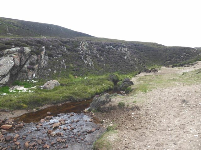
The headland itself is made up of rugged cliffs, which provide a stunning backdrop to the sandy beach below. The cliffs are formed from layers of sedimentary rock, showcasing the geological history of the area. They are also home to numerous seabirds, including puffins, guillemots, and kittiwakes, making it a popular spot for birdwatching enthusiasts.

Sandy Geo is known for its stunning natural beauty and is a haven for wildlife. The clear blue waters surrounding the headland are home to a variety of marine life, including seals and otters. During low tide, visitors can explore the rock pools and discover an array of fascinating sea creatures.

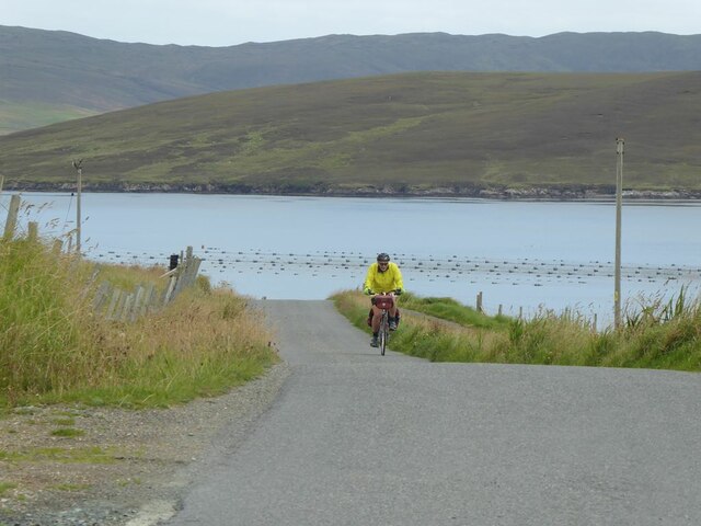
The location of Sandy Geo also offers breathtaking views of the surrounding coastline and the North Sea. On a clear day, visitors can see other nearby headlands and enjoy the tranquil atmosphere that this remote coastal feature provides.

Overall, Sandy Geo is a must-visit destination for nature lovers and those seeking a peaceful retreat. Its sandy beach, rugged cliffs, and diverse wildlife make it a truly remarkable coastal feature in the Shetland Islands.

If you have any feedback on the listing, please let us know in the comments section below.
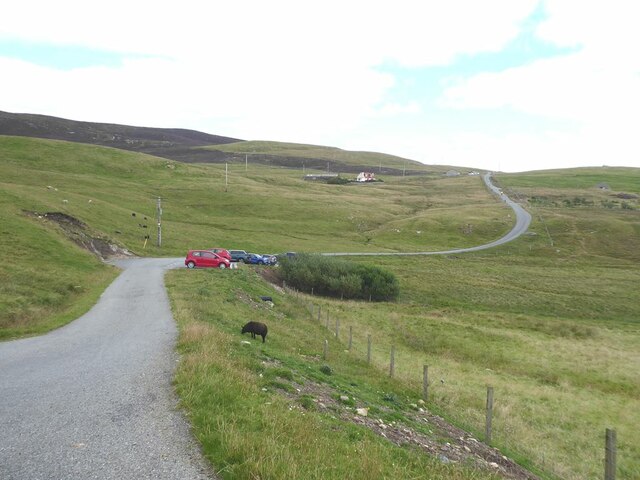
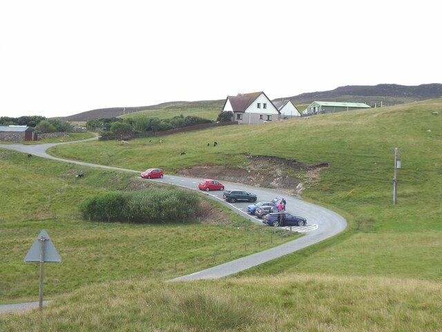
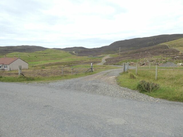
Sandy Geo Images

Images are sourced within 2km of 60.351328/-1.3965052 or Grid Reference HU3363. Thanks to Geograph Open Source API. All images are credited.
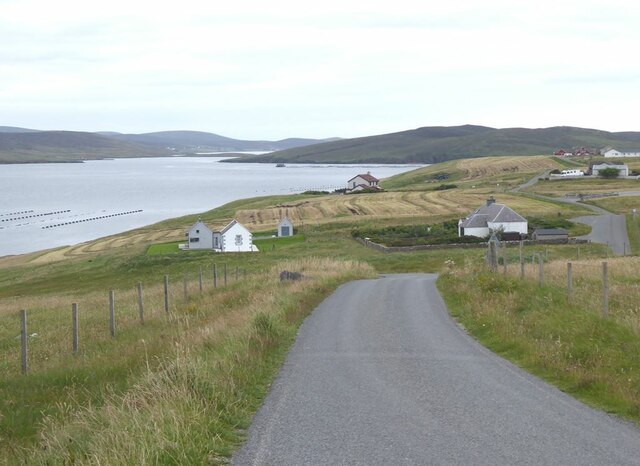
Sheepfold on Burki Hill
Muckle Ayre Beach on the south coast of Muckle Roe.
Muckle Ayre
Beach on the south coast of Muckle Roe.
Mill Burn Where the Mill Burn emerges onto the beach of Muckle Ayre.
Mill Burn
Where the Mill Burn emerges onto the beach of Muckle Ayre.
Muckle Ayre Beach on the south coast of Muckle Roe.
Muckle Ayre
Beach on the south coast of Muckle Roe.
End of the road at Little-Ayre The car park at the end of the road which runs along the south side of Muckle Roe caters for many walkers and cyclists, mostly taking the rough road over to South Ham at the north-west corner of the island.
End of the road at Little-Ayre
The car park at the end of the road which runs along the south side of Muckle Roe caters for many walkers and cyclists, mostly taking the rough road over to South Ham at the north-west corner of the island.
Access road to Burki Waters
View across Boat Geo The island of Linga <a href="https://www.geograph.org.uk/gridref/HU3563">HU3563</a> in the middle distance.
View across Boat Geo
The island of Linga HU3563 in the middle distance.
Littleburn Scattering of houses on the south shore of Muckle Roe.
Littleburn
Scattering of houses on the south shore of Muckle Roe.
Hill climb at Knowe Mussel farm in the sea. The island of Linga <a href="https://www.geograph.org.uk/gridref/HU3563">HU3563</a> beyond.
Hill climb at Knowe
Mussel farm in the sea. The island of Linga HU3563 beyond.
Ayredale on Muckle Roe Mussel farm in the sea. The island of Linga <a href="https://www.geograph.org.uk/gridref/HU3563">HU3563</a> beyond.
Ayredale on Muckle Roe
Mussel farm in the sea. The island of Linga HU3563 beyond.
Gorge of the Burn of Scarfataing The map shows a waterfall at this spot. Although a spectacular gorge, any waterfall mush be pretty small.
Gorge of the Burn of Scarfataing
The map shows a waterfall at this spot. Although a spectacular gorge, any waterfall mush be pretty small.
The Burn of Scarfataing
Muckle Roe Cemetery Up a track some distance inland. The cemetery allegedly includes war grave(s) but we couldn't identify any.
Muckle Roe Cemetery
Up a track some distance inland. The cemetery allegedly includes war grave(s) but we couldn't identify any.
Freshly mown field at Greentaing On the east coast of Muckle Roe.
Freshly mown field at Greentaing
On the east coast of Muckle Roe.
Mown field and mussel farm at Greentaing The island of Linga <a href="https://www.geograph.org.uk/gridref/HU3563">HU3563</a> in the middle distance.
Mown field and mussel farm at Greentaing
The island of Linga HU3563 in the middle distance.
Greentaing House on Muckle Roe. The village of Brae <a href="https://www.geograph.org.uk/gridref/HU3567">HU3567</a>] can be seen in the distance at the head of Busta Voe.
Greentaing
House on Muckle Roe. The village of Brae HU3567] can be seen in the distance at the head of Busta Voe.
Road on the east side of Muckle Roe The island of Papa Little <a href="https://www.geograph.org.uk/gridref/HU3561">HU3561</a> in the middle distance.
Road on the east side of Muckle Roe
The island of Papa Little HU3561 in the middle distance.
Show me another place!

Sandy Geo is located at Grid Ref: HU3363 (Lat: 60.351328, Lng: -1.3965052)

Unitary Authority: Shetland Islands

Police Authority: Highlands and Islands

What 3 Words

///dominate.stem.thrusters. Near Brae, Shetland Islands

Related Wikis

Papa Little

Papa Little (Scots: Papa Little; Old Norse: Papey Litla, meaning "the little island of the priests") is an island in St Magnus Bay, Shetland, Scotland...

Linga, Busta Voe

Linga is a small, uninhabited island, 1 km (0.62 mi) east of Muckle Roe in the Shetland Islands. The island is roughly circular in shape and its highest...

Muckle Roe

Muckle Roe is an island in Shetland, Scotland, in St. Magnus Bay, to the west of Mainland. It has a population of around 130 people, who mainly croft and...

Shetland

Shetland, also called the Shetland Islands and formerly Zetland, is an archipelago in Scotland lying between Orkney, the Faroe Islands, and Norway. It...

Busta Voe

Busta Voe, (HU665350), in the north central Mainland, Shetland, is a sea inlet lying between the village of Brae and the island of Muckle Roe. At the head...

Linga (near Vementry)

Linga is one of the Shetland Islands, near Vementry. It is one of many islands in Shetland called Linga. The island is uninhabited. == Geography and... ==

Vementry

Vementry (Old Norse: "Vemunðarey") is an uninhabited Scottish island in Shetland on the north side of the West Mainland, lying south of Muckle Roe. �...

Mavis Grind

Mavis Grind (Old Norse: Mæfeiðs grind or Mæveiðs grind, meaning "gate of the narrow isthmus") is a narrow isthmus joining the Northmavine peninsula to...

Nearby Amenities

Located within 500m of 60.351328,-1.3965052
Power: pole
Lat/Long: 60.3498872/-1.4048123
Power: pole
Lat/Long: 60.3505254/-1.405212
Power: pole
Lat/Long: 60.3522689/-1.4052898
Power: pole
Lat/Long: 60.3525568/-1.4040157
Power: pole
Lat/Long: 60.3526802/-1.4033827
Power: pole
Lat/Long: 60.3528222/-1.4026853
Power: pole
Lat/Long: 60.3533847/-1.3951966
Power: pole
Lat/Long: 60.3537721/-1.3960764
Generator Method: wind_turbine
Generator Output Electricity: yes
Generator Source: wind
Generator Type: horizontal_axis
Power: generator
Lat/Long: 60.3536182/-1.4023688
Power: pole
Lat/Long: 60.3531021/-1.4014864
Power: pole
Lat/Long: 60.3533582/-1.4003223
Power: pole
Lat/Long: 60.3535532/-1.3993299
Power: pole
Lat/Long: 60.3537655/-1.3982302
Power: pole
Lat/Long: 60.3540706/-1.3968033
Generator Method: wind_turbine
Generator Output Electricity: yes
Generator Source: wind
Generator Type: horizontal_axis
Power: generator
Lat/Long: 60.3548335/-1.3929677
Power: pole
Lat/Long: 60.3542749/-1.3958001
Power: pole
Lat/Long: 60.3546783/-1.3951215
Power: pole
Lat/Long: 60.3550564/-1.3945046
Power: pole
Lat/Long: 60.3555114/-1.3937911
Power: pole
Lat/Long: 60.3526651/-1.3965369
Power: pole
Lat/Long: 60.3529899/-1.3958107
Power: pole
Lat/Long: 60.3533029/-1.3911564
Power: pole
Lat/Long: 60.35361/-1.3909551
Power: pole
Lat/Long: 60.3540533/-1.3906675
Power: pole
Lat/Long: 60.3544433/-1.390423
The data included in this document is from www.openstreetmap.org. The data is made available under ODbL.

Have you been to Sandy Geo?

Leave your review of Sandy Geo below (or comments, questions and feedback).