Skervalie

Coastal Feature, Headland, Point in Shetland

Scotland

Skervalie

The north east of Fair Isle The North Light in the distance.
The north east of Fair Isle Credit: David Purchase

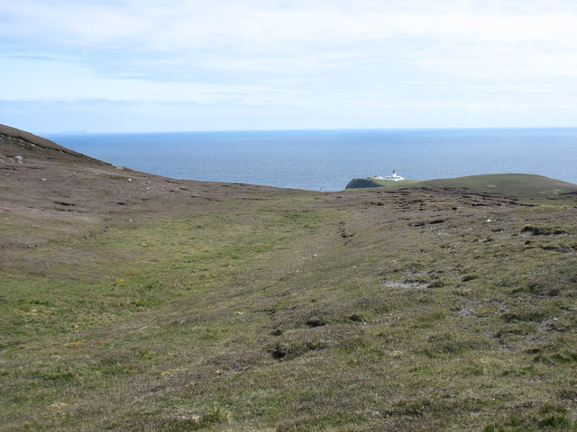
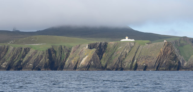
Skervalie is a prominent coastal feature located on the Shetland Islands, an archipelago in Scotland, United Kingdom. It is a stunning headland that juts out into the North Sea, forming a distinctive point along the island's coastline. Skervalie is situated on the eastern side of the Shetland mainland, close to the town of Lerwick.

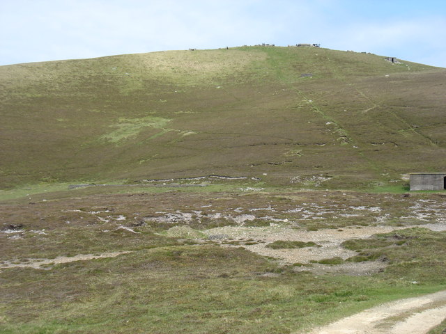
This headland is characterized by its rugged and dramatic landscape, with steep cliffs that plunge into the sea below. The cliffs are composed of layers of sedimentary rock, displaying a variety of colors and textures, which add to the visual appeal of Skervalie.

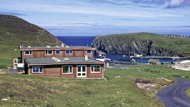
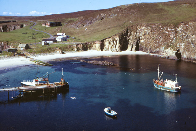
The headland is a popular spot for outdoor enthusiasts and nature lovers due to its breathtaking views and rich biodiversity. The coastal area surrounding Skervalie is home to a diverse range of seabirds, including puffins, kittiwakes, and guillemots. Visitors can often observe these fascinating creatures nesting and soaring through the air.

The cliff tops offer stunning panoramic vistas of the surrounding coastline, with the North Sea stretching out endlessly into the horizon. On a clear day, one can see distant islands such as Bressay and Whalsay, adding to the allure of Skervalie.

In addition to its natural beauty, Skervalie also has historical significance. It is believed that the headland was once used as a lookout point during World War II, as its strategic location provided an ideal vantage point for monitoring enemy activities.

Overall, Skervalie is a captivating coastal feature that showcases the rugged beauty of the Shetland Islands. Its stunning cliffs, diverse wildlife, and historical importance make it a must-visit destination for anyone exploring this enchanting region.

If you have any feedback on the listing, please let us know in the comments section below.

Skervalie Images

Images are sourced within 2km of 59.537574/-1.5995449 or Grid Reference HZ2272. Thanks to Geograph Open Source API. All images are credited.

The north east of Fair Isle The North Light in the distance.
The north east of Fair Isle
The North Light in the distance.
The middle of the Fair Isle landing strip Flight DFL002 for Tingwall had just departed, and the next flight wasn't due to arrive for about six hours. So it was deemed quite safe for me to cross the strip on my way to the track to Ward Hill.

Amusingly, when that next flight arrived, the landing was aborted at the last minute, and the pilot went round for another attempt. The reason? There was a sheep on the strip!

The trip reminded me of my visit to the Isles of Scilly, at the other end of the country, in 2013. Similar small and rather noisy planes, and a runway (in <a href="https://www.geograph.org.uk/gridref/SV9110">SV9110</a>) on a convex slope so that the pilots couldn't see that far ahead.
The middle of the Fair Isle landing strip
Flight DFL002 for Tingwall had just departed, and the next flight wasn't due to arrive for about six hours. So it was deemed quite safe for me to cross the strip on my way to the track to Ward Hill. Amusingly, when that next flight arrived, the landing was aborted at the last minute, and the pilot went round for another attempt. The reason? There was a sheep on the strip! The trip reminded me of my visit to the Isles of Scilly, at the other end of the country, in 2013. Similar small and rather noisy planes, and a runway (in SV9110) on a convex slope so that the pilots couldn't see that far ahead.
Looking to Ward Hill, Fair Isle From near the transmission station. The two diagonal lines are clearly the routes of the cables used to haul goods up to the former radar station on the summit. What a shame that they weren't used to bring down some of the debris left on the summit after closure!

Although one can argue about "What is a hill?", I think there are five hills of any significance on Fair Isle. At 217m, Ward Hill is clearly the highest.
Looking to Ward Hill, Fair Isle
From near the transmission station. The two diagonal lines are clearly the routes of the cables used to haul goods up to the former radar station on the summit. What a shame that they weren't used to bring down some of the debris left on the summit after closure! Although one can argue about "What is a hill?", I think there are five hills of any significance on Fair Isle. At 217m, Ward Hill is clearly the highest.
Vaasetter Hill, Fair Isle Vaasetter Hill, 110m, is the rounded light-coloured hill straight ahead. It is a very easy walk, though unfortunately I did not have time to climb it. Beyond Vaasetter Hill looms the dark summit of Sheep Rock (132m, and still just in square). Sheep Rock is accessible only to climbers capable at a high grade.

It may not be very long before Sheep Rock becomes a separate island, as the link is very narrow and fragile. This won't make it any more difficult to climb, as the only practicable route is from the east.

Although one can argue about "What is a hill?", I think there are five hills of any significance on Fair Isle. On this basis, Sheep Rock is the third highest and Vaasetter the fourth.
Vaasetter Hill, Fair Isle
Vaasetter Hill, 110m, is the rounded light-coloured hill straight ahead. It is a very easy walk, though unfortunately I did not have time to climb it. Beyond Vaasetter Hill looms the dark summit of Sheep Rock (132m, and still just in square). Sheep Rock is accessible only to climbers capable at a high grade. It may not be very long before Sheep Rock becomes a separate island, as the link is very narrow and fragile. This won't make it any more difficult to climb, as the only practicable route is from the east. Although one can argue about "What is a hill?", I think there are five hills of any significance on Fair Isle. On this basis, Sheep Rock is the third highest and Vaasetter the fourth.
The gorge of Gilsetter Burn Falling to the east coast of Fair Isle, with South Gavel on Bu Ness beyond. It had been dry for some weeks, so there was almost no water in the burn.
The gorge of Gilsetter Burn
Falling to the east coast of Fair Isle, with South Gavel on Bu Ness beyond. It had been dry for some weeks, so there was almost no water in the burn.
Fair Isle from the air Taken from a plane en route between Sumburgh and Aberdeen. The closest part of the island is Buness.
Fair Isle from the air
Taken from a plane en route between Sumburgh and Aberdeen. The closest part of the island is Buness.
Evening at North Haven, Fair Isle Even the bonxie looked relaxed, but watchful.

Fair Isle experiences extremely strong winds and even heavy wooden rowing boats have to be securely tied down.
Evening at North Haven, Fair Isle
Even the bonxie looked relaxed, but watchful. Fair Isle experiences extremely strong winds and even heavy wooden rowing boats have to be securely tied down.
Mavers Geo, South Haven, Fair Isle
Harbour and beach, North Haven, Fair Isle The Bird Observatory and hostel can be seen on the skyline
Harbour and beach, North Haven, Fair Isle
The Bird Observatory and hostel can be seen on the skyline
Sea Entrance to North Haven, Fair Isle The harbour lies behind the breakwater
Sea Entrance to North Haven, Fair Isle
The harbour lies behind the breakwater
Fair Isle North Lighthouse Radio station on Ward Hill in the background.

"On 28 March 1941 the dwelling houses were machine gunned by an enemy plane. Two bombs were also dropped but landed 60 yards south east of the tower and damage was confined to broken glass. The second main attack happened on 18 April 1941 when a single enemy plane machine gunned the buildings and dropped two HE bombs one of which registered a direct hit on the buildings situated 30 feet from the back wall of the dwelling houses. The outhouses, comprising store houses and closets were completely demolished and all contents destroyed, plus 24 feet of boundary wall which was also demolished. 

"Roderick Macaulay, Assistant Lightkeeper, walked 3 miles from North Lighthouse, where he and his daughter had a narrow escape in the former raid, through snowdrifts and gale-force winds to lend a hand in restoring the South Light to operational order, and returned in the dark to take his own regular watch at the North Light: he received the BEM for his outstanding services" - <span class="nowrap"><a title="https://www.nlb.org.uk/LighthouseLibrary/Lighthouse/Fair-Isle-North/" rel="nofollow ugc noopener" href="https://www.nlb.org.uk/LighthouseLibrary/Lighthouse/Fair-Isle-North/">Link</a><img style="margin-left:2px;" alt="External link" title="External link - shift click to open in new window" src="https://s1.geograph.org.uk/img/external.png" width="10" height="10"/></span>
Fair Isle North Lighthouse
Radio station on Ward Hill in the background. "On 28 March 1941 the dwelling houses were machine gunned by an enemy plane. Two bombs were also dropped but landed 60 yards south east of the tower and damage was confined to broken glass. The second main attack happened on 18 April 1941 when a single enemy plane machine gunned the buildings and dropped two HE bombs one of which registered a direct hit on the buildings situated 30 feet from the back wall of the dwelling houses. The outhouses, comprising store houses and closets were completely demolished and all contents destroyed, plus 24 feet of boundary wall which was also demolished. "Roderick Macaulay, Assistant Lightkeeper, walked 3 miles from North Lighthouse, where he and his daughter had a narrow escape in the former raid, through snowdrifts and gale-force winds to lend a hand in restoring the South Light to operational order, and returned in the dark to take his own regular watch at the North Light: he received the BEM for his outstanding services" - LinkExternal link
Fair Isle Bird Observatory, 1974 The purpose-built Bird  Observatory was opened in 1969 and encased in blockwork in 1989.  The current observatory was opened in July 2010.

By 1982 the wood fascia of the observatory had been stained a darker hue <a href="https://www.geograph.org.uk/photo/3830582">HZ2272 : Fair Isle Bird Observatory in 1982</a>.  New observatory buildings were opened in July 2010.  I visited it within a month of its opening.  <a href="https://www.geograph.org.uk/photo/1999001">HZ2272 : Fair Isle Bird Observatory reopened June 2010</a>.
Fair Isle Bird Observatory, 1974
The purpose-built Bird Observatory was opened in 1969 and encased in blockwork in 1989. The current observatory was opened in July 2010. By 1982 the wood fascia of the observatory had been stained a darker hue HZ2272 : Fair Isle Bird Observatory in 1982. New observatory buildings were opened in July 2010. I visited it within a month of its opening. HZ2272 : Fair Isle Bird Observatory reopened June 2010.
Good Shepherd IV between Fair Isle and Lerwick This image was taken on the high seas.  Exact position unknown with Mainland Shetland still ahead.  I have located this at Fair Isle as one of its two main ports. A sunny day with hardly a breeze but certainly cool on the high seas.
Good Shepherd IV between Fair Isle and Lerwick
This image was taken on the high seas. Exact position unknown with Mainland Shetland still ahead. I have located this at Fair Isle as one of its two main ports. A sunny day with hardly a breeze but certainly cool on the high seas.
North Haven, Fair Isle The Fair Isle ferry, Good Shepherd III, lies at the pier and a trawler is also in North Haven.  The Fair Isle Bird Observatory is the flat-roofed brown building on the road heading south.
North Haven, Fair Isle
The Fair Isle ferry, Good Shepherd III, lies at the pier and a trawler is also in North Haven. The Fair Isle Bird Observatory is the flat-roofed brown building on the road heading south.
Good Shepherd III arrival at Fair Isle Islanders and transport lined up to take the cargo from the arrival of the ferry.
Good Shepherd III arrival at Fair Isle
Islanders and transport lined up to take the cargo from the arrival of the ferry.
The southwest face of Sheep Rock, Fair Isle
North & South Haven from Bu Ness
On Goorn peninsula Looking into South Haven. The Fair Isle Bird Observatory is visible left of the narrow strand.
On Goorn peninsula
Looking into South Haven. The Fair Isle Bird Observatory is visible left of the narrow strand.
Show me another place!

Skervalie is located at Grid Ref: HZ2272 (Lat: 59.537574, Lng: -1.5995449)

Unitary Authority: Shetland Islands

Police Authority: Highlands and Islands

What 3 Words

///baths.breaches.retail. Near Sumburgh, Shetland Islands

Related Wikis

North Haven (harbour)

North Haven is a natural cove, developed in the 20th century as one of the primary ports of Fair Isle, an outlying island of the Shetland Isles in the...

Fair Isle

Fair Isle (; Scots: Fair Isle; Old Norse: Friðarey; Scottish Gaelic: Fara), sometimes Fairisle, is the southernmost Shetland island, situated roughly 38km...

Fair Isle Airport

Fair Isle Airport (IATA: FIE, ICAO: EGEF), is a small airport located in Fair Isle, Shetland, Scotland. It is owned by the National Trust for Scotland...

Stroms Hellier

Stroms Hellier (Stroms Heelor) is a steep-sided rocky cove located off the Swartz Geo inlet on Fair Isle in the Scottish Shetland Islands.On 27 September...

El Gran Grifón

El Gran Grifón was the flagship of the Spanish Armada's supply squadron of Baltic hulks (built in and chartered from the City of Rostock, in modern-day...

Black Watch (full-rigged ship)

Black Watch was a large full-rigged ship built by Windsor shipbuilder Bennett Smith in Windsor, Nova Scotia. It was the last ship built by Smith in Windsor...

Related Videos

Skyelark's Daily Walks are Superb! Roll Video

And in other news:Skyelark's Daily Walks are Superb! Roll Video.

2021 Fair Isle By Land Sea and Air

Impressions Of Fair Isle this August 2021 Backstory: Set in the middle of the North Atlantic, 38km (23mi) from Shetland and 43km ...

Nearby Amenities

Located within 500m of 59.537574,-1.5995449
Ferry Terminal
Ferry: yes
Public Transport: station
Lat/Long: 59.5378462/-1.603784
Seamark Light 1 Character: Oc
Seamark Light 1 Colour: green
Seamark Light 1 Height: 10
Seamark Light 1 Period: 8
Seamark Light 1 Range: 6
Seamark Light 1 Sector End: 208.1
Seamark Light 1 Sector Start: 203.6
Seamark Light 1 Sequence: 6+(2)
Seamark Light 2 Character: Oc
Seamark Light 2 Colour: white
Seamark Light 2 Height: 10
Seamark Light 2 Period: 8
Seamark Light 2 Range: 6
Seamark Light 2 Sector End: 211.1
Seamark Light 2 Sector Start: 208.1
Seamark Light 2 Sequence: 6+(2)
Seamark Light 3 Character: Oc
Seamark Light 3 Colour: red
Seamark Light 3 Height: 10
Seamark Light 3 Period: 8
Seamark Light 3 Range: 6
Seamark Light 3 Sector End: 220.6
Seamark Light 3 Sector Start: 211.1
Seamark Light 3 Sequence: 6+(2)
Seamark Light Reference: A 3753
Seamark Type: light_minor
Source: US NGA Pub. 114. 2011-05-26.
Lat/Long: 59.5373667/-1.60635
Bbq
Lat/Long: 59.5372865/-1.6066728
Bench
Lat/Long: 59.53753/-1.6066353
Bbq
Lat/Long: 59.5372756/-1.60424
Leisure: slipway
Lat/Long: 59.5376836/-1.6031932
Leisure: slipway
Lat/Long: 59.5374538/-1.605583
Buness
Place: locality
Lat/Long: 59.5391075/-1.6000223
Arch Viewpoint
Direction: W
Tourism: viewpoint
Lat/Long: 59.5404181/-1.6007504
Cliffs viewpoint
Direction: N
Tourism: viewpoint
Lat/Long: 59.5345533/-1.6008469
Atlantic puffin rookery
Leisure: bird_hide
Lat/Long: 59.5337359/-1.6018876
North Haven
Natural: bay
Wikidata: Q25172050
Wikipedia: en:North Haven (harbour)
Lat/Long: 59.5387538/-1.6044706
The data included in this document is from www.openstreetmap.org. The data is made available under ODbL.

Have you been to Skervalie?

Leave your review of Skervalie below (or comments, questions and feedback).