Black Stone

Coastal Feature, Headland, Point in Aberdeenshire

Scotland

Black Stone

A90 at Stirling Hill The A90 as it passes between Stirling and Boddam villages. The houses in the foreground have been built along the route of the former Ellon to Boddam railway line, near to its terminus at Boddam, which was located in what was itself the domestic site for RAF Buchan.

Other landmarks to be seen are; the old Doctor's house off left centred, the now partially restored Buchan Ness Lodge (former residence of Lord Aberdeen) right centred, and of course the lighthouse on Buchan Ness itself.
A90 at Stirling Hill Credit: Iain Smith

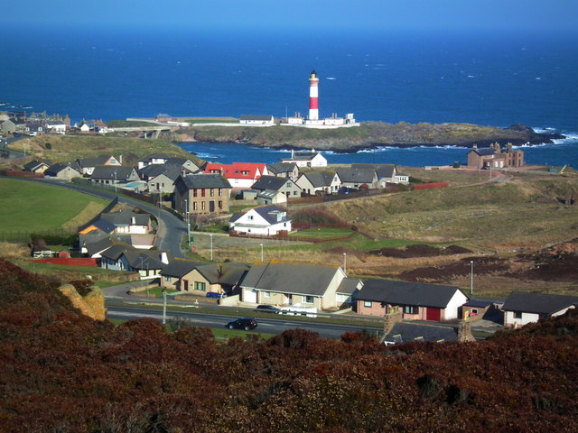
Black Stone is a prominent coastal feature located in Aberdeenshire, Scotland. Situated on the eastern coast of Scotland, it is a headland jutting out into the North Sea. The Black Stone is a popular point of interest due to its unique geological formations and scenic beauty.

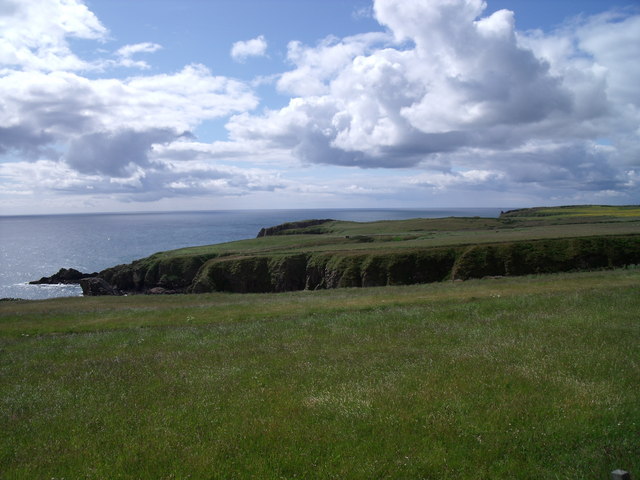
The headland is characterized by towering cliffs and jagged rocks that have been carved by the relentless crashing of waves over time. These cliffs provide a dramatic backdrop to the expansive views of the North Sea, making it a favorite spot for nature enthusiasts and photographers.

The Black Stone itself is a large boulder that sits at the edge of the headland, giving the feature its name. The origins of this distinctive black rock are still debated among geologists, with theories ranging from volcanic activity to glacial movements. Regardless of its origins, the Black Stone adds an intriguing element to the already captivating landscape.

Visitors to the area can enjoy breathtaking coastal walks along the headland, exploring the rugged cliffs and observing the diverse marine life that thrives in the surrounding waters. Seabirds, such as gulls and puffins, can often be spotted nesting on the cliffs, while seals and dolphins occasionally make appearances offshore.

Black Stone, Aberdeenshire offers a unique blend of natural beauty, geological intrigue, and wildlife sightings. Whether one seeks a peaceful coastal stroll or a chance to witness the power of the North Sea, this headland is a must-visit destination for nature enthusiasts and those seeking a glimpse into Scotland's stunning coastline.

If you have any feedback on the listing, please let us know in the comments section below.
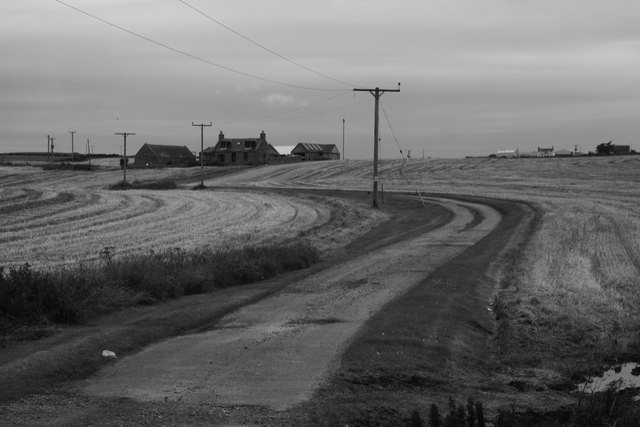
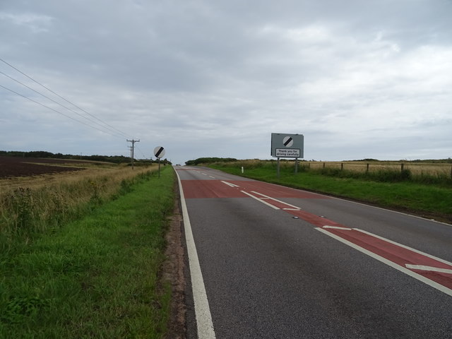
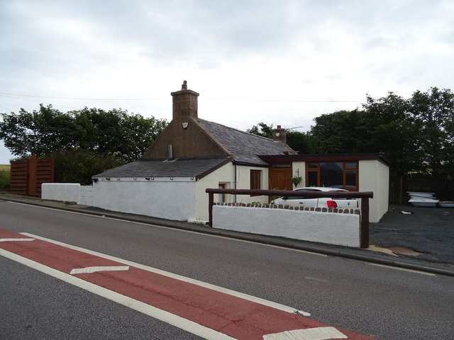
Black Stone Images

Images are sourced within 2km of 57.452194/-1.7983715 or Grid Reference NK1240. Thanks to Geograph Open Source API. All images are credited.

A90 at Stirling Hill The A90 as it passes between Stirling and Boddam villages. The houses in the foreground have been built along the route of the former Ellon to Boddam railway line, near to its terminus at Boddam, which was located in what was itself the domestic site for RAF Buchan.

Other landmarks to be seen are; the old Doctor's house off left centred, the now partially restored Buchan Ness Lodge (former residence of Lord Aberdeen) right centred, and of course the lighthouse on Buchan Ness itself.
A90 at Stirling Hill
The A90 as it passes between Stirling and Boddam villages. The houses in the foreground have been built along the route of the former Ellon to Boddam railway line, near to its terminus at Boddam, which was located in what was itself the domestic site for RAF Buchan. Other landmarks to be seen are; the old Doctor's house off left centred, the now partially restored Buchan Ness Lodge (former residence of Lord Aberdeen) right centred, and of course the lighthouse on Buchan Ness itself.
Rocky coastline near Little Dumeath The photograph was taken from an A90 parking area. Notice the beautiful clouds.
Rocky coastline near Little Dumeath
The photograph was taken from an A90 parking area. Notice the beautiful clouds.
Den Dam Den Dam, famous in the area for the traditional sailing of model yachts, is located in the area of the Buchan Gravel Ridge, an important source of flint which was quarried by early farmers

The water from the dam fed the watercourse that provided power for the granite works of Sandford Mill near Peterhead.
Den Dam
Den Dam, famous in the area for the traditional sailing of model yachts, is located in the area of the Buchan Gravel Ridge, an important source of flint which was quarried by early farmers The water from the dam fed the watercourse that provided power for the granite works of Sandford Mill near Peterhead.
Junction of A975 and A90 The A975 is a short loop to the east of the A90.
Junction of A975 and A90
The A975 is a short loop to the east of the A90.
A975 - A90 junction
A975 - A90 junction
Community Hall, Longhaven
Barley stubble, Coldwells
Coldwells
Coldwells
Cereal crop towards Lochside Off the A90.
Cereal crop towards Lochside
Off the A90.
Peterhead 6 Miles On the A90.
Peterhead 6 Miles
On the A90.
House on the A90, Longhaven
A90 leaving Longhaven Towards Peterhead.
A90 leaving Longhaven
Towards Peterhead.
Elizabethan postbox on the A90, Longhaven Postbox No. AB42 50.

See <a href="https://www.geograph.org.uk/photo/6594567">NK1039 : Newsagents on the A90, Longhaven</a> for context.
Elizabethan postbox on the A90, Longhaven
Postbox No. AB42 50. See NK1039 : Newsagents on the A90, Longhaven for context.
Newsagents on the A90, Longhaven Showing position of Postbox No. AB42 50.

See <a href="https://www.geograph.org.uk/photo/6594562">NK1039 : Elizabethan postbox on the A90, Longhaven</a> for postbox.
Newsagents on the A90, Longhaven
Showing position of Postbox No. AB42 50. See NK1039 : Elizabethan postbox on the A90, Longhaven for postbox.
A975 towards the A90
A975 junction with the A90
Old Schoolhouse on the A90, Longhaven
Bloody Hole and the Hawk's Nest Bloody Hole is an 80m long subterranean passage running right through to the beach behind. Its eastern entrance is the tall, dark rectangle near the centre. On its right, is a promontory called the Hawk's Nest, under which is a fine natural arch, running NNE/SSW and invisible from this angle.
Bloody Hole is fairly spacious for much of its length from the sea end.
Bloody Hole and the Hawk's Nest
Bloody Hole is an 80m long subterranean passage running right through to the beach behind. Its eastern entrance is the tall, dark rectangle near the centre. On its right, is a promontory called the Hawk's Nest, under which is a fine natural arch, running NNE/SSW and invisible from this angle. Bloody Hole is fairly spacious for much of its length from the sea end.
Show me another place!

Black Stone is located at Grid Ref: NK1240 (Lat: 57.452194, Lng: -1.7983715)

Unitary Authority: Aberdeenshire

Police Authority: North East

What 3 Words

///negotiators.stammer.looks. Near Boddam, Aberdeenshire

Related Wikis

Longhaven

Longhaven is a village in Aberdeenshire, Scotland, located two miles southwest of Boddam.Longhaven railway station closed in 1948. The village had a primary...

Longhaven railway station

Longhaven railway station was a railway station in Longhaven, Aberdeen, serving passengers and goods on the line to Boddam. It opened with the branch in...
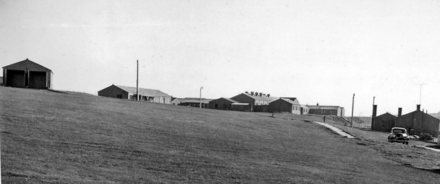
RAF Buchan

Royal Air Force Buchan or more simply RAF Buchan is a former Royal Air Force station near Peterhead in Aberdeenshire, Scotland. Buchan opened in 1952 as...

RRH Buchan

Remote Radar Head Buchan or RRH Buchan is an air defence radar station operated by the Royal Air Force. It is located at Stirling Hill, 3.2 kilometres...

Boddam Castle

Boddam Castle is a ruined castle in Boddam, Aberdeenshire, Scotland. It was thought to have been built in the early 16th century as a seat for the Keiths...

Stirling Village

Stirling Village is a settlement in the Buchan area of Aberdeenshire, Scotland, located on the A90 road immediately to the west of Boddam and 3 miles...

Boddam railway station

Boddam railway station was a railway station in Boddam, Aberdeenshire that served as the terminus of a now closed line from Ellon. == History == The station...

Boddam Masonic Hall

Boddam Masonic Hall is an historic building in Boddam, Aberdeenshire, Scotland. It is a Category B listed structure, located a few hundred yards west of...

Nearby Amenities

Located within 500m of 57.452194,-1.7983715
Source: Old Landsat image trace
Lat/Long: 57.455377/-1.79263
Source: Old Landsat image trace
Lat/Long: 57.4548423/-1.7934647
Source: Old Landsat image trace
Lat/Long: 57.4539009/-1.7969441
Source: OS7
Lat/Long: 57.4538198/-1.7977064
Source: OS7
Lat/Long: 57.4512094/-1.7992159
Source: OS7
Lat/Long: 57.4513829/-1.7976232
Source: OS7
Lat/Long: 57.4507361/-1.796486
Source: OS7
Lat/Long: 57.4507079/-1.7965828
Source: OS7
Lat/Long: 57.4495767/-1.7967091
Source: OS7
Lat/Long: 57.4492866/-1.7971147
Source: OS7
Lat/Long: 57.44917/-1.7980706
Source: OS7
Lat/Long: 57.4490314/-1.7986994
Source: OS7
Lat/Long: 57.4481448/-1.7991446
Source: OS7
Lat/Long: 57.4522885/-1.7987181
Source: OS7
Lat/Long: 57.4487996/-1.7992308
Source: OS7
Lat/Long: 57.4529789/-1.7998087
Source: OS7
Lat/Long: 57.453784/-1.8001091
Source: OS7
Lat/Long: 57.4531569/-1.8001091
Source: OS7
Lat/Long: 57.4528328/-1.7995711
Source: Old Landsat image trace
Lat/Long: 57.4552796/-1.7944999
Long Haven
Natural: bay
Source: OS30
Lat/Long: 57.453395/-1.8000501
north Glash
Natural: bay
Lat/Long: 57.4477087/-1.7980626
Heathery Haven
Natural: bay
Lat/Long: 57.4515213/-1.798657
Watery Haven
Natural: bay
Source: OS Opendata Streetmap
Lat/Long: 57.4487621/-1.7987411
The data included in this document is from www.openstreetmap.org. The data is made available under ODbL.

Have you been to Black Stone?

Leave your review of Black Stone below (or comments, questions and feedback).