Annie's Rock

Coastal Feature, Headland, Point in Berwickshire

Scotland

Annie's Rock

Ross Point I don't know if this qualifies as a geograph (this is my first posting) as it is actually taken in NT9561 looking into NT9660. However it shows the landscape features of the coastline that wouldn't really be visible from within NT9660 itself. 
The photo shows the hard coastal cliffs, vegetated sometimes down to sea level and backed by arable fields baked in the summer sun. 
In the foreground part of the small fishing settlement of Burnmouth can be seen. Several of the sea front houses are painted in different pastel shades.
Ross Point Credit: Colin Stewart

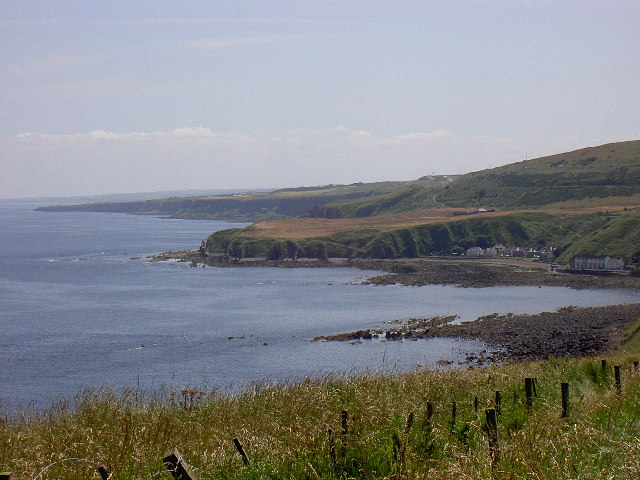
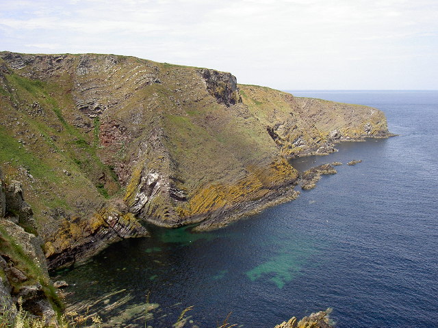
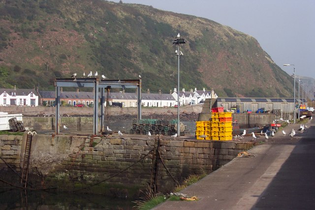
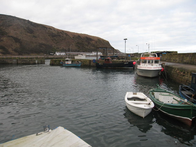
Annie's Rock is a prominent coastal feature located in Berwickshire, Scotland. It is a stunning headland that juts out into the North Sea, forming a distinctive point along the coastline. The rock gets its name from a local legend that tells the story of a young woman named Annie who used to sit on the rock and watch for her fisherman husband to return from the sea.

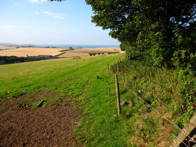
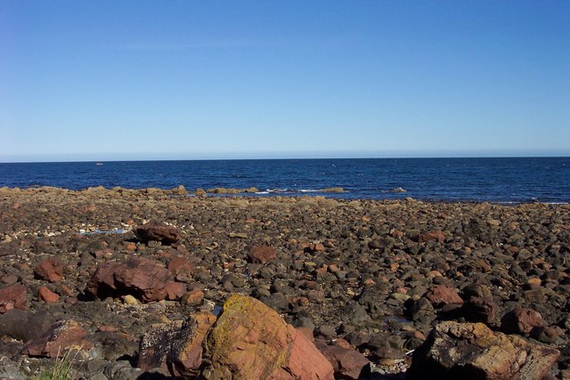
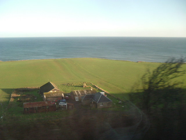
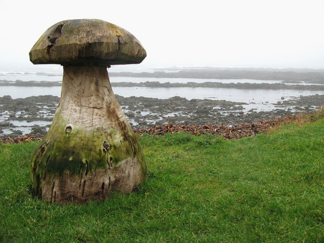
The headland is composed of rugged cliffs that rise steeply from the sea, providing breathtaking views of the surrounding area. Atop the cliffs, there is a grassy plateau where visitors can enjoy a picnic or simply take in the beauty of the landscape. The cliff edges are adorned with lush vegetation, including wildflowers and grasses, adding to the picturesque charm of the location.

Annie's Rock is a popular spot for birdwatching, as it serves as a nesting site for various seabirds. Visitors can often observe species such as puffins, guillemots, and kittiwakes, among others. The crashing waves below the cliffs create a soothing soundtrack that enhances the overall experience.

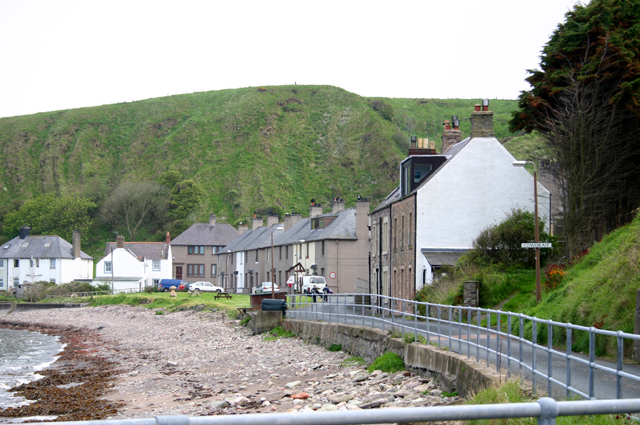
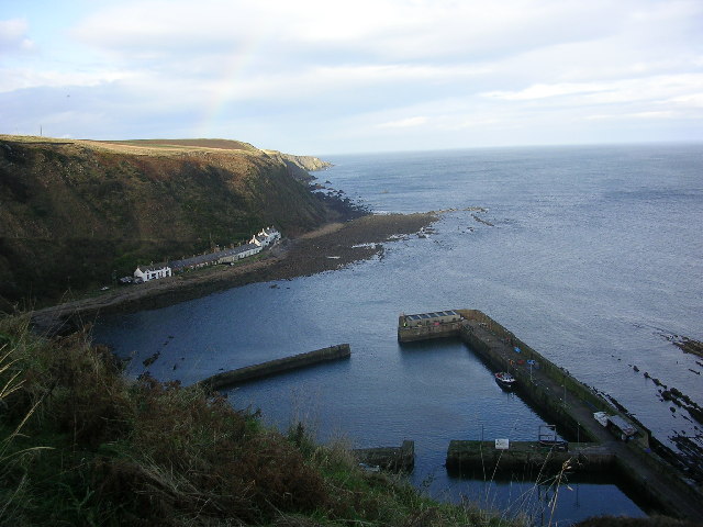
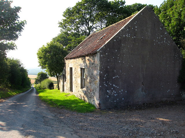
Access to Annie's Rock is relatively easy, with a well-maintained footpath leading from the nearby village to the headland. The path winds through scenic countryside, providing glimpses of the surrounding farms and fields. As visitors reach the headland, they are greeted by a sign detailing the history and significance of Annie's Rock.

Overall, Annie's Rock is a captivating coastal feature that offers visitors a chance to immerse themselves in the beauty of the Scottish coastline, observe diverse wildlife, and connect with the rich history and folklore of the region.

If you have any feedback on the listing, please let us know in the comments section below.

Annie's Rock Images

Images are sourced within 2km of 55.840324/-2.0630469 or Grid Reference NT9660. Thanks to Geograph Open Source API. All images are credited.

Ross Point I don't know if this qualifies as a geograph (this is my first posting) as it is actually taken in NT9561 looking into NT9660. However it shows the landscape features of the coastline that wouldn't really be visible from within NT9660 itself. 
The photo shows the hard coastal cliffs, vegetated sometimes down to sea level and backed by arable fields baked in the summer sun. 
In the foreground part of the small fishing settlement of Burnmouth can be seen. Several of the sea front houses are painted in different pastel shades.
Ross Point
I don't know if this qualifies as a geograph (this is my first posting) as it is actually taken in NT9561 looking into NT9660. However it shows the landscape features of the coastline that wouldn't really be visible from within NT9660 itself. The photo shows the hard coastal cliffs, vegetated sometimes down to sea level and backed by arable fields baked in the summer sun. In the foreground part of the small fishing settlement of Burnmouth can be seen. Several of the sea front houses are painted in different pastel shades.
Hurker's Haven Looking down into Hurker's Haven from the coastal path close to Fancove Head. The hard geology is immediately apparent in the distorted layers of strata. Numerous seabirds use the small coastal outcrops as nesting sites accessible only from the sea. This area is popular with divers and canoeists and supports small scale fishing operations.
Hurker's Haven
Looking down into Hurker's Haven from the coastal path close to Fancove Head. The hard geology is immediately apparent in the distorted layers of strata. Numerous seabirds use the small coastal outcrops as nesting sites accessible only from the sea. This area is popular with divers and canoeists and supports small scale fishing operations.
Cowdrait The short coast road at the bottom of Burnmouth hill leading to the isolated village.
Cowdrait
The short coast road at the bottom of Burnmouth hill leading to the isolated village.
Burnmouth Harbour
Burnmouth Harbour
Cottage at Partanhall, Burnmouth One of the cottages in a row at Partanhall, Burnmouth separated from the high water mark only by the width of the track leading round to Burnmouth Harbour.
Cottage at Partanhall, Burnmouth
One of the cottages in a row at Partanhall, Burnmouth separated from the high water mark only by the width of the track leading round to Burnmouth Harbour.
Partenhall, Burnmouth Row of cottages that is Partenhall.
Partenhall, Burnmouth
Row of cottages that is Partenhall.
Cottages at Partenhall, Burnmouth
Fishing boats ropes Burnmouth Harbour
Fishing boats ropes
Burnmouth Harbour
Burnmouth Harbour
Burnmouth Harbour
Houses at Burnmouth Harbour A touch of colour.
Houses at Burnmouth Harbour
A touch of colour.
Chesterbank View over farmland to the Firth of Forth.
Chesterbank
View over farmland to the Firth of Forth.
East Coast Line at Flemington East Coast Line from Edinburgh to London
East Coast Line at Flemington
East Coast Line from Edinburgh to London
Chesterbank
Chesterbank
Old fishermen's cottages at Partanhall, Burnmouth. These substantial old cottages are now mostly holiday/second homes. Still if it's a sea view you're after... See <a href="https://www.geograph.org.uk/photo/287278">NT9561 : The rocky shore at Partanhall.</a> for the view from the door.
Old fishermen's cottages at Partanhall, Burnmouth.
These substantial old cottages are now mostly holiday/second homes. Still if it's a sea view you're after... See NT9561 : The rocky shore at Partanhall. for the view from the door.
The rocky shore at Partanhall. This is the view from the cottages.
The rocky shore at Partanhall.
This is the view from the cottages.
Harbour and fishing equipment at Burnmouth. Cottages and cliffs at Partanhall in the background.
Harbour and fishing equipment at Burnmouth.
Cottages and cliffs at Partanhall in the background.
Lamberton Holdings By the railway, near Ross Point.
Lamberton Holdings
By the railway, near Ross Point.
Cowdrait, Burnmouth Rocks of Ross Point visible from the shore at the small seaside hamlet of Cowdrait.
Cowdrait, Burnmouth
Rocks of Ross Point visible from the shore at the small seaside hamlet of Cowdrait.
Show me another place!

Annie's Rock is located at Grid Ref: NT9660 (Lat: 55.840324, Lng: -2.0630469)

Unitary Authority: The Scottish Borders

Police Authority: The Lothians and Scottish Borders

What 3 Words

///infinite.widen.trim. Near Eyemouth, Scottish Borders

Related Wikis

Ross, Scottish Borders

Ross is a hamlet on the coast of the Scottish Borders area of Scotland, south of Burnmouth, in the parish of Ayton, and close to the A1. Ross is one of...
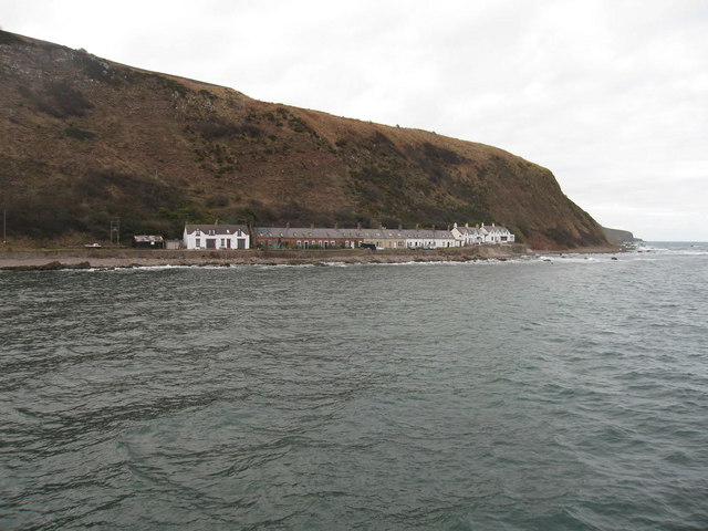
Burnmouth

Burnmouth is a small fishing village located adjacent to the A1 road on the east coast of Scotland. It is the first village in Scotland on the A1, after...

Burnmouth railway station

Burnmouth railway station served the village of Burnmouth, Ayton, Scotland from 1848 to 1962 on the East Coast Main Line. == History == There is some confusion...

Lamberton Skerrs

Lamberton Skerrs is towards the southernmost point on the east coast of Scotland. It was the scene of a building known as the "Smuggler's Bothy" which...

Eye Water

Eye Water is a river in the Scottish Borders, it flows in a general southeasterly direction from its source in the Lammermuir Hills to its estuary at Eyemouth...

Ayton railway station

Ayton railway station was a station which served the village of Ayton in the Scottish area of Scottish Borders. It was located on what is now known as...

Ayton Parish Church

Ayton and Burnmouth Parish Church is a member church (Scots: kirk) of the Church of Scotland, serving the communities of Ayton and Burnmouth in the Scottish...

Eyemouth railway station

Eyemouth railway station served the village of Eyemouth, Scottish Borders, Scotland from 1891 to 1962 on the Eyemouth Railway. == History == The station...

Nearby Amenities

Located within 500m of 55.840324,-2.0630469
Lower Burnmouth
Place: neighbourhood
Wikidata: Q5000032
Wikipedia: en:Burnmouth
Lat/Long: 55.8408481/-2.0657461
Natural: bay
Source: Bing
Lat/Long: 55.8438001/-2.0661076
Cowdrait
Is In: Burnmouth, Scottish Borders, UK
Place: neighbourhood
Wikidata: Q5000032
Wikipedia: en:Burnmouth
Lat/Long: 55.8385763/-2.0637509
Ross
Is In: Burnmouth, Scottish Borders, UK
Place: neighbourhood
Wikidata: Q5000032
Wikipedia: en:Burnmouth
Lat/Long: 55.8380097/-2.0625284
Barrier: stile
Lat/Long: 55.8384207/-2.0678779
Post Box
Collection Times: Mo-Sa 11:00
Operator: Royal Mail
Post Box Type: lamp
Lat/Long: 55.8386368/-2.0635915
Passing Place
Source: survey
Lat/Long: 55.8416412/-2.0687366
Telephone
Booth: KX100
Covered: booth
Note: No cash calls
Operator: British Telecom
Phone: +44 1890 781 370
Source: survey
Wikipedia: en:BT Group
Lat/Long: 55.8412117/-2.0668454
Information: board
Source: survey
Tourism: information
Lat/Long: 55.8412117/-2.0668747
Recycling
Operator: Scottish Borders Council
Recycling Paper: yes
Recycling Plastic: yes
Recycling Type: container
Source: survey
Website: https://www.scotborders.gov.uk/info/20001/bins_rubbish_and_recycling
Lat/Long: 55.8415977/-2.0684539
Waste Disposal
Operator: Scottish Borders Council
Source: survey
Lat/Long: 55.8416304/-2.0685312
Street Lamp
Source: survey
Lat/Long: 55.8412014/-2.0667507
Artist Name: Jill Watson
Historic: memorial
Material: bronze
Memorial: plaque
Note: Commissioned by the people of Berwickshire to commemorate the women and children left by the East Coast Fishing Disaster of 1881.
Source: survey
Lat/Long: 55.8413174/-2.066752
Artist Name: Brian Bell
Historic: memorial
Material: metal
Memorial: plaque
Note: Memorial of the fisherman of Burnmouth who lost their lives in the great storm of Black Friday the 14th of October 1881.
Source: survey
Lat/Long: 55.8413394/-2.0667584
Artist Name: Brian Bell
Historic: memorial
Material: metal
Memorial: plaque
Note: Memorial of the 1881 Burnmouth Fishing Disaster.
Source: survey
Lat/Long: 55.8412948/-2.0667487
Information: board
Source: survey
Tourism: information
Lat/Long: 55.8413635/-2.0667648
Street Lamp
Source: survey
Lat/Long: 55.8413942/-2.0675755
Harbourmaster
Email: j.aitchison021@btinternet.com
Phone: +44 1890 781 283
Source: survey
Lat/Long: 55.841398/-2.0667762
Street Lamp
Source: survey
Lat/Long: 55.8414808/-2.0683587
Street Lamp
Source: survey
Lat/Long: 55.84241/-2.0700377
Street Lamp
Source: survey
Lat/Long: 55.8410983/-2.06628
Defibrillator
Emergency: defibrillator
Source: survey
Lat/Long: 55.8410113/-2.0661167
Street Lamp
Source: survey
Lat/Long: 55.8405482/-2.0650629
Street Lamp
Source: survey
Lat/Long: 55.8406743/-2.065254
Street Lamp
Source: survey
Lat/Long: 55.8409149/-2.0656161
Passing Place
Source: survey
Lat/Long: 55.8413151/-2.0671262
Backrest: no
Colour: brown
Covered: no
Leisure: picnic_table
Material: wood
Seats: 4
Source: Bing
Lat/Long: 55.8400926/-2.0648409
Street Lamp
Source: survey
Lat/Long: 55.8398784/-2.064727
Street Lamp
Source: survey
Lat/Long: 55.8396374/-2.0646116
Street Lamp
Source: survey
Lat/Long: 55.8400968/-2.0648021
Barrier: stile
Lat/Long: 55.8381191/-2.0651086
Grit Bin
Access: yes
Source: survey
Lat/Long: 55.8390146/-2.0639008
Street Lamp
Source: survey
Lat/Long: 55.8393347/-2.0643863
Bench
Backrest: 2
Colour: brown
Material: wood
Seats: 2
Source: survey
Lat/Long: 55.839599/-2.0645794
Historic: memorial
Material: wood
Note: Memorial of one of the five Burnmouth boats that were lost during the 1881 Burnmouth Fishing Disaster.
Source: survey
Lat/Long: 55.8400403/-2.0648383
Street Lamp
Source: survey
Lat/Long: 55.8380921/-2.0627958
Street Lamp
Source: survey
Lat/Long: 55.838373/-2.0632115
Bench
Backrest: 2
Colour: brown
Material: wood
Seats: 2
Source: survey
Lat/Long: 55.838666/-2.0635602
Bench
Backrest: 2
Colour: brown
Material: wood
Seats: 2
Source: survey
Lat/Long: 55.8388121/-2.0637587
Bench
Backrest: 2
Colour: brown
Material: wood
Seats: 2
Source: survey
Lat/Long: 55.8388648/-2.0638016
Waste Basket
Source: survey
Waste: trash
Lat/Long: 55.838666/-2.0636326
Street Lamp
Source: survey
Lat/Long: 55.8389826/-2.0638807
Backrest: no
Colour: brown
Covered: no
Leisure: picnic_table
Material: wood
Seats: 4
Source: Bing
Lat/Long: 55.8385364/-2.0633161
Backrest: no
Colour: brown
Covered: no
Leisure: picnic_table
Material: wood
Seats: 4
Source: Bing
Lat/Long: 55.8383647/-2.0629755
Bench
Backrest: 2
Colour: brown
Material: wood
Seats: 2
Source: survey
Lat/Long: 55.8379739/-2.0630398
Backrest: no
Colour: brown
Covered: no
Leisure: picnic_table
Material: wood
Seats: 4
Source: Bing
Lat/Long: 55.8386148/-2.0634288
Backrest: no
Colour: brown
Covered: no
Leisure: picnic_table
Material: wood
Seats: 4
Source: Bing
Lat/Long: 55.8384461/-2.0631525
Historic: memorial
Material: wood
Note: Memorial of one of the five Burnmouth boats that were lost during the 1881 Burnmouth Fishing Disaster.
Source: survey
Lat/Long: 55.8412242/-2.0668287
Leisure: slipway
Source: Bing
Lat/Long: 55.8416096/-2.0682124
Power: pole
Lat/Long: 55.8360591/-2.0634988
Power: pole
Lat/Long: 55.8364648/-2.0641545
Power: pole
Lat/Long: 55.8369211/-2.0648639
Power: pole
Lat/Long: 55.8365529/-2.0657239
Power: pole
Lat/Long: 55.8364243/-2.066013
Power: pole
Lat/Long: 55.8364611/-2.0669353
Power: pole
Lat/Long: 55.837276/-2.0641223
Power: pole
Lat/Long: 55.8378651/-2.0628969
Power: pole
Lat/Long: 55.8422422/-2.0696365
Power: pole
Lat/Long: 55.8418583/-2.0689948
Power: pole
Lat/Long: 55.8414286/-2.0677576
Power: pole
Lat/Long: 55.8413055/-2.0673018
Power: pole
Lat/Long: 55.8407194/-2.0659001
The data included in this document is from www.openstreetmap.org. The data is made available under ODbL.

Have you been to Annie's Rock?

Leave your review of Annie's Rock below (or comments, questions and feedback).