Tanga

Coastal Feature, Headland, Point in Orkney

Scotland

Tanga

Linkshouse Currently (2021) being converted to an Artists Residency Centre for the Pier Arts Centre, Stromness.
Linkshouse Credit: Graeme Yuill

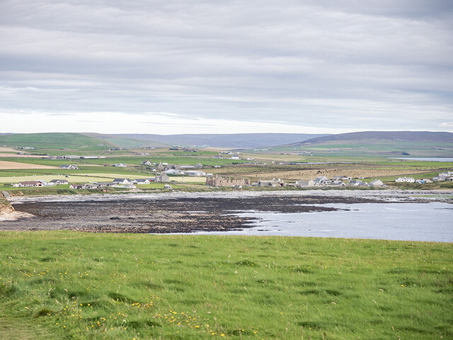
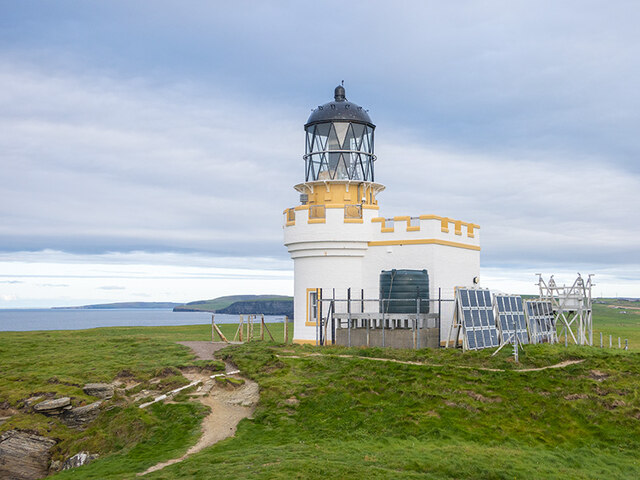
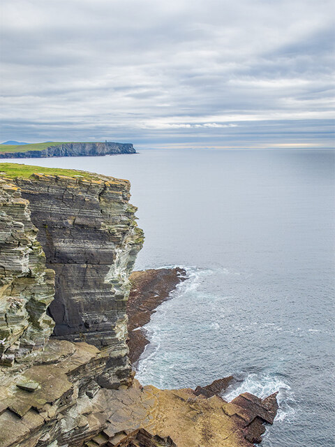
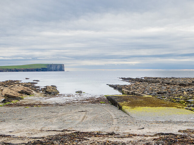
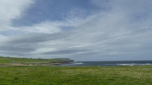
Tanga is a prominent headland located on the northeast coast of the Orkney Islands in Scotland. Positioned at the easternmost point of the island of Mainland, Tanga stands as a distinct coastal feature that juts out into the North Sea. Its geographical coordinates are approximately 59.001°N latitude and 3.102°W longitude.

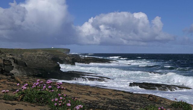
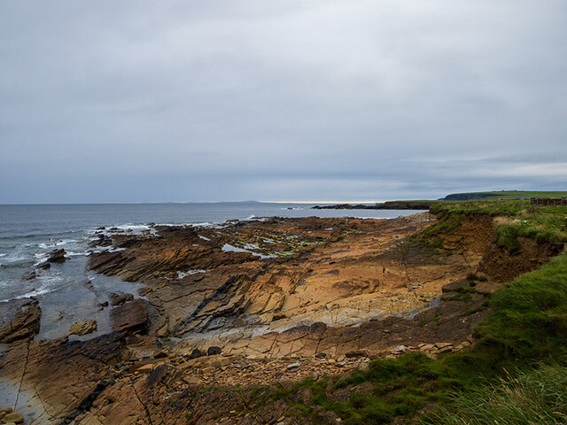
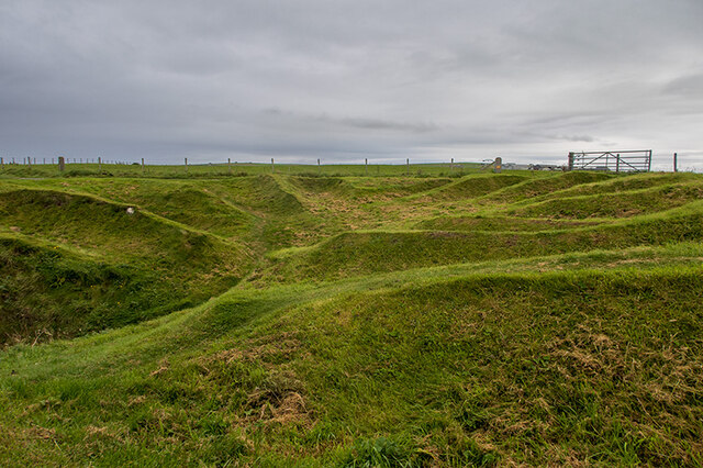
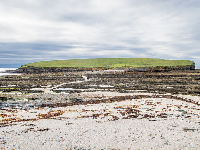
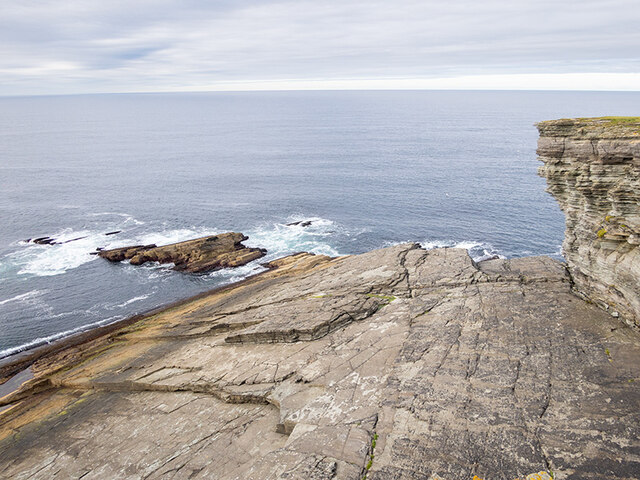
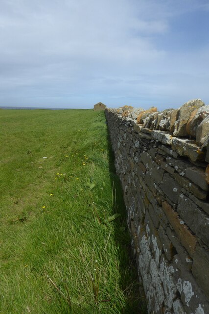
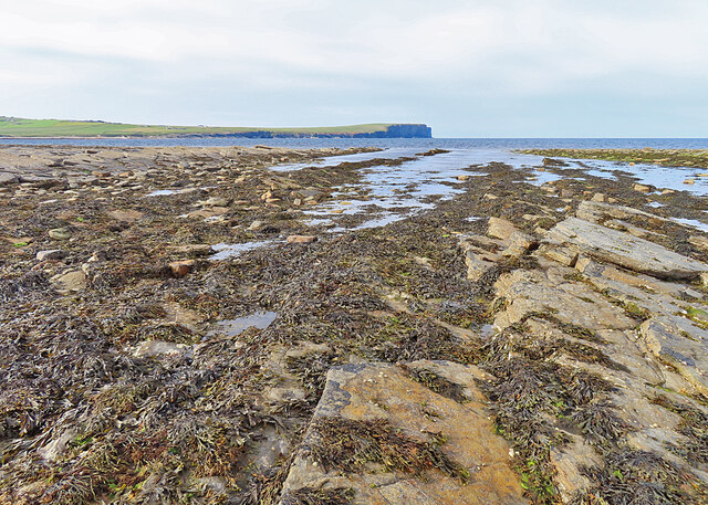
This headland, also referred to as Tanga Ness, features rugged cliffs that rise steeply from the sea, offering breathtaking panoramic views of the surrounding coastal landscape. The cliffs, composed mainly of sandstone and sedimentary rocks, showcase distinct geological formations and provide habitat for a diverse range of seabirds, such as guillemots and razorbills.

Tanga is known for its exposed and windswept environment, with strong currents and frequent gales making it a challenging spot for maritime navigation. As such, the headland has historically been a site of shipwrecks, adding to its allure and intrigue.

The area surrounding Tanga is rich in archaeological heritage, with several ancient sites nearby. The Brough of Deerness, an Iron Age broch situated on a nearby headland, showcases the island's ancient history and attracts visitors interested in exploring Orkney's past.

Overall, Tanga serves as an important coastal feature in Orkney, offering stunning natural beauty and a glimpse into the region's historical and geological significance. Whether admired from a distance or explored up close, Tanga is a remarkable destination for nature enthusiasts, history buffs, and those seeking tranquility amidst the rugged beauty of Scotland's coastline.

If you have any feedback on the listing, please let us know in the comments section below.
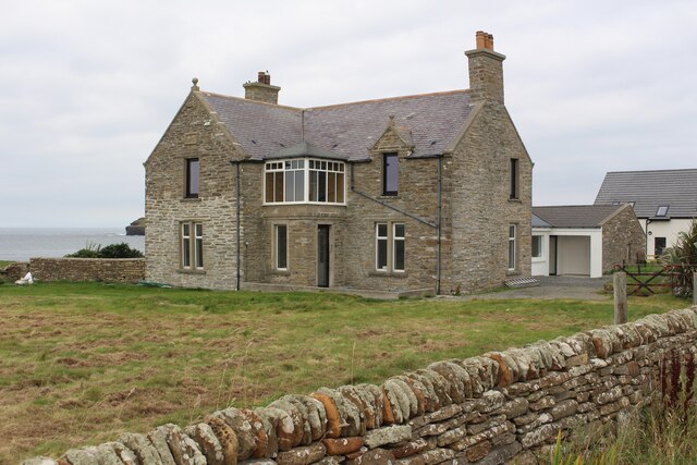
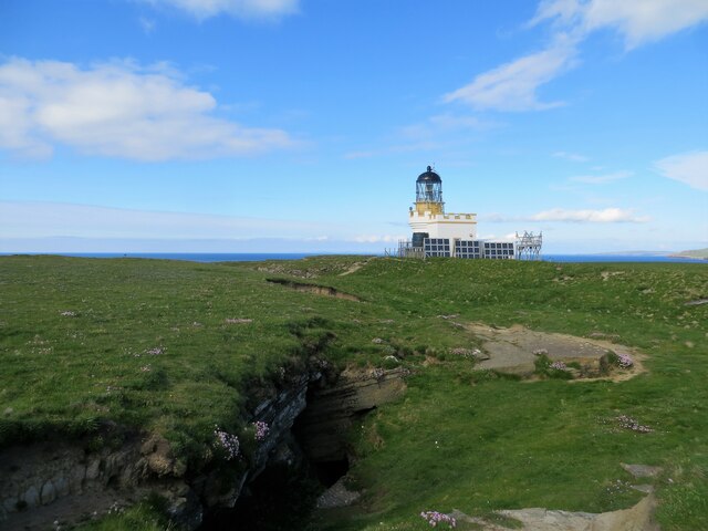
Tanga Images

Images are sourced within 2km of 59.135824/-3.3143477 or Grid Reference HY2428. Thanks to Geograph Open Source API. All images are credited.

Linkshouse Currently (2021) being converted to an Artists Residency Centre for the Pier Arts Centre, Stromness.
Linkshouse
Currently (2021) being converted to an Artists Residency Centre for the Pier Arts Centre, Stromness.
Linkshouse Site Signboard Currently (2021) being converted to an Artists Residency Centre for the Pier Arts Centre, Stromness.
Linkshouse Site Signboard
Currently (2021) being converted to an Artists Residency Centre for the Pier Arts Centre, Stromness.
Coastline, Northside, Orkney Looking towards the lighthouse on the Brough of Birsay.
Coastline, Northside, Orkney
Looking towards the lighthouse on the Brough of Birsay.
Brough Head lighthouse
The western range of the Earl's Palace at Birsay
The eastern range of the Earl's Palace at Birsay
Huts on the shore at Birsay
Rocky shore at Brough Sounds
Nousts at Skiba Geo The nousts are the remains of huts used by fishermen for whom Skiba Geo was a natural harbour.
Note: Skiba Geo is the local spelling.
Nousts at Skiba Geo
The nousts are the remains of huts used by fishermen for whom Skiba Geo was a natural harbour. Note: Skiba Geo is the local spelling.
Tidal causeway across Brough Sounds
Lower Palace from the Brough of Birsay
Rocks below the cliffs at Brough Head On the Brough of Birsay.
Rocks below the cliffs at Brough Head
On the Brough of Birsay.
Brough of Birsay lighthouse
Looking towards Marwick Head and the Kitchener Memorial Taken from the clifftops of Brough Head on the Brough of Birsay.
Looking towards Marwick Head and the Kitchener Memorial
Taken from the clifftops of Brough Head on the Brough of Birsay.
Slipway at the Point of Buckquoy Marwick Head and the Kitchener Memorial in the distance.
Slipway at the Point of Buckquoy
Marwick Head and the Kitchener Memorial in the distance.
Grassland by Birsay Bay, Orkney
Old wall and building at Point of Buckquoy, Orkney
Rocky Shore The shore south of the causeway that gives access to the Brough of Birsay, with Marwick Head in the distance. The causeway is under water at high tide, so you need to be sure to get off the island in good time.
Rocky Shore
The shore south of the causeway that gives access to the Brough of Birsay, with Marwick Head in the distance. The causeway is under water at high tide, so you need to be sure to get off the island in good time.
Show me another place!

Tanga is located at Grid Ref: HY2428 (Lat: 59.135824, Lng: -3.3143477)

Unitary Authority: Orkney Islands

Police Authority: Highlands and Islands

What 3 Words

///flame.gent.newsstand. Near Birsay, Orkney Islands

Related Wikis

Buckquoy spindle-whorl

The Buckquoy spindle-whorl is an Ogham-inscribed spindle-whorl dating from the Early Middle Ages, probably the 8th century, which was found in 1970 in...

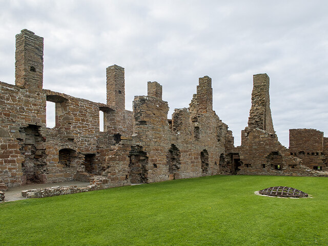
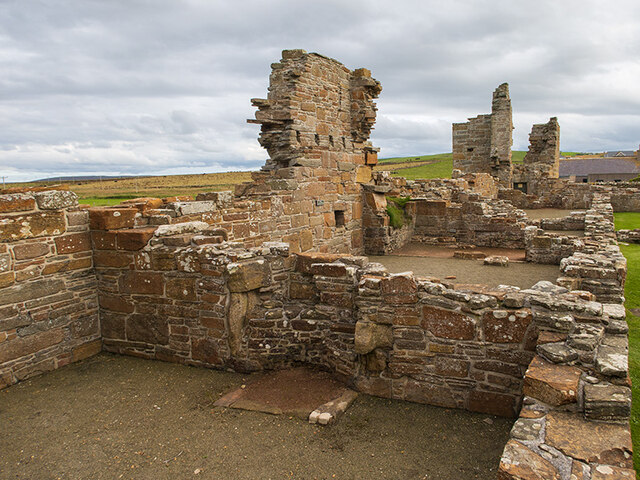
Earl's Palace, Birsay

The Earl's Palace in Birsay, Orkney, Scotland, is a ruined 16th-century castle. It was built by Robert Stewart, 1st Earl of Orkney (1533–1593), illegitimate...

St Magnus Church, Birsay

St Magnus Church, Birsay is a 17th-century church located in the parish of Birsay on Mainland, Orkney in Scotland. Built in 1664 on the site of an earlier...

Birsay

Birsay () (Old Norse: Birgisherað) is a parish in the north west corner of The Mainland of Orkney, Scotland. Almost all the land in the parish is devoted...

Nearby Amenities

Located within 500m of 59.135824,-3.3143477
The Whalebone
Tourism: artwork
Lat/Long: 59.1378844/-3.3127705
Bench
Source: survey
Lat/Long: 59.1375583/-3.3127281
Bench
Source: survey
Lat/Long: 59.1368864/-3.3124933
Parking
Fee: no
Surface: gravel
Lat/Long: 59.1351057/-3.3110934
Skiba Geo
Alt Name: Skipi Geo
Alt Name En: Skibba Geo
Alt Name 1: Skibi Geo
Natural: bay
Lat/Long: 59.1354167/-3.3116667
Power: pole
Lat/Long: 59.1366715/-3.3072714
Power: pole
Lat/Long: 59.1368747/-3.306426
Power: pole
Lat/Long: 59.1372312/-3.306507
The data included in this document is from www.openstreetmap.org. The data is made available under ODbL.

Have you been to Tanga?

Leave your review of Tanga below (or comments, questions and feedback).