Portugal Pump

Coastal Feature, Headland, Point in Cornwall

England

Portugal Pump

On SW Coast Path heading towards Portwrinkle
On SW Coast Path heading towards Portwrinkle Credit: Colin Park

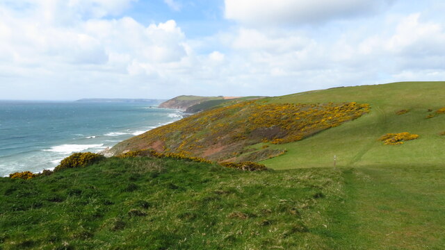
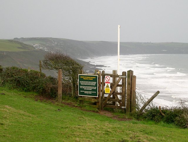
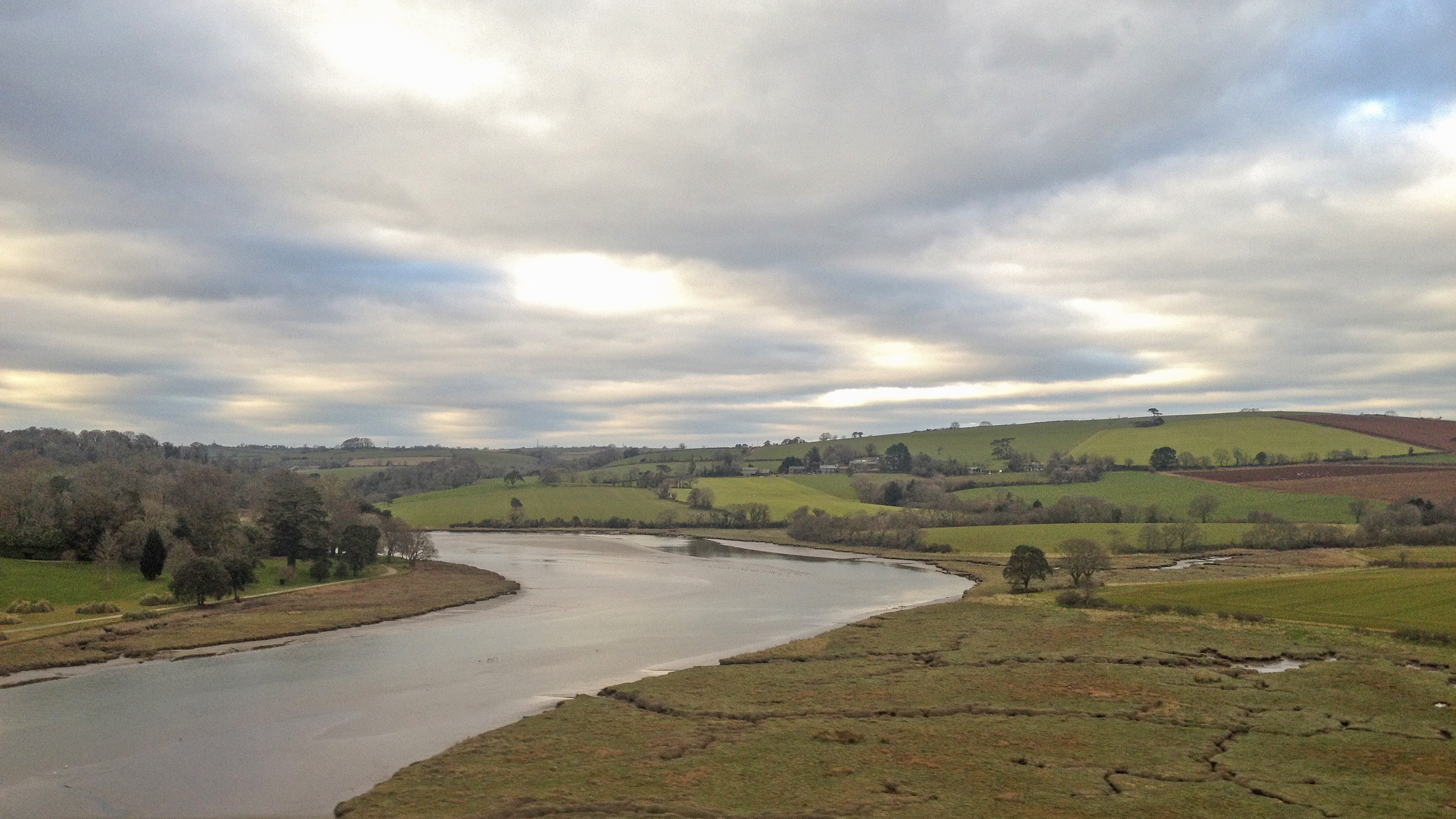
Portugal Pump is a prominent coastal feature located in Cornwall, England. Situated on the southern coast, this headland juts out into the Atlantic Ocean, forming a distinct point that offers breathtaking panoramic views of the surrounding coastline. The name "Portugal Pump" is derived from the powerful surges of water that crash against the rocks, resembling the forceful pumping action of a water pump.

This stunning headland is characterized by its rugged and dramatic cliffs, which rise majestically from the sea. The cliffs are composed of a mix of sedimentary rocks, including granite and slate, which contribute to the unique geological formations found in this area. The constant erosion from the relentless sea has sculpted caves, arches, and stacks along the coastline, providing a striking contrast against the deep blue ocean.

The Portugal Pump headland is a popular destination for nature enthusiasts, hikers, and photographers. The coastal path that runs along the cliff edge offers spectacular views and opportunities to observe a diverse range of marine life, including seabirds, seals, and even dolphins if one is lucky. The area is also home to a variety of plant species, such as heather and gorse, which add bursts of color to the landscape.

Due to its exposed location, Portugal Pump can experience strong winds and rough seas, making it a challenging spot for swimming or water-based activities. Nevertheless, the sheer beauty and raw power of this coastal feature make it a must-visit for those seeking an awe-inspiring experience in the natural wonders of Cornwall.

If you have any feedback on the listing, please let us know in the comments section below.

Portugal Pump Images

Images are sourced within 2km of 50.3601/-4.3021617 or Grid Reference SX3653. Thanks to Geograph Open Source API. All images are credited.

On SW Coast Path heading towards Portwrinkle
View W to Portwrinkle from SW Coast Path
On SW Coast Path - view W above Trethill Cliffs
Finneygook Beach, Portwrinkle Looking Seaward (South) from the rockpools.
Finneygook Beach, Portwrinkle
Looking Seaward (South) from the rockpools.
Portwrinkle This photograph of the small coastal village of Portwrinkle was taken from the hillside adjacent to Finnygook lane. The photograph shows the 20th century development of the village including a large hotel.  The area of Portwrinkle which formed the original fishing village is at the western end of the village, just out of sight on this shot.
Portwrinkle
This photograph of the small coastal village of Portwrinkle was taken from the hillside adjacent to Finnygook lane. The photograph shows the 20th century development of the village including a large hotel. The area of Portwrinkle which formed the original fishing village is at the western end of the village, just out of sight on this shot.
Crafthole Village Crafthole is a village on the hilltop above Portwrinkle. The picture shows part of the old village centre although there are many more 20th century houses in the village.
Crafthole Village
Crafthole is a village on the hilltop above Portwrinkle. The picture shows part of the old village centre although there are many more 20th century houses in the village.
Valley to the north of Trewrickle Farm.
Old farm buildings at Tredrossel Conversions are taking place, the farthest building has been converted into cottages.
Old farm buildings at Tredrossel
Conversions are taking place, the farthest building has been converted into cottages.
Sheviock Looking east towards the village of Sheviock from Horsepool Road.  The freshwater lake in the foreground has been artificially created.
Sheviock
Looking east towards the village of Sheviock from Horsepool Road. The freshwater lake in the foreground has been artificially created.
Sheviock A view of the village from the eastern side.  The church spire on the right is the Parish Church of St Mary, Sheviock.  While this may look an idyllic scene, Sheviock is one of those unfortunate villages which is split by a fast main road.  Although some of the traffic actually obeys the 40mph speed limit, this does not really help to make it either peaceful or safe.
Sheviock
A view of the village from the eastern side. The church spire on the right is the Parish Church of St Mary, Sheviock. While this may look an idyllic scene, Sheviock is one of those unfortunate villages which is split by a fast main road. Although some of the traffic actually obeys the 40mph speed limit, this does not really help to make it either peaceful or safe.
The A374 east of Sheviock This stretch of road between the villages of Antony and Polbathic cuts through the low-lying mainly wooded countryside along the south side of Lynher River estuary.  Its open curves and good cambers make it a favourite with motor cyclists.
The A374 east of Sheviock
This stretch of road between the villages of Antony and Polbathic cuts through the low-lying mainly wooded countryside along the south side of Lynher River estuary. Its open curves and good cambers make it a favourite with motor cyclists.
Houses on the Seafront Road This is at the western end of Portwrinkle, the site of the old village.  The white house in the foreground called "Smuggler's Cottage" is probably the oldest house in the village.  It has a date mark of 1795 on the front.  In the 17th and early 18th century it is likely that almost all male residents of the village took part in smuggling from time to time as it was one way to supplement the meagre income from the pilchard fishery.
Houses on the Seafront Road
This is at the western end of Portwrinkle, the site of the old village. The white house in the foreground called "Smuggler's Cottage" is probably the oldest house in the village. It has a date mark of 1795 on the front. In the 17th and early 18th century it is likely that almost all male residents of the village took part in smuggling from time to time as it was one way to supplement the meagre income from the pilchard fishery.
The old fish cellars, Portwrinkle This derelict building in Portwrinkle used to be the Pilchard processing plant.  Pilchards are the reason that Portwrinkle exists.  The village was set up by the local landowners, the Carew-Pole family in order to take advantage of the pilchard fisheries.  The shoals of pilchard would be spotted by a look-out on the hill above the village who would guide the boats into the shoal by semaphore.  Pilchards were salted and pressed in the cellar and the oil which drained off was an important by-product.  The fish could then be boxed and sent away for sale.  In the mid 19th century with the pilchard fisheries beginning to decline, local fisherman bought the fishery from the landowner by forming a co-operative which they called "The Poor Man's Endeavour", quite a provocative name for the time.  This continued until the First World War.

The last factory producing traditionally processed Cornish pilchards operated in Newlyn and closed in October 2005.
The old fish cellars, Portwrinkle
This derelict building in Portwrinkle used to be the Pilchard processing plant. Pilchards are the reason that Portwrinkle exists. The village was set up by the local landowners, the Carew-Pole family in order to take advantage of the pilchard fisheries. The shoals of pilchard would be spotted by a look-out on the hill above the village who would guide the boats into the shoal by semaphore. Pilchards were salted and pressed in the cellar and the oil which drained off was an important by-product. The fish could then be boxed and sent away for sale. In the mid 19th century with the pilchard fisheries beginning to decline, local fisherman bought the fishery from the landowner by forming a co-operative which they called "The Poor Man's Endeavour", quite a provocative name for the time. This continued until the First World War. The last factory producing traditionally processed Cornish pilchards operated in Newlyn and closed in October 2005.
The Boathouse, Portwrinkle This is an old building going back to at least the 19th century. It is situated at the top of the slipway and, when this photograph was taken, was still performing exactly the duties for which it was intended.  In the 19th century the fishermen of Portwrinkle bought out the fishery from the local landowner by forming a co-operative called "The Poor Man's Endeavour", quite a radical name for the time.  I like to think that they also recognised there was an element of black humour in the name (hint: shorten the last word).  They were photographed standing in front of this boathouse in around 1880.
The Boathouse, Portwrinkle
This is an old building going back to at least the 19th century. It is situated at the top of the slipway and, when this photograph was taken, was still performing exactly the duties for which it was intended. In the 19th century the fishermen of Portwrinkle bought out the fishery from the local landowner by forming a co-operative called "The Poor Man's Endeavour", quite a radical name for the time. I like to think that they also recognised there was an element of black humour in the name (hint: shorten the last word). They were photographed standing in front of this boathouse in around 1880.
Golf Course near Crafthole Looking over part of a golf course between Crafthole and the sea cliffs.
Golf Course near Crafthole
Looking over part of a golf course between Crafthole and the sea cliffs.
Entrance to the path by Tregantle Fort This permissive path is one of the most recently opened sections of the South West Coast Path.  It is closed when the MOD firing ranges at Tregantle are being used, at which times walkers must take a detour to the landward side of the fort.
Entrance to the path by Tregantle Fort
This permissive path is one of the most recently opened sections of the South West Coast Path. It is closed when the MOD firing ranges at Tregantle are being used, at which times walkers must take a detour to the landward side of the fort.
World War II Pillbox This old pillbox sits decaying in the corner of a field.
World War II Pillbox
This old pillbox sits decaying in the corner of a field.
Port Wrinkle harbour
Show me another place!

Portugal Pump is located at Grid Ref: SX3653 (Lat: 50.3601, Lng: -4.3021617)

Unitary Authority: Cornwall

Police Authority: Devon and Cornwall

What 3 Words

///retrain.unite.clash. Near Millbrook, Cornwall

Related Wikis

Crafthole

Crafthole is a village in the parish of Sheviock, in southeast Cornwall, England, UK. The village has a pub (Finnygook Inn), Post Office, shop, Methodist...

Portwrinkle

Portwrinkle (Cornish: Porthwykkel) is a small coastal village in south-east Cornwall, England, United Kingdom. It is at the western end of Whitsand Bay...

Sheviock

Sheviock (Cornish: Seviek, meaning strawberry bed) is a coastal civil parish and a hamlet in south-east Cornwall, England, United Kingdom. The parish is...

Tregantle Fort

Tregantle Fort in south east Cornwall is one of several forts surrounding Plymouth that were built as a result of a decision in Lord Palmerston's premiership...

Tregantle Down Battery

Tregantle Down Battery was a high angle gun battery in south east Cornwall. It was built between 1888 and 1894 to defend HMNB Devonport from Whitsand Bay...

Lower Tregantle

Lower Tregantle is a hamlet in Cornwall, England, UK. It is about half a mile south of Antony; Higher Tregantle is about a quarter of a mile further south...

Scraesdon Fort

Scraesdon Fort, near the village of Antony, is one of several forts in South East Cornwall which formed part of the ring of forts surrounding Plymouth...

River Tiddy

The River Tiddy (Cornish: Teudhi) is a small river in south-east Cornwall, the main tributary of the River Lynher. The Tiddy rises near Pensilva and flows...

Nearby Amenities

Located within 500m of 50.3601,-4.3021617
Bench
Backrest: yes
Lat/Long: 50.3617748/-4.30551
Generator Method: photovoltaic
Generator Output Electricity: yes
Generator Source: solar
Generator Type: solar_photovoltaic_panel
Location: roof
Power: generator
Lat/Long: 50.3640254/-4.299128
Bench
Backrest: yes
Lat/Long: 50.3608864/-4.2981987
Defibrillator
Defibrillator Location: On side wall of Jolly Roger cafe, facing car park
Emergency: defibrillator
Indoor: no
Mapillary: 223687552937302
Survey Date: 2021-07-08
Lat/Long: 50.3619337/-4.3085898
Life Ring
Emergency: life_ring
Lat/Long: 50.3614879/-4.3075423
Natural: shrub
Lat/Long: 50.3625842/-4.3019141
Height: 5
Man Made: dovecote
Lat/Long: 50.3643037/-4.3023973
The data included in this document is from www.openstreetmap.org. The data is made available under ODbL.

Have you been to Portugal Pump?

Leave your review of Portugal Pump below (or comments, questions and feedback).