Butler's Horse
Coastal Feature, Headland, Point in Pembrokeshire
Wales
Butler's Horse

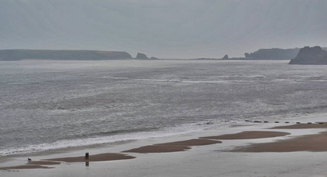
Butler's Horse is a prominent coastal feature located in Pembrokeshire, Wales. It is a headland that juts out into the sea, forming a distinctive point along the coastline.
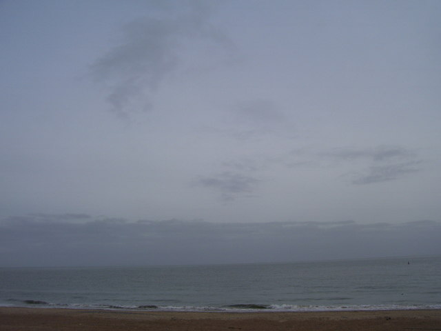
The headland is characterized by its rugged cliffs, which tower above the crashing waves below. The cliffs are composed of sedimentary rock, displaying layers of different rock types that have been formed over millions of years. This geological formation provides a stunning backdrop to the surrounding landscape.
Atop the headland, there is a flat grassy area, offering panoramic views of the surrounding ocean and coastline. This vantage point allows visitors to appreciate the natural beauty of the area, as well as observe the diverse marine life that inhabits the waters below.
Butler's Horse is also known for its historical significance. It has been used as a lookout point for centuries, with evidence of Iron Age fortifications found in the vicinity. This suggests that the headland may have served as a defensive position or a signaling station in ancient times.
Today, Butler's Horse is a popular destination for nature enthusiasts, hikers, and photographers. The headland is accessible via footpaths that wind through the surrounding countryside, offering visitors an opportunity to explore the area's unique flora and fauna.
Overall, Butler's Horse is a captivating coastal feature that combines natural beauty, geological interest, and historical significance, making it a must-visit destination for those exploring Pembrokeshire's coastline.
If you have any feedback on the listing, please let us know in the comments section below.
Butler's Horse Images
Images are sourced within 2km of 51.67303/-4.6946954 or Grid Reference SN1300. Thanks to Geograph Open Source API. All images are credited.


Butler's Horse is located at Grid Ref: SN1300 (Lat: 51.67303, Lng: -4.6946954)
Unitary Authority: Pembrokeshire
Police Authority: Dyfed Powys
What 3 Words
///downsize.boss.calculating. Near Tenby, Pembrokeshire
Nearby Locations
Related Wikis
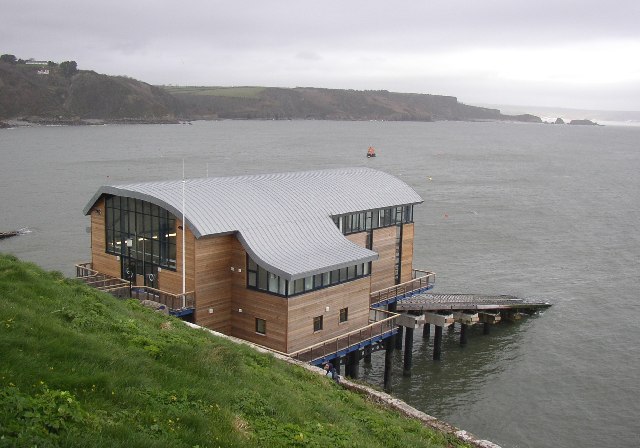
Tenby Lifeboat Station
Tenby Lifeboat Station is a lifeboat station in Tenby, Pembrokeshire, Wales that has been situated to the east of the town since 1852, three generations...

Tenby Castle
Tenby Castle (Welsh: Castell Dinbych-y-pysgod) was a fortification standing on a headland separated by an isthmus from the town of Tenby, Pembrokeshire...
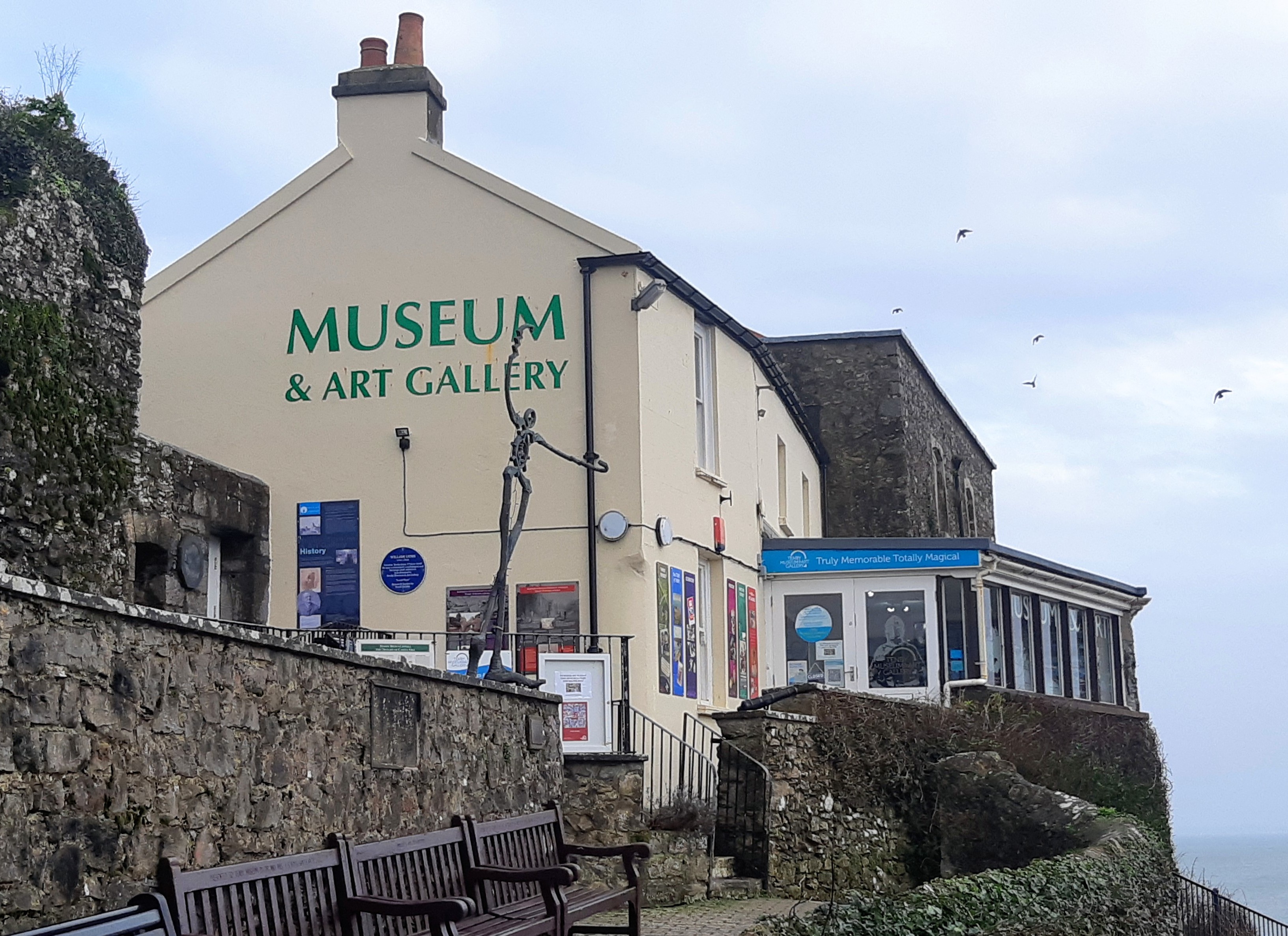
Tenby Museum and Art Gallery
Tenby Museum and Art Gallery, located in Tenby, Pembrokeshire, South West Wales, is the oldest independent museum in Wales. Established in 1878, the museum...
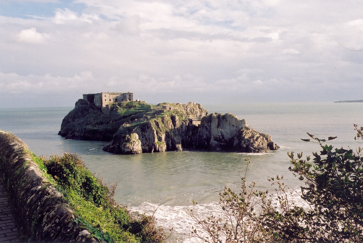
St Catherine's Island
St Catherine's Island (Welsh: Ynys Catrin) is a small tidal island linked to Tenby in Pembrokeshire, Wales, by Castle beach at low tide. The island, which...

Cobourg Hotel
Cobourg Hotel was a hotel in Tenby, Pembrokeshire, Wales, situated at the northwest of the High Street, where it joins Crackwell Street. Though an inn...
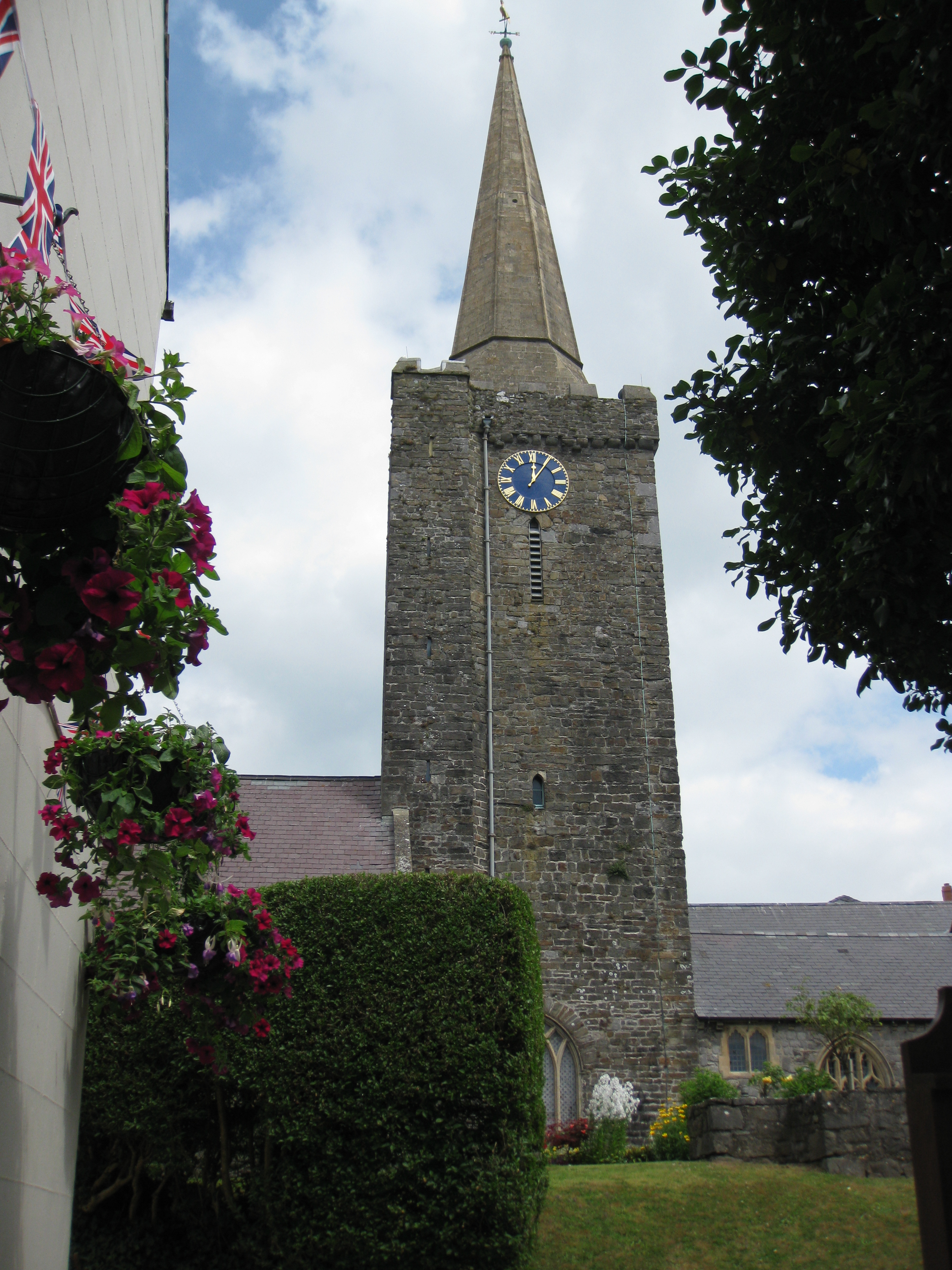
St Mary's Church, Tenby
St Mary's Church, Tenby is a church located in the centre of the town of Tenby in Pembrokeshire, western Wales. The church is in the Diocese of Saint David...
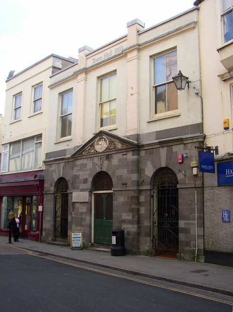
Tenby Town Hall
Tenby Town Hall (Welsh: Neuadd y Dref Dinbych-y-pysgod) is a municipal building in the High Street, Tenby, Pembrokeshire, Wales. The structure, which is...
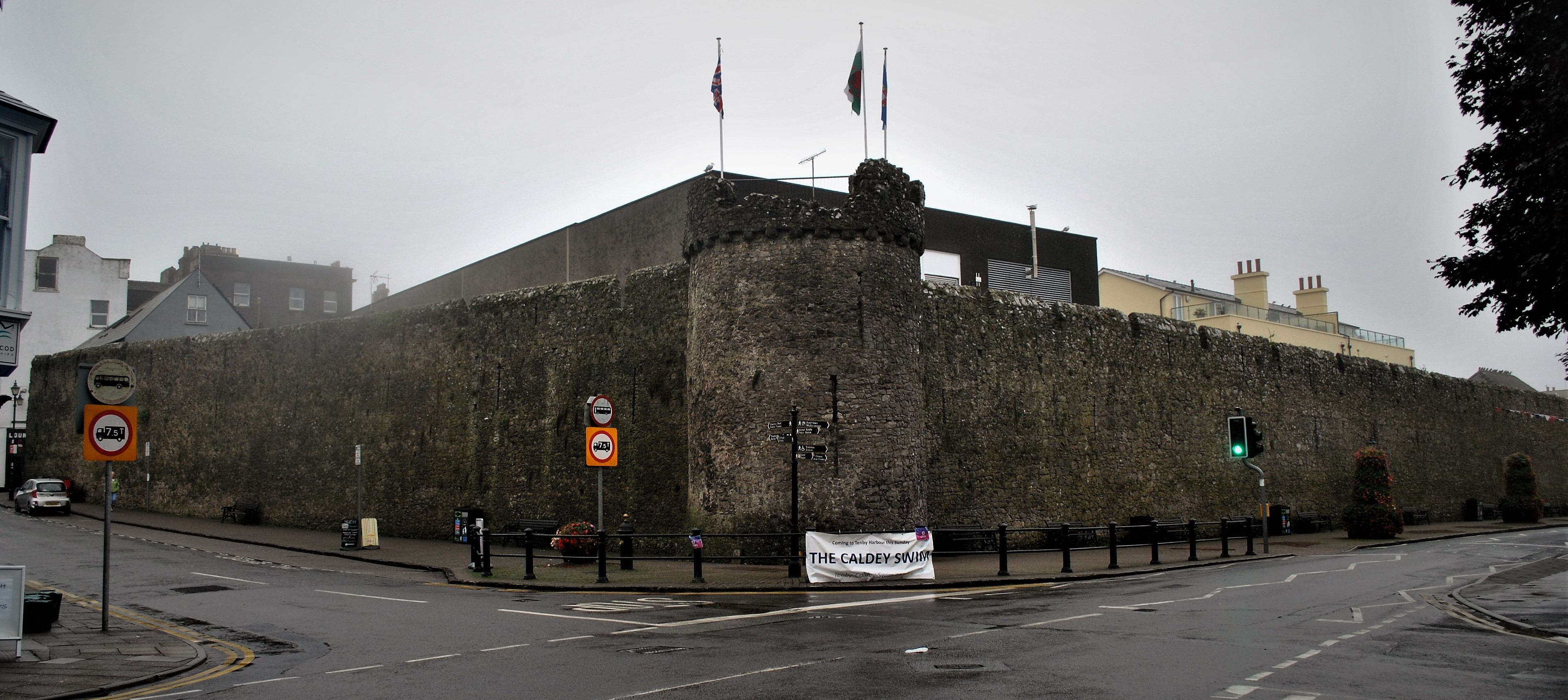
Tenby town walls
The Tenby town walls are Grade I-listed medieval defensive structures around the town of Tenby in Pembrokeshire. They are assessed as one of the most important...
Nearby Amenities
Located within 500m of 51.67303,-4.6946954Have you been to Butler's Horse?
Leave your review of Butler's Horse below (or comments, questions and feedback).