Face of the Carrick

Coastal Feature, Headland, Point in Wigtownshire

Scotland

Face of the Carrick

Fields above Knockencule Farm On the west coast of the Rhins.
Fields above Knockencule Farm Credit: David Purchase

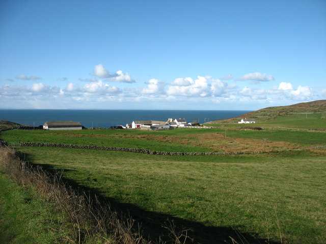
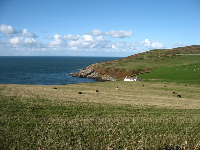
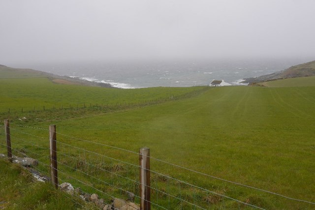
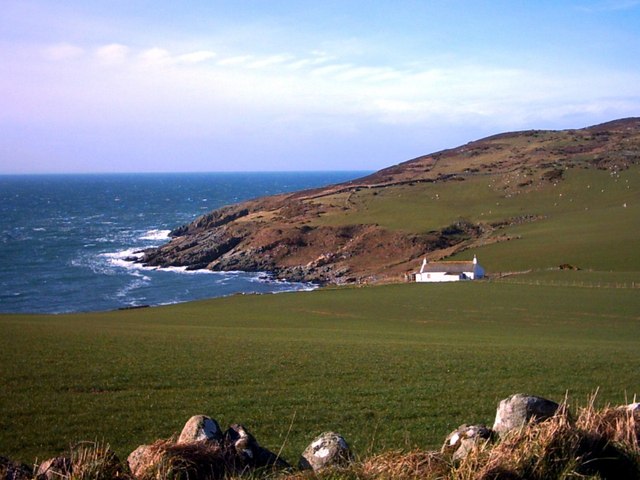
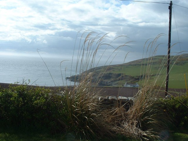
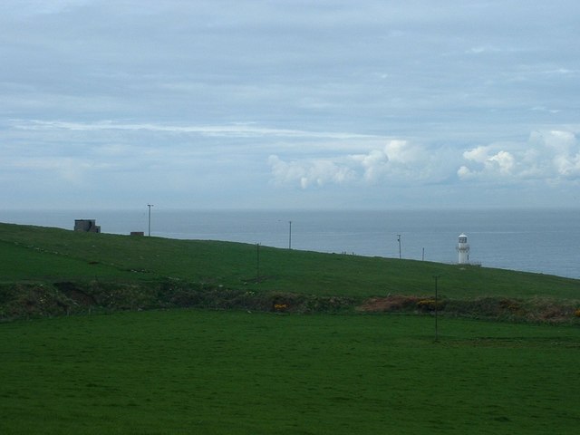
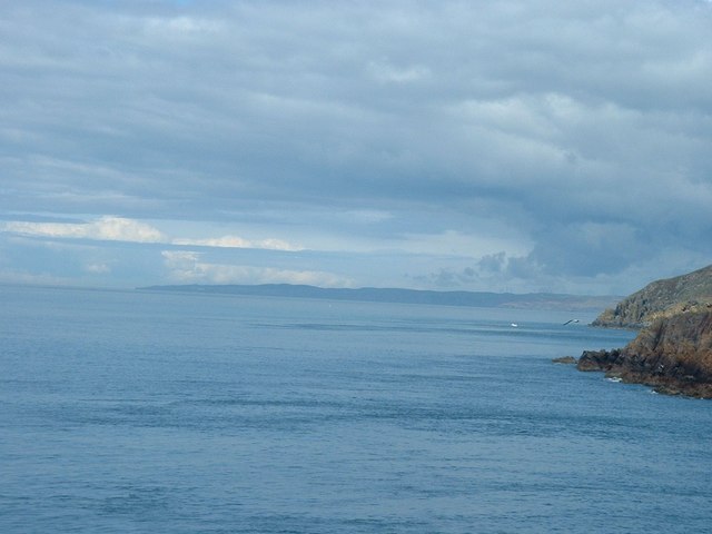
Face of the Carrick is a prominent coastal feature located in Wigtownshire, Scotland. Situated on the western coast of the Carrick Bay, this headland offers stunning views of the Irish Sea and the surrounding landscape.

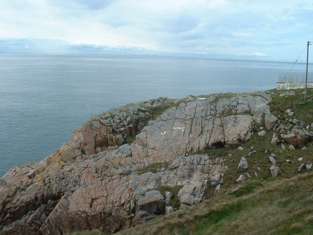
The Face of the Carrick gets its name from the distinctive rock formation that resembles a face when viewed from a certain angle. This unique feature has been shaped by years of erosion and weathering, resulting in a rugged and dramatic appearance. The rock face is composed mainly of sandstone, which gives it a reddish hue and adds to its visual appeal.

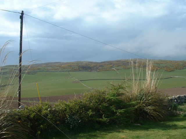
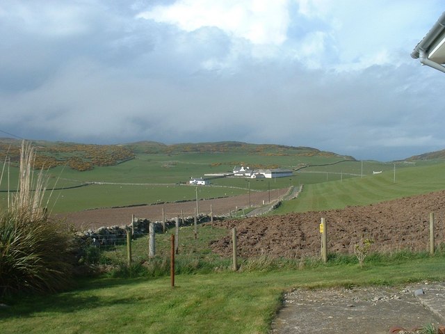
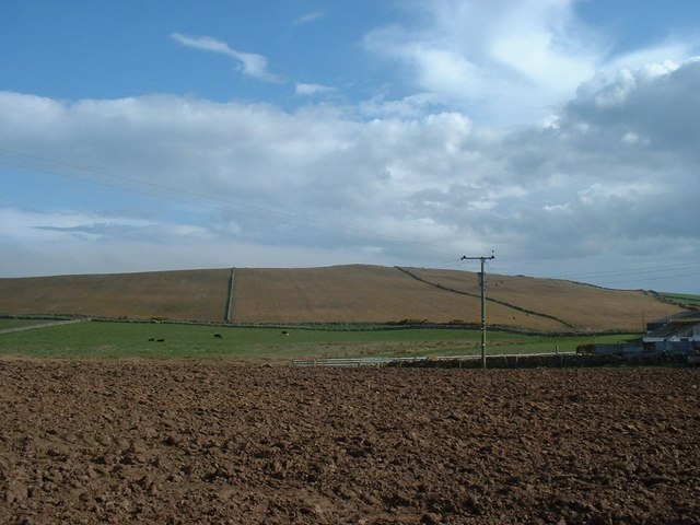
The headland is easily accessible, with a footpath leading up to the summit. From there, visitors are treated to panoramic views of the coastline, the bay, and the nearby Galloway Hills. On a clear day, the Isle of Man can even be seen in the distance.

The area surrounding Face of the Carrick is rich in biodiversity, with a variety of plants and wildlife calling it home. Seabirds such as gulls and cormorants can be spotted nesting on the cliffs, while seals and dolphins occasionally make appearances in the waters below.

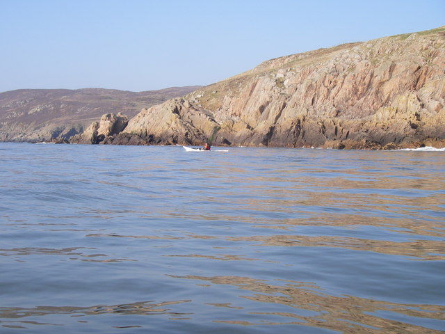
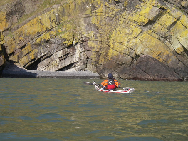
The headland is a popular destination for nature lovers, hikers, and photographers, who come to capture the beauty of the Scottish coastline. It also serves as a starting point for coastal walks and exploration of the nearby Carrick Bay, where visitors can indulge in activities such as beachcombing and rock pooling.

In summary, the Face of the Carrick is a captivating coastal feature in Wigtownshire, offering breathtaking views, unique rock formations, and a chance to immerse oneself in the natural beauty of Scotland's coastline.

If you have any feedback on the listing, please let us know in the comments section below.

Face of the Carrick Images

Images are sourced within 2km of 54.664106/-4.9613027 or Grid Reference NX0933. Thanks to Geograph Open Source API. All images are credited.

Fields above Knockencule Farm On the west coast of the Rhins.
Fields above Knockencule Farm
On the west coast of the Rhins.
The west shore of The Rhins Bay House in view, just right of centre.
The west shore of The Rhins
Bay House in view, just right of centre.
Bay House The bay is Portencorkrie. The west side of the Rhins is wild and there is a gale blowing out to sea.
Bay House
The bay is Portencorkrie. The west side of the Rhins is wild and there is a gale blowing out to sea.
Road to Slockmill Serving scattered dwellings on the exposed west coast of the Rhins of Galloway.
Road to Slockmill
Serving scattered dwellings on the exposed west coast of the Rhins of Galloway.
Bay House, Portencorkrie An idyllic traditional Galloway cottage above Portencorkrie Bay.
Bay House, Portencorkrie
An idyllic traditional Galloway cottage above Portencorkrie Bay.
North of Crammag Head
Arched Rock bed at Portdown bay
Knockencule Cottages Farm cottages at Knockencule in the remote south-west corner of South Rhins.
Knockencule Cottages
Farm cottages at Knockencule in the remote south-west corner of South Rhins.
North End Portencorkrie Bay The beach side house is now boarded up and abandoned.
North End Portencorkrie Bay
The beach side house is now boarded up and abandoned.
Towards Barncorkrie Moor The gorse on the hillside glows brightly against the new spring grass in the sheep pasture.
Towards Barncorkrie Moor
The gorse on the hillside glows brightly against the new spring grass in the sheep pasture.
Barncorkrie Farm With Barncorkrie Moor behind and the minor road to Inshanks Fell in front.
Barncorkrie Farm
With Barncorkrie Moor behind and the minor road to Inshanks Fell in front.
Fields by Knockencule With outbuildings of Knockencule Farm to right.
Fields by Knockencule
With outbuildings of Knockencule Farm to right.
Buildings on Crammag Head To left, abandoned coastguard lookout.  To right, newly erected glass fibre lighthouse.
Buildings on Crammag Head
To left, abandoned coastguard lookout. To right, newly erected glass fibre lighthouse.
View north from Crammag Head From north side of new lighthouse, with Laggantalluch Head middle right and Black Head, beyond Portpatrick in left far distance.
View north from Crammag Head
From north side of new lighthouse, with Laggantalluch Head middle right and Black Head, beyond Portpatrick in left far distance.
New lighthouse at Crammag Head Erected over the winter of 2009/2010 by specialist builders from the Orkney's, this glass fibre lighthouse replaced previous structure whose square base is visible to left. Coast of Northern Ireland near Belfast just visible on far horizon.
New lighthouse at Crammag Head
Erected over the winter of 2009/2010 by specialist builders from the Orkney's, this glass fibre lighthouse replaced previous structure whose square base is visible to left. Coast of Northern Ireland near Belfast just visible on far horizon.
Towards Mull of Galloway From south side of newly erected lighthouse at Crammag Head along western coast line of South Rhinns with Isle of Mann visible on far horizon.
Towards Mull of Galloway
From south side of newly erected lighthouse at Crammag Head along western coast line of South Rhinns with Isle of Mann visible on far horizon.
Old coastguard lookout Derelict but still identifiable.
Old coastguard lookout
Derelict but still identifiable.
Lighthouse constructors graffiti South side of newly erected lighthouse at Crammag Head, platform to right, where the very fresh and white coloured initials were probably left by the constructors in February 2010.
Lighthouse constructors graffiti
South side of newly erected lighthouse at Crammag Head, platform to right, where the very fresh and white coloured initials were probably left by the constructors in February 2010.
Show me another place!

Face of the Carrick is located at Grid Ref: NX0933 (Lat: 54.664106, Lng: -4.9613027)

Unitary Authority: Dumfries and Galloway

Police Authority: Dumfries and Galloway

What 3 Words

///acoustics.timidly.like. Near Drummore, Dumfries & Galloway

Related Wikis

Cairngaan

Cairngaan, Wigtownshire, is the southmost settlement in Scotland. The hamlet of Cairngaan lies just north of the Mull of Galloway (which contains Scotland...

Kirkmaiden (village)

Kirkmaiden (sometimes Maidenkirk; Scottish Gaelic: Cill M'Eudan) is a small settlement in Galloway, Scotland, located approximately 17 miles (27 km) south...

Kirkmaiden

Kirkmaiden is a parish in the Rhins of Galloway, the most southerly in Scotland; the present Church of Scotland parish has the same name as and is approximately...

Drummore

Drummore (drum-ORE; (from Gaelic An Druim Mòr meaning "the great ridge") is the southernmost village in Scotland, located at the southern end of the Rhins...

Nearby Amenities

Located within 500m of 54.664106,-4.9613027
Source: PGS
Lat/Long: 54.6682364/-4.9642728
Source: PGS
Lat/Long: 54.667834/-4.9642782
Source: PGS
Lat/Long: 54.6677324/-4.9643814
Source: PGS
Lat/Long: 54.6670916/-4.9641226
Source: PGS
Lat/Long: 54.6668263/-4.9641096
Source: PGS
Lat/Long: 54.6665327/-4.9644907
Source: PGS
Lat/Long: 54.6659404/-4.9650845
Source: PGS
Lat/Long: 54.6655861/-4.965063
Source: PGS
Lat/Long: 54.6645133/-4.9644458
Source: PGS
Lat/Long: 54.6644207/-4.9644746
Source: PGS
Lat/Long: 54.6640499/-4.9639615
Source: PGS
Lat/Long: 54.6639351/-4.9626467
Source: PGS
Lat/Long: 54.6639211/-4.9614255
Source: PGS
Lat/Long: 54.6637475/-4.9604721
Source: PGS
Lat/Long: 54.6640758/-4.9598183
Source: PGS
Lat/Long: 54.663628/-4.9588397
Source: PGS
Lat/Long: 54.6633842/-4.9586265
Source: PGS
Lat/Long: 54.6632885/-4.9582891
Source: PGS
Lat/Long: 54.6630526/-4.9580953
Source: PGS
Lat/Long: 54.6628621/-4.9575313
Source: PGS
Lat/Long: 54.6630948/-4.9570337
Source: PGS
Lat/Long: 54.662677/-4.957197
Source: PGS
Lat/Long: 54.6627837/-4.9566784
Source: PGS
Lat/Long: 54.6625426/-4.9564202
Source: PGS
Lat/Long: 54.6624842/-4.9559814
Source: PGS
Lat/Long: 54.6627334/-4.9559813
Source: PGS
Lat/Long: 54.6623822/-4.9549341
Source: PGS
Lat/Long: 54.6620526/-4.9558536
Source: PGS
Lat/Long: 54.6621613/-4.955119
Source: PGS
Lat/Long: 54.6621596/-4.9548657
Crammag Head Lighthouse
Man Made: lighthouse
Seamark Light Character: Fl
Seamark Light Colour: white
Seamark Light Height: 35
Seamark Light Period: 10
Seamark Light Range: 18
Seamark Light Reference: A 4608
Seamark Light Sequence: 0.4+(9.6)
Seamark Type: light_major
Source: US NGA Pub. 114. 2011-05-26.
Website: https://www.nlb.org.uk/lighthouses/crammag-head/
Lat/Long: 54.6651621/-4.9648172
Power: pole
Lat/Long: 54.6659345/-4.9542584
Power: pole
Lat/Long: 54.6656989/-4.9541925
Power: pole
Lat/Long: 54.6654431/-4.954109
The data included in this document is from www.openstreetmap.org. The data is made available under ODbL.

Have you been to Face of the Carrick?

Leave your review of Face of the Carrick below (or comments, questions and feedback).