Bib Rock

Coastal Feature, Headland, Point in Cornwall

England

Bib Rock

All Saints United Church of England and Methodist Church
All Saints United Church of England and Methodist Church Credit: Paul Barnett

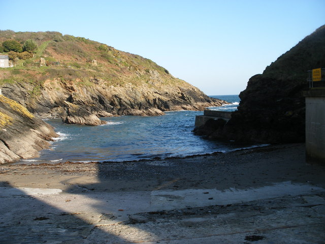
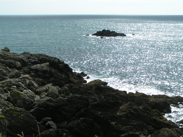
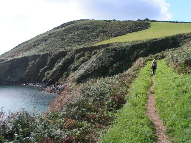
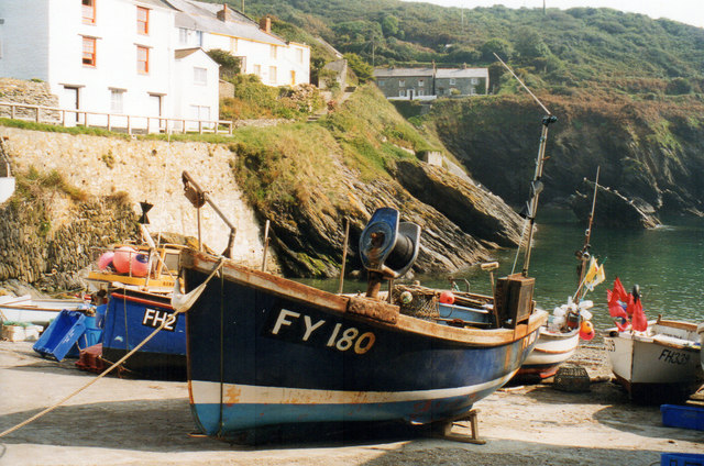
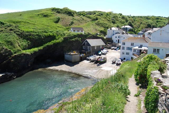
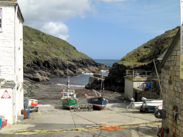
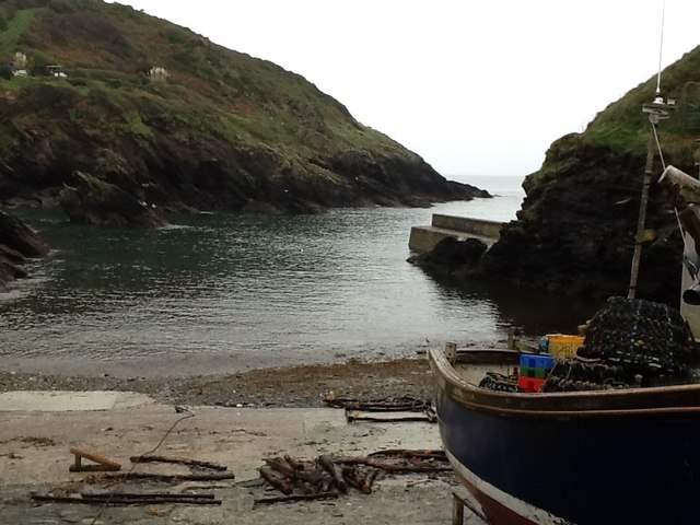
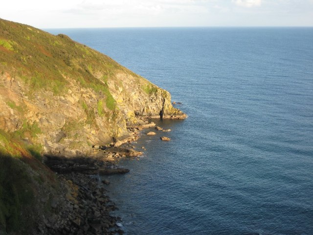
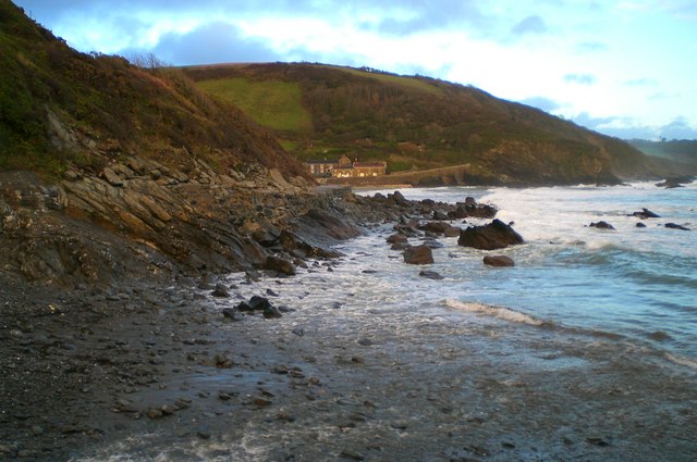
Bib Rock is a prominent coastal feature located in Cornwall, England. Situated along the rugged coastline, this headland juts out into the Atlantic Ocean, forming a distinctive point that is recognizable from afar. With its unique shape and geographical characteristics, Bib Rock has become a popular landmark for locals and tourists alike.

The headland is composed of granite, which gives it a solid and enduring structure. The rock formation is characterized by its jagged edges, which have been shaped over time by the relentless pounding of the waves. At low tide, the rock is partially exposed, providing an opportunity for visitors to explore its nooks and crannies.

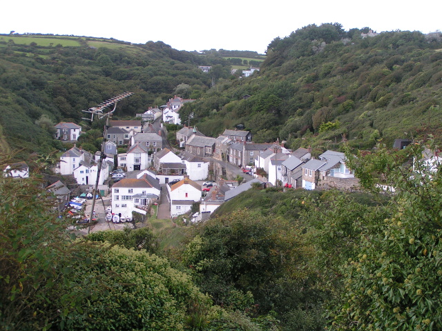
Bib Rock offers breathtaking panoramic views of the surrounding coastline. From its vantage point, visitors can enjoy sweeping vistas of the azure sea, dramatic cliffs, and sandy beaches. The headland also provides an excellent vantage point for observing marine wildlife, such as seals and seabirds, which inhabit the nearby waters.

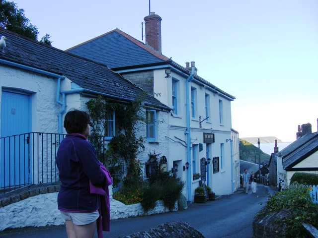
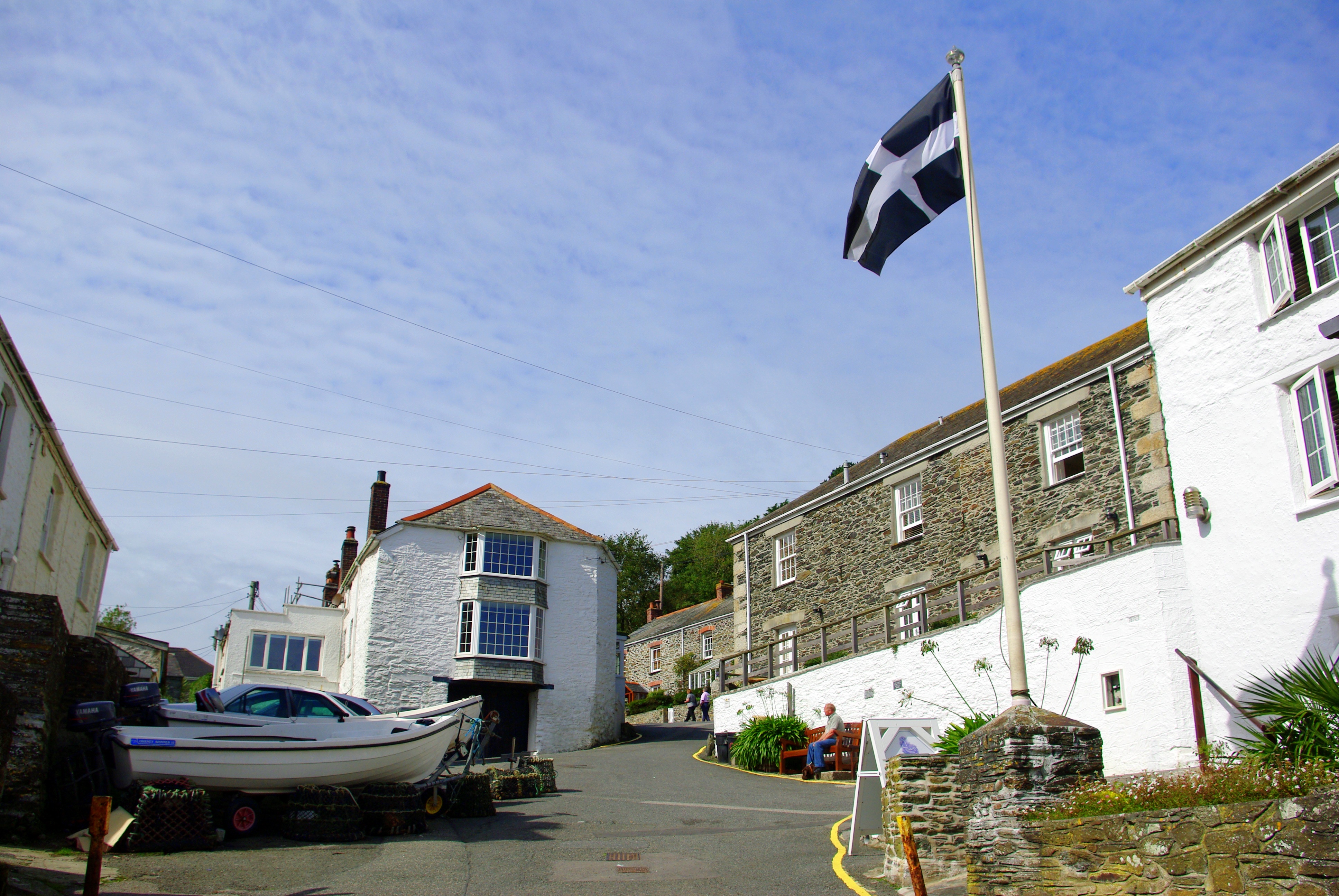
Access to Bib Rock is relatively easy, with a well-maintained footpath leading from a nearby parking area. The headland is also a popular spot for hiking enthusiasts, who can take advantage of the numerous coastal trails that pass through the area. Additionally, the rock is a favorite spot for photographers, who are drawn to its picturesque beauty and the opportunity to capture stunning sunsets over the ocean.

In conclusion, Bib Rock is a captivating coastal feature in Cornwall that offers visitors a unique and mesmerizing experience. Its rugged beauty, panoramic views, and accessibility make it a must-see destination for nature lovers and adventurers.

If you have any feedback on the listing, please let us know in the comments section below.

Bib Rock Images

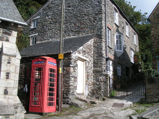
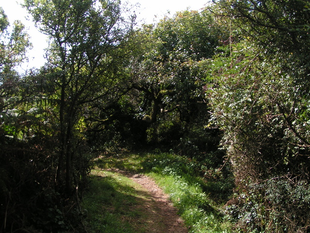
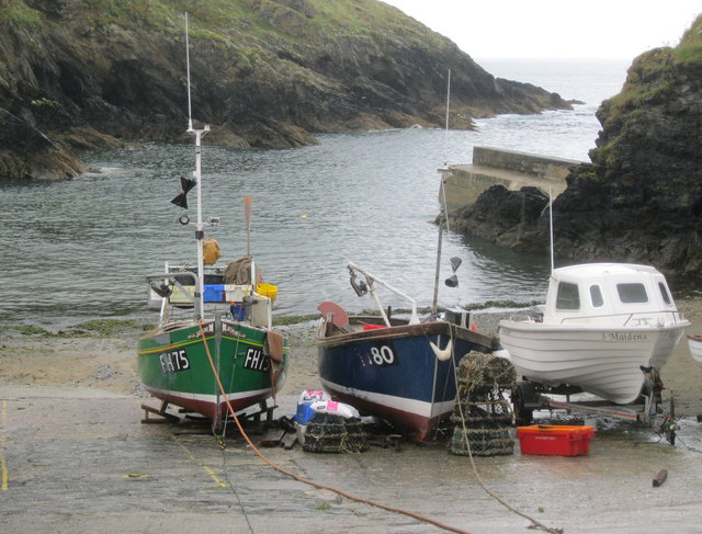
Images are sourced within 2km of 50.218302/-4.8898374 or Grid Reference SW9339. Thanks to Geograph Open Source API. All images are credited.

All Saints United Church of England and Methodist Church
Portloe
Portloe
Rugged coast and Shag Rock
Portloe seen from the South West Coast Path
Telephone box in Portloe
Coast path to Portloe
Fields and sea
Fields and sea
The South West Coast Path on a sunny day
On the South West Coast Path heading south
Portloe Harbour Portloe once supported a small drift fleet and a seine fishery, whilst trading ketches landed and loaded goods on the beach. Some fishing continues today, mainly for lobster and crab.
Portloe Harbour
Portloe once supported a small drift fleet and a seine fishery, whilst trading ketches landed and loaded goods on the beach. Some fishing continues today, mainly for lobster and crab.
Portloe Slipway 1999
The Ship Inn, Portloe
The Village of Portloe
Portloe Cove slipway
Portloe slipway in Dec 12
Broom Parc House,  Veryan Location for the TV drama "The Camomile Lawn".
Broom Parc House, Veryan
Location for the TV drama "The Camomile Lawn".
Parc Caragloose Rock From Broom Parc
Parc Caragloose Rock
From Broom Parc
Manare Point Manare Point is situated to the south of Portloe, here it is viewed from the South West Coast Path.
Manare Point
Manare Point is situated to the south of Portloe, here it is viewed from the South West Coast Path.
Show me another place!

Bib Rock is located at Grid Ref: SW9339 (Lat: 50.218302, Lng: -4.8898374)

Unitary Authority: Cornwall

Police Authority: Devon and Cornwall

What 3 Words

///blogging.names.moped. Near Tregoney, Cornwall

Related Wikis

Portloe

Portloe (Cornish: Porthlogh) is a small village in Cornwall, England, on the Roseland Peninsula, in the civil parish of Veryan. Portloe harbours two full...

Treviskey

Treviskey is a hamlet in the parish of Veryan, in the county of Cornwall in south-west England. == References ==

Trewartha, Cornwall

Trewartha is a hamlet in the civil parish of Veryan on the Roseland Peninsula, Cornwall, England, United Kingdom.Trewartha is also the name of places in...

Portholland

Portholland (Cornish: Porthalan) is a settlement in Cornwall, England, UK. It is on the south coast in the civil parish of St Michael Caerhays. The name...

Nearby Amenities

Located within 500m of 50.218302,-4.8898374
Portloe
Is In: Cornwall, England, UK
Is In Country: England
Is In Country Code: GB
Is In County: Cornwall
Name Kw: Porthlogh
Place: village
Source: npe
Wikidata: Q2105208
Lat/Long: 50.2184625/-4.8928681
The Flagstaff
Tourism: viewpoint
Lat/Long: 50.2190796/-4.8893441
Carradale Guest House
Tourism: guest_house
Website: http://www.carradale-bnb.co.uk/
Lat/Long: 50.2186674/-4.8968344
Addr Housename: Edgcumbe House
Lat/Long: 50.2207181/-4.8911221
Bench
Backrest: yes
Lat/Long: 50.2183/-4.8916088
Bench
Backrest: yes
Lat/Long: 50.2182494/-4.8914367
Portloe
Information: map
Tourism: information
Lat/Long: 50.2205066/-4.8913099
Fire Hydrant
Emergency: fire_hydrant
Fire Hydrant Diameter: 75
Fire Hydrant Position: lane
Fire Hydrant Type: underground
Lat/Long: 50.2190182/-4.8914541
Entrance: main
Male: yes
Lat/Long: 50.218346/-4.8918995
Life Ring
Emergency: life_ring
Lat/Long: 50.2185309/-4.8921232
Veryan Parish Council
Advertising: board
Board Type: notice
Information: board
Operator: Veryan Parish Council
Tourism: information
Lat/Long: 50.2186784/-4.8926282
Post Box
Collection Times: Mo-Fr 09:00; Sa 07:00; Su off
Note: The post box is just behind the wall on the house side, but since the wall is lower than the post box it doesn't present an obstacle
Operator: Royal Mail
Operator Wikidata: Q638098
Post Box Design: 2010_pattern
Post Box Mounting: pier
Post Box Type: lamp
Ref: TR2 136D
Royal Cypher: EIIR
Royal Cypher Wikidata: Q33102113
Source: survey;aerial imagery
Survey Date: 2023-03-26
Lat/Long: 50.2186085/-4.892719
Give Way
Lat/Long: 50.2186184/-4.8927509
Entrance: main
Female: yes
Lat/Long: 50.2183312/-4.8918061
Bench
Backrest: yes
Material: wood
Lat/Long: 50.2178348/-4.8913501
Fire Hydrant
Emergency: fire_hydrant
Fire Hydrant Diameter: 1"
Fire Hydrant Position: lane
Fire Hydrant Type: underground
Lat/Long: 50.2186669/-4.8927616
Telephone
Booth: K6
Operator: BT
Operator Wikidata: Q593786
Survey Date: 2023-03-26
Lat/Long: 50.2187917/-4.8926027
Bench
Backrest: yes
Survey Date: 2023-03-26
Lat/Long: 50.218628/-4.8923859
Fire Hydrant
Emergency: fire_hydrant
Fire Hydrant Diameter: 75
Fire Hydrant Position: lane
Fire Hydrant Type: underground
Survey Date: 2023-03-26
Lat/Long: 50.2197532/-4.8912406
Grit Bin
Survey Date: 2023-03-26
Lat/Long: 50.2213574/-4.8910037
Fire Hydrant
Emergency: fire_hydrant
Fire Hydrant Type: underground
Survey Date: 2023-03-26
Lat/Long: 50.2213675/-4.8909978
Bench
Backrest: yes
Survey Date: 2023-03-26
Lat/Long: 50.2199864/-4.888477
Life Ring
Emergency: life_ring
Survey Date: 2023-03-26
Lat/Long: 50.2187217/-4.8917761
Waste Basket
Survey Date: 2023-03-26
Lat/Long: 50.2186161/-4.892448
Fire Hydrant
Emergency: fire_hydrant
Fire Hydrant Type: underground
Survey Date: 2023-03-26
Lat/Long: 50.2205614/-4.8910538
Fire Hydrant
Emergency: fire_hydrant
Fire Hydrant Type: underground
Survey Date: 2023-03-26
Lat/Long: 50.2221835/-4.8905785
Bus Stop
Portloe Church
Bus: yes
Long Name: Portloe, opp Church
Naptan AdministrativeAreaCode: 73
Naptan AtcoCode: 0800COC30842
Naptan Bearing: SW
Naptan BusStopType: CUS
Naptan CommonName: Church
Naptan Indicator: opp
Naptan LocalityName: Portloe
Naptan ModificationDate: 2017-01-04 09:42
Naptan NaptanCode: cordgdjw
Naptan NptgLocalityCode: E0002932
Naptan RegionCode: cordgdjw
Naptan Verified: no
Public Transport: platform
Source: naptan;bing;naptan_compare_tool
Survey Date: 2023-04-23
Lat/Long: 50.2186766/-4.8926396
Bench
Backrest: yes
Survey Date: 2023-04-23
Lat/Long: 50.218039/-4.8912367
Fire Hydrant
Emergency: fire_hydrant
Fire Hydrant Type: underground
Survey Date: 2023-04-23
Lat/Long: 50.2183961/-4.8940418
Bench
Backrest: yes
Survey Date: 2023-04-23
Lat/Long: 50.2181458/-4.8912655
Bench
Backrest: yes
Survey Date: 2023-04-23
Lat/Long: 50.2180284/-4.8923034
Fire Hydrant
Emergency: fire_hydrant
Fire Hydrant Type: underground
Survey Date: 2023-04-23
Lat/Long: 50.2187139/-4.8963984
Bench
Backrest: no
Survey Date: 2023-04-23
Lat/Long: 50.2170039/-4.8944133
Tourism: viewpoint
Lat/Long: 50.2179981/-4.8921271
Tourism: viewpoint
Lat/Long: 50.2176933/-4.8912759
Defibrillator
Access: yes
Defibrillator Location: Wall outside The Ship Inn
Emergency: defibrillator
Indoor: no
Mapillary: 933523901028044
Lat/Long: 50.2184133/-4.8944643
Bus Stop
Portloe Church
Bus: yes
Long Name: Portloe Church (NE-bound)
Naptan AdministrativeAreaCode: 73
Naptan AtcoCode: 0800COC30843
Naptan Bearing: NE
Naptan BusStopType: CUS
Naptan CommonName: Church
Naptan Indicator: NE-bound
Naptan LocalityName: Portloe
Naptan ModificationDate: 2017-01-04 09:42
Naptan NptgLocalityCode: E0002932
Naptan RegionCode: cordgdjp
Naptan Verified: no
Public Transport: platform
Lat/Long: 50.2187655/-4.8925801
The data included in this document is from www.openstreetmap.org. The data is made available under ODbL.

Have you been to Bib Rock?

Leave your review of Bib Rock below (or comments, questions and feedback).