Rubha Reamhar

Coastal Feature, Headland, Point in Argyllshire

Scotland

Rubha Reamhar

Descending Creag Bhàn The descent of Creag Bhàn offers a fine view over the south and west of the Isle of Gigha, and a distant Islay.  In this view, Ardailly can be noted, with the covered Gigha service reservoir below.  Mill Loch and High Loch can be noted to the left in the near and far distance, respectively.

This photograph was taken during the Coronavirus (COVID-19) pandemic of 2020/21.
Descending Creag Bhàn Credit: James T M Towill

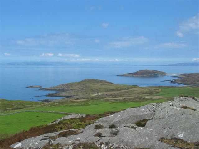
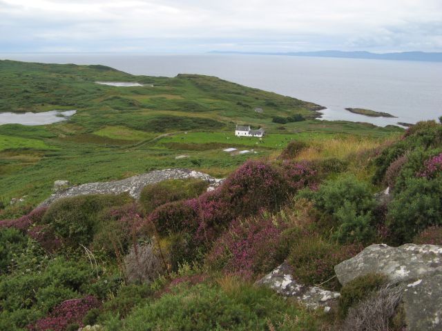
Rubha Reamhar is a prominent headland located in Argyllshire, Scotland. Situated on the rugged west coast, this coastal feature is known for its stunning natural beauty and rich history. The name Rubha Reamhar translates to "thick promontory" in Gaelic, which accurately describes its physical characteristics.

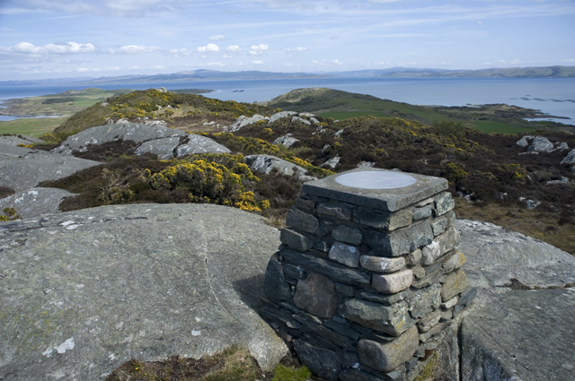
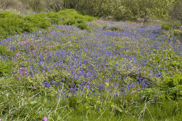
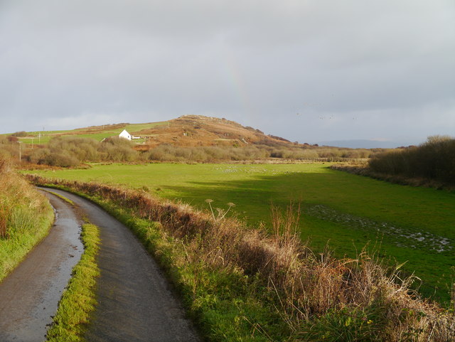
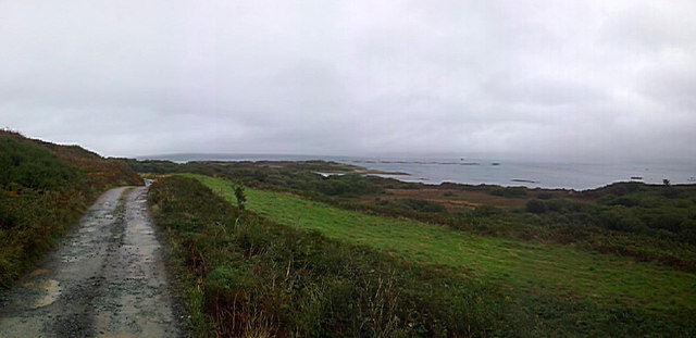
With its dramatic cliffs and commanding views of the surrounding landscape, Rubha Reamhar serves as a popular destination for nature lovers and outdoor enthusiasts. The headland is adorned with lush vegetation, including heather and grasses, adding to its picturesque charm. Its position on the coast also makes it an ideal spot for birdwatching, as numerous seabird species can be observed soaring above the waves.

In addition to its natural splendor, Rubha Reamhar holds historical significance. The headland is home to the remains of an ancient fort, which dates back to the Iron Age. The fort's strategic location on the headland would have allowed its inhabitants to have a clear view of the surrounding sea, providing protection from potential invaders. Today, visitors can explore the remnants of the fort and imagine what life was like for its ancient inhabitants.

Access to Rubha Reamhar is facilitated by a well-maintained footpath that winds its way along the coast. This allows visitors to fully appreciate the breathtaking scenery and take in the fresh sea air. The headland's proximity to nearby towns and attractions makes it a popular stop for tourists exploring the region.

Overall, Rubha Reamhar is a captivating coastal feature that offers a combination of natural beauty and historical intrigue. Its rugged cliffs, diverse flora, and ancient fort make it a must-visit destination for those seeking to immerse themselves in Argyllshire's unique landscape.

If you have any feedback on the listing, please let us know in the comments section below.

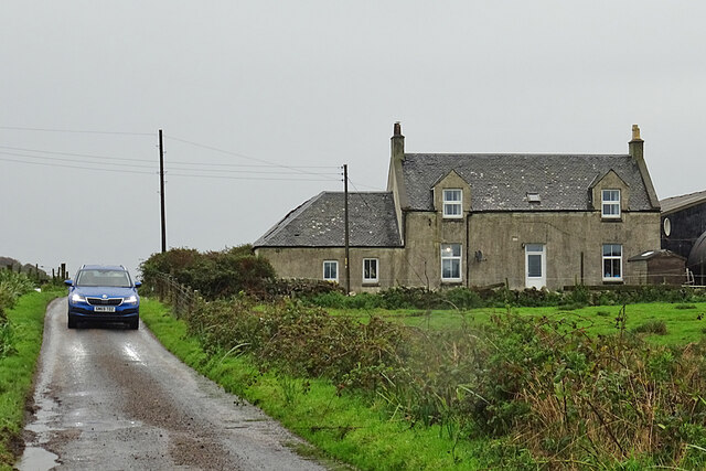
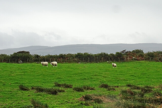
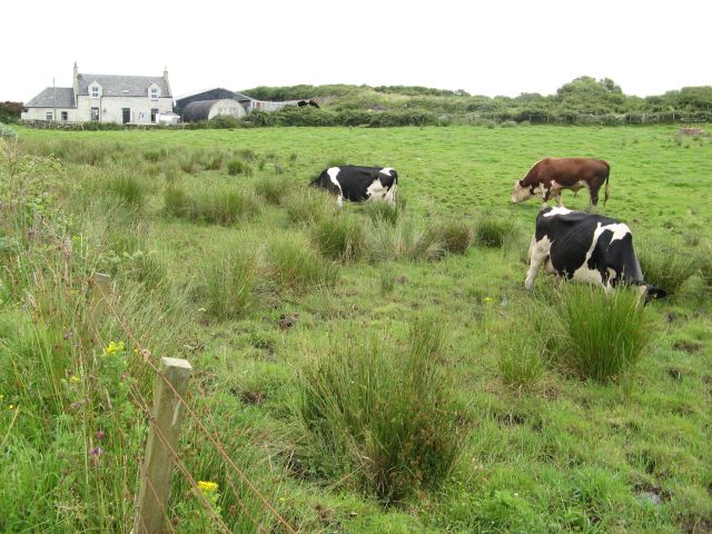
Rubha Reamhar Images

Images are sourced within 2km of 55.679537/-5.7303261 or Grid Reference NR6549. Thanks to Geograph Open Source API. All images are credited.

Descending Creag Bhàn The descent of Creag Bhàn offers a fine view over the south and west of the Isle of Gigha, and a distant Islay.  In this view, Ardailly can be noted, with the covered Gigha service reservoir below.  Mill Loch and High Loch can be noted to the left in the near and far distance, respectively.

This photograph was taken during the Coronavirus (COVID-19) pandemic of 2020/21.
Descending Creag Bhàn
The descent of Creag Bhàn offers a fine view over the south and west of the Isle of Gigha, and a distant Islay. In this view, Ardailly can be noted, with the covered Gigha service reservoir below. Mill Loch and High Loch can be noted to the left in the near and far distance, respectively. This photograph was taken during the Coronavirus (COVID-19) pandemic of 2020/21.
Druimyeon More Farm The name of this farm by the roadside is curious. The spelling is not Gaelic; perhaps it's a mangled version of Druim an Eoin Mòr 'The ridge of the big bird'?
Druimyeon More Farm
The name of this farm by the roadside is curious. The spelling is not Gaelic; perhaps it's a mangled version of Druim an Eoin Mòr 'The ridge of the big bird'?
Bedraggled Sheep Even the sheep look a bit dispirited on this horrible wet day.
Bedraggled Sheep
Even the sheep look a bit dispirited on this horrible wet day.
Grassland near Ardailly Looking towards the west coast of Gigha and beyond to the Paps of Jura. Just visible (towards the left) are the gables of the ruined old water mill at Port An Duin, which dates from the 18th century.
Grassland near Ardailly
Looking towards the west coast of Gigha and beyond to the Paps of Jura. Just visible (towards the left) are the gables of the ruined old water mill at Port An Duin, which dates from the 18th century.
Approaching Rain at Creag Bhan, Gigha
Gigha trig point at Creag Bhan
North east view from Gigha trig point
East view from Gigha trig point
North view from Gigha trig point
Summit of Creag Bhan The toposcope or topograph on the summit of Creag Bhan the highest point on Gigha
Summit of Creag Bhan
The toposcope or topograph on the summit of Creag Bhan the highest point on Gigha
Small flower meadow A small field full of wild flowers mainly Bluebell and Campion near Druimyeon Farm.
Small flower meadow
A small field full of wild flowers mainly Bluebell and Campion near Druimyeon Farm.
Pasture At Druimyeon More A small pasture which also featured a flock of nearly 100 Greylag Geese.
Pasture At Druimyeon More
A small pasture which also featured a flock of nearly 100 Greylag Geese.
The Road to Highfield A small track on the East of Gigha leading to a salmon farm.
The Road to Highfield
A small track on the East of Gigha leading to a salmon farm.
Salmon Farm buildings and jetty at Highfield
Cows at pasture Cows grazing at Druimyeon More on a very boggy area of pasture. It appeared not to bother the nearest cow that she was standing up to her knees in the bog. The farmhouse appears in the left background.
Cows at pasture
Cows grazing at Druimyeon More on a very boggy area of pasture. It appeared not to bother the nearest cow that she was standing up to her knees in the bog. The farmhouse appears in the left background.
Derelict tractor Long immobile and becoming part of the hedge as it is engulfed by brambles, this appears to be a Ford 4000 tractor.
Derelict tractor
Long immobile and becoming part of the hedge as it is engulfed by brambles, this appears to be a Ford 4000 tractor.
Ardailly view A view from Creag Bhan of the farm at Ardailly with the Mill Loch appearing at the left of the image.
Ardailly view
A view from Creag Bhan of the farm at Ardailly with the Mill Loch appearing at the left of the image.
Creag Bhan rocks and trig The summit of Creag Bhan is a magnificently ice-moulded landscape surmounted by a cairn and triangulation pillar. That the hill survives this obvious abrasion is a surprise, since the surrounding rocks are obviously much lower. The reason is that the hill comprises a massive body of amphibolite, a relic of basaltic magmatism that affected the sedimentary succession long before the Caledoniam metamorphism which produced the classic Dalradian metasediments. Most of the prominent ridges and hills on the island have the same origin, including Eilean Garbh <a href="https://www.geograph.org.uk/gridref/NR6554">NR6554</a> which can be seen in the near distance.
Creag Bhan rocks and trig
The summit of Creag Bhan is a magnificently ice-moulded landscape surmounted by a cairn and triangulation pillar. That the hill survives this obvious abrasion is a surprise, since the surrounding rocks are obviously much lower. The reason is that the hill comprises a massive body of amphibolite, a relic of basaltic magmatism that affected the sedimentary succession long before the Caledoniam metamorphism which produced the classic Dalradian metasediments. Most of the prominent ridges and hills on the island have the same origin, including Eilean Garbh NR6554 which can be seen in the near distance.
Show me another place!

Rubha Reamhar is located at Grid Ref: NR6549 (Lat: 55.679537, Lng: -5.7303261)

Unitary Authority: Argyll and Bute

Police Authority: Argyll and West Dunbartonshire

What 3 Words

///thumb.spreads.casually. Near Craighouse, Argyll & Bute

Related Wikis

Gigha

Gigha (; Scottish Gaelic: Giogha; Scots: Gigha) or the Isle of Gigha (and formerly Gigha Island) is an island off the west coast of Kintyre in Scotland...

Kilchattan Chapel

Kilchattan Chapel (St Cathan's Chapel) is a ruined medieval chapel near Ardminish, Isle of Gigha, Argyll and Bute, Scotland. Built in the 13th century...

Achamore House

Achamore House is a mansion on the Isle of Gigha, Scotland. It was built in 1884 for Lt-Col William James Scarlett, and the extensive gardens were laid...

Sound of Gigha

The Sound of Gigha is a sound between the Inner Hebridean Isle of Gigha and Kintyre. It forms part of the Atlantic Ocean. == External links ==

Nearby Amenities

Located within 500m of 55.679537,-5.7303261
Created By: dmgroom_coastlines
Lat/Long: 55.6804716/-5.7270529
Created By: dmgroom_coastlines
Lat/Long: 55.6786149/-5.7328305
Ardminish Bay
Natural: bay
Source: OS7
Lat/Long: 55.6753598/-5.7307414
Ferry Terminal
Gigha
Lat/Long: 55.6778907/-5.7331536
Shower
Lat/Long: 55.6788786/-5.7345685
Toilets
Lat/Long: 55.6788812/-5.7346301
Bench
Lat/Long: 55.6772226/-5.7367883
Power: pole
Lat/Long: 55.6794706/-5.7377501
Power: pole
Lat/Long: 55.679843/-5.7366037
Power: pole
Lat/Long: 55.6804623/-5.7355818
Power: pole
Lat/Long: 55.680245/-5.7353738
Achamhinish
Name Gd: Achadh a' Mhèanais
Place: isolated_dwelling
Lat/Long: 55.6806945/-5.7356606
Location Transition: yes
Power: pole
Lat/Long: 55.6827019/-5.7277206
Power: pole
Lat/Long: 55.6806846/-5.7340667
Power: pole
Lat/Long: 55.6791339/-5.7366523
Power: pole
Lat/Long: 55.6786656/-5.735595
Power: pole
Lat/Long: 55.6789564/-5.7362738
Power: pole
Lat/Long: 55.679598/-5.737358
The data included in this document is from www.openstreetmap.org. The data is made available under ODbL.

Have you been to Rubha Reamhar?

Leave your review of Rubha Reamhar below (or comments, questions and feedback).