Sròn a' Mhoil Bhig

Coastal Feature, Headland, Point in Ross-shire

Scotland

Sròn a' Mhoil Bhig

Traigh Mhòr Beach Traigh Mhòr Beach, Isle of Lewis, looking north towards cliffs round to Garry Beach
Traigh Mhòr Beach Credit: Adam Forsyth

Sròn a' Mhoil Bhig is a prominent coastal feature located in Ross-shire, Scotland. It is classified as a headland or point due to its distinct geographical characteristics. The headland is situated on the northwestern coast of Scotland, specifically on the eastern side of Loch Broom.

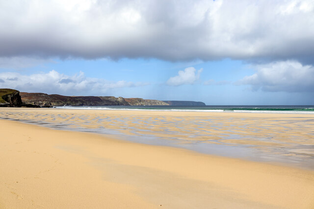
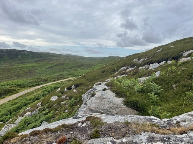
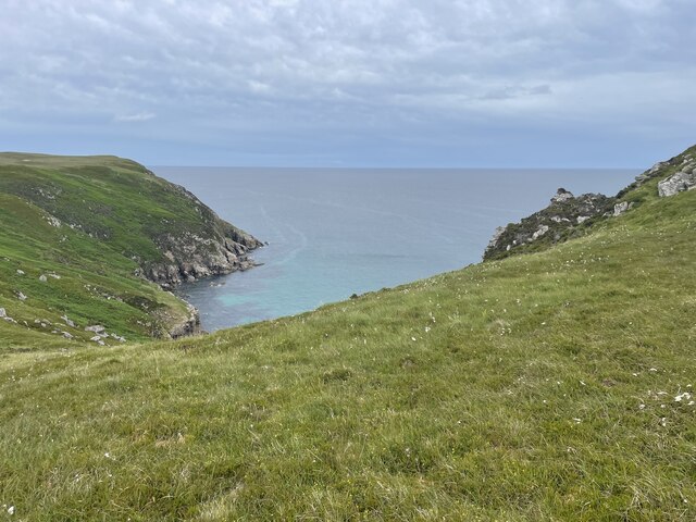
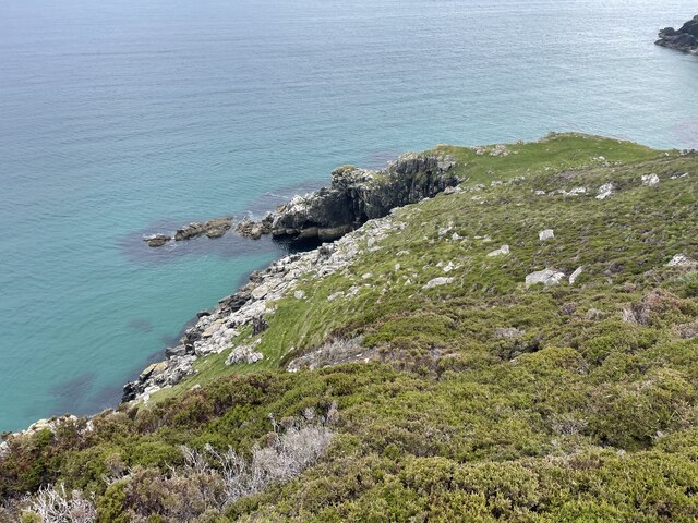
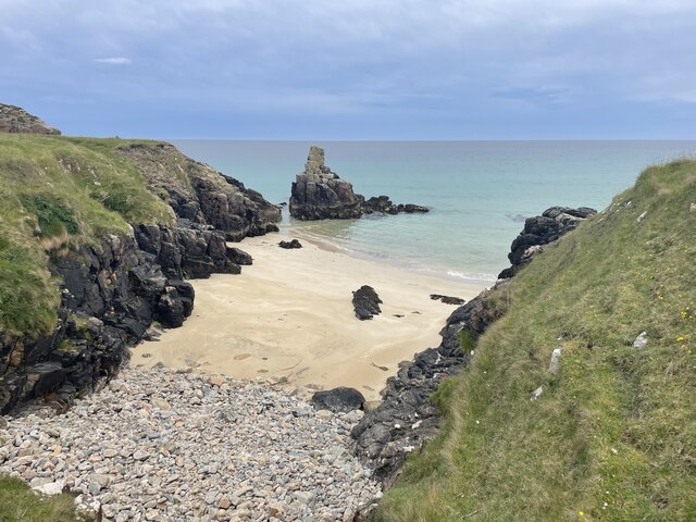
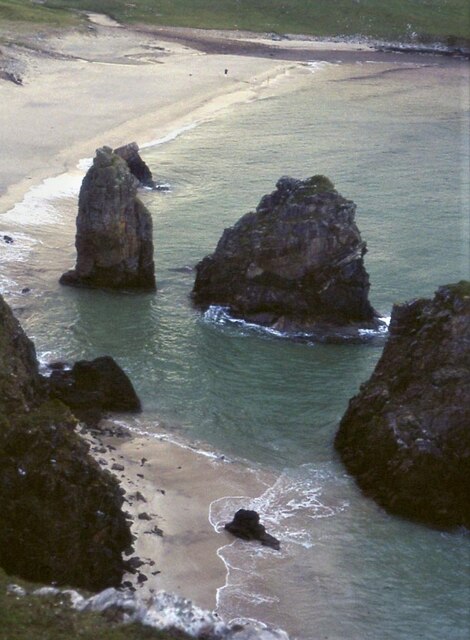
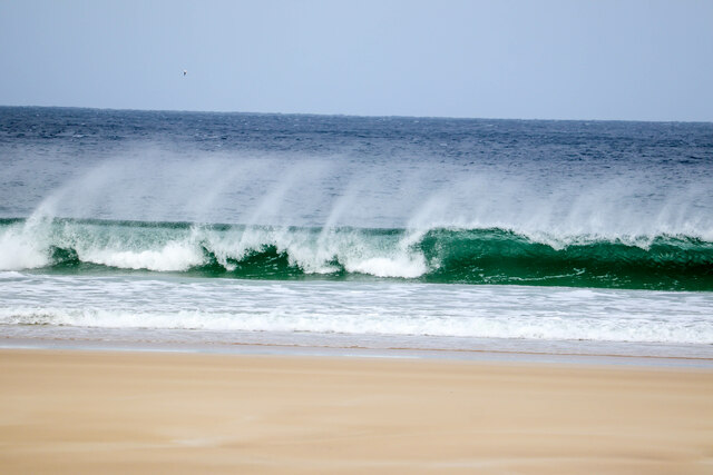
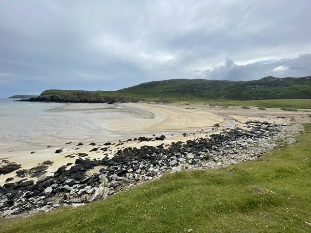
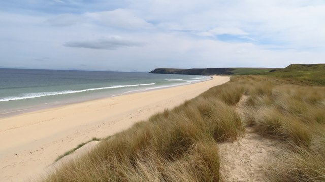
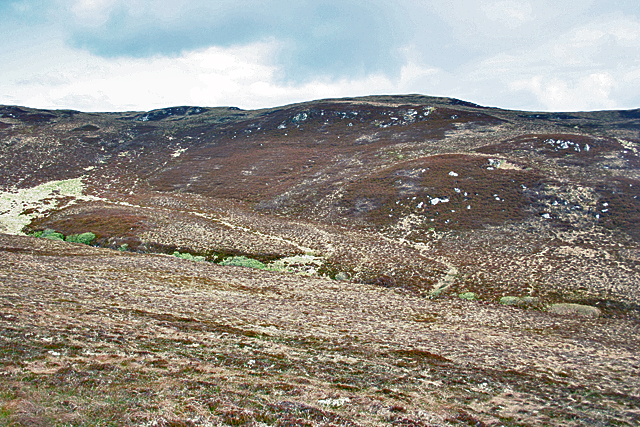
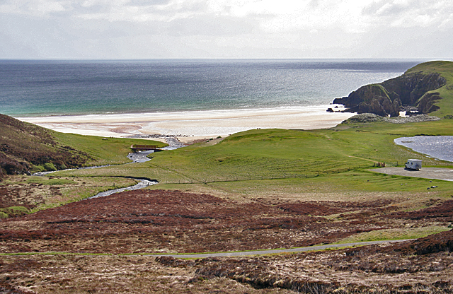
The landscape of Sròn a' Mhoil Bhig is characterized by rugged cliffs and rocky outcrops, which provide a stunning backdrop against the expanse of the North Atlantic Ocean. The headland extends into the sea, creating a natural barrier that protects the surrounding areas from the force of the waves. This feature also provides an ideal vantage point for panoramic views of the surrounding coastline and the distant mountains.

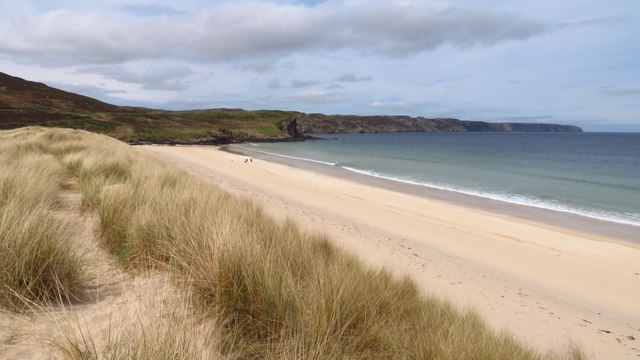
The headland is accessible via a coastal path that winds its way along the cliff edge, allowing visitors to explore the area and enjoy the breathtaking scenery. The path offers opportunities for nature enthusiasts to observe a variety of seabirds, such as gannets and fulmars, nesting on the cliffs. It is also not uncommon to spot seals and dolphins swimming in the waters below.

Sròn a' Mhoil Bhig is a popular destination for outdoor activities such as hiking, birdwatching, and photography. The headland's rugged beauty, combined with its proximity to other natural attractions in the area, makes it a must-visit location for both locals and tourists alike.

If you have any feedback on the listing, please let us know in the comments section below.

Sròn a' Mhoil Bhig Images

Images are sourced within 2km of 58.370378/-6.2150822 or Grid Reference NB5350. Thanks to Geograph Open Source API. All images are credited.

Traigh Mhòr Beach Traigh Mhòr Beach, Isle of Lewis, looking north towards cliffs round to Garry Beach
Traigh Mhòr Beach
Traigh Mhòr Beach, Isle of Lewis, looking north towards cliffs round to Garry Beach
Lewis Coastal path
Lewis Coastal path
The real bridge to nowhere Geocaching is a type of global treasure hunt of people looking for caches, or hidden stashes of objects. Geocaching may also be described as a series of hide-and-seek games, where hiders provide online clues for seekers. Seekers use global positioning system (GPS) devices to find hidden caches
The real bridge to nowhere
Geocaching is a type of global treasure hunt of people looking for caches, or hidden stashes of objects. Geocaching may also be described as a series of hide-and-seek games, where hiders provide online clues for seekers. Seekers use global positioning system (GPS) devices to find hidden caches
A secret bothy Geocaching is a type of global treasure hunt of people looking for caches, or hidden stashes of objects. Geocaching may also be described as a series of hide-and-seek games, where hiders provide online clues for seekers. Seekers use global positioning system (GPS) devices to find hidden caches
A secret bothy
Geocaching is a type of global treasure hunt of people looking for caches, or hidden stashes of objects. Geocaching may also be described as a series of hide-and-seek games, where hiders provide online clues for seekers. Seekers use global positioning system (GPS) devices to find hidden caches
The coast of Lewis
The coast of Lewis
Lewis coastline
Lewis coastline
Old building on Lewis
A private beach
A private beach
Sea stacks on Tràigh Ghearadha
Waves at Traigh Mhòr beach, Isle of Lewis The waves at Traigh Mhòr beach, Isle of Lewis seen breaking as they reach the shore of the Western Isles
Waves at Traigh Mhòr beach, Isle of Lewis
The waves at Traigh Mhòr beach, Isle of Lewis seen breaking as they reach the shore of the Western Isles
Tràigh Ghearadha beach
Traigh Mhor, North Tolsta - northern end of beach
Traigh Mhor, North Tolsta - view towards southern end of beach
Abhainn Ghearadha (Garry River) Abhainn Ghearadha drains a gentle boggy glen on to Tràigh Ghearadha (Garry Beach). This is the view of the river from Lord Leverhulme's <a href="https://www.geograph.org.uk/photo/2423596">NB5350 : A Bridge to Nowhere</a>.
Abhainn Ghearadha (Garry River)
Abhainn Ghearadha drains a gentle boggy glen on to Tràigh Ghearadha (Garry Beach). This is the view of the river from Lord Leverhulme's NB5350 : A Bridge to Nowhere.
Abandoned Vehicle This looks like the remains of one of those little 4wd things with roll-over bars. Presumably it expired or got irrevocably stuck in the bog here on Cnocan Ruairidh, and, not being visible from the public road, has escaped the attention of the council's collectors of rusting metal.
Abandoned Vehicle
This looks like the remains of one of those little 4wd things with roll-over bars. Presumably it expired or got irrevocably stuck in the bog here on Cnocan Ruairidh, and, not being visible from the public road, has escaped the attention of the council's collectors of rusting metal.
Nameless Glen The map doesn't name this rather featureless glen, though it does manage to name the river that drains it as Abhainn Ghearadha (River Garry).
Nameless Glen
The map doesn't name this rather featureless glen, though it does manage to name the river that drains it as Abhainn Ghearadha (River Garry).
Bella Chnoc Looking across the glen of the Abhiann Ghearadha from Cnocan Ruairidh. The slope on the far side of the glen is named as Bella Chnoc on the 1:25,000 map. This is a very odd-looking name because Gaelic, at least according to my dictionary, has no words beginning 'b' then 'e' then a consonant.
Bella Chnoc
Looking across the glen of the Abhiann Ghearadha from Cnocan Ruairidh. The slope on the far side of the glen is named as Bella Chnoc on the 1:25,000 map. This is a very odd-looking name because Gaelic, at least according to my dictionary, has no words beginning 'b' then 'e' then a consonant.
Tràigh Ghearadha (Garry Beach) This is one of the most beautiful of the beaches on the east coast of Lewis. The car park at lower right is the very end of the public road, and rather to my surprise the bus runs all the way to here. The grid line actually bisects the beach.
Tràigh Ghearadha (Garry Beach)
This is one of the most beautiful of the beaches on the east coast of Lewis. The car park at lower right is the very end of the public road, and rather to my surprise the bus runs all the way to here. The grid line actually bisects the beach.
Show me another place!

Sròn a' Mhoil Bhig is located at Grid Ref: NB5350 (Lat: 58.370378, Lng: -6.2150822)

Unitary Authority: Na h-Eileanan an Iar

Police Authority: Highlands and Islands

What 3 Words

///hopping.hill.brambles. Near North Tolsta, Na h-Eileanan Siar

Related Wikis

New Tolsta

New Tolsta (Scottish Gaelic: Baile Ùr Tholastaidh) is a village on the Isle of Lewis in the Outer Hebrides, Scotland. New Tolsta is within the parish of...

North Tolsta

North Tolsta (Scottish Gaelic: Tolastadh bho Thuath) is a village in the Scottish Outer Hebrides, on the east side of the Isle of Lewis. North Tolsta is...

Gress

Gress (Scottish Gaelic: Griais), a hamlet on the Isle of Lewis in Scotland, is adjacent to the larger village of Back. Gress is within the parish of Stornoway...

Nearby Amenities

Located within 500m of 58.370378,-6.2150822
Bridge to nowhere
Tourism: viewpoint
Lat/Long: 58.3701813/-6.2232589
Barrier: kissing_gate
Source: survey
Lat/Long: 58.3678981/-6.2210151
The data included in this document is from www.openstreetmap.org. The data is made available under ODbL.

Have you been to Sròn a' Mhoil Bhig?

Leave your review of Sròn a' Mhoil Bhig below (or comments, questions and feedback).