Geodha Ghàraidh

Coastal Feature, Headland, Point in Ross-shire

Scotland

Geodha Ghàraidh

Remains of the Wyre Law, Gob Chaileagadh, Isle of Lewis The Wyre Law was a Fleetwood based steam trawler which was built in Hull in 1915 and launched with the name Miletus. She ran around during a gale in October 1952.  At first she remained upright but continuing bad weather made her unsalvageable.
Remains of the Wyre Law, Gob Chaileagadh, Isle of Lewis Credit: Claire Pegrum

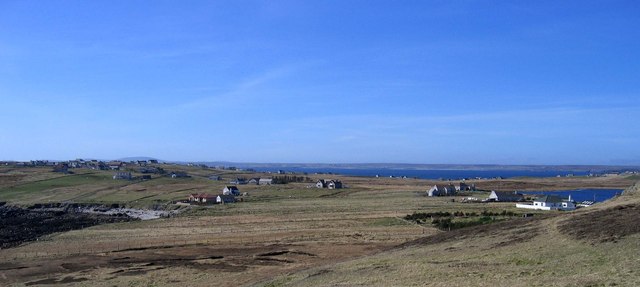
Geodha Ghàraidh is a picturesque coastal feature located in Ross-shire, Scotland. It is a stunning headland that juts out into the North Atlantic Ocean, forming a prominent point along the rugged coastline. The name Geodha Ghàraidh translates to "Gàraidh Bay" in English, reflecting its natural bay-like formation.

This coastal feature is known for its dramatic cliffs and breathtaking views. The rugged terrain is made up of rocky outcrops that have been shaped by the relentless power of the ocean waves over centuries. These cliffs provide a nesting site for various seabird species, including fulmars and gulls, making it a haven for birdwatchers and nature enthusiasts.

Geodha Ghàraidh offers visitors the opportunity to experience the raw beauty of the Scottish coastline. The headland provides panoramic views of the surrounding sea, with the Isle of Skye visible in the distance on clear days. The crashing waves and the sound of seabirds create a serene and peaceful atmosphere, making it an ideal spot for those seeking solitude and tranquility.

Access to Geodha Ghàraidh is relatively easy, with a well-defined footpath leading to the headland. Visitors can enjoy leisurely walks along the coastline, exploring the rugged landscape and taking in the breathtaking vistas. The area is also popular for fishing, with anglers often casting their lines from the cliffs.

Overall, Geodha Ghàraidh is a captivating coastal feature that showcases the raw beauty of Scotland's coastline. Its dramatic cliffs, stunning views, and abundant wildlife make it a must-visit destination for nature lovers and those seeking an escape into the untamed wilderness.

If you have any feedback on the listing, please let us know in the comments section below.

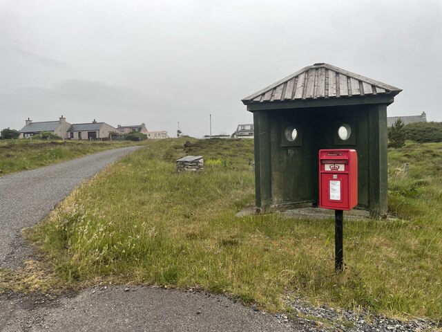
Geodha Ghàraidh Images

Images are sourced within 2km of 58.241501/-6.2055361 or Grid Reference NB5335. Thanks to Geograph Open Source API. All images are credited.

Remains of the Wyre Law, Gob Chaileagadh, Isle of Lewis The Wyre Law was a Fleetwood based steam trawler which was built in Hull in 1915 and launched with the name Miletus. She ran around during a gale in October 1952.  At first she remained upright but continuing bad weather made her unsalvageable.
Remains of the Wyre Law, Gob Chaileagadh, Isle of Lewis
The Wyre Law was a Fleetwood based steam trawler which was built in Hull in 1915 and launched with the name Miletus. She ran around during a gale in October 1952. At first she remained upright but continuing bad weather made her unsalvageable.
Geodh 'an Uillt The title translates as "the bay of the single stream".
However the local name for this place is Bagh nan Eithrichean which translates as "the bay of the boats" as this is the place where the fishermen of Sulishader once kept their boats.
Geodh 'an Uillt
The title translates as "the bay of the single stream". However the local name for this place is Bagh nan Eithrichean which translates as "the bay of the boats" as this is the place where the fishermen of Sulishader once kept their boats.
Roads around An Rubha In around 1999, the Ordnance Survey replaced English-language placenames in the Western Isles with Gaelic-language names. Some of the more prominent features (e.g. Isle of Barra; Stornoway; Sound of Harris) do have bilingual labels but, on the whole, villages, lochs, peaks etc. generally have the Gaelic names on the modern-day mapping.

Because the English versions have a tendency not to appear on the maps any more, I have decided to use them in my image titles and, as such, a translation will be readily available from the Gaelic labelling on the map. 

(NB I have not translated some of the more minor loch and river names, where I have not easily found the English version.)
Roads around An Rubha
In around 1999, the Ordnance Survey replaced English-language placenames in the Western Isles with Gaelic-language names. Some of the more prominent features (e.g. Isle of Barra; Stornoway; Sound of Harris) do have bilingual labels but, on the whole, villages, lochs, peaks etc. generally have the Gaelic names on the modern-day mapping. Because the English versions have a tendency not to appear on the maps any more, I have decided to use them in my image titles and, as such, a translation will be readily available from the Gaelic labelling on the map. (NB I have not translated some of the more minor loch and river names, where I have not easily found the English version.)
Roads around An Rubha Geocaching is a type of global treasure hunt of people looking for caches, or hidden stashes of objects. Geocaching may also be described as a series of hide-and-seek games, where hiders provide online clues for seekers. Seekers use global positioning system (GPS) devices to find hidden caches
Roads around An Rubha
Geocaching is a type of global treasure hunt of people looking for caches, or hidden stashes of objects. Geocaching may also be described as a series of hide-and-seek games, where hiders provide online clues for seekers. Seekers use global positioning system (GPS) devices to find hidden caches
Sheep Pens On the fringe of the crofting township of Fleisirin (Flesherin) is a set of pens for managing sheep at dipping, shearing and other times. Beyond the pens is typical Lewis moorland.
Sheep Pens
On the fringe of the crofting township of Fleisirin (Flesherin) is a set of pens for managing sheep at dipping, shearing and other times. Beyond the pens is typical Lewis moorland.
Sheep Pens On the fringe of the crofting township of Fleisirin (Flesherin) is a set of pens for managing sheep at dipping, shearing and other times. Beyond the pens is typical Lewis moorland, and to the right is Loch a Tuath, usually anglicised as Broad Bay though its Gaelic name means 'north loch'.
Sheep Pens
On the fringe of the crofting township of Fleisirin (Flesherin) is a set of pens for managing sheep at dipping, shearing and other times. Beyond the pens is typical Lewis moorland, and to the right is Loch a Tuath, usually anglicised as Broad Bay though its Gaelic name means 'north loch'.
A Rowdy Reception I was extremely glad that this croft at Fleiserin has a stout garden wall and a firmly closed gate here to prevent these two friendly dogs from getting any closer to me. They would be excellent watchdogs, because they sent up a huge amount of noise as soon as I approached, but dogs racing towards me, friendly or otherwise, fill me with fear, especially when they are big enough to knock me over.
A Rowdy Reception
I was extremely glad that this croft at Fleiserin has a stout garden wall and a firmly closed gate here to prevent these two friendly dogs from getting any closer to me. They would be excellent watchdogs, because they sent up a huge amount of noise as soon as I approached, but dogs racing towards me, friendly or otherwise, fill me with fear, especially when they are big enough to knock me over.
Not a Success Someone has planted some broadleaved saplings here, but the experiment has not proved successful. Only one still shows any sign of life, and its leaves have barely managed to creep from the spindly trunk. All the rest are dead, and most have fallen over. I imagine that the combination of wind, salt water and wet acid soil here is not really ideal habitat for young trees.
Not a Success
Someone has planted some broadleaved saplings here, but the experiment has not proved successful. Only one still shows any sign of life, and its leaves have barely managed to creep from the spindly trunk. All the rest are dead, and most have fallen over. I imagine that the combination of wind, salt water and wet acid soil here is not really ideal habitat for young trees.
The Eye Peninsula Low grade farm land with dispersed settlement.
The Eye Peninsula
Low grade farm land with dispersed settlement.
Shulishader: postbox № HS2 31 A small postbox on a service road running alongside the A866 for a short distance. It is emptied daily except Sunday at 10:45am. Behind it is a fine view across Broad Bay.
Shulishader: postbox № HS2 31
A small postbox on a service road running alongside the A866 for a short distance. It is emptied daily except Sunday at 10:45am. Behind it is a fine view across Broad Bay.
Peat Track in Fleisirin (Flesherin) This Peat Track leads into the moorland west of Fleisirin Village and is used to gain access to the Peat Banks for the people of the village to gather their winter stock of peat. The area is also used as sheep grazing land and you can just make out a flock in the centre of the photo on the track.
Peat Track in Fleisirin (Flesherin)
This Peat Track leads into the moorland west of Fleisirin Village and is used to gain access to the Peat Banks for the people of the village to gather their winter stock of peat. The area is also used as sheep grazing land and you can just make out a flock in the centre of the photo on the track.
Rough grazing near Garrabost Newly shorn sheep in a field on the Eye Peninsula.
Rough grazing near Garrabost
Newly shorn sheep in a field on the Eye Peninsula.
Dumped car near Garrabost Not just the car, but a jumble of abandoned wire as well make this field a bit of a health and safety nightmare for these sheep.
Dumped car near Garrabost
Not just the car, but a jumble of abandoned wire as well make this field a bit of a health and safety nightmare for these sheep.
Sulaisiadar Sulaisiadar is a small crofting community on the north coast of the Eye Peninsula.
Sulaisiadar
Sulaisiadar is a small crofting community on the north coast of the Eye Peninsula.
Decorative dyke at road junction The entrances to some Lewis villages and townships are marked by dry-stone structures similar to the one shown.  This one sits at the junction of the A866 (seen here as it heads to the north-east of the Eye Peninsula) and the minor road to Seisiadar.
Decorative dyke at road junction
The entrances to some Lewis villages and townships are marked by dry-stone structures similar to the one shown. This one sits at the junction of the A866 (seen here as it heads to the north-east of the Eye Peninsula) and the minor road to Seisiadar.
Show me another place!

Geodha Ghàraidh is located at Grid Ref: NB5335 (Lat: 58.241501, Lng: -6.2055361)

Unitary Authority: Na h-Eileanan an Iar

Police Authority: Highlands and Islands

What 3 Words

///reverted.used.precautions. Near Stornoway, Na h-Eileanan Siar

Related Wikis

Shulishader

Shulishader (Scottish Gaelic: Siadar an Rubha) is a small village with a population of around 120 people in Point, Outer Hebrides on the Isle of Lewis...

Flesherin

Flesherin (Scottish Gaelic: Na Fleisirean) is a small village on the Point peninsula of the Isle of Lewis in the Outer Hebrides. Located near Portnaguran...

Broker, Lewis

Broker (Scottish Gaelic: Brocair) is a small hamlet next to the village of Portvoller and Portnaguran on the Eye Peninsula located on the east side of...

Aird, Lewis

Aird (Scottish Gaelic: Àird an Rubha) is a village in the Scottish council area of Eileanan Siar (Western Isles). It is located on the Eye Peninsula on...

Nearby Amenities

Located within 500m of 58.241501,-6.2055361
Passing Place
Lat/Long: 58.2396179/-6.1992355
Passing Place
Lat/Long: 58.2391371/-6.1990517
Passing Place
Lat/Long: 58.2388114/-6.1989027
The data included in this document is from www.openstreetmap.org. The data is made available under ODbL.

Have you been to Geodha Ghàraidh?

Leave your review of Geodha Ghàraidh below (or comments, questions and feedback).