Rubha Bàn

Coastal Feature, Headland, Point in Ross-shire

Scotland

Rubha Bàn

Great Bernera bridges The new bridge under construction and the old white bridge.
Great Bernera bridges Credit: Catherine Morgan

Rubha Bàn is a prominent headland located in Ross-shire, Scotland. Situated along the rugged coastline, this coastal feature offers breathtaking views of the surrounding landscape and the vast expanse of the North Atlantic Ocean. The name "Rubha Bàn" translates to "white point" in Gaelic, a fitting description for the headland's distinctive white cliffs.

The headland is characterized by its dramatic cliffs, which rise sharply from the water, forming a natural barrier against the crashing waves. These imposing cliffs are composed of limestone, giving them a unique white appearance that stands out against the greenery of the surrounding land.

Rubha Bàn is a popular destination for outdoor enthusiasts and nature lovers. The headland offers excellent opportunities for hiking and exploring, with well-maintained trails that wind their way along the edge of the cliffs. Along these trails, visitors can admire the diverse flora and fauna of the area, including rare bird species that nest in the cliffs.

The headland also provides a vantage point for observing various marine wildlife. Dolphins, seals, and even whales can often be spotted in the waters surrounding Rubha Bàn. The area is also renowned for its rich fishing grounds, attracting anglers from near and far.

In addition to its natural beauty, Rubha Bàn holds historical significance. The headland is home to ancient ruins and archaeological sites, providing glimpses into the area's past. These remnants of the past add an extra layer of intrigue to an already captivating destination.

Overall, Rubha Bàn is a stunning coastal feature that showcases the natural beauty and rich history of Ross-shire. Its white cliffs, scenic trails, and abundant wildlife make it a must-visit destination for anyone exploring the Scottish coast.

If you have any feedback on the listing, please let us know in the comments section below.

Rubha Bàn Images

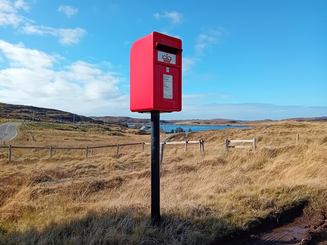
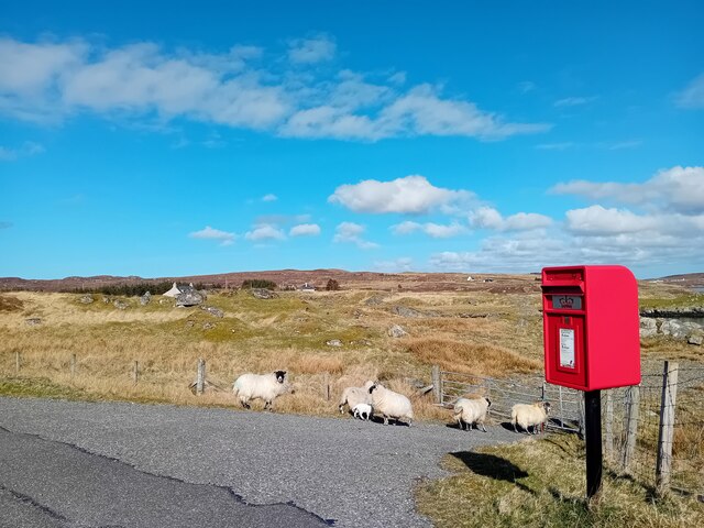
Images are sourced within 2km of 58.200496/-6.8108434 or Grid Reference NB1733. Thanks to Geograph Open Source API. All images are credited.

Great Bernera bridges The new bridge under construction and the old white bridge.
Great Bernera bridges
The new bridge under construction and the old white bridge.
Postbox at Crulivig HS2 91. Royal Mail list this box as 'Crulivig'.
Postbox at Crulivig
HS2 91. Royal Mail list this box as 'Crulivig'.
Postbox on Great Bernera HS2 88. Royal Mail list this box as 'Shore'.
Postbox on Great Bernera
HS2 88. Royal Mail list this box as 'Shore'.
"The Bridge Across the Atlantic" Bernera Bridge is one of several bridges which claim to span the Atlantic Ocean. This one connects the Lewis mainland with the island of Great Bernera / Bearnaraigh. Note the standing stones on the far side of the bridge.
<span class="nowrap"><a title="http://www.uigandbernera.com/" rel="nofollow ugc noopener" href="http://www.uigandbernera.com/">Link</a><img style="margin-left:2px;" alt="External link" title="External link - shift click to open in new window" src="https://s1.geograph.org.uk/img/external.png" width="10" height="10"/></span>
"The Bridge Across the Atlantic"
Bernera Bridge is one of several bridges which claim to span the Atlantic Ocean. This one connects the Lewis mainland with the island of Great Bernera / Bearnaraigh. Note the standing stones on the far side of the bridge. LinkExternal link
Bernera Bridge Opened in 1953 and connecting Lewis with Great Bernera / Bearnaraigh.
<span class="nowrap"><a title="http://www.uigandbernera.com/" rel="nofollow ugc noopener" href="http://www.uigandbernera.com/">Link</a><img style="margin-left:2px;" alt="External link" title="External link - shift click to open in new window" src="https://s1.geograph.org.uk/img/external.png" width="10" height="10"/></span>
Bernera Bridge
Opened in 1953 and connecting Lewis with Great Bernera / Bearnaraigh. LinkExternal link
Sea Kayakers by Port a Chruidh Kayakers who have come from Miavaig / Miabhaig and are heading eastwards, having just passed below Bernera Bridge. The mainland of Lewis is on the far side of the 1953 bridge.
<span class="nowrap"><a title="http://www.uigandbernera.com/" rel="nofollow ugc noopener" href="http://www.uigandbernera.com/">Link</a><img style="margin-left:2px;" alt="External link" title="External link - shift click to open in new window" src="https://s1.geograph.org.uk/img/external.png" width="10" height="10"/></span>
Sea Kayakers by Port a Chruidh
Kayakers who have come from Miavaig / Miabhaig and are heading eastwards, having just passed below Bernera Bridge. The mainland of Lewis is on the far side of the 1953 bridge. LinkExternal link
Lewisian Gneiss Pink, folded Lewisian gneiss at the north end of Bernera Bridge. These are amongst the oldest rocks in the world.
<span class="nowrap"><a title="http://www.uigandbernera.com/" rel="nofollow ugc noopener" href="http://www.uigandbernera.com/">Link</a><img style="margin-left:2px;" alt="External link" title="External link - shift click to open in new window" src="https://s1.geograph.org.uk/img/external.png" width="10" height="10"/></span>
Lewisian Gneiss
Pink, folded Lewisian gneiss at the north end of Bernera Bridge. These are amongst the oldest rocks in the world. LinkExternal link
Stone Circle by Bernera Bridge Ancient stone circle on a mound above the north end of the bridge. the stones are part of the famous Callanish complex of standing stones.
Stone Circle by Bernera Bridge
Ancient stone circle on a mound above the north end of the bridge. the stones are part of the famous Callanish complex of standing stones.
Cleitir Stone Circle Calanais VIII - four standing stones above Bernera Bridge and the sound separating the island from Lewis.
Cleitir Stone Circle
Calanais VIII - four standing stones above Bernera Bridge and the sound separating the island from Lewis.
Telephone Box at Crulabhig Probably it's only the sheep that get calls here?
Telephone Box at Crulabhig
Probably it's only the sheep that get calls here?
Bernera Bridge
Bernera Bridge
Standing stones by Bernera Bridge
Great Bernera: postbox № HS2 82 and a ruined croft house This postbox stands at the southern end of the island, a few hundred yards from the Bernera Bridge. Behind it, we see a ruined croft house, so common in the Scottish islands.
Great Bernera: postbox № HS2 82 and a ruined croft house
This postbox stands at the southern end of the island, a few hundred yards from the Bernera Bridge. Behind it, we see a ruined croft house, so common in the Scottish islands.
Crulivig: the telephone box Pictured during heavy rain, this phone box has Hebridean doors, to keep the wind at bay.
Crulivig: the telephone box
Pictured during heavy rain, this phone box has Hebridean doors, to keep the wind at bay.
Crulivig: postbox № HS2 91 This postbox stands on the opposite side of the road to <a href="https://www.geograph.org.uk/photo/3286743">NB1733 : Crulivig: the telephone box</a>. It is emptied each morning except Sunday at a quarter to nine.
Crulivig: postbox № HS2 91
This postbox stands on the opposite side of the road to NB1733 : Crulivig: the telephone box. It is emptied each morning except Sunday at a quarter to nine.
Great Bernera Road Bridge Great Bernera lies in Loch Roag on the north-west coast of Lewis and is linked to it by a road bridge. Built in 1953, the bridge was the first pre-stressed concrete bridge in Europe. The main settlement on the island is Breaclete (Gaelic: Breacleit).
I was here bagging the island of Great Bernera with George Morl and its high point a TuMP called Middle Shalaval, at 87 metres and a P87 hill.
Great Bernera Road Bridge
Great Bernera lies in Loch Roag on the north-west coast of Lewis and is linked to it by a road bridge. Built in 1953, the bridge was the first pre-stressed concrete bridge in Europe. The main settlement on the island is Breaclete (Gaelic: Breacleit). I was here bagging the island of Great Bernera with George Morl and its high point a TuMP called Middle Shalaval, at 87 metres and a P87 hill.
Callanish X
Callanish X
Abandoned croft house near Lundal
Show me another place!

Rubha Bàn is located at Grid Ref: NB1733 (Lat: 58.200496, Lng: -6.8108434)

Unitary Authority: Na h-Eileanan an Iar

Police Authority: Highlands and Islands

What 3 Words

///pest.growl.sprinter. Near Carloway, Na h-Eileanan Siar

Related Wikis

Callanish VIII

The Callanish VIII stone setting is one of many megalithic structures around the better-known (and larger) Calanais I on the west coast of the Isle of...

Eilean Chearstaidh

Eilean Kearstay (Scottish Gaelic: Eilean Chearstaigh) is an uninhabited island in Loch Roag in the Outer Hebrides of Scotland. It lies south east of Great...

Ceabhaigh

Ceabhaigh is a small island in an arm of Loch Ròg on the west coast of Lewis in the Outer Hebrides of Scotland. It is about 25 hectares (62 acres) in extent...

Dun Bharabhat, Great Bernera

Dun Bharabhat (or Dun Baravat) is an Iron Age galleried dun or "semi-broch" situated on the island of Great Bernera near Lewis in Scotland (grid reference...

Nearby Amenities

Located within 500m of 58.200496,-6.8108434
Bus Stop
Crulivig
Naptan AtcoCode: 6010731627
Naptan Bearing: NW
Naptan CommonName: Crulivig
Naptan Indicator: Village
Naptan Landmark: Village
Naptan NaptanCode: 94723846
Naptan Street: Village
Naptan Verified: no
Source: naptan_import
Lat/Long: 58.1979058/-6.8105197
Post Box
Crulivig
Collection Times: Mo-Fr 08:45; Sa 08:45
Operator: Royal Mail
Post Box Type: lamp
Ref: HS2 91
Royal Cypher: scottish_crown
Source: survey
Lat/Long: 58.1980404/-6.8102639
Telephone
Booth: K6
Covered: booth
Note: phone box has a pair of half doors rather than just one
Operator: BT
Phone: +44 1851 612223
Source: survey
Lat/Long: 58.197977/-6.8102899
Crùlabhig
Name En: Crulivig
Name Gd: Crùlabhig
Place: hamlet
Lat/Long: 58.1978799/-6.8098764
Turning Circle
Lat/Long: 58.1991442/-6.8101813
Power: pole
Lat/Long: 58.1965137/-6.81445
Power: pole
Lat/Long: 58.1967559/-6.8153608
Power: pole
Lat/Long: 58.1970383/-6.8163053
Power: pole
Lat/Long: 58.1966707/-6.8127369
Power: pole
Lat/Long: 58.1973187/-6.8124238
Power: pole
Lat/Long: 58.1976847/-6.8122708
Power: pole
Lat/Long: 58.1979957/-6.811837
Power: pole
Lat/Long: 58.1985394/-6.8110697
Power: pole
Lat/Long: 58.1990162/-6.8104104
Power: pole
Lat/Long: 58.1992102/-6.8101074
Power: pole
Lat/Long: 58.199066/-6.8097748
Power: pole
Lat/Long: 58.1989625/-6.8093376
Power: pole
Lat/Long: 58.1982751/-6.8082336
Power: pole
Lat/Long: 58.1979625/-6.807663
Power: pole
Lat/Long: 58.197739/-6.8064811
Power: pole
Lat/Long: 58.1979815/-6.8125338
Power: pole
Lat/Long: 58.1982706/-6.8127933
Power: pole
Lat/Long: 58.1987118/-6.8132244
Power: pole
Lat/Long: 58.1990782/-6.8135833
Power: pole
Lat/Long: 58.1995325/-6.8139986
Power: pole
Lat/Long: 58.1998775/-6.814354
Power: pole
Lat/Long: 58.1978673/-6.8176144
Power: pole
Lat/Long: 58.1984918/-6.8179056
Power: pole
Lat/Long: 58.19905/-6.8181671
Power: pole
Lat/Long: 58.199771/-6.8185128
Power: pole
Lat/Long: 58.2001832/-6.8186934
Loch Barraglom
Natural: bay
Lat/Long: 58.2037482/-6.809767
Power: pole
Lat/Long: 58.1984693/-6.8085105
The data included in this document is from www.openstreetmap.org. The data is made available under ODbL.

Have you been to Rubha Bàn?

Leave your review of Rubha Bàn below (or comments, questions and feedback).