Leathad na Leige

Coastal Feature, Headland, Point in Ross-shire

Scotland

Leathad na Leige

Camas Bastadh/Bostadh Spelled differently on the map and gazetteer.
Camas Bastadh/Bostadh Credit: John Lucas

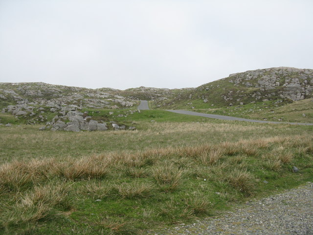
Leathad na Leige is a prominent coastal feature located in Ross-shire, Scotland. It is known as a headland or point, jutting out into the sea and offering breathtaking views of the surrounding landscape. The name Leathad na Leige translates to "slope of the flagstone" in Gaelic, which accurately describes the geological composition of the area.

This headland is characterized by its rugged terrain, with steep cliffs plunging into the Atlantic Ocean. The cliffs are composed of flagstone, a type of sedimentary rock that is rich in fossils and adds to the area's charm. The layers of flagstone can be observed in various hues, ranging from grey to brown, which provide a striking contrast against the deep blue waters below.

Leathad na Leige is a popular destination for nature enthusiasts and hikers who are drawn to its natural beauty and tranquility. The headland offers stunning panoramic views of the coastline, where visitors can marvel at the crashing waves and dramatic rock formations. It is also a haven for birdwatchers, as the area attracts a diverse range of seabirds such as gannets, fulmars, and puffins.

In addition to its natural wonders, Leathad na Leige is steeped in history. It is believed to have been occupied by humans since ancient times, with archaeological evidence suggesting the presence of settlements and burial sites. The headland also played a role in the defense of the coastline during World War II, with remnants of military structures still visible today.

Overall, Leathad na Leige is a captivating coastal feature that combines stunning natural beauty with a rich historical heritage, making it a must-visit destination for anyone exploring the Ross-shire region.

If you have any feedback on the listing, please let us know in the comments section below.

Leathad na Leige Images

Images are sourced within 2km of 58.240476/-6.8765543 or Grid Reference NB1338. Thanks to Geograph Open Source API. All images are credited.

Camas Bastadh/Bostadh Spelled differently on the map and gazetteer.
Camas Bastadh/Bostadh
Spelled differently on the map and gazetteer.
The cemetery at Bostadh Perhaps not a surprising number of burials for such a remote location, as it is a very desirable place to be laid to rest.
The cemetery at Bostadh
Perhaps not a surprising number of burials for such a remote location, as it is a very desirable place to be laid to rest.
The road to Bostadh With Siaram Bostadh in mid view on the left side.
The road to Bostadh
With Siaram Bostadh in mid view on the left side.
Bostadh Iron Age House The reconstructed house, viewed looking south.
Bostadh Iron Age House
The reconstructed house, viewed looking south.
Information about Bostadh Iron Age Village The Gaelic version.
Information about Bostadh Iron Age Village
The Gaelic version.
Information about Bostadh Iron Age Village The English version.
Information about Bostadh Iron Age Village
The English version.
Public convenience at Bostadh Near the end of the road at the cemetery and Iron Age Village.
Public convenience at Bostadh
Near the end of the road at the cemetery and Iron Age Village.
Camas Bostadh Sand dunes at Bostadh, looking to a cloud-covered Flodaigh.
Camas Bostadh
Sand dunes at Bostadh, looking to a cloud-covered Flodaigh.
Beach at Bostadh Looking across Camas Bostadh, with part of Flodaigh on the right.
Beach at Bostadh
Looking across Camas Bostadh, with part of Flodaigh on the right.
Traigh Bostadh Looking across to Cnoc Urraman.
Traigh Bostadh
Looking across to Cnoc Urraman.
Iron Age Village at Bostadh A reconstructed house and, farther up the valley, traces of other houses.
Iron Age Village at Bostadh
A reconstructed house and, farther up the valley, traces of other houses.
View from an Iron Age house Looking over Traigh Bosdtadh to Camus Bostadh and Flodaigh, from the enclosure surrounding the reconstructed house.
View from an Iron Age house
Looking over Traigh Bosdtadh to Camus Bostadh and Flodaigh, from the enclosure surrounding the reconstructed house.
Garden Tiger Moth larva A larva of Arctia caja on the path close to the Iron Age house at Bostadh. Thin plant growth on sand, with clear signs of rabbit grazing.
Garden Tiger Moth larva
A larva of Arctia caja on the path close to the Iron Age house at Bostadh. Thin plant growth on sand, with clear signs of rabbit grazing.
Iron Age House at Bostadh The inland end. Beyond is the path down from the car park.
Iron Age House at Bostadh
The inland end. Beyond is the path down from the car park.
Entrance to the Iron Age House A gap in the surrounding wall leads to the top of steps leading down to an underground entrance.
Entrance to the Iron Age House
A gap in the surrounding wall leads to the top of steps leading down to an underground entrance.
Iron Age House Underground doorway at the foot of the entrance steps. It is possible to go inside when the site is open.
Iron Age House
Underground doorway at the foot of the entrance steps. It is possible to go inside when the site is open.
Steps at the Iron Age House Leading up from the underground entrance.
Steps at the Iron Age House
Leading up from the underground entrance.
The road from Bostadh Near the cul-de-sac by the cemetery and Iron Age Village, at the northern end of Great Bernera/Beàrnaraigh.
The road from Bostadh
Near the cul-de-sac by the cemetery and Iron Age Village, at the northern end of Great Bernera/Beàrnaraigh.
Show me another place!

Leathad na Leige is located at Grid Ref: NB1338 (Lat: 58.240476, Lng: -6.8765543)

Unitary Authority: Na h-Eileanan an Iar

Police Authority: Highlands and Islands

What 3 Words

///vegans.island.warthog. Near Carloway, Na h-Eileanan Siar

Related Wikis

Bernera Riot

The Bernera Riot occurred in 1874, on the island of Great Bernera, in Scotland in response to the Highland Clearances. The use of the term 'Bernera Riot...

Great Bernera

Great Bernera (; Scottish Gaelic: Beàrnaraigh Mòr), often known just as Bernera (Scottish Gaelic: Beàrnaraigh), is an island and community in the Outer...

Breaclete

Breacleit (or Roulanish; Scottish Gaelic: Breacleit; Old Norse: Breiðiklettr) is the central village on Great Bernera in the Outer Hebrides, Scotland....

Little Bernera

Little Bernera (Scottish Gaelic: Beàrnaraigh Beag) is a small island situated off the west coast of the Isle of Lewis in the Outer Hebrides.Little Bernera...

Vacsay

Vacsay (Scottish Gaelic: Bhacsaigh from Old Norse "bakkiey" meaning "peat bank island") is one of the Outer Hebrides. It is off the west coast of Lewis...

Dun Bharabhat, Great Bernera

Dun Bharabhat (or Dun Baravat) is an Iron Age galleried dun or "semi-broch" situated on the island of Great Bernera near Lewis in Scotland (grid reference...

Pabaigh Mòr

Pabay Mòr or Pabaigh Mòr is an uninhabited island in the Outer Hebrides of Scotland. == History == The island's name comes from papey, an Old Norse name...

Fuaigh Mòr

Fuaigh Mòr (sometimes anglicised as Vuia Mor) is an island in the Outer Hebrides of Scotland. It is off the west coast of Lewis near Great Bernera in...

Nearby Amenities

Located within 500m of 58.240476,-6.8765543
Bus Stop
Tobson
Bus: yes
Naptan AtcoCode: 6010731557
Naptan Bearing: NE
Naptan BusStopType: CUS
Naptan CommonName: Township
Naptan Indicator: at
Naptan Landmark: bus turning point
Naptan NaptanCode: 94723937
Naptan Street: Minor Road
Naptan Verified: no
Public Transport: platform
Source: naptan_import
Lat/Long: 58.241787/-6.8797106
Barrier: cattle_grid
Lat/Long: 58.240964/-6.8816166
Passing Place
Lat/Long: 58.240021/-6.8733152
Passing Place
Lat/Long: 58.2420525/-6.8776175
Tòpsann
Alt Name Gd: Tòbsun;Tobsunn
Name En: Tobson
Name Gd: Tòpsann
Place: village
Lat/Long: 58.2428063/-6.8736748
Turning Circle
Lat/Long: 58.2408917/-6.8725834
Power: pole
Lat/Long: 58.2410014/-6.8818856
Power: pole
Lat/Long: 58.241262/-6.8813628
Power: pole
Lat/Long: 58.2416292/-6.8807649
Power: pole
Lat/Long: 58.2419417/-6.8801804
Power: pole
Lat/Long: 58.2421366/-6.8795908
Power: pole
Lat/Long: 58.2423515/-6.8791534
Power: pole
Lat/Long: 58.2424955/-6.8787389
Power: pole
Lat/Long: 58.2424657/-6.8778626
Power: pole
Lat/Long: 58.242442/-6.877266
Power: pole
Lat/Long: 58.2424157/-6.8764105
Power: pole
Lat/Long: 58.2426602/-6.8761069
Power: pole
Lat/Long: 58.2429565/-6.8754531
Power: pole
Lat/Long: 58.2432793/-6.8748176
Power: pole
Lat/Long: 58.2433221/-6.8740727
Power: pole
Lat/Long: 58.2431095/-6.8733077
Power: pole
Lat/Long: 58.2428707/-6.8721926
Power: pole
Lat/Long: 58.2425737/-6.8709253
Power: pole
Lat/Long: 58.2424335/-6.8699592
Power: pole
Lat/Long: 58.2423242/-6.8690948
Power: pole
Lat/Long: 58.2436152/-6.8730804
Power: pole
Lat/Long: 58.2438025/-6.8730282
Power: pole
Lat/Long: 58.244163/-6.8730716
Power: pole
Lat/Long: 58.2427989/-6.8749275
Power: pole
Lat/Long: 58.2425452/-6.874154
Power: pole
Lat/Long: 58.242171/-6.873987
Power: pole
Lat/Long: 58.2417385/-6.8737251
Power: pole
Lat/Long: 58.2413287/-6.8734994
Power: pole
Lat/Long: 58.2408772/-6.8731744
Power: pole
Lat/Long: 58.2404484/-6.8732737
Power: pole
Lat/Long: 58.2398965/-6.873183
Power: pole
Lat/Long: 58.2394641/-6.8732196
Power: pole
Lat/Long: 58.2389651/-6.8728065
Power: pole
Lat/Long: 58.2430995/-6.8698389
Barrier: cattle_grid
Lat/Long: 58.2434611/-6.8731038
Passing Place
Lat/Long: 58.2430038/-6.8704274
Barrier: cattle_grid
Lat/Long: 58.2430898/-6.8703707
Passing Place
Lat/Long: 58.2424893/-6.8746869
Barrier: cattle_grid
Lat/Long: 58.2424233/-6.8746393
Generator Method: photovoltaic
Generator Output Electricity: small_installation
Generator Source: solar
Generator Type: solar_photovoltaic_panel
Power: generator
Lat/Long: 58.2387265/-6.8721918
Turning Circle
Lat/Long: 58.2412473/-6.8812275
Power: pole
Lat/Long: 58.2421901/-6.8763299
Power: pole
Lat/Long: 58.2420059/-6.8769884
Great Bernera Walk
Hiking: yes
Information: guidepost
Tourism: information
Lat/Long: 58.2381731/-6.8743635
Great Bernera Walk
Hiking: yes
Information: guidepost
Tourism: information
Lat/Long: 58.2375798/-6.873574
Great Bernera Walk
Hiking: yes
Information: guidepost
Tourism: information
Lat/Long: 58.2369888/-6.8727561
The data included in this document is from www.openstreetmap.org. The data is made available under ODbL.

Have you been to Leathad na Leige?

Leave your review of Leathad na Leige below (or comments, questions and feedback).