Àirigh nan Càrn

Coastal Feature, Headland, Point in Ross-shire

Scotland

Àirigh nan Càrn

Ruined blackhouse, Ungaisidar
Ruined blackhouse, Ungaisidar Credit: Simon Bonney

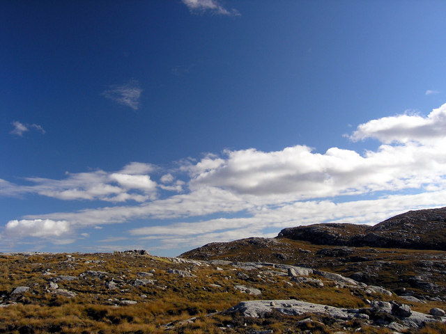
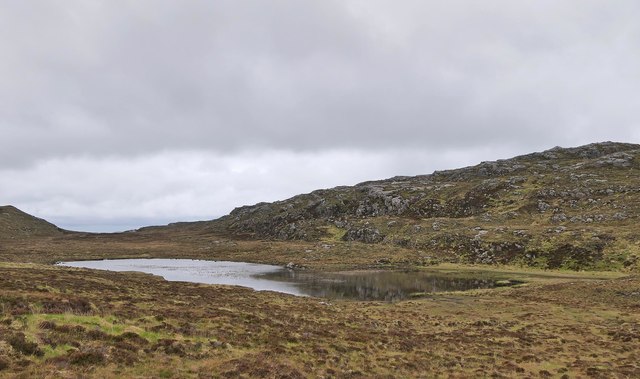
Àirigh nan Càrn is a prominent coastal feature located in Ross-shire, Scotland. It is a headland or point that juts out into the North Atlantic Ocean, offering breathtaking views of the surrounding landscape. The name Àirigh nan Càrn translates to "shelter of the cairns" in Scottish Gaelic, which is a fitting description for this stunning natural formation.

The headland is characterized by its rugged and rocky terrain, with steep cliffs that plunge into the sea below. These cliffs provide nesting grounds for various seabird species, including puffins, guillemots, and razorbills. The surrounding waters are also home to a diverse range of marine life, making it a popular spot for fishing and wildlife enthusiasts.

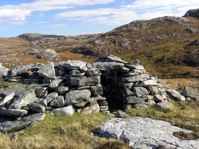
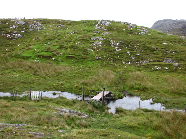
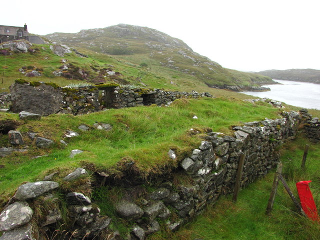
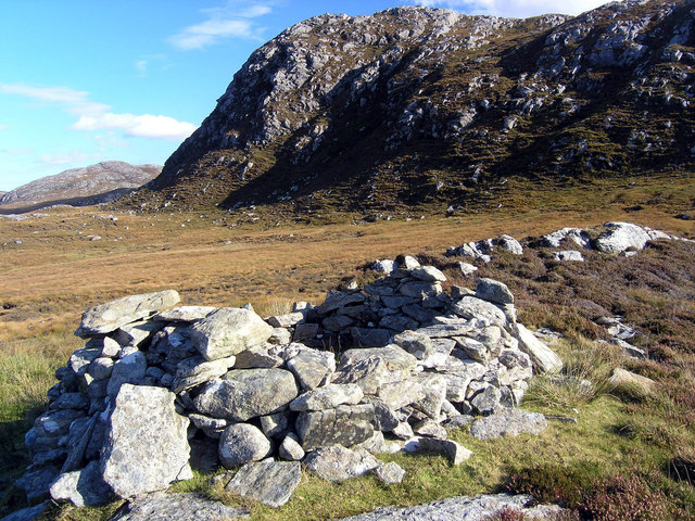
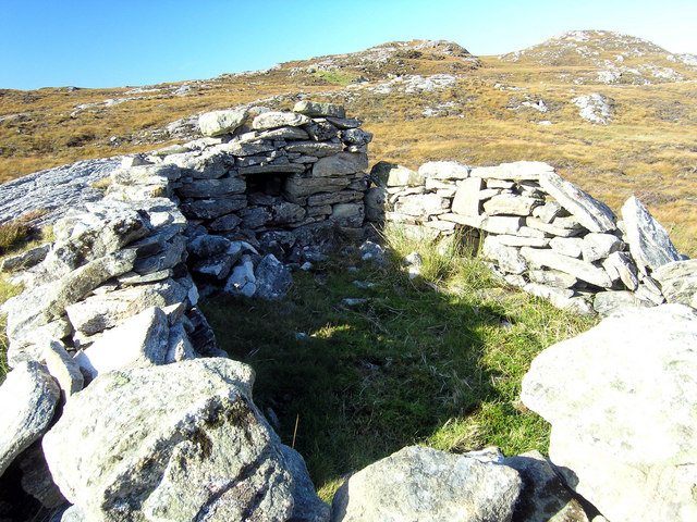
Visitors to Àirigh nan Càrn can enjoy a variety of outdoor activities, such as hiking along the coastal paths that wind through the headland. These paths offer stunning panoramic views of the ocean and the neighboring coastline. The area is also known for its rich history, with ancient ruins and archaeological sites scattered throughout the landscape.

The headland is easily accessible by road, with a car park located nearby for visitors to park their vehicles. It is a popular destination for nature lovers, photographers, and those seeking a peaceful retreat away from the hustle and bustle of city life.

In conclusion, Àirigh nan Càrn is a captivating coastal feature in Ross-shire, Scotland. Its dramatic cliffs, diverse wildlife, and stunning views make it a must-visit destination for anyone exploring the area.

If you have any feedback on the listing, please let us know in the comments section below.

Àirigh nan Càrn Images

Images are sourced within 2km of 58.170379/-6.868568 or Grid Reference NB1330. Thanks to Geograph Open Source API. All images are credited.

Ruined blackhouse, Ungaisidar
Cairn, Druim Sandavig, Isle of Lewis This is one of several similarly shaped cairns in the area.  See also <a href="https://www.geograph.org.uk/photo/6205867">NB1129 : Cairn, Druim Sandavig, Isle of Lewis</a>.
Cairn, Druim Sandavig, Isle of Lewis
This is one of several similarly shaped cairns in the area. See also NB1129 : Cairn, Druim Sandavig, Isle of Lewis.
Crofthouse at Ungisiadar Overlooking Loch Ròg Beag.
Crofthouse at Ungisiadar
Overlooking Loch Ròg Beag.
Disused Croft Buildings Ungisiadar.
Disused Croft Buildings
Ungisiadar.
Shieling above Strome Ruined shieling on high ground above Strome and Drovinish.
Shieling above Strome
Ruined shieling on high ground above Strome and Drovinish.
Shieling above Strome Ruined shieling above Strome and Drovinish.  The hill behind is Creag na h-Iolaire, the rock of the eagle.
Shieling above Strome
Ruined shieling above Strome and Drovinish. The hill behind is Creag na h-Iolaire, the rock of the eagle.
Gate and Mailbox to No1 Ungaisidar The un-metalled track beyond the gate leads down to Ungaisidar. You soon reach the limit of vehicular access and the rest of the journey to No1 is definitely upon foot.
Gate and Mailbox to No1 Ungaisidar
The un-metalled track beyond the gate leads down to Ungaisidar. You soon reach the limit of vehicular access and the rest of the journey to No1 is definitely upon foot.
Footbridge to Ungaisidar In 1992 this bridge was precarious; now in 2009, and clearly showing no signs of renovation, it was with some trepidation that we crossed it again in the pouring rain. The metal plate has rusted through in several places giving a view of the mud below.
Footbridge to Ungaisidar
In 1992 this bridge was precarious; now in 2009, and clearly showing no signs of renovation, it was with some trepidation that we crossed it again in the pouring rain. The metal plate has rusted through in several places giving a view of the mud below.
No 1 Ungaisidar A one-time croft and subsequent holiday cottage this property now appears to be inhabited. However, the access by track seems no better with the final few hundred metres being by foot only.
No 1 Ungaisidar
A one-time croft and subsequent holiday cottage this property now appears to be inhabited. However, the access by track seems no better with the final few hundred metres being by foot only.
Mill Ruins at Ungaisidar Where the stream runs down from west to east and into Little Loch Roag evidence of a water powered mill is present. I understand, from locals, that this was where local cereals were ground. No 1 Ungaisidar and the narrows on Little Loch Roag can be seen in the background.
Mill Ruins at Ungaisidar
Where the stream runs down from west to east and into Little Loch Roag evidence of a water powered mill is present. I understand, from locals, that this was where local cereals were ground. No 1 Ungaisidar and the narrows on Little Loch Roag can be seen in the background.
Dam on Loch Mòr na Muilne, Isle of Lewis The name of the loch means large loch of the mill.  The outflow controlled by the dam flows into Loch Beag na Muilne (small loch of the mill).  This lower loch supplied water to the mill shown at <a href="https://www.geograph.org.uk/photo/1522799">NB1229 : Mill Ruins at Ungaisidar</a>.
Dam on Loch Mòr na Muilne, Isle of Lewis
The name of the loch means large loch of the mill. The outflow controlled by the dam flows into Loch Beag na Muilne (small loch of the mill). This lower loch supplied water to the mill shown at NB1229 : Mill Ruins at Ungaisidar.
Loch Mòr na Muilne, Isle of Lewis Loch Mòr na Muilne means large loch of the mill. The outflow from the loch flows into Loch Beag na Muilne (small loch of the mill). This lower loch supplied water to the mill shown at <a href="https://www.geograph.org.uk/photo/1522799">NB1229 : Mill Ruins at Ungaisidar</a>.
Loch Mòr na Muilne, Isle of Lewis
Loch Mòr na Muilne means large loch of the mill. The outflow from the loch flows into Loch Beag na Muilne (small loch of the mill). This lower loch supplied water to the mill shown at NB1229 : Mill Ruins at Ungaisidar.
Shieling at the head of Loch Strome Ruined shieling (Airigh nan Carn) with the remains of the township of Strome on the water's edge, and the hill Stromacleit behind.
Shieling at the head of Loch Strome
Ruined shieling (Airigh nan Carn) with the remains of the township of Strome on the water's edge, and the hill Stromacleit behind.
Village of Strome Ruined blackhouses in the village of Strome at the head of Loch Strome.
Village of Strome
Ruined blackhouses in the village of Strome at the head of Loch Strome.
Loch Strome Ruins in the deserted village of Strome, looking down Loch Strome towards Loch Roag.
Loch Strome
Ruins in the deserted village of Strome, looking down Loch Strome towards Loch Roag.
Shieling below Sron Mhor Ruined shieling near Strome.
Shieling below Sron Mhor
Ruined shieling near Strome.
Shieling near Strome Ruined shieling (and another visible in the distance) on moorland below Sron Mhor.
Shieling near Strome
Ruined shieling (and another visible in the distance) on moorland below Sron Mhor.
Loch an Strom and Aird Orasaigh Loch an Strom (Norse = Straumr meaning a tidal current) and Aird Orasaigh (Norse = Orfirsey meaning a tidal island)
Loch an Strom and Aird Orasaigh
Loch an Strom (Norse = Straumr meaning a tidal current) and Aird Orasaigh (Norse = Orfirsey meaning a tidal island)
Show me another place!

Àirigh nan Càrn is located at Grid Ref: NB1330 (Lat: 58.170379, Lng: -6.868568)

Unitary Authority: Na h-Eileanan an Iar

Police Authority: Highlands and Islands

What 3 Words

///goods.vest.investors. Near Carloway, Na h-Eileanan Siar

Related Wikis

Fuaigh Beag

Fuaigh Beag or Vuia Be(a)g is an island in the Outer Hebrides. It is off the west coast of Lewis near Great Bernera in Loch Roag. Its name means "little...

Loch Ròg

Loch Ròg or Loch Roag is a large sea loch on the west coast of Lewis, Outer Hebrides. It is broadly divided into East Loch Roag and West Loch Roag with...

Flodaigh, Lewis

Flodaigh is a small island in Loch Roag on the west coast of Lewis in the Outer Hebrides of Scotland. It is about 33 hectares (82 acres) in extent and...

Fuaigh Mòr

Fuaigh Mòr (sometimes anglicised as Vuia Mor) is an island in the Outer Hebrides of Scotland. It is off the west coast of Lewis near Great Bernera in...

Callanish VIII

The Callanish VIII stone setting is one of many megalithic structures around the better-known (and larger) Calanais I on the west coast of the Isle of...

Gisla Hydro-Electric Scheme

Gisla Hydro-Electric Scheme was a small scheme promoted by the North of Scotland Hydro-Electric Board on the Isle of Lewis, Outer Hebrides, Scotland. It...

Dun Bharabhat, Great Bernera

Dun Bharabhat (or Dun Baravat) is an Iron Age galleried dun or "semi-broch" situated on the island of Great Bernera near Lewis in Scotland (grid reference...

Loch na Berie

Loch Na Berie is a broch in the Outer Hebrides of Scotland, located approximately 400 yards from the shore, and is thought to have been located on an island...

Nearby Amenities

Located within 500m of 58.170379,-6.868568
Strom
Place: locality
Lat/Long: 58.1708457/-6.8769665
Airigh nan Carn
Place: locality
Lat/Long: 58.1696147/-6.8690185
The data included in this document is from www.openstreetmap.org. The data is made available under ODbL.

Have you been to Àirigh nan Càrn?

Leave your review of Àirigh nan Càrn below (or comments, questions and feedback).