Leac an Toa

Coastal Feature, Headland, Point in Ross-shire

Scotland

Leac an Toa

The cemetery at Bostadh Perhaps not a surprising number of burials for such a remote location, as it is a very desirable place to be laid to rest.
The cemetery at Bostadh Credit: John Lucas

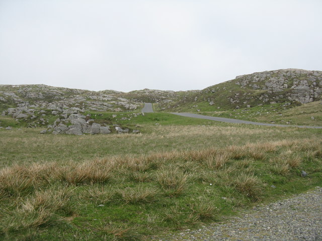
Leac an Toa is a prominent coastal feature located in Ross-shire, a historic county in the Highland region of Scotland. This headland, also known as Leachintore Point, juts out into the North Sea, offering breathtaking views of the surrounding rugged coastline.

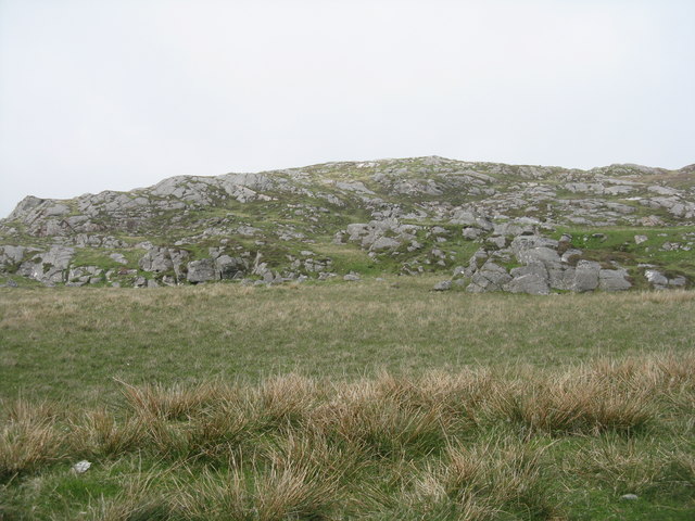
Rising to an elevation of approximately 50 meters (164 feet), Leac an Toa is characterized by its steep cliffs and rocky terrain. The headland is composed of a variety of geological formations, with basalt columns and sedimentary layers adding to its visual appeal. These unique rock formations are a result of ancient volcanic activity and have attracted the attention of geologists and nature enthusiasts alike.

Leac an Toa is renowned for its rich biodiversity, serving as a habitat for a diverse range of plant and animal species. The coastal heathland is adorned with vibrant wildflowers, including thrift and sea pinks, creating a colorful spectacle during the summer months. The surrounding waters are home to a variety of marine life, such as seals, dolphins, and seabirds, making it a popular spot for wildlife watching.

In addition to its natural beauty, Leac an Toa holds historical significance. It has been a popular spot for fishermen and sailors for centuries, providing a vantage point for monitoring the sea and its changing weather conditions. The headland also boasts the remnants of an ancient fort, believed to have been constructed during the Iron Age, adding an air of mystery and intrigue to the site.

Overall, Leac an Toa is a captivating coastal feature that combines stunning natural landscapes with a rich cultural and historical heritage, making it a must-visit destination for nature lovers and history enthusiasts alike.

If you have any feedback on the listing, please let us know in the comments section below.

Leac an Toa Images

Images are sourced within 2km of 58.238929/-6.8836084 or Grid Reference NB1338. Thanks to Geograph Open Source API. All images are credited.

The cemetery at Bostadh Perhaps not a surprising number of burials for such a remote location, as it is a very desirable place to be laid to rest.
The cemetery at Bostadh
Perhaps not a surprising number of burials for such a remote location, as it is a very desirable place to be laid to rest.
Bostadh Iron Age House The reconstructed house, viewed looking south.
Bostadh Iron Age House
The reconstructed house, viewed looking south.
Information about Bostadh Iron Age Village The Gaelic version.
Information about Bostadh Iron Age Village
The Gaelic version.
Information about Bostadh Iron Age Village The English version.
Information about Bostadh Iron Age Village
The English version.
Public convenience at Bostadh Near the end of the road at the cemetery and Iron Age Village.
Public convenience at Bostadh
Near the end of the road at the cemetery and Iron Age Village.
Iron Age Village at Bostadh A reconstructed house and, farther up the valley, traces of other houses.
Iron Age Village at Bostadh
A reconstructed house and, farther up the valley, traces of other houses.
Garden Tiger Moth larva A larva of Arctia caja on the path close to the Iron Age house at Bostadh. Thin plant growth on sand, with clear signs of rabbit grazing.
Garden Tiger Moth larva
A larva of Arctia caja on the path close to the Iron Age house at Bostadh. Thin plant growth on sand, with clear signs of rabbit grazing.
Iron Age House at Bostadh The inland end. Beyond is the path down from the car park.
Iron Age House at Bostadh
The inland end. Beyond is the path down from the car park.
Entrance to the Iron Age House A gap in the surrounding wall leads to the top of steps leading down to an underground entrance.
Entrance to the Iron Age House
A gap in the surrounding wall leads to the top of steps leading down to an underground entrance.
Iron Age House Underground doorway at the foot of the entrance steps. It is possible to go inside when the site is open.
Iron Age House
Underground doorway at the foot of the entrance steps. It is possible to go inside when the site is open.
Steps at the Iron Age House Leading up from the underground entrance.
Steps at the Iron Age House
Leading up from the underground entrance.
The road from Bostadh Near the cul-de-sac by the cemetery and Iron Age Village, at the northern end of Great Bernera/Beàrnaraigh.
The road from Bostadh
Near the cul-de-sac by the cemetery and Iron Age Village, at the northern end of Great Bernera/Beàrnaraigh.
Cnoc Ruinagaidh A rocky out crop near the roadend at Bostadh.
Cnoc Ruinagaidh
A rocky out crop near the roadend at Bostadh.
Replica Iron Age house at Bostadh Replica house built in 1999. <span class="nowrap"><a title="https://canmore.org.uk/site/268694/lewis-great-bernera-bosta" rel="nofollow ugc noopener" href="https://canmore.org.uk/site/268694/lewis-great-bernera-bosta">Link</a><img style="margin-left:2px;" alt="External link" title="External link - shift click to open in new window" src="https://s1.geograph.org.uk/img/external.png" width="10" height="10"/></span>
Replica Iron Age house at Bostadh
Replica house built in 1999. LinkExternal link
West coast of Great Bernera This is the west side of a spit of land extending south of Tobson. The ground is rocky with a thin covering of grass.

In the distance, on the left is the tip of the island of Pabaigh Mor .. and on the right Geodha Mor (west of Tobson).
West coast of Great Bernera
This is the west side of a spit of land extending south of Tobson. The ground is rocky with a thin covering of grass. In the distance, on the left is the tip of the island of Pabaigh Mor .. and on the right Geodha Mor (west of Tobson).
Camas Sanndaig Looking across the bay. In the distance is the low island of Pabaigh Mor with the headland of Bhaltos beyond.

A bundle of fencing wire is abandoned in the rocky gully above the sea.
Camas Sanndaig
Looking across the bay. In the distance is the low island of Pabaigh Mor with the headland of Bhaltos beyond. A bundle of fencing wire is abandoned in the rocky gully above the sea.
Beach north of Bhalasaigh
Sea loch west of Loch Veiravat Although it isn't obvious from here, this is the start of a long channel that leads out to the sea.
Sea loch west of Loch Veiravat
Although it isn't obvious from here, this is the start of a long channel that leads out to the sea.
Show me another place!

Leac an Toa is located at Grid Ref: NB1338 (Lat: 58.238929, Lng: -6.8836084)

Unitary Authority: Na h-Eileanan an Iar

Police Authority: Highlands and Islands

What 3 Words

///unwraps.limit.blotches. Near Carloway, Na h-Eileanan Siar

Related Wikis

Bernera Riot

The Bernera Riot occurred in 1874, on the island of Great Bernera, in Scotland in response to the Highland Clearances. The use of the term 'Bernera Riot...

Great Bernera

Great Bernera (; Scottish Gaelic: Beàrnaraigh Mòr), often known just as Bernera (Scottish Gaelic: Beàrnaraigh), is an island and community in the Outer...

Vacsay

Vacsay (Scottish Gaelic: Bhacsaigh from Old Norse "bakkiey" meaning "peat bank island") is one of the Outer Hebrides. It is off the west coast of Lewis...

Breaclete

Breacleit (or Roulanish; Scottish Gaelic: Breacleit; Old Norse: Breiðiklettr) is the central village on Great Bernera in the Outer Hebrides, Scotland....

Pabaigh Mòr

Pabay Mòr or Pabaigh Mòr is an uninhabited island in the Outer Hebrides of Scotland. == History == The island's name comes from papey, an Old Norse name...

Little Bernera

Little Bernera (Scottish Gaelic: Beàrnaraigh Beag) is a small island situated off the west coast of the Isle of Lewis in the Outer Hebrides.Little Bernera...

Fuaigh Mòr

Fuaigh Mòr (sometimes anglicised as Vuia Mor) is an island in the Outer Hebrides of Scotland. It is off the west coast of Lewis near Great Bernera in...

Dun Bharabhat, Great Bernera

Dun Bharabhat (or Dun Baravat) is an Iron Age galleried dun or "semi-broch" situated on the island of Great Bernera near Lewis in Scotland (grid reference...

Nearby Amenities

Located within 500m of 58.238929,-6.8836084
Bus Stop
Tobson
Bus: yes
Naptan AtcoCode: 6010731557
Naptan Bearing: NE
Naptan BusStopType: CUS
Naptan CommonName: Township
Naptan Indicator: at
Naptan Landmark: bus turning point
Naptan NaptanCode: 94723937
Naptan Street: Minor Road
Naptan Verified: no
Public Transport: platform
Source: naptan_import
Lat/Long: 58.241787/-6.8797106
Barrier: cattle_grid
Lat/Long: 58.240964/-6.8816166
Passing Place
Lat/Long: 58.2420525/-6.8776175
Power: pole
Lat/Long: 58.2410014/-6.8818856
Power: pole
Lat/Long: 58.241262/-6.8813628
Power: pole
Lat/Long: 58.2416292/-6.8807649
Power: pole
Lat/Long: 58.2419417/-6.8801804
Power: pole
Lat/Long: 58.2421366/-6.8795908
Power: pole
Lat/Long: 58.2423515/-6.8791534
Power: pole
Lat/Long: 58.2424955/-6.8787389
Turning Circle
Lat/Long: 58.2412473/-6.8812275
The data included in this document is from www.openstreetmap.org. The data is made available under ODbL.

Have you been to Leac an Toa?

Leave your review of Leac an Toa below (or comments, questions and feedback).