Geodha Gainmhich

Coastal Feature, Headland, Point in Ross-shire

Scotland

Geodha Gainmhich

Beehive Cell - Eilean Fir Chrothair The beautiful little beehive cell on the island of Eilean Fir Chrothair.
Beehive Cell - Eilean Fir Chrothair Credit: Marc Calhoun

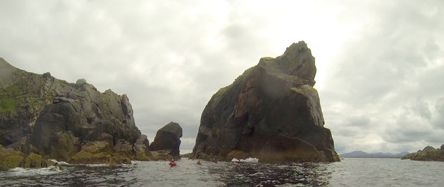
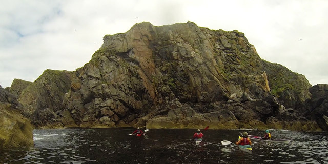
Geodha Gainmhich is a coastal feature located in Ross-shire, Scotland. It is a prominent headland that extends out into the sea, forming a point that offers stunning views of the surrounding coastline. The name Geodha Gainmhich translates to "rocky cove" in Gaelic, which accurately describes the geological composition of the area.

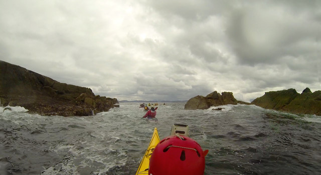
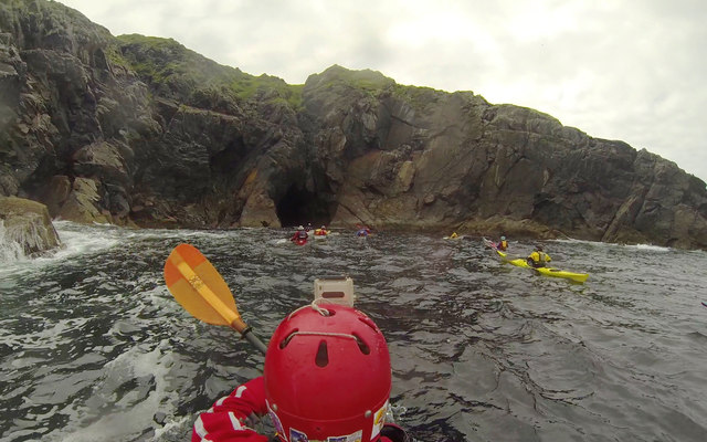
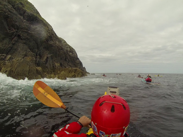
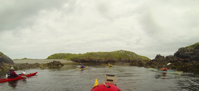
The headland is characterized by rugged cliffs and rocky outcrops, which have been shaped over time by the relentless forces of the sea. These cliffs provide a nesting habitat for a variety of seabirds, including guillemots and kittiwakes, making it a popular spot for birdwatching enthusiasts. The surrounding waters are teeming with marine life, and seals can often be spotted resting on the nearby rocks.

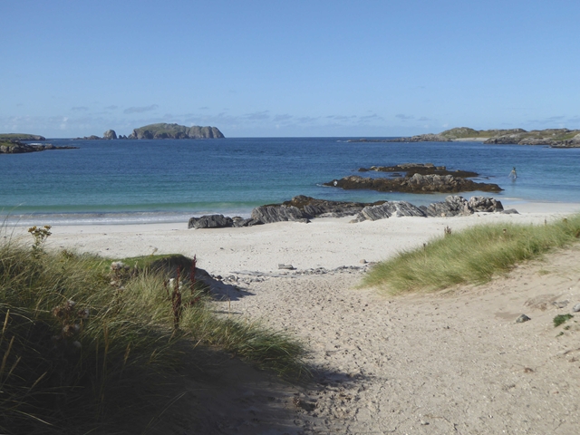
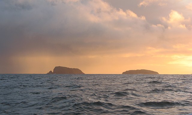
Geodha Gainmhich is known for its breathtaking landscapes, with panoramic views of the North Sea and the nearby mountains. The headland is a haven for outdoor enthusiasts, offering opportunities for hiking, photography, and exploration. There are several walking trails that lead visitors along the cliff tops, providing access to the stunning vistas and allowing them to immerse themselves in the natural beauty of the area.

The headland is easily accessible by road, with a nearby car park offering convenient parking facilities. It is a popular destination for both locals and tourists alike, who come to experience the rugged charm and unspoiled beauty of Geodha Gainmhich. Whether it is to enjoy a leisurely stroll along the coastline, observe the abundant wildlife, or simply take in the awe-inspiring views, Geodha Gainmhich is a coastal feature that truly captivates all who visit.

If you have any feedback on the listing, please let us know in the comments section below.

Geodha Gainmhich Images

Images are sourced within 2km of 58.268704/-6.9068535 or Grid Reference NB1241. Thanks to Geograph Open Source API. All images are credited.

Beehive Cell - Eilean Fir Chrothair The beautiful little beehive cell on the island of Eilean Fir Chrothair.
Beehive Cell - Eilean Fir Chrothair
The beautiful little beehive cell on the island of Eilean Fir Chrothair.
Camas Bostadh Sand dunes at Bostadh, looking to a cloud-covered Flodaigh.
Camas Bostadh
Sand dunes at Bostadh, looking to a cloud-covered Flodaigh.
Rocky coast at Bostadh Looking across Camas Bostadh from near the cemetery wall.
Rocky coast at Bostadh
Looking across Camas Bostadh from near the cemetery wall.
Beach at Bostadh Looking across Camas Bostadh, with part of Flodaigh on the right.
Beach at Bostadh
Looking across Camas Bostadh, with part of Flodaigh on the right.
Traigh Bostadh Looking across to Cnoc Urraman.
Traigh Bostadh
Looking across to Cnoc Urraman.
View from an Iron Age house Looking over Traigh Bosdtadh to Camus Bostadh and Flodaigh, from the enclosure surrounding the reconstructed house.
View from an Iron Age house
Looking over Traigh Bosdtadh to Camus Bostadh and Flodaigh, from the enclosure surrounding the reconstructed house.
Poll a' Roin A small sandy inlet off Traigh Bostadh; looking north from Cnoc a' Chuispair out to Camas Bostadh and a rocky headland.
Poll a' Roin
A small sandy inlet off Traigh Bostadh; looking north from Cnoc a' Chuispair out to Camas Bostadh and a rocky headland.
Visiting the Tide Bell at Bostadh The idea of the tide bell is to toll as the waves cause movement when the tide is high enough. There are a number of these installations around the UK, which will toll at different times as the tide rises and falls in each of the locations. As the tide gets later by a bit under an hour each day, the bell will toll at night as often as during the day, and for longer at spring tides than neaps. Perhaps it is just as well no-one lives here. Visiting the bell is straightforward at low tide and probably needs a small boat (and ear defenders) at high tide. In between, a certain degree of hardiness is required unless, as with these visitors, you happen to be wearing a drysuit...
Visiting the Tide Bell at Bostadh
The idea of the tide bell is to toll as the waves cause movement when the tide is high enough. There are a number of these installations around the UK, which will toll at different times as the tide rises and falls in each of the locations. As the tide gets later by a bit under an hour each day, the bell will toll at night as often as during the day, and for longer at spring tides than neaps. Perhaps it is just as well no-one lives here. Visiting the bell is straightforward at low tide and probably needs a small boat (and ear defenders) at high tide. In between, a certain degree of hardiness is required unless, as with these visitors, you happen to be wearing a drysuit...
Lunch stop on Little Bernera Although well under halfway round our trip exploring sea caves in the islands north of Great Bernera, this would be the last sandy beach offering an easy landing, so a stop was inevitable, if only to stretch the legs and relieve any undue pressure. The sea here is deceptively calm - out on the rocky coasts there was an interesting level of swell, which always makes sea cave exploration "interesting".
Lunch stop on Little Bernera
Although well under halfway round our trip exploring sea caves in the islands north of Great Bernera, this would be the last sandy beach offering an easy landing, so a stop was inevitable, if only to stretch the legs and relieve any undue pressure. The sea here is deceptively calm - out on the rocky coasts there was an interesting level of swell, which always makes sea cave exploration "interesting".
Stac an Tùill of Bearasaigh Returning from Seanna Chnoc on our way to Bostadh, the most interesting route seemed to be to thread the Caolas Stac an Tùill on the west side of Bearasaigh. This 43m high stack is prominent in the view from Bostadh, and is scarcely less in height than the island of Bearasaigh itself (58m). However, there are other skerries (off to the right of the view) providing some shelter here, so the swell as we came into the channel was quite a bit less than it had been earlier in our trip, and towards the southeastern end, the water was almost calm.
Stac an Tùill of Bearasaigh
Returning from Seanna Chnoc on our way to Bostadh, the most interesting route seemed to be to thread the Caolas Stac an Tùill on the west side of Bearasaigh. This 43m high stack is prominent in the view from Bostadh, and is scarcely less in height than the island of Bearasaigh itself (58m). However, there are other skerries (off to the right of the view) providing some shelter here, so the swell as we came into the channel was quite a bit less than it had been earlier in our trip, and towards the southeastern end, the water was almost calm.
Threading the channel past Flodaigh On our return from Seanna Chnoc via Bearasaigh, we'd just passed Sgeir nan Saoidhean and were now skirting the west side of Flodaigh (which offered more interesting paddling than the east side in the prevailing weather). Sea kayakers cannot resist narrow channels between skerries, especially with a bit of swell, and this was almost the last bit of excitement in our trip as we headed into more sheltered waters on our last day of a week exploring islands, stacks and sea caves.
Threading the channel past Flodaigh
On our return from Seanna Chnoc via Bearasaigh, we'd just passed Sgeir nan Saoidhean and were now skirting the west side of Flodaigh (which offered more interesting paddling than the east side in the prevailing weather). Sea kayakers cannot resist narrow channels between skerries, especially with a bit of swell, and this was almost the last bit of excitement in our trip as we headed into more sheltered waters on our last day of a week exploring islands, stacks and sea caves.
Heading into a cave on the north side of Seanna Chnoc Seanna Chnoc was the northernmost island of our trip out from Bostadh. There are at least four caves in the cliffs of the island, though the one we looked into on the south coast did not go very far. The one here proved to extend further under the cliffs than any of the others, though still not beyond the realms of daylight. Being set back into a deep cove on the north coast, this one had very little swell for such a location, as today's weather was bringing the wind and waves from the southwest.
Heading into a cave on the north side of Seanna Chnoc
Seanna Chnoc was the northernmost island of our trip out from Bostadh. There are at least four caves in the cliffs of the island, though the one we looked into on the south coast did not go very far. The one here proved to extend further under the cliffs than any of the others, though still not beyond the realms of daylight. Being set back into a deep cove on the north coast, this one had very little swell for such a location, as today's weather was bringing the wind and waves from the southwest.
The extreme eastern tip of Seanna Chnoc On this, the more sheltered end of Seanna Chnoc, we could paddle within a few metres of the rocks at the start of our circumnavigation. The sea caves of the northern coast were also easy to enter today - only the western side was a bit more exciting. This was the northernmost island of our day exploring skerries, coves and caves, out from Bostadh on Great Bernera.
The extreme eastern tip of Seanna Chnoc
On this, the more sheltered end of Seanna Chnoc, we could paddle within a few metres of the rocks at the start of our circumnavigation. The sea caves of the northern coast were also easy to enter today - only the western side was a bit more exciting. This was the northernmost island of our day exploring skerries, coves and caves, out from Bostadh on Great Bernera.
In the shelter of Stac an Tùill at Bearasaigh On our return from Seanna Chnoc, we passed close west of Bearasiagh, threading the gap between it and Stac an Tùill, to enter this sheltered lagoon. This was part of a day trip (a bit over ten miles, not counting all the excursions in and out of the indented coastlines), starting from and returning to Bostadh, exploring the cliffs, coves and sea caves of several of the small rocky islands north of Great Bernera, made interesting by wind and swell from the southwest.
In the shelter of Stac an Tùill at Bearasaigh
On our return from Seanna Chnoc, we passed close west of Bearasiagh, threading the gap between it and Stac an Tùill, to enter this sheltered lagoon. This was part of a day trip (a bit over ten miles, not counting all the excursions in and out of the indented coastlines), starting from and returning to Bostadh, exploring the cliffs, coves and sea caves of several of the small rocky islands north of Great Bernera, made interesting by wind and swell from the southwest.
Paddling over reefs on the south end of Flodaigh Towards the end of a day trip out from Bostadh on Great Bernera, exploring the cliffs, coves and sea caves of several of the small islands, we skirted down the west side of Flodaigh and then threaded our way through shallow and quite sheltered water between Flodaigh and Tamna (joined at low tide) before the final short crossing back to our starting point.
Paddling over reefs on the south end of Flodaigh
Towards the end of a day trip out from Bostadh on Great Bernera, exploring the cliffs, coves and sea caves of several of the small islands, we skirted down the west side of Flodaigh and then threaded our way through shallow and quite sheltered water between Flodaigh and Tamna (joined at low tide) before the final short crossing back to our starting point.
The beach at Bostadh The Island of Bearasaigh on the horizon.
The beach at Bostadh
The Island of Bearasaigh on the horizon.
Bostadh Beach With the hill of Cnoc Urraman beyond.
Bostadh Beach
With the hill of Cnoc Urraman beyond.
Time and Tide Bell, Bostadh Installed by Marcus Vergette in 2010, this is one of twelve Tide and Tide Bells to be installed round the coast of Great Britain. Silent, of course, at low tide as when this photograph was taken.
Time and Tide Bell, Bostadh
Installed by Marcus Vergette in 2010, this is one of twelve Tide and Tide Bells to be installed round the coast of Great Britain. Silent, of course, at low tide as when this photograph was taken.
Show me another place!

Geodha Gainmhich is located at Grid Ref: NB1241 (Lat: 58.268704, Lng: -6.9068535)

Unitary Authority: Na h-Eileanan an Iar

Police Authority: Highlands and Islands

What 3 Words

///diary.terms.succumbs. Near Carloway, Na h-Eileanan Siar

Related Wikis

Flodaigh (Outer Loch Ròg)

Flodaigh is an islet in outer Loch Ròg, Lewis, Scotland. It lies north west of Great Bernera and Little Bernera, south of Bearasaigh and Seanna Chnoc and...

Bearasaigh

Bearasaigh or Bearasay (and sometimes Berisay) is an islet in outer Loch Ròg, Lewis, Scotland. During the late 16th and early 17th centuries it was used...

Seanna Chnoc

Seanna Chnoc (English: "old hill"), correctly known as Seana Bheinn is an islet in outer Loch Ròg, Lewis, Scotland. It lies north west of Great Bernera...

Little Bernera

Little Bernera (Scottish Gaelic: Beàrnaraigh Beag) is a small island situated off the west coast of the Isle of Lewis in the Outer Hebrides.Little Bernera...

Nearby Amenities

Located within 500m of 58.268704,-6.9068535
Created By: dmgroom_coastlines
Lat/Long: 58.27157/-6.90842
The data included in this document is from www.openstreetmap.org. The data is made available under ODbL.

Have you been to Geodha Gainmhich?

Leave your review of Geodha Gainmhich below (or comments, questions and feedback).