Geodha Dubh

Coastal Feature, Headland, Point in Ross-shire

Scotland

Geodha Dubh

Houses at Islibhig An interesting juxtaposition of old and new.
Houses at Islibhig Credit: Sandy Gerrard

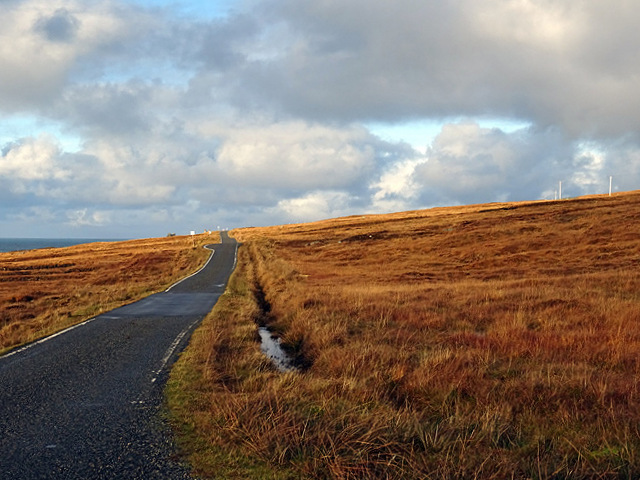
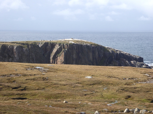
Geodha Dubh, located in Ross-shire, Scotland, is a magnificent coastal feature known for its stunning headland and point. Situated on the northwestern coast of Scotland, it is a popular destination for nature enthusiasts and avid photographers alike.

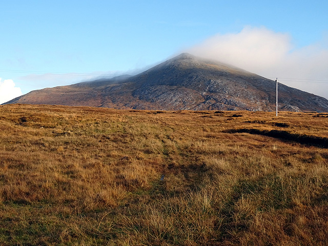
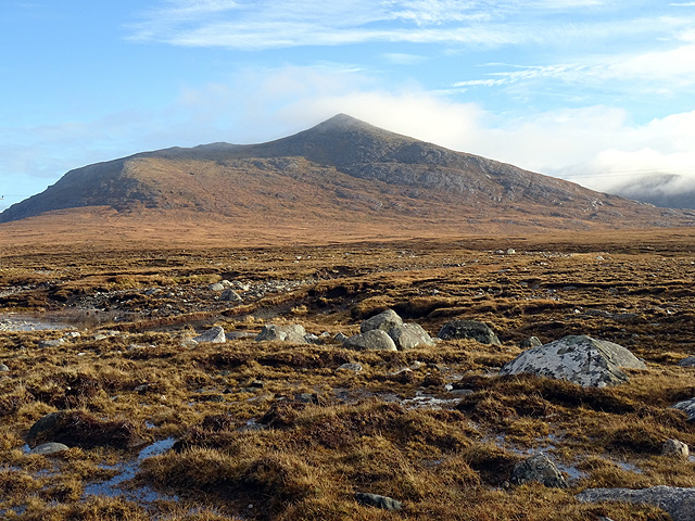
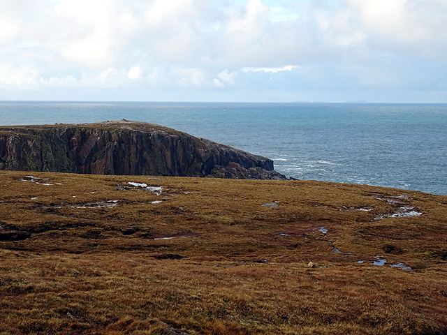
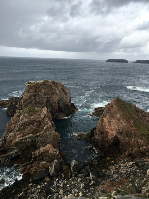
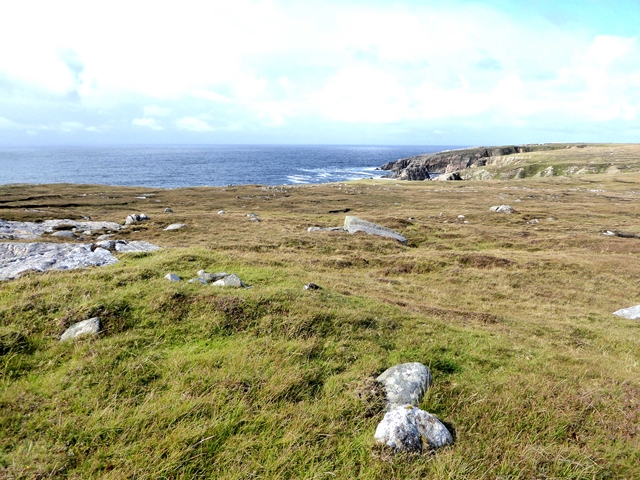
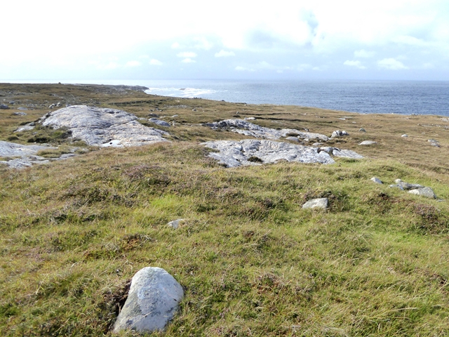
The headland at Geodha Dubh offers breathtaking panoramic views of the surrounding landscape. Rising high above the sea, it provides a perfect vantage point to observe the rugged cliffs, crashing waves, and the vast expanse of the North Atlantic Ocean. The geological formations here are remarkable, with layers of sedimentary rocks displaying millions of years of natural history.

The point at Geodha Dubh offers a unique experience for visitors. Jutting out into the sea, it provides a dramatic setting for watching seabirds soaring gracefully above the water, while below, the crashing waves create a mesmerizing spectacle. The area is also home to a diverse range of marine life, including seals and dolphins, which can often be spotted swimming in the clear, turquoise waters.

For those seeking outdoor activities, Geodha Dubh offers opportunities for coastal walks, as well as rock climbing and fishing. The area's rich biodiversity and unspoiled natural beauty make it an ideal spot for birdwatching and wildlife photography.

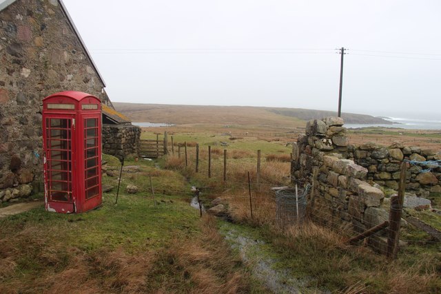
Geodha Dubh is easily accessible by car, with ample parking available nearby. It is a place of tranquility and natural wonder, where visitors can immerse themselves in the awe-inspiring beauty of the Scottish coastline.

If you have any feedback on the listing, please let us know in the comments section below.

Geodha Dubh Images

Images are sourced within 2km of 58.137462/-7.1284862 or Grid Reference NA9827. Thanks to Geograph Open Source API. All images are credited.

Houses at Islibhig An interesting juxtaposition of old and new.
Houses at Islibhig
An interesting juxtaposition of old and new.
Small pond beside the road to Islibhig This probably represents the site of a small quarry cut for stone when the road was being constructed.
Small pond beside the road to Islibhig
This probably represents the site of a small quarry cut for stone when the road was being constructed.
Geodh' an Fhithich Sea Stacks
Heading north from Breanais on the far west of Lewis Towards Islibhig.
Heading north from Breanais on the far west of Lewis
Towards Islibhig.
Near Breanais Looking inland towards Mealaisbhal.
Near Breanais
Looking inland towards Mealaisbhal.
Some very boggy ground near Islibhig With Mealaisbhal dominating the view.
Some very boggy ground near Islibhig
With Mealaisbhal dominating the view.
The headland of Ãird Feinis The Flannan Isles/Na h-Eileanan Flannach are just visible on the right horizon. The next landfall from there would be North America, which at this latitude, would be in northern Newfoundland.
The headland of Ãird Feinis
The Flannan Isles/Na h-Eileanan Flannach are just visible on the right horizon. The next landfall from there would be North America, which at this latitude, would be in northern Newfoundland.
Rock strewn landscape north of Islibhig Looking across Druim Raois towards Mealaisbhal.
Rock strewn landscape north of Islibhig
Looking across Druim Raois towards Mealaisbhal.
Geodh' an Fhithich Rock Stacks viewed from cliff top A view of the stacks seen just below the cliffs close to Islibhig.
Geodh' an Fhithich Rock Stacks viewed from cliff top
A view of the stacks seen just below the cliffs close to Islibhig.
Telephone box at Islibhig
Moorland near Islibhig
Àird Feinis Spectacular headland to the south of Uig.
Àird Feinis
Spectacular headland to the south of Uig.
Tom Raois The peak is Mealaisbhal <a href="https://www.geograph.org.uk/gridref/NB0227">NB0227</a>.
Tom Raois
The peak is Mealaisbhal NB0227.
Aird Feinis A deep rock pool in a cleft on the top of Aird Feinis.
Aird Feinis
A deep rock pool in a cleft on the top of Aird Feinis.
Cairn on Aird Feinis A cairn marks the highest point on the relatively level summit of Aird Feinis, with Aird Mangarstadh in the background.
Cairn on Aird Feinis
A cairn marks the highest point on the relatively level summit of Aird Feinis, with Aird Mangarstadh in the background.
Boulder-strewn Hillside These strange rounded boulders lie on the hill slope above the road opposite Aird Feinis. They have been rounded and polished by the movement of ice during the last Ice Age, which ended about 10,000 years ago.
Boulder-strewn Hillside
These strange rounded boulders lie on the hill slope above the road opposite Aird Feinis. They have been rounded and polished by the movement of ice during the last Ice Age, which ended about 10,000 years ago.
Geodha an Fhithich Several ridges of rock have been eroded to form a series of jagged rock stacks north of Aird Feinis.
Geodha an Fhithich
Several ridges of rock have been eroded to form a series of jagged rock stacks north of Aird Feinis.
Show me another place!

Geodha Dubh is located at Grid Ref: NA9827 (Lat: 58.137462, Lng: -7.1284862)

Unitary Authority: Na h-Eileanan an Iar

Police Authority: Highlands and Islands

What 3 Words

///cookie.adhesive.worksheet. Near Carloway, Na h-Eileanan Siar

Related Wikis

Brenish

Brenish (Scottish Gaelic: Brèinis) is a small village situated on the west coast of the Isle of Lewis, which is part of the Outer Hebrides of Scotland...

Game pieces of the Lewis chessmen hoard

Game pieces of the Lewis chessmen hoard include the ninety-three game pieces of the Lewis chessmen hoard found on the Isle of Lewis in the Outer Hebrides...

Mealista

Mealista (Scottish Gaelic: Mealasta) was a township in the west of the Isle of Lewis. It is currently largely uninhabited due to the Highland Clearances...

Stac Dhòmhnaill Chaim

Stac Dhòmnuill Chaim, or Stac Dhòmhnaill Chaim, or Stac Domhnuill Chaim, is a fortified promontory located near Mangursta (or Mangersta, Scottish Gaelic...

Nearby Amenities

Located within 500m of 58.137462,-7.1284862
Created By: dmgroom_coastlines
Lat/Long: 58.13924/-7.12607
Geodha Cam
Natural: bay
Lat/Long: 58.1339563/-7.1306291
Geodha´ a´ Gharaidh
Natural: bay
Lat/Long: 58.1351542/-7.1294865
The data included in this document is from www.openstreetmap.org. The data is made available under ODbL.

Have you been to Geodha Dubh?

Leave your review of Geodha Dubh below (or comments, questions and feedback).