Caolas Chèabhaigh

Sea, Estuary, Creek in Ross-shire

Scotland

Caolas Chèabhaigh

Croft near Breasclete
Croft near Breasclete Credit: David Dixon

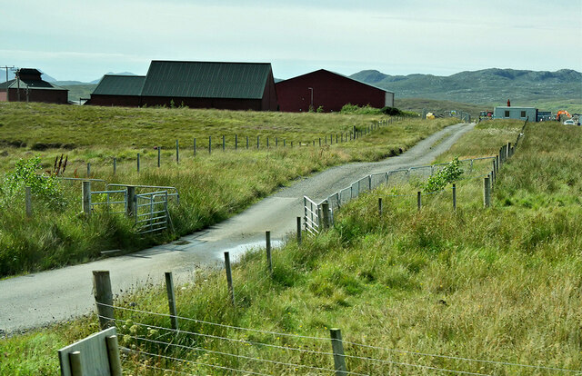
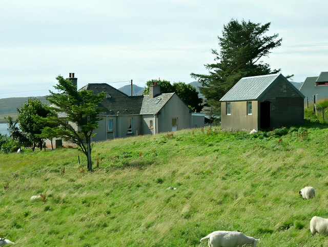
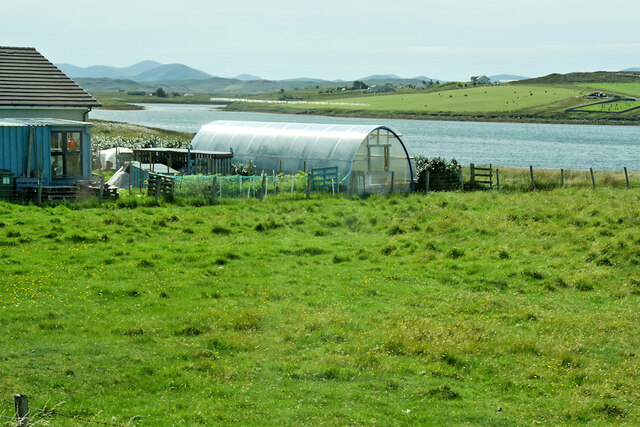
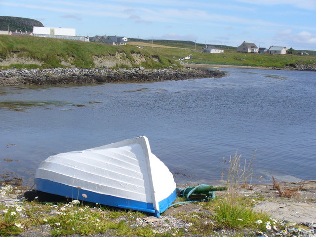
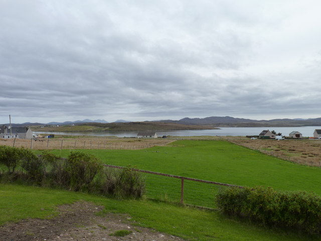
Caolas Chèabhaigh, located in Ross-shire, Scotland, is a picturesque sea inlet, also known as a creek or estuary. It is situated between the mainland and the scenic Isle of Skye, offering breathtaking views of the surrounding landscape. The area is known for its stunning natural beauty and diverse wildlife, attracting visitors and nature enthusiasts from all over the world.

The crystal-clear waters of Caolas Chèabhaigh are well-known for their tranquility and are a haven for various marine species. The estuary is a crucial habitat for numerous bird species, including herons, oystercatchers, and gulls, making it a popular spot for birdwatching. The surrounding marshes and mudflats provide an abundant food source for these birds.

The coastline around Caolas Chèabhaigh is dotted with rocky outcrops and sandy beaches, offering visitors a chance to explore and relax in a peaceful environment. The area is also home to a variety of marine life, such as seals, otters, and dolphins, which can often be spotted swimming and playing in the waters.

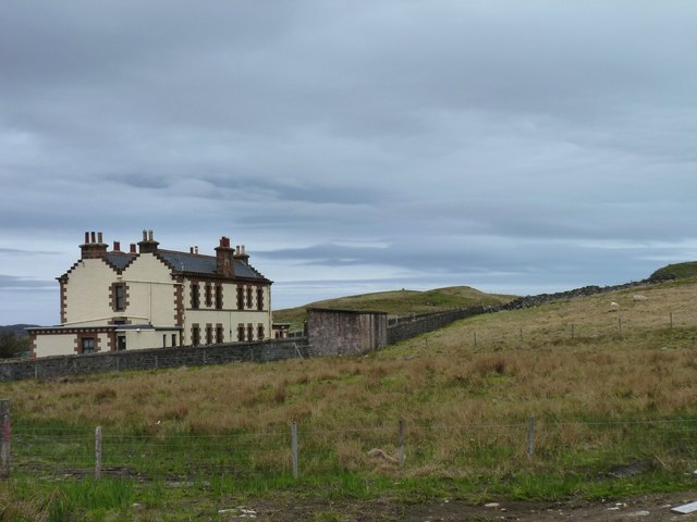
For those interested in history, Caolas Chèabhaigh has several archaeological sites nearby, including ancient burial grounds and standing stones. These remnants of the past give an insight into the area's rich cultural heritage.

The stunning natural beauty, diverse wildlife, and historical significance make Caolas Chèabhaigh a must-visit destination for anyone seeking a peaceful and immersive experience in the heart of the Scottish Highlands.

If you have any feedback on the listing, please let us know in the comments section below.

Caolas Chèabhaigh Images

Images are sourced within 2km of 58.215897/-6.7785654 or Grid Reference NB1935. Thanks to Geograph Open Source API. All images are credited.

Croft near Breasclete
House on a hill near Breasclete
Farm Track at Breascleit
Sheep grazing at Breascleit
Polythene tunnel greenhouse on the shore of Loch Ròg an Ear
Craft workshop in Kirkibost One of the old shellfish processing factories at Kirkibost (Circeabost) is now reborn as a craftshop.
Craft workshop in Kirkibost
One of the old shellfish processing factories at Kirkibost (Circeabost) is now reborn as a craftshop.
Cleibh ghiomaich aig cidhe Chirceabost Lobster creels at Kirkibost harbour
Cleibh ghiomaich aig cidhe Chirceabost
Lobster creels at Kirkibost harbour
View towards Circebost Pier
Croftland, Circebost, Great Bernera Looking across Loch Ròg an Ear (East Loch Roag) towards Eilean Chearstaigh.
Croftland, Circebost, Great Bernera
Looking across Loch Ròg an Ear (East Loch Roag) towards Eilean Chearstaigh.
Calanais/Callanish XV, Circebost, Great Bernera/Beàrnaraigh From Discovery and Excavation in Scotland, 1976: "On grassy ridge 100m N of road, 25m E of track through Croft 24, Kirkibost. A large prone slab approx. 3.55m x 1.35m, thickness varying from 0.25-0.45m, lying in peat on a grassy ridge. The lower end appears to be surrounded by packing stones and there is a void under the centre of the stone. This stone was brought to our notice by Mr Norman MacDonald of Kirkibost."
Calanais/Callanish XV, Circebost, Great Bernera/Beàrnaraigh
From Discovery and Excavation in Scotland, 1976: "On grassy ridge 100m N of road, 25m E of track through Croft 24, Kirkibost. A large prone slab approx. 3.55m x 1.35m, thickness varying from 0.25-0.45m, lying in peat on a grassy ridge. The lower end appears to be surrounded by packing stones and there is a void under the centre of the stone. This stone was brought to our notice by Mr Norman MacDonald of Kirkibost."
Possible fallen standing stone, Circebost, Great Bernera/Beàrnaraigh This stone lies approximately 80m ESE of <a href="https://www.geograph.org.uk/photo/5293759">NB1734 : Calanais/Callanish XV, Circebost, Great Bernera/Beàrnaraigh</a>.  The croft owner, who is the grandson of Norman MacDonald who originally brought Callanish XV to archaeologists' attention, believes it to be fallen standing stone.
Possible fallen standing stone, Circebost, Great Bernera/Beàrnaraigh
This stone lies approximately 80m ESE of NB1734 : Calanais/Callanish XV, Circebost, Great Bernera/Beàrnaraigh. The croft owner, who is the grandson of Norman MacDonald who originally brought Callanish XV to archaeologists' attention, believes it to be fallen standing stone.
Looking down at Circebost Circebost or Kirkibost is a tiny settlement on Great Bernera. This island is now connected to Lewis by a short pre-stressed concrete bridge. In 1953 when it was built it was and remains the first bridge of such material in Europe.  

The settlemenr is also important as it is the first planned crofting township in the Outer Hebrides, though I think town is a lofty description for such a small group of houses.
Looking down at Circebost
Circebost or Kirkibost is a tiny settlement on Great Bernera. This island is now connected to Lewis by a short pre-stressed concrete bridge. In 1953 when it was built it was and remains the first bridge of such material in Europe. The settlemenr is also important as it is the first planned crofting township in the Outer Hebrides, though I think town is a lofty description for such a small group of houses.
Boat at Rubha Arspaig Upturned boat by the fish oil factory at Tob Bhreascleit, an inlet off the sea loch, Loch Rog an Ear.
Boat at Rubha Arspaig
Upturned boat by the fish oil factory at Tob Bhreascleit, an inlet off the sea loch, Loch Rog an Ear.
Crofting strip Lush grass, much favoured by migrating geese, on a crofting strip in the village of Breascleit. The water in the distance is Loch Roag.
Crofting strip
Lush grass, much favoured by migrating geese, on a crofting strip in the village of Breascleit. The water in the distance is Loch Roag.
Largest house in Breascleit Architecturally a complete contrast to the other houses in the small village of Breascleit, this building has a history. Currently it forms flats owned by the local council but it was originally built in 1895 for the Northern Lighthouse Board as residences for families of the keepers working on the Flannan Isles lighthouse (NA7247) about 25 miles offshore from Breascleit. It must have been a sad place just five years after it was built when in December 1900 all three keepers vanished without trace from the island. Many are the rumours that have grown up concerning their mysterious disappearance (including some involving sea monsters and abduction by aliens) but it seems most probable that they were swept to their deaths by a huge Atlantic wave. Two of them left widows who lived in this house, one with four and the other with two young children.
Largest house in Breascleit
Architecturally a complete contrast to the other houses in the small village of Breascleit, this building has a history. Currently it forms flats owned by the local council but it was originally built in 1895 for the Northern Lighthouse Board as residences for families of the keepers working on the Flannan Isles lighthouse (NA7247) about 25 miles offshore from Breascleit. It must have been a sad place just five years after it was built when in December 1900 all three keepers vanished without trace from the island. Many are the rumours that have grown up concerning their mysterious disappearance (including some involving sea monsters and abduction by aliens) but it seems most probable that they were swept to their deaths by a huge Atlantic wave. Two of them left widows who lived in this house, one with four and the other with two young children.
Lighthouse crest This Northern Lighthouse Board crest is still above the front door of the house shown in<a href="https://www.geograph.org.uk/photo/3488562">NB2135 : Largest house in Breascleit</a>.
Lighthouse crest
This Northern Lighthouse Board crest is still above the front door of the house shown inNB2135 : Largest house in Breascleit.
Rubha Arspaig The pier at Rubha Arspaig.
Rubha Arspaig
The pier at Rubha Arspaig.
Pharmaceutical factory A surprisingly large industrial investment in an otherwise rural coastal area of Lewis, this plant, employing around 50 people, became part of BASF Pharma in March 2012 when the German company took over Equateq Ltd who had opened the plant in 2005 and operated it until then. It manufactures omega-3 fatty acids at exceptional purity levels for use in pharmaceuticals.
Pharmaceutical factory
A surprisingly large industrial investment in an otherwise rural coastal area of Lewis, this plant, employing around 50 people, became part of BASF Pharma in March 2012 when the German company took over Equateq Ltd who had opened the plant in 2005 and operated it until then. It manufactures omega-3 fatty acids at exceptional purity levels for use in pharmaceuticals.
Show me another place!

Caolas Chèabhaigh is located at Grid Ref: NB1935 (Lat: 58.215897, Lng: -6.7785654)

Unitary Authority: Na h-Eileanan an Iar

Police Authority: Highlands and Islands

What 3 Words

///socialite.escaping.tinsel. Near Carloway, Na h-Eileanan Siar

Related Wikis

Ceabhaigh

Ceabhaigh is a small island in an arm of Loch Ròg on the west coast of Lewis in the Outer Hebrides of Scotland. It is about 25 hectares (62 acres) in extent...

Eilean Chearstaidh

Eilean Kearstay (Scottish Gaelic: Eilean Chearstaigh) is an uninhabited island in Loch Roag in the Outer Hebrides of Scotland. It lies south east of Great...

Breasclete

Breasclete (Scottish Gaelic: Brèascleit) is a village and community on the west side of the Isle of Lewis, in the Outer Hebrides, Scotland. Breasclete...

Callanish

Callanish (Scottish Gaelic: Calanais) is a village (township) on the west side of the Isle of Lewis, in the Outer Hebrides (Western Isles), Scotland. Callanish...

Tolsta Chaolais

Tolsta Chaolais (also Tolastadh Chaolais, Tolstadh a' Chaolais) is a village on the Isle of Lewis, Scotland. It consists of about forty houses, clustered...

Callanish Stones

The Callanish Stones (or "Callanish I": Scottish Gaelic: Clachan Chalanais or Tursachan Chalanais) are an arrangement of standing stones placed in a cruciform...

Callanish VIII

The Callanish VIII stone setting is one of many megalithic structures around the better-known (and larger) Calanais I on the west coast of the Isle of...

Callanish II

The Callanish II stone circle (Scottish Gaelic: Cnoc Ceann a' Gharaidh) is one of many megalithic structures around the better-known (and larger) Calanais...

Nearby Amenities

Located within 500m of 58.215897,-6.7785654
Tob Liath
Natural: bay
Lat/Long: 58.2176072/-6.7846396
Leur Thob
Natural: bay
Lat/Long: 58.2131767/-6.784307
The data included in this document is from www.openstreetmap.org. The data is made available under ODbL.

Have you been to Caolas Chèabhaigh?

Leave your review of Caolas Chèabhaigh below (or comments, questions and feedback).