Beef Neck

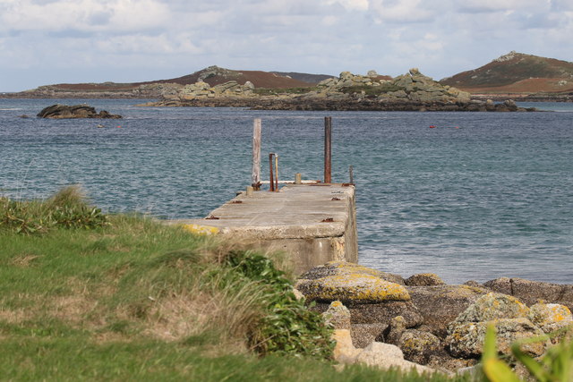
Sea, Estuary, Creek in Cornwall

England

Beef Neck

Gimble Porth This is just one of Tresco's many wonderful beaches.
Gimble Porth Credit: Malcolm Neal

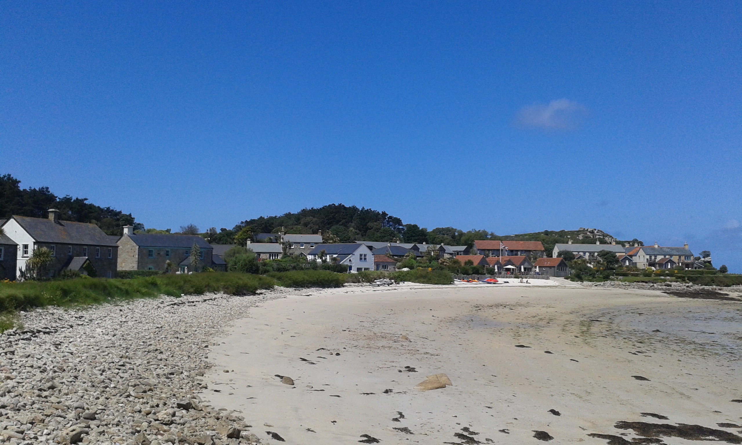
Beef Neck is a small coastal region located in Cornwall, England. It is situated along the southwestern coast, known for its stunning sea views, estuaries, and creeks. The area is renowned for its natural beauty and is a popular destination for tourists and locals alike.

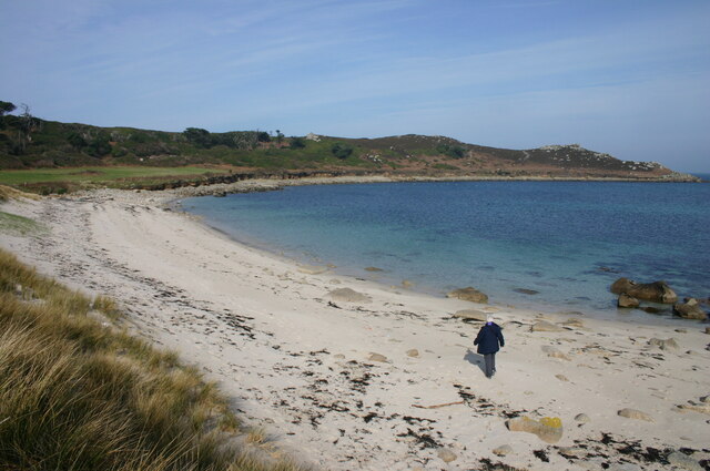
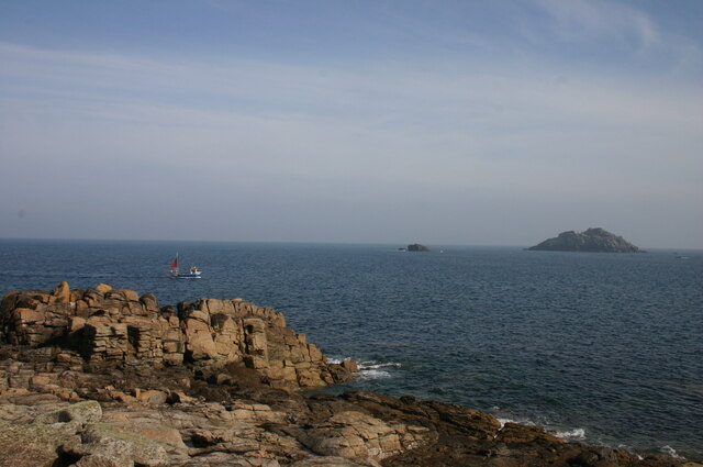
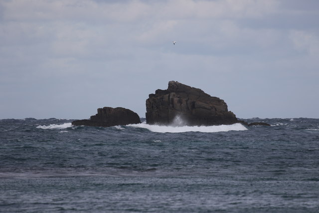
The main attraction of Beef Neck is its picturesque sea, which offers breathtaking views and opportunities for various water activities. The crystal-clear waters provide an ideal environment for swimming, snorkeling, and diving. Additionally, the sea is a hotspot for fishing enthusiasts, who can try their luck at catching a variety of marine species.

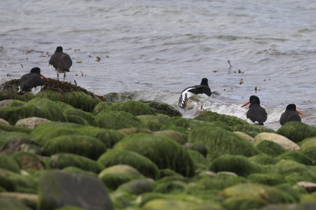
The estuaries in Beef Neck are another significant feature of the area. These estuaries are formed where rivers meet the sea, creating a unique ecosystem that supports a diverse range of flora and fauna. They are a haven for birdwatchers, as many species of birds can be spotted in these habitats.

Beef Neck is also home to several creeks, which add to the charm of the region. These narrow water channels wind their way through the landscape, offering tranquil spots for boating and kayaking. The creeks are a haven for wildlife, with otters, seals, and various species of fish often seen in these waters.

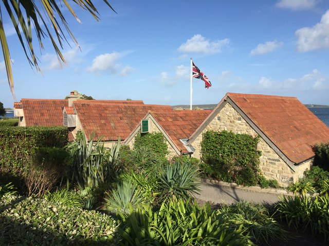
In addition to its natural wonders, Beef Neck also boasts a rich history and cultural heritage. Visitors can explore ancient ruins, such as castles and standing stones, which provide glimpses into the area's past.

Overall, Beef Neck in Cornwall offers a perfect blend of scenic beauty, outdoor activities, and historical intrigue, making it a must-visit destination for nature lovers and history enthusiasts.

If you have any feedback on the listing, please let us know in the comments section below.

Beef Neck Images

Images are sourced within 2km of 49.969811/-6.3337142 or Grid Reference SV8916. Thanks to Geograph Open Source API. All images are credited.

Gimble Porth This is just one of Tresco's many wonderful beaches.
Gimble Porth
This is just one of Tresco's many wonderful beaches.
A boat off the north of Tresco Taken in 2005 but only just being submitted, so I hope I have the view direction correct. Tresco is a wonderful peaceful island at any time of the year, but especially in Spring.
A boat off the north of Tresco
Taken in 2005 but only just being submitted, so I hope I have the view direction correct. Tresco is a wonderful peaceful island at any time of the year, but especially in Spring.
From Shipman Head Down, Bryher to New Grimsby Harbour, Tresco, Scilly
Cromwell's Castle, Tresco, Scilly Seen from Shipman Head Down, Bryher with the ruins of King Charles' Castle on the hill above.
Cromwell's Castle, Tresco, Scilly
Seen from Shipman Head Down, Bryher with the ruins of King Charles' Castle on the hill above.
From Shipman Head Down, Bryher to Abbey Farm, Tresco, Scilly From Shipman Head Down on Bryher looking across New Grimsby Harbour to Abbey Farm buildings on Tresco. Immediately behind these farm buildings lies the Great Pool. Beyond wooded Abbey Hill the eastern side of St Mary's is visible. In the foreground, virtually at the shore line, is the White House where we had a memorable family holiday in the mid-1960s. Unfortunately I didn't take any photos.
From Shipman Head Down, Bryher to Abbey Farm, Tresco, Scilly
From Shipman Head Down on Bryher looking across New Grimsby Harbour to Abbey Farm buildings on Tresco. Immediately behind these farm buildings lies the Great Pool. Beyond wooded Abbey Hill the eastern side of St Mary's is visible. In the foreground, virtually at the shore line, is the White House where we had a memorable family holiday in the mid-1960s. Unfortunately I didn't take any photos.
Cromwell's Castle, Tresco, seen from Bryher, Scilly The White House is on the left.
Cromwell's Castle, Tresco, seen from Bryher, Scilly
The White House is on the left.
From Watch Hill, Bryher to Tresco across New Grimsby Harbour Below is the Bryher jetty and an assortment of vessels. Across the harbour is the landing stage at New Grimsby Quay. On the right is Vane Hill, on the left, Castle Down The low land across the waist of Tresco gives a view over some of the many rocks, with St Martin's in the background.
From Watch Hill, Bryher to Tresco across New Grimsby Harbour
Below is the Bryher jetty and an assortment of vessels. Across the harbour is the landing stage at New Grimsby Quay. On the right is Vane Hill, on the left, Castle Down The low land across the waist of Tresco gives a view over some of the many rocks, with St Martin's in the background.
Bryher to Tresco; from Watch Hill over Hangman Island Looking left from <a href="https://www.geograph.org.uk/photo/7763423">SV8815 : From Watch Hill, Bryher to Tresco across New Grimsby Harbour</a>. Below left is Norrard, the northern part of The Town on Bryher. Hangman Island dominates this streatch of the natural harbour between the islands, overshadowing Little Hangman Island on this side. Just to the left on Tresco is Cromwell's Castle,  a grade II* listed gun tower <span class="nowrap"><a title="https://historicengland.org.uk/listing/the-list/list-entry/1141198?section=official-list-entry" rel="nofollow ugc noopener" href="https://historicengland.org.uk/listing/the-list/list-entry/1141198?section=official-list-entry">Link</a><img style="margin-left:2px;" alt="External link" title="External link - shift click to open in new window" src="https://s1.geograph.org.uk/img/external.png" width="10" height="10"/></span> .
Bryher to Tresco; from Watch Hill over Hangman Island
Looking left from SV8815 : From Watch Hill, Bryher to Tresco across New Grimsby Harbour. Below left is Norrard, the northern part of The Town on Bryher. Hangman Island dominates this streatch of the natural harbour between the islands, overshadowing Little Hangman Island on this side. Just to the left on Tresco is Cromwell's Castle, a grade II* listed gun tower LinkExternal link .
Hangman Island A view from the northern slopes of Watch Hill, across New Grimsby Harbour. On the left, on Tresco, is Cromwell's Castle, a grade II* listed gun tower <span class="nowrap"><a title="https://historicengland.org.uk/listing/the-list/list-entry/1141198?section=official-list-entry" rel="nofollow ugc noopener" href="https://historicengland.org.uk/listing/the-list/list-entry/1141198?section=official-list-entry">Link</a><img style="margin-left:2px;" alt="External link" title="External link - shift click to open in new window" src="https://s1.geograph.org.uk/img/external.png" width="10" height="10"/></span> .
Hangman Island
A view from the northern slopes of Watch Hill, across New Grimsby Harbour. On the left, on Tresco, is Cromwell's Castle, a grade II* listed gun tower LinkExternal link .
Towards Shipman Head The northern end of Bryher, seen across Great Bottom. Much of the peninsula is a Scheduled Monument <span class="nowrap"><a title="https://historicengland.org.uk/listing/the-list/list-entry/1016174?section=official-list-entry" rel="nofollow ugc noopener" href="https://historicengland.org.uk/listing/the-list/list-entry/1016174?section=official-list-entry">Link</a><img style="margin-left:2px;" alt="External link" title="External link - shift click to open in new window" src="https://s1.geograph.org.uk/img/external.png" width="10" height="10"/></span> .
Towards Shipman Head
The northern end of Bryher, seen across Great Bottom. Much of the peninsula is a Scheduled Monument LinkExternal link .
Shipman Head The eastern side of the island, seen from across The Gulf on Badplace Hill.
Shipman Head
The eastern side of the island, seen from across The Gulf on Badplace Hill.
Cliff, Badplace Hill, Bryher On the east side of the headland shown in <a href="https://www.geograph.org.uk/photo/7763876">SV8716 : Towards Shipman Head</a>. Across the water is Kettle Point, with the islands of Men-a-Vaur and Round Island beyond. The latter has a lighthouse.
Cliff, Badplace Hill, Bryher
On the east side of the headland shown in SV8716 : Towards Shipman Head. Across the water is Kettle Point, with the islands of Men-a-Vaur and Round Island beyond. The latter has a lighthouse.
Cliffs at Smith's Hole, Bryher The rocky headland jutting out most is named "The Horse"  Across New Grimsby Harbour on Tresco is Cromwell's Castle, a grade II* listed gun tower <span class="nowrap"><a title="https://historicengland.org.uk/listing/the-list/list-entry/1141198?section=official-list-entry" rel="nofollow ugc noopener" href="https://historicengland.org.uk/listing/the-list/list-entry/1141198?section=official-list-entry">Link</a><img style="margin-left:2px;" alt="External link" title="External link - shift click to open in new window" src="https://s1.geograph.org.uk/img/external.png" width="10" height="10"/></span> .
Cliffs at Smith's Hole, Bryher
The rocky headland jutting out most is named "The Horse" Across New Grimsby Harbour on Tresco is Cromwell's Castle, a grade II* listed gun tower LinkExternal link .
Clearing the bracken Near the Blockhouse, Tresco
Clearing the bracken
Near the Blockhouse, Tresco
The Ruin Inn A cafe and restaurant in Old Grimsby, Tresco
The Ruin Inn
A cafe and restaurant in Old Grimsby, Tresco
Oystercatchers in Gimble Porth On Tresco
Oystercatchers in Gimble Porth
On Tresco
Golden Ball From Tresco
Golden Ball
From Tresco
Old Grimsby Quay Looking towards Foreman's Island
Old Grimsby Quay
Looking towards Foreman's Island
Show me another place!

Beef Neck is located at Grid Ref: SV8916 (Lat: 49.969811, Lng: -6.3337142)

Division: Isles of Scilly

Unitary Authority: Isles of Scilly

Police Authority: Devon and Cornwall

What 3 Words

///animated.desiring.touched. Near Tresco, Isles of Scilly

Related Wikis

St Helen's, Isles of Scilly

St Helen's (Cornish: Enys Elyd or Enys Elidius) is one of the fifty or so uninhabited islands in the archipelago of the Isles of Scilly and has an approximate...

Piper's Hole

Piper's Hole is a sea cave located on Tresco, an island of the Isles of Scilly. The name Piper's Hole can also refer to another, more minor, sea cave in...

Castle Down

Castle Down is a windswept plateau of maritime heath in the northern part of the island of Tresco, Isles of Scilly. The area has a number of designations...

Old Grimsby

Old Grimsby (Cornish: Enysgrymm Goth) is a coastal settlement on the island of Tresco in the Isles of Scilly, England. It is located on the east side of...

Nearby Amenities

Located within 500m of 49.969811,-6.3337142
Northwethal
Place: island
Lat/Long: 49.9662467/-6.3311646
Natural: peak
Lat/Long: 49.9659281/-6.3320243
Coal Porth
Natural: bay
Lat/Long: 49.967081/-6.3314463
The data included in this document is from www.openstreetmap.org. The data is made available under ODbL.

Have you been to Beef Neck?

Leave your review of Beef Neck below (or comments, questions and feedback).